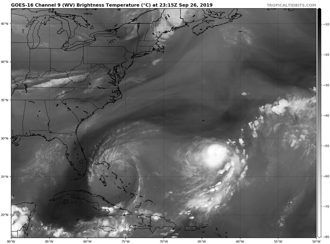
gatorcane wrote:That spot in the middle of Karen is a bit weird. Looks like an eye is forming but we know that can’t be...right?
I doubt it, but if it is, I may have to retract my "kidding."
Moderator: S2k Moderators


gatorcane wrote:That spot in the middle of Karen is a bit weird. Looks like an eye is forming but we know that can’t be...right?
Aric Dunn wrote:LarryWx wrote:Aric Dunn wrote:So the DVORAK estimate of the center was in fact correct..
https://www.nrlmry.navy.mil/tcdat/tc19/ATL/12L.KAREN/windsat/color37/20190926.2208.coriolis.x.color37.12LKAREN.40kts-1005mb-269N-632W.088pc.jpg
https://www.nrlmry.navy.mil/tcdat/tc19/ATL/12L.KAREN/windsat/37h/20190926.2208.coriolis.x.37h.12LKAREN.40kts-1005mb-269N-632W.088pc.jpg
This tells me that the center is likely pretty much on track.
given the last recon fix the dvorak position and this.. along with the cloud motion.. it wont make it to 28n.. looks like it has already turned east.

LarryWx wrote:Aric Dunn wrote:LarryWx wrote:
This tells me that the center is likely pretty much on track.
given the last recon fix the dvorak position and this.. along with the cloud motion.. it wont make it to 28n.. looks like it has already turned east.
I'm guessing that's because it is getting stronger and thus raising the mean steering layer, which is more ENE than the lower level's NE. I noticed the 18Z Euro's initialization is stronger and it has her moving a little further east vs the 12Z run.

Ubuntwo wrote:northjaxpro wrote:Apparently, that 998.9 mb pressure reading is correct. Karen is not weakening based on this fact alone. It is quite the contrary. Karen is once again dipping into her bag of tricks deceiving quite a number of folks. Lol..
I guess some will keep on writing her off, butvshe keeps saying No, not yet LOL...
fwiw, that isn’t a pressure reading. Instead it’s a satellite estimate based on presentation. A buoy recorded 1006mb as the storm passed 30 miles to the south. Based on the recon pressure gradient this comes out to around 1004mb which is far more reasonable.


gatorcane wrote:That spot in the middle of Karen is a bit weird. Looks like an eye is forming but we know that can’t be...right?
Do_For_Love wrote:gatorcane wrote:That spot in the middle of Karen is a bit weird. Looks like an eye is forming but we know that can’t be...right?
I could defintely be wrong, but it looks like on that Dvorak reading the center was east of the convection? And I think other posters had suggested that earlier, so if that's true, it shouldn't be, right? Definitely an odd "dimple" though.


GCANE wrote:Stacked now surface to 700mb.
Big improvement from this morning.
https://i.imgur.com/uUHQiWg.gif
AutoPenalti wrote:GCANE wrote:Stacked now surface to 700mb.
Big improvement from this morning.
https://i.imgur.com/uUHQiWg.gif
Still looks elongated.
wx98 wrote:The hurricane center isn’t optimistic...
...KAREN FORECAST TO DEGENERATE INTO A REMNANT LOW BY SATURDAY...
11:00 PM AST Thu Sep 26
Location: 27.8°N 62.1°W
Moving: NE at 8 mph
Min pressure: 1005 mb
Max sustained: 40 mph
wx98 wrote:The hurricane center isn’t optimistic...
...KAREN FORECAST TO DEGENERATE INTO A REMNANT LOW BY SATURDAY...
11:00 PM AST Thu Sep 26
Location: 27.8°N 62.1°W
Moving: NE at 8 mph
Min pressure: 1005 mb
Max sustained: 40 mph
Users browsing this forum: No registered users and 44 guests


