2019 Tropics: Global Model Runs Discussion (Out to day 16)

This is the general tropical discussion area. Anyone can take their shot at predicting a storms path.

Moderator: S2k Moderators

Forum rules

The posts in this forum are NOT official forecasts and should not be used as such. They are just the opinion of the poster and may or may not be backed by sound meteorological data. They are NOT endorsed by any professional institution or STORM2K. For official information, please refer to products from the National Hurricane Center and National Weather Service.

Help Support Storm2K
Message
Author
User avatar
SFLcane
S2K Supporter
S2K Supporter
Posts: 10163
Age: 47
Joined: Sat Jun 05, 2010 1:44 pm
Location: Lake Worth Florida

Re: 2019 Tropics: Global Model Runs Discussion (Out to day 16)

#1201 Postby SFLcane » Sun Oct 06, 2019 12:18 pm

LarryWx wrote:
Hurricaneman wrote:Is it me or does the 12zGFS form this well NE of its previous runs

Edit: indeed forms this 150mi NE of the last several runs, much more dangerous position


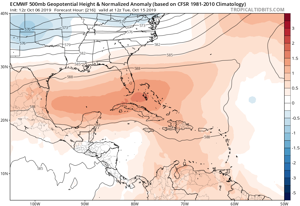
And even with that more dangerous position, it still turns out to be a nothingburger for the US as it gets buried into C America while a second TC tries to form to its east over the NW Caribbean. Interesting.


Yep, gfs last couple of runs keeps high pressure and buries this into CA. Even if it develops might not be a problem for the US.
1 likes   

User avatar
gatorcane
S2K Supporter
S2K Supporter
Posts: 23691
Age: 47
Joined: Sun Mar 13, 2005 3:54 pm
Location: Boca Raton, FL

Re: 2019 Tropics: Global Model Runs Discussion (Out to day 16)

#1202 Postby gatorcane » Sun Oct 06, 2019 12:23 pm

ICON forms a low more to the NE heading slowly WNW south of Jamaica, looks like it has this heading for the NW Caribbean:

Image
0 likes   

User avatar
SFLcane
S2K Supporter
S2K Supporter
Posts: 10163
Age: 47
Joined: Sat Jun 05, 2010 1:44 pm
Location: Lake Worth Florida

Re: 2019 Tropics: Global Model Runs Discussion (Out to day 16)

#1203 Postby SFLcane » Sun Oct 06, 2019 12:53 pm

Might add GFS is delaying genesis again not pushing past D7 now :roll:
0 likes   

LarryWx
S2K Supporter
S2K Supporter
Posts: 6305
Joined: Sun Sep 07, 2003 2:04 pm
Location: GA

Re: 2019 Tropics: Global Model Runs Discussion (Out to day 16)

#1204 Postby LarryWx » Sun Oct 06, 2019 1:15 pm

LarryWx wrote:
LarryWx wrote:
WxEp wrote:Through 264 hours, it looks like around 10-11 of the 51 EPS members develop a TC in the Western Caribbean. I believe this is the biggest signal for potential development that the EPS has shown so far.

Edit: Some move west into Central America, but the majority move north west and end up moving into the GOM or over Cuba. Obviously this far out any tracks are still highly suspect.


This fairly sharp increase in EPS activity to ~20% of members along with the GEFS finally showing signs of progressing/sticking with a busy 0Z on 10/18 is now starting to get me a bit concerned. That doesn't mean I think we should panic though. It just bares watching a bit more than it did earlier imo.

For example, here is the 0Z GEFS for 0Z on 10/18, my benchmark timeframe:

https://www.tropicaltidbits.com/analysis/models/gfs-ens/2019100600/gfs-ememb_lowlocs_watl_49.png


Since I made this post, two things happened:

1. The 0Z EPS is a good bit quieter than that prior (12Z) run, which had 20% concerning members. This run has way fewer. Was that run just an aberration? Nobody knows.

2. The 6Z GEFS is less threatening than the 0Z as of my benchmark time, 0Z on 10/18, with fewer strong members:

https://www.tropicaltidbits.com/analysis/models/gfs-ens/2019100606/gfs-ememb_lowlocs_watl_48.png


The 12Z GEFS for 0Z on 10/18 is less threatening than the 6Z, which was less threatening than the 0Z. It has only 3-4 (15-20%) of members sub 999 mb vs ~5 (25%) on each of the 3 prior runs and only one (5%) that is sub 991 mb, which is fewer than the 2 (10%) of 6Z and the ~4 (20%) of the 0Z and 18Z. Also, the mean TC is a little further south in the NW Caribbean.

Image
1 likes   
Personal Forecast Disclaimer:
The posts in this forum are NOT official forecasts and should not be used as such. They are just the opinion of the poster and may or may not be backed by sound meteorological data. They are NOT endorsed by any professional institution or storm2k.org. For official information, please refer to the NHC and NWS products.

User avatar
SFLcane
S2K Supporter
S2K Supporter
Posts: 10163
Age: 47
Joined: Sat Jun 05, 2010 1:44 pm
Location: Lake Worth Florida

Re: 2019 Tropics: Global Model Runs Discussion (Out to day 16)

#1205 Postby SFLcane » Sun Oct 06, 2019 1:35 pm

Thought I’d post this here to..I just don’t know in terms of the Caribbean as the Euro still silent in this area.

 https://twitter.com/hurricanetrack/status/1180903692414996483


2 likes   

Aric Dunn
Category 5
Category 5
Posts: 21238
Age: 42
Joined: Sun Sep 19, 2004 9:58 pm
Location: Ready for the Chase.
Contact:

Re: 2019 Tropics: Global Model Runs Discussion (Out to day 16)

#1206 Postby Aric Dunn » Sun Oct 06, 2019 1:49 pm

Surface Circ has formed east of the bahamas quite a big south and earlier than the models. probably going to make it to FL before turning..

slightly elongated still as it has just formed the last several hours.

Models will adjust. should be interesting to watch.. likely going to be sub tropical at least initially.

Image
2 likes   
Note: If I make a post that is brief. Please refer back to previous posts for the analysis or reasoning. I do not re-write/qoute what my initial post said each time.
If there is nothing before... then just ask :)

Space & Atmospheric Physicist, Embry-Riddle Aeronautical University,
I believe the sky is falling...

User avatar
Hypercane_Kyle
Category 5
Category 5
Posts: 3352
Joined: Sat Mar 07, 2015 7:58 pm
Location: Cape Canaveral, FL

Re: 2019 Tropics: Global Model Runs Discussion (Out to day 16)

#1207 Postby Hypercane_Kyle » Sun Oct 06, 2019 1:51 pm

Consistency from the GFS plus the very strong ensemble support and climatology leads me to lean more towards the GFS solution. ECMWF might be struggling with the MJO.
0 likes   
My posts are my own personal opinion, defer to the National Hurricane Center (NHC) and other NOAA products for decision making during hurricane season.

LarryWx
S2K Supporter
S2K Supporter
Posts: 6305
Joined: Sun Sep 07, 2003 2:04 pm
Location: GA

Re: 2019 Tropics: Global Model Runs Discussion (Out to day 16)

#1208 Postby LarryWx » Sun Oct 06, 2019 2:37 pm

Hypercane_Kyle wrote:Consistency from the GFS plus the very strong ensemble support and climatology leads me to lean more towards the GFS solution. ECMWF might be struggling with the MJO.


Actually, the 12Z Euro has a weak low moving NW into Belize at 240 (12Z on 10/16).
0 likes   
Personal Forecast Disclaimer:
The posts in this forum are NOT official forecasts and should not be used as such. They are just the opinion of the poster and may or may not be backed by sound meteorological data. They are NOT endorsed by any professional institution or storm2k.org. For official information, please refer to the NHC and NWS products.

User avatar
gatorcane
S2K Supporter
S2K Supporter
Posts: 23691
Age: 47
Joined: Sun Mar 13, 2005 3:54 pm
Location: Boca Raton, FL

Re: 2019 Tropics: Global Model Runs Discussion (Out to day 16)

#1209 Postby gatorcane » Sun Oct 06, 2019 2:46 pm

12Z EPS has come to life again with SW Caribbean development. Most of the lows go inland into CA. If this expansive ridge does come to fruition over the Gulf and Florida, how timely it would be given climo suggests something forming should head NW towards the NW Caribbean. Surprised there is no trough to break down this ridge given it would be mid October.
1 likes   

LarryWx
S2K Supporter
S2K Supporter
Posts: 6305
Joined: Sun Sep 07, 2003 2:04 pm
Location: GA

Re: 2019 Tropics: Global Model Runs Discussion (Out to day 16)

#1210 Postby LarryWx » Sun Oct 06, 2019 3:10 pm

gatorcane wrote:12Z EPS has come to life again with SW Caribbean development. Most of the lows go inland into CA. If this expansive ridge does come to fruition over the Gulf and Florida, how timely it would be given climo suggests something forming should head NW towards the NW Caribbean. Surprised there is no trough to break down this ridge given it would be mid October.


Indeed, Gator, the 12Z EPS is much more active than the 0Z and looks like yesterday’s 12Z with once again ~20% of the members at sub 999 mb.
0 likes   
Personal Forecast Disclaimer:
The posts in this forum are NOT official forecasts and should not be used as such. They are just the opinion of the poster and may or may not be backed by sound meteorological data. They are NOT endorsed by any professional institution or storm2k.org. For official information, please refer to the NHC and NWS products.

User avatar
gatorcane
S2K Supporter
S2K Supporter
Posts: 23691
Age: 47
Joined: Sun Mar 13, 2005 3:54 pm
Location: Boca Raton, FL

Re: 2019 Tropics: Global Model Runs Discussion (Out to day 16)

#1211 Postby gatorcane » Sun Oct 06, 2019 3:14 pm

Euro with a stout ridge that would block anything in the SW Carib from heading north, though this is long-range:

Image
0 likes   

User avatar
NDG
S2K Supporter
S2K Supporter
Posts: 15446
Joined: Sun Jul 09, 2006 10:14 pm
Location: Orlando, FL

Re: 2019 Tropics: Global Model Runs Discussion (Out to day 16)

#1212 Postby NDG » Sun Oct 06, 2019 3:43 pm

Little by little the Euro is going to be coming along with the GFS and other models. IMO.

Image
1 likes   

User avatar
SFLcane
S2K Supporter
S2K Supporter
Posts: 10163
Age: 47
Joined: Sat Jun 05, 2010 1:44 pm
Location: Lake Worth Florida

Re: 2019 Tropics: Global Model Runs Discussion (Out to day 16)

#1213 Postby SFLcane » Sun Oct 06, 2019 3:49 pm

gatorcane wrote:Euro with a stout ridge that would block anything in the SW Carib from heading north, though this is long-range:

https://i.postimg.cc/mZP85Z05/ecmwf-z500a-Norm-watl-10.png


How it's been all summer with US ridge Atlantic trough.
0 likes   

psyclone
S2K Supporter
S2K Supporter
Posts: 4762
Joined: Wed Aug 24, 2005 9:04 pm
Location: palm harbor fl

Re: 2019 Tropics: Global Model Runs Discussion (Out to day 16)

#1214 Postby psyclone » Sun Oct 06, 2019 3:59 pm

WPC QPF output, which was generous over the southern gulf a few days back no longer is. Today's 6-10 and 8-14 day outlooks now show normal to below normal precip over Florida at what is already a dry time of the year. This throws a massive bucket of cold water on late season chicanery...at least impacting Florida. At this point it looks like the most likely scenario is either A.) nothing or B.) a system that slowly trudges into Central America. My earlier expectations of a western Caribbean cane are looking to be built upon increasingly shaky ground
1 likes   

User avatar
EquusStorm
Category 5
Category 5
Posts: 1649
Age: 34
Joined: Thu Nov 07, 2013 1:04 pm
Location: Jasper, AL
Contact:

Re: 2019 Tropics: Global Model Runs Discussion (Out to day 16)

#1215 Postby EquusStorm » Sun Oct 06, 2019 4:16 pm

Can't forget November is still a thing even if conditions aren't great the next few weeks; probably not for the US but it's done some nasty stuff in the Caribbean in this active cycle
0 likes   
Colors of lost purpose on the canvas of irrelevance

Not a meteorologist, in fact more of an idiot than anything. You should probably check with the NHC or a local NWS office for official information.

User avatar
NDG
S2K Supporter
S2K Supporter
Posts: 15446
Joined: Sun Jul 09, 2006 10:14 pm
Location: Orlando, FL

Re: 2019 Tropics: Global Model Runs Discussion (Out to day 16)

#1216 Postby NDG » Sun Oct 06, 2019 4:17 pm

gatorcane wrote:Euro with a stout ridge that would block anything in the SW Carib from heading north, though this is long-range:

https://i.postimg.cc/mZP85Z05/ecmwf-z500a-Norm-watl-10.png


Past 5-6 days the Euro is not that good with height forecasts, way too early to say what is going to be the sypnotic set up across the southern US 7-10 days from now.

Image
3 likes   

User avatar
SFLcane
S2K Supporter
S2K Supporter
Posts: 10163
Age: 47
Joined: Sat Jun 05, 2010 1:44 pm
Location: Lake Worth Florida

Re: 2019 Tropics: Global Model Runs Discussion (Out to day 16)

#1217 Postby SFLcane » Sun Oct 06, 2019 5:04 pm

NDG wrote:
gatorcane wrote:Euro with a stout ridge that would block anything in the SW Carib from heading north, though this is long-range:

https://i.postimg.cc/mZP85Z05/ecmwf-z500a-Norm-watl-10.png


Past 5-6 days the Euro is not that good with height forecasts, way too early to say what is going to be the sypnotic set up across the southern US 7-10 days from now.

https://i.imgur.com/NBtZDku.gif


GFS has something similar.
0 likes   

User avatar
gatorcane
S2K Supporter
S2K Supporter
Posts: 23691
Age: 47
Joined: Sun Mar 13, 2005 3:54 pm
Location: Boca Raton, FL

Re: 2019 Tropics: Global Model Runs Discussion (Out to day 16)

#1218 Postby gatorcane » Sun Oct 06, 2019 6:07 pm

Ut oh 18Z GFS. Ridge is much weaker allowing a path north. :eek:
1 likes   

User avatar
SFLcane
S2K Supporter
S2K Supporter
Posts: 10163
Age: 47
Joined: Sat Jun 05, 2010 1:44 pm
Location: Lake Worth Florida

Re: 2019 Tropics: Global Model Runs Discussion (Out to day 16)

#1219 Postby SFLcane » Sun Oct 06, 2019 6:24 pm

gatorcane wrote:Ut oh 18Z GFS. Ridge is much weaker allowing a path north. :eek:


This makes much more sense upper steering wise climo.
0 likes   

User avatar
SFLcane
S2K Supporter
S2K Supporter
Posts: 10163
Age: 47
Joined: Sat Jun 05, 2010 1:44 pm
Location: Lake Worth Florida

Re: 2019 Tropics: Global Model Runs Discussion (Out to day 16)

#1220 Postby SFLcane » Sun Oct 06, 2019 6:37 pm

Image
1 likes   


Return to “Talkin' Tropics”

Who is online

Users browsing this forum: Cdenton12, rolltide, StormWeather and 55 guests