Florida Weather
Moderator: S2k Moderators
Forum rules

The posts in this forum are NOT official forecast and should not be used as such. They are just the opinion of the poster and may or may not be backed by sound meteorological data. They are NOT endorsed by any professional institution or STORM2K.

Re: Florida Weather
Like always, we'll just have to enjoy watching the ebb and flow of changing influences that will ultimately hone in on a reasonably accurate 3-5 day forecast. Seems apparent to me that the GFS is overall suggesting a cool-down for the E. CONUS. Just how strong, how deep, and how broad these individual shortwaves will be with regard to their impact to our subtropical peninsula to the south is something that longer range modeling can not and will not consistently predict model run after model run. The only "for sure" is that mid to long range model details will nearly always change, and even change again. I personally am just as excited as some to see the potential for record breaking cold heading well south into mid/southern Florida. It's interesting to anticipate those more extreme swings in temps that individual model runs depict, but what nearly always seems to verify is a more diluted version of those predicted temperate changes instead. I still think the entire state will see a general cool down but probably far less crazy as record-breaking, and probably much closer to a range of "cooler then normal" to just plain seasonably normal. Maybe the Florida Chamber of Commerce will run out of money and no longer be able to afford paying for that upper level dome of high pressure generally sitting over the E. Gulf and Florida? 
0 likes
Andy D
(For official information, please refer to the NHC and NWS products.)
(For official information, please refer to the NHC and NWS products.)
Re: Florida Weather
We are in the process of "stepping down" into a more sane temp regime. In the near term warm and muggy conditions, which were never booted out of south florida, are headed back north... but our new baseline is whole lot more reasonable than the October heatwave. Even better, another front is on the horizon for late week. If the GFS suggests a freeze into central florida and Tampa's earliest freeze on record is 11-16...and the GFS is notorious for overdoing cold, is anyone seriously going to give it credence? Such absurd long range predictions are the weather weenie equivalent of a Nigerian lotto scam. Having said that, a pattern that favors closer to normal temps following a protracted period of record heat at a time of the year when normals and records are both rapidly declining is something worth celebrating and we should be grateful.
1 likes
-
Hypercane_Kyle

- Category 5

- Posts: 3465
- Joined: Sat Mar 07, 2015 7:58 pm
- Location: Cape Canaveral, FL
Re: Florida Weather
00z ECMWF brings freezing temperatures as far south as Tampa by Day 9.
0 likes
My posts are my own personal opinion, defer to the National Hurricane Center (NHC) and other NOAA products for decision making during hurricane season.
-
TheStormExpert
Re: Florida Weather
Hypercane_Kyle wrote:00z ECMWF brings freezing temperatures as far south as Tampa by Day 9.
That will change.
 GFS not even close to as cold.
0 likes
-
Hypercane_Kyle
- Category 5
- Posts: 3465
- Joined: Sat Mar 07, 2015 7:58 pm
- Location: Cape Canaveral, FL
Re: Florida Weather
TheStormExpert wrote:Hypercane_Kyle wrote:00z ECMWF brings freezing temperatures as far south as Tampa by Day 9.
That will change.
12z GFS is similar to the 00z ECMWF, although freezing line stops at Cedar Key instead of Tampa.
0 likes
My posts are my own personal opinion, defer to the National Hurricane Center (NHC) and other NOAA products for decision making during hurricane season.
Re: Florida Weather
A freeze over north florida and into the nature coast in November is certainly within the realm of climo. I'm hoping for cooler air and think we'll get some but the freeze line will likely stay north..
0 likes
-
gatorcane

- S2K Supporter

- Posts: 23708
- Age: 48
- Joined: Sun Mar 13, 2005 3:54 pm
- Location: Boca Raton, FL
Re: Florida Weather
Looks like a robust front for sure with both the GFS and Euro on board. This is going to feel frigid for Florida if it verifies. Compare this to 70s and 80s most of the peninsula has been enjoying 
Oh and the GFS brings in another strong front after this one though it is out in the long-range.
Oh and the GFS brings in another strong front after this one though it is out in the long-range.
0 likes
Re: Florida Weather
0 likes
-
StormingB81

- S2K Supporter
- Posts: 5676
- Age: 44
- Joined: Thu Aug 27, 2009 1:45 am
- Location: Rockledge, Florida
-
Hypercane_Kyle
- Category 5
- Posts: 3465
- Joined: Sat Mar 07, 2015 7:58 pm
- Location: Cape Canaveral, FL
Re: Florida Weather
Still 10 days out. Front forecasts are just as reliable as hurricane forecasts this far out.
0 likes
My posts are my own personal opinion, defer to the National Hurricane Center (NHC) and other NOAA products for decision making during hurricane season.
-
HurricaneBelle

- S2K Supporter
- Posts: 1209
- Joined: Sun Aug 27, 2006 6:12 pm
- Location: Clearwater, FL
Re: Florida Weather
On the bright side here in the Tampa Bay area, it at least looks like this week is hopefully our last sustained, multi-day period of low temps and dewpoints in the 70s, once the front comes through Friday/Saturday it appears there's a decent chance after that we oscillate between 70s/50s (or chillier) and 80s/60s, with only maybe the day before a front giving us oppressive humidity.
1 likes
-
northjaxpro

- S2K Supporter
- Posts: 8900
- Joined: Mon Sep 27, 2010 11:21 am
- Location: Jacksonville, FL
Re: Florida Weather
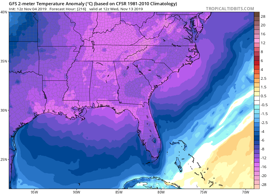
12Z GFS 216 hr 500 mb Heights forecast

12Z EURO 216 hr Heights forecast

GFS a bit sharper with the amplification of the upper trough for the Eastern CONUS, as compared to the EURO for the same time for this run. Cold air would dive deeper into the Deep South with its trough orientation on this run. EURO shows the brunt of the coldest air staying over New England and the Mid-Atlantic and the upper trough axis swinging off the Eastern seaboard this run.
CPC 6-10 day temperature outlook reflects colder times ahead for much of the Eastern CONUS, the notable exception of course is for South Florida

12Z EURO 216 hr Heights forecast
GFS a bit sharper with the amplification of the upper trough for the Eastern CONUS, as compared to the EURO for the same time for this run. Cold air would dive deeper into the Deep South with its trough orientation on this run. EURO shows the brunt of the coldest air staying over New England and the Mid-Atlantic and the upper trough axis swinging off the Eastern seaboard this run.
CPC 6-10 day temperature outlook reflects colder times ahead for much of the Eastern CONUS, the notable exception of course is for South Florida
0 likes
NEVER, EVER SAY NEVER in the tropics and weather in general, and most importantly, with life itself!!
________________________________________________________________________________________
Fay 2008 Beryl 2012 Debby 2012 Colin 2016 Hermine 2016 Julia 2016 Matthew 2016 Irma 2017 Dorian 2019
________________________________________________________________________________________
Fay 2008 Beryl 2012 Debby 2012 Colin 2016 Hermine 2016 Julia 2016 Matthew 2016 Irma 2017 Dorian 2019

Re: Florida Weather
I think now South Florida has the same climate as the Caribbean islands so as far as I’m concerned we are not subtropical but now tropical.
https://www.cpc.ncep.noaa.gov/products/ ... /nao.shtml
https://www.cpc.ncep.noaa.gov/products/ ... /nao.shtml
0 likes
Re: Florida Weather
The CPC outlooks (6-10 day posted above by northjax) have been steadily trending cooler for fl...even for the lower peninsula. Antecedant warm + declining normals+ anoms closer to normal=a meaningful cooldown over time.
0 likes

Re: Florida Weather
As usual every year during the winter, the models will always change for FL once we get within the 5 day range. Near neutral NAO and PNA should keep the core of the cold air north of central and southern FL.
0 likes
Re: Florida Weather
I have long been a proponent of looking at trends in the CPC outlook as means of cutting through the noise of individual model runs. These outlooks have quietly been suggestive of cooler times for Florida. That trend remains intact with today's output. For the first time...in what seems an eternity...there are no above normal anoms for Florida. Northern and central florida are somewhat below while south florida is normal. A significant cooldown is coming. This doesn't mean the freeze line is coming to Tampa but it does mean legit Autumnal chill is incoming. As for actual temps we'll have to wait but widespread 40's into the mid peninsula seems reasonable along with some freezing temps into the normal cold spots up north. We'll see but we should be excited for some comfort food temps. I certainly am.
1 likes
-
gatorcane
- S2K Supporter
- Posts: 23708
- Age: 48
- Joined: Sun Mar 13, 2005 3:54 pm
- Location: Boca Raton, FL
Re: Florida Weather
Certainly looks like some colder weather is on the way next week for peninsula Florida particularly Central and North Florida. It does look like the coldest air is going to stay to the north and get shunted east towards the mid-Atlantic, no surprise. Models often times overdo how much the core of the cold digs plus it is only mid November afterall.
One interesting thing is the GFS has a day next week with cloud cover behind the front keeping high temps well below normal for Central and North Florida. Could feel a bit “raw” if that verifies.
One interesting thing is the GFS has a day next week with cloud cover behind the front keeping high temps well below normal for Central and North Florida. Could feel a bit “raw” if that verifies.
0 likes
-
northjaxpro
- S2K Supporter
- Posts: 8900
- Joined: Mon Sep 27, 2010 11:21 am
- Location: Jacksonville, FL
Re: Florida Weather
Latest 06Z GFS run continues to show the first true arctic air mass of the Fall/Winter 2019-20 season arriving to the Deep South region and infiltrating into the peninsula, bringing a potential very significant cold spell to àll of North Florida by next Thursday morning (11/14), and YES, even to you all in South Florida will see a cool down by next week. Freezing temps a very good possibility for Thursday morming(11/14) across all of North Florida, and possibly a hard freeze for areas of the Big Bend and Panhandle.
Also, 06Z GFS this morning spins up a Gulf Low on Tuesday (11/12) next which could trigger strong to possible severe storms . It definitely merits watching to see if the dynamics for that actually come together in future model runs the next few days of run cycles. The 00Z Canadian spins up a Gulf Low off the TX coast, but a bit later on Thursday of next week.
Also, 06Z GFS this morning spins up a Gulf Low on Tuesday (11/12) next which could trigger strong to possible severe storms . It definitely merits watching to see if the dynamics for that actually come together in future model runs the next few days of run cycles. The 00Z Canadian spins up a Gulf Low off the TX coast, but a bit later on Thursday of next week.
0 likes
NEVER, EVER SAY NEVER in the tropics and weather in general, and most importantly, with life itself!!
________________________________________________________________________________________
Fay 2008 Beryl 2012 Debby 2012 Colin 2016 Hermine 2016 Julia 2016 Matthew 2016 Irma 2017 Dorian 2019
________________________________________________________________________________________
Fay 2008 Beryl 2012 Debby 2012 Colin 2016 Hermine 2016 Julia 2016 Matthew 2016 Irma 2017 Dorian 2019
Re: Florida Weather
We still need that NAO go way negative and PNA to go way positive for any cold air penetration across the FL Peninsula.
Last evening there was quite a lightning show across Orlando with very warm & humid conditions, it felt like a summer night.
0 likes
Return to “USA & Caribbean Weather”
Who is online
Users browsing this forum: No registered users and 63 guests