Well we're half way to May so here's my Atlantic tropical "throw-down" for the upcoming season - 19/11/5 225 ACE and 8 or more total landfalls with 5 or more striking the U.S. I've been vacillating back and forth between 19 & 20 named storms for a while but finally settled on the lessor.
I'd suggest that most begin to stock up on toilet paper now but given the shortage in stores, it seems like most of us have already checked THAT off their hurricane check list already

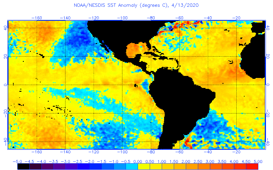
Overall I think a plethora of genesis will occur in the GOM, Caribbean, Bahamian waters. I do think this year will feature low latitude strong easterly waves however most remaining largely suppressed until until reaching approx. 50W-60W. Mid August I believe we'll see surface and mid level heights begin to slacken throughout the MDR resulting in a couple long trackers (ala Allen) to cruise westward through the Caribbean. Seems to me that the most persistent mid level height anomalies are presently occurring (and forecast) fairly well south with greatest ridging occurring around the Greater Antilles eastward. My guess is that strong westerlies will occur but primarily within the sub-tropical regions north of what I believe will be broad ridging generally occurring between 20N-25N. Sure, April is a long time from peak Hurricane Season but right now my guess is that W. Cuba/Florida Keys, the lower Texas coast, Jamaica, and Yucatan to Belize are apt to be most at risk of getting waxed with honorable mentions going out to Florida and South Carolina and a potential Grand Finale Cat2/3 threat to Cuba & Bahamas around Nov. 1st.