2020 Indicators: SST's / SAL / MSLP / Steering / Shear / Instability / Sat Images

This is the general tropical discussion area. Anyone can take their shot at predicting a storms path.

Moderator: S2k Moderators

Forum rules

The posts in this forum are NOT official forecasts and should not be used as such. They are just the opinion of the poster and may or may not be backed by sound meteorological data. They are NOT endorsed by any professional institution or STORM2K. For official information, please refer to products from the National Hurricane Center and National Weather Service.

Help Support Storm2K
Message
Author
USTropics
Professional-Met
Professional-Met
Posts: 2650
Joined: Sun Aug 12, 2007 3:45 am
Location: Florida State University

Re: 2020 Indicators: SST's / SAL / MSLP / Steering / Shear / Instability / Sat Images

#441 Postby USTropics » Wed May 06, 2020 9:02 pm

The area that is showing signs of potentially being favorable later in the season is the Caribbean. 2010-2019 was anomalously void of the typical Caribbean "cruiser". In fact, it doesn't appear any major hurricanes had a traditional track through the western Caribbean. This is a drastic difference from the previous 10 years (2000-2009).

2010-2019
Image

2000-2009
Image
11 likes   

TheStormExpert

Re: 2020 Indicators: SST's / SAL / MSLP / Steering / Shear / Instability / Sat Images

#442 Postby TheStormExpert » Wed May 06, 2020 9:23 pm

USTropics wrote:The area that is showing signs of potentially being favorable later in the season is the Caribbean. 2010-2019 was anomalously void of the typical Caribbean "cruiser". In fact, it doesn't appear any major hurricanes had a traditional track through the western Caribbean. This is a drastic difference from the previous 10 years (2000-2009).

2010-2019
https://i.imgur.com/c2K9JAs.png

2000-2009
https://i.imgur.com/WwrrSLB.png

The Gulf of Mexico too saw a decent drop in storms and hurricanes outside of the two notable ones such as Harvey in 2017 and Michael in 2018. This right here is why the U.S. during the period of 2010-2016 went untouched from any major hurricane strikes, though Matthew in 2016 came close and Sandy in 2012 was significant though post-tropical.

All in all if we get a west based season similar to or a lot like 2005 or 2008 things could get ugly in terms of U.S. impact especially along the U.S. Gulf Coast.
0 likes   

User avatar
toad strangler
S2K Supporter
S2K Supporter
Posts: 4543
Joined: Sun Jul 28, 2013 3:09 pm
Location: Earth
Contact:

Re: 2020 Indicators: SST's / SAL / MSLP / Steering / Shear / Instability / Sat Images

#443 Postby toad strangler » Wed May 06, 2020 9:30 pm

TheStormExpert wrote:
USTropics wrote:The area that is showing signs of potentially being favorable later in the season is the Caribbean. 2010-2019 was anomalously void of the typical Caribbean "cruiser". In fact, it doesn't appear any major hurricanes had a traditional track through the western Caribbean. This is a drastic difference from the previous 10 years (2000-2009).

2010-2019
https://i.imgur.com/c2K9JAs.png

2000-2009
https://i.imgur.com/WwrrSLB.png

The Gulf of Mexico too saw a decent drop in storms and hurricanes outside of the two notable ones such as Harvey in 2017 and Michael in 2018. This right here is why the U.S. during the period of 2010-2016 went untouched from any major hurricane strikes, though Matthew in 2016 came close and Sandy in 2012 was significant though post-tropical.

All in all if we get a west based season similar to or a lot like 2005 or 2008 things could get ugly in terms of U.S. impact especially along the U.S. Gulf Coast.


The Gulf and Caribbean go hand in hand for the most part.
0 likes   

USTropics
Professional-Met
Professional-Met
Posts: 2650
Joined: Sun Aug 12, 2007 3:45 am
Location: Florida State University

Re: 2020 Indicators: SST's / SAL / MSLP / Steering / Shear / Instability / Sat Images

#444 Postby USTropics » Wed May 06, 2020 10:24 pm

Conversely, 2010-2019 had a higher concentration of hurricanes off the east coast compared to 2000-2009.

2000-2009
Image

2010-2019
Image
9 likes   

TheStormExpert

Re: 2020 Indicators: SST's / SAL / MSLP / Steering / Shear / Instability / Sat Images

#445 Postby TheStormExpert » Wed May 06, 2020 11:11 pm

So basically at the moment we have two camps.

Those that believe this season will be average to above average, and those that think this season will be average to below average.

Talk about no consensus on here and the season starts in less than 30 days! :lol:
0 likes   

User avatar
CyclonicFury
Category 5
Category 5
Posts: 2025
Age: 26
Joined: Sun Jul 02, 2017 12:32 pm
Location: NC
Contact:

Re: 2020 Indicators: SST's / SAL / MSLP / Steering / Shear / Instability / Sat Images

#446 Postby CyclonicFury » Wed May 06, 2020 11:26 pm

TheStormExpert wrote:So basically at the moment we have two camps.

Those that believe this season will be average to above average, and those that think this season will be average to below average.

Talk about no consensus on here and the season starts in less than 30 days! :lol:

The vast majority of the predictions on here are calling for above average to well above average activity. Not one expert group is calling for average or below average activity at the moment.
9 likes   
NCSU B.S. in Meteorology Class of 2021. Tropical weather blogger at http://www.cyclonicfury.com. My forecasts and thoughts are NOT official, for official forecasts please consult the National Hurricane Center.

User avatar
toad strangler
S2K Supporter
S2K Supporter
Posts: 4543
Joined: Sun Jul 28, 2013 3:09 pm
Location: Earth
Contact:

Re: 2020 Indicators: SST's / SAL / MSLP / Steering / Shear / Instability / Sat Images

#447 Postby toad strangler » Thu May 07, 2020 6:42 am

CyclonicFury wrote:
TheStormExpert wrote:So basically at the moment we have two camps.

Those that believe this season will be average to above average, and those that think this season will be average to below average.

Talk about no consensus on here and the season starts in less than 30 days! :lol:

The vast majority of the predictions on here are calling for above average to well above average activity. Not one expert group is calling for average or below average activity at the moment.


I don’t think any group let alone one individual has been talking below average. There have been a couple mentions of a possible AMO switch is all I remember seeing. Not sure what “camps” he’s referring to. I think one of those camps house a bunch of empty tents :lol:
4 likes   

tolakram
Admin
Admin
Posts: 20009
Age: 62
Joined: Sun Aug 27, 2006 8:23 pm
Location: Florence, KY (name is Mark)

Re: 2020 Indicators: SST's / SAL / MSLP / Steering / Shear / Instability / Sat Images

#448 Postby tolakram » Thu May 07, 2020 6:59 am

TheStormExpert wrote:So basically at the moment we have two camps.

Those that believe this season will be average to above average, and those that think this season will be average to below average.

Talk about no consensus on here and the season starts in less than 30 days! :lol:


Who has been talking about below average?
1 likes   
M a r k
- - - - -
Join us in chat: Storm2K Chatroom Invite. Android and IOS apps also available.

The posts in this forum are NOT official forecasts and should not be used as such. Posts are NOT endorsed by any professional institution or STORM2K.org. For official information and forecasts, please refer to NHC and NWS products.

User avatar
aspen
Category 5
Category 5
Posts: 8818
Joined: Sat Oct 12, 2019 7:10 pm
Location: Connecticut, USA

Re: 2020 Indicators: SST's / SAL / MSLP / Steering / Shear / Instability / Sat Images

#449 Postby aspen » Thu May 07, 2020 7:01 am

Most of the factors at play for the 2020 season seem to be favorable for above-average activity, but how do the MDR, Caribbean, and Gulf conditions compare to 2017? That season’s ACE was dominated by several long-tracking Cape Verde major hurricanes, so if 2020 could have a similarly favorable MDR, perhaps the same thing could happen this year (although I highly doubt we’ll get something as ridiculous as Irma’s 60+ ACE).
0 likes   
Irene '11 Sandy '12 Hermine '16 5/15/2018 Derecho Fay '20 Isaias '20 Elsa '21 Henri '21 Ida '21

I am only a meteorology enthusiast who knows a decent amount about tropical cyclones. Look to the professional mets, the NHC, or your local weather office for the best information.

User avatar
NotSparta
Professional-Met
Professional-Met
Posts: 1668
Age: 23
Joined: Fri Aug 18, 2017 8:24 am
Location: Naples, FL
Contact:

Re: 2020 Indicators: SST's / SAL / MSLP / Steering / Shear / Instability / Sat Images

#450 Postby NotSparta » Thu May 07, 2020 7:05 am

aspen wrote:Most of the factors at play for the 2020 season seem to be favorable for above-average activity, but how do the MDR, Caribbean, and Gulf conditions compare to 2017? That season’s ACE was dominated by several long-tracking Cape Verde major hurricanes, so if 2020 could have a similarly favorable MDR, perhaps the same thing could happen this year (although I highly doubt we’ll get something as ridiculous as Irma’s 60+ ACE).


The MDR is a good bit cooler than in 2017 at this point, as with the Caribbean. Bit early to tell with other conditions but shear looks relatively favorable. Obviously though things are going to look less active than 2017 because that season was hyperactive, and comparing to a hyperactive season will make almost any season seem like it will be inactive
5 likes   
This post was probably an opinion of mine, and in no way is official. Please refer to http://www.hurricanes.gov for official tropical analysis and advisories.

My website, with lots of tropical wx graphics, including satellite and recon: http://cyclonicwx.com

User avatar
Ubuntwo
Category 5
Category 5
Posts: 1406
Age: 31
Joined: Thu Oct 05, 2017 10:41 pm

Re: 2020 Indicators: SST's / SAL / MSLP / Steering / Shear / Instability / Sat Images

#451 Postby Ubuntwo » Thu May 07, 2020 7:15 am

NotSparta wrote:
aspen wrote:Most of the factors at play for the 2020 season seem to be favorable for above-average activity, but how do the MDR, Caribbean, and Gulf conditions compare to 2017? That season’s ACE was dominated by several long-tracking Cape Verde major hurricanes, so if 2020 could have a similarly favorable MDR, perhaps the same thing could happen this year (although I highly doubt we’ll get something as ridiculous as Irma’s 60+ ACE).


The MDR is a good bit cooler than in 2017 at this point, as with the Caribbean. Bit early to tell with other conditions but shear looks relatively favorable. Obviously though things are going to look less active than 2017 because that season was hyperactive, and comparing to a hyperactive season will make almost any season seem like it will be inactive


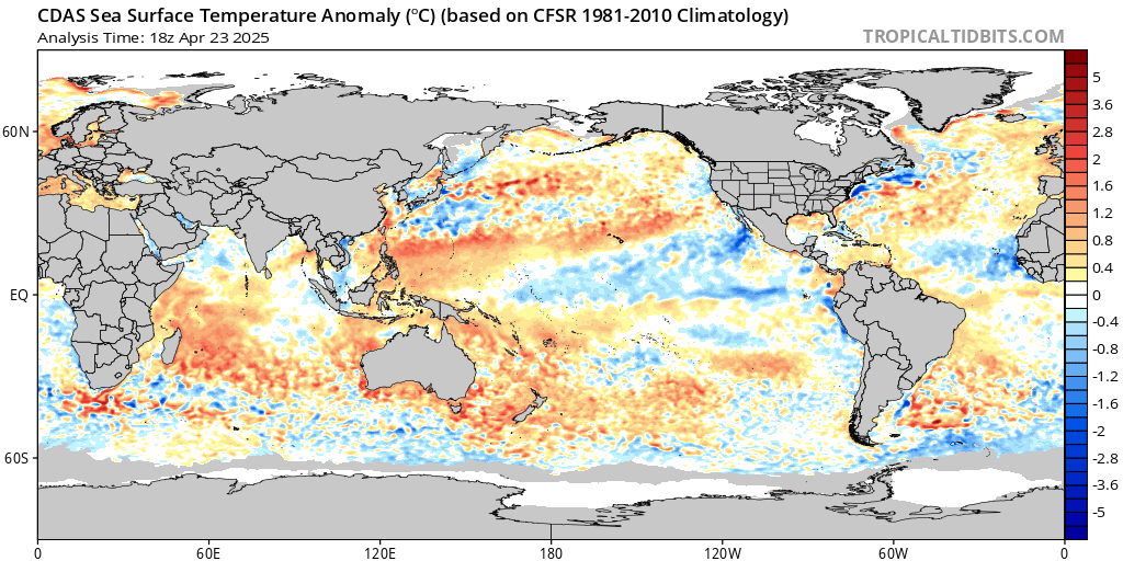
Here's the anomaly comparison for now vs. now in 2017 (just a day off)
Image
Image
(Don't know why the resolution is different since it's the same produce, but you can see the differences)

2017 had warmer MDR anomalies, but 2020 has a far warmer GOM
0 likes   
Kendall -> SLO -> PBC

Memorable Storms: Katrina (for its Florida landfall...) Wilma Matthew Irma

User avatar
cycloneye
Admin
Admin
Posts: 145303
Age: 68
Joined: Thu Oct 10, 2002 10:54 am
Location: San Juan, Puerto Rico

Re: 2020 Indicators: SST's / SAL / MSLP / Steering / Shear / Instability / Sat Images

#452 Postby cycloneye » Thu May 07, 2020 8:53 am

The Eastern Atlantic is warming and the rest of MDR although cool,it will begin to warm shortly.

Image

Image
0 likes   
Visit the Caribbean-Central America Weather Thread where you can find at first post web cams,radars
and observations from Caribbean basin members Click Here

User avatar
JetFuel_SE
Category 1
Category 1
Posts: 282
Age: 25
Joined: Thu Apr 30, 2020 3:57 pm

Re: 2020 Indicators: SST's / SAL / MSLP / Steering / Shear / Instability / Sat Images

#453 Postby JetFuel_SE » Thu May 07, 2020 8:58 am

Ubuntwo wrote:
NotSparta wrote:
aspen wrote:Most of the factors at play for the 2020 season seem to be favorable for above-average activity, but how do the MDR, Caribbean, and Gulf conditions compare to 2017? That season’s ACE was dominated by several long-tracking Cape Verde major hurricanes, so if 2020 could have a similarly favorable MDR, perhaps the same thing could happen this year (although I highly doubt we’ll get something as ridiculous as Irma’s 60+ ACE).


The MDR is a good bit cooler than in 2017 at this point, as with the Caribbean. Bit early to tell with other conditions but shear looks relatively favorable. Obviously though things are going to look less active than 2017 because that season was hyperactive, and comparing to a hyperactive season will make almost any season seem like it will be inactive


Here's the anomaly comparison for now vs. now in 2017 (just a day off)
https://www.tropicaltidbits.com/analysis/ocean/cdas-sflux_ssta_global_1.png
https://images.squarespace-cdn.com/content/v1/56530521e4b0c307d59bbe97/1494420088464-ARRDMWXGME1Q3HPII4IL/ke17ZwdGBToddI8pDm48kG4VqDreF-qTqyP-RyQBlzwUqsxRUqqbr1mOJYKfIPR7LoDQ9mXPOjoJoqy81S2I8N_N4V1vUb5AoIIIbLZhVYxCRW4BPu10St3TBAUQYVKcz9FKOkYZZtCaZTQFz_pq4njr3fQnFjhxZuT9qSS4BtKI42iWDYN3Yj3ILGKtJgbC/SST_anom_08_may_2017.png?format=1000w
(Don't know why the resolution is different since it's the same produce, but you can see the differences)

2017 had warmer MDR anomalies, but 2020 has a far warmer GOM

I personally wouldn't use CDAS anomalies, doesn't do well with SAL outbreaks, which is something we've been dealing with recently.
Image
Image
Last edited by JetFuel_SE on Thu May 07, 2020 11:39 am, edited 1 time in total.
4 likes   

User avatar
cycloneye
Admin
Admin
Posts: 145303
Age: 68
Joined: Thu Oct 10, 2002 10:54 am
Location: San Juan, Puerto Rico

Re: 2020 Indicators: SST's / SAL / MSLP / Steering / Shear / Instability / Sat Images

#454 Postby cycloneye » Thu May 07, 2020 10:40 am

0 likes   
Visit the Caribbean-Central America Weather Thread where you can find at first post web cams,radars
and observations from Caribbean basin members Click Here

User avatar
cycloneye
Admin
Admin
Posts: 145303
Age: 68
Joined: Thu Oct 10, 2002 10:54 am
Location: San Juan, Puerto Rico

Re: 2020 Indicators: SST's / SAL / MSLP / Steering / Shear / Instability / Sat Images

#455 Postby cycloneye » Thu May 07, 2020 1:31 pm

3 likes   
Visit the Caribbean-Central America Weather Thread where you can find at first post web cams,radars
and observations from Caribbean basin members Click Here

USTropics
Professional-Met
Professional-Met
Posts: 2650
Joined: Sun Aug 12, 2007 3:45 am
Location: Florida State University

Re: 2020 Indicators: SST's / SAL / MSLP / Steering / Shear / Instability / Sat Images

#456 Postby USTropics » Thu May 07, 2020 4:23 pm

Comparing activity by filtering ONI values for JAS, there are 22 years where values were -0.4 or less (subset1 - La Nina) and 22 years that were +0.4 or higher (subset2 - El Nino). This is filtered again by hurricanes and the months of JAS. Here are some breakdowns of activity (the first image is always La Nina seasons, second image is El Nino seasons):

Gulf of Mexico
Image
Image

Caribbean
Image
Image

East Coast
Image
Image

MDR
Image
Image

Subset1 | JAS ONI values | La Nina (-0.4 or less) | n=22 years

Code: Select all

2010
1973
1975
1988
1998
1999
1954
1970
1971
2007
1955
1964
2011
1956
2016
1985
1995
2000
1950
1974
1978
2013


Subset2 | JAS ONI values | El Nino (+0.4 or higher) | n=22 years

Code: Select all

1997
2015
1987
1965
1972
1957
1963
1982
1951
2002
1953
1991
2004
1968
1969
2009
1958
1976
1977
1986
1990
1994
6 likes   

TheStormExpert

Re: 2020 Indicators: SST's / SAL / MSLP / Steering / Shear / Instability / Sat Images

#457 Postby TheStormExpert » Thu May 07, 2020 8:27 pm

tolakram wrote:
TheStormExpert wrote:So basically at the moment we have two camps.

Those that believe this season will be average to above average, and those that think this season will be average to below average.

Talk about no consensus on here and the season starts in less than 30 days! :lol:


Who has been talking about below average?

Maybe I should've worded it better, but I was referring to those who are being skeptical or cautious on how active this season may be.
1 likes   

TheStormExpert

Re: 2020 Indicators: SST's / SAL / MSLP / Steering / Shear / Instability / Sat Images

#458 Postby TheStormExpert » Thu May 07, 2020 8:29 pm


The Atlantic is toasty, but mostly in the mid-latitudes between 20-40ºN. Will this change come peak season is the wild card.
0 likes   

User avatar
DorkyMcDorkface
Category 3
Category 3
Posts: 888
Age: 27
Joined: Mon Sep 30, 2019 1:32 pm
Location: Mid-Atlantic

Re: 2020 Indicators: SST's / SAL / MSLP / Steering / Shear / Instability / Sat Images

#459 Postby DorkyMcDorkface » Thu May 07, 2020 8:35 pm


This most recent NMME run is by far the most favorable looking of each of the past 5 May runs in terms of Atlantic SSTs and precip:
Image
Image
4 likes   
Please note the thougths expressed by this account are solely those of the user and are from a hobbyist perspective. For more comprehensive analysis, consult an actual professional meteorologist or meteorology agency.


Floyd 1999 | Isabel 2003 | Hanna 2008 | Irene 2011 | Sandy 2012 | Isaias 2020

User avatar
toad strangler
S2K Supporter
S2K Supporter
Posts: 4543
Joined: Sun Jul 28, 2013 3:09 pm
Location: Earth
Contact:

Re: 2020 Indicators: SST's / SAL / MSLP / Steering / Shear / Instability / Sat Images

#460 Postby toad strangler » Thu May 07, 2020 10:18 pm

TheStormExpert wrote:

The Atlantic is toasty, but mostly in the mid-latitudes between 20-40ºN. Will this change come peak season is the wild card.


No man, that is not the wild card. It is one ingredient. Also, anomalies are still a touch plus right now even in the MDR. No idea what you are talking about here.
1 likes   


Return to “Talkin' Tropics”

Who is online

Users browsing this forum: IsabelaWeather and 42 guests