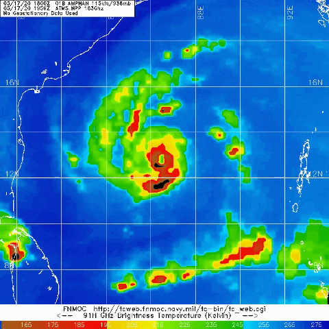
Yellow Evan wrote:12z SHIPS FWIW suggests this may be peaking sooner than I thought yesterday.IO, 01, 2020051712, 03, SHIP, 0, 120N, 864E, 75, 0, HU, 0, , 0, 0, 0, 0,
IO, 01, 2020051712, 03, SHIP, 12, 131N, 865E, 85, 0, HU, 0, , 0, 0, 0, 0,
IO, 01, 2020051712, 03, SHIP, 24, 143N, 866E, 84, 0, HU, 0, , 0, 0, 0, 0,
IO, 01, 2020051712, 03, SHIP, 36, 158N, 870E, 84, 0, HU, 0, , 0, 0, 0, 0,
IO, 01, 2020051712, 03, SHIP, 48, 176N, 875E, 74, 0, HU, 0, , 0, 0, 0, 0,
IO, 01, 2020051712, 03, SHIP, 60, 199N, 882E, 58, 0, TS, 0, , 0, 0, 0, 0,
IO, 01, 2020051712, 03, SHIP, 72, 221N, 889E, 48, 0, TS, 0, , 0, 0, 0, 0,
IO, 01, 2020051712, 03, SHIP, 84, 236N, 892E, 28, 0, TD, 0, , 0, 0, 0, 0,
The initialization for 12Z SHIPS was made when the best track was giving us a medium category 1 hurricane. I want to see what their next model run looks like (with the updated best track).