98S GENESIS004 200517 1200 6.7S 94.2E SHEM 15 1010
SIO: Mangga - Extratropical
Moderator: S2k Moderators
-
Jay Typhoon
- Tropical Low

- Posts: 21
- Joined: Mon Aug 26, 2019 6:31 am
SIO: Mangga - Extratropical
Last edited by Jay Typhoon on Thu May 21, 2020 9:46 am, edited 1 time in total.
0 likes
-
Nancy Smar

- Category 5

- Posts: 1081
- Age: 25
- Joined: Wed Aug 16, 2017 10:03 pm
Re: SIO: INVEST 98S
WTXS21 PGTW 200300
MSGID/GENADMIN/JOINT TYPHOON WRNCEN PEARL HARBOR HI//
SUBJ/TROPICAL CYCLONE FORMATION ALERT//
RMKS/
1. FORMATION OF A SIGNIFICANT TROPICAL CYCLONE IS POSSIBLE WITHIN
120 NM EITHER SIDE OF A LINE FROM 6.2S 92.0E TO 9.6S 93.2E WITHIN
THE NEXT 12 TO 24 HOURS. AVAILABLE DATA DOES NOT JUSTIFY ISSUANCE
OF NUMBERED TROPICAL CYCLONE WARNINGS AT THIS TIME. WINDS IN THE
AREA ARE ESTIMATED TO BE 20 TO 25 KNOTS. METSAT IMAGERY AT
200000Z INDICATES THAT A CIRCULATION CENTER IS LOCATED NEAR 6.6S
92.1E. THE SYSTEM IS MOVING SOUTH-SOUTHWESTWARD AT 06 KNOTS.
2. REMARKS:
THE AREA OF CONVECTION (INVEST 98S) PREVIOUSLY LOCATED NEAR 5.5S
92.5E IS NOW LOCATED NEAR 6.6S 92.1E, APPROXIMATELY 430 NM NORTHWEST
OF COCOS ISLAND. ANIMATED ENHANCED INFRARED SATELLITE IMAGERY, ALONG
WITH A 200006Z SSMIS 91GHZ MICROWAVE IMAGE, DEPICT A VERY BROAD LOW
LEVEL CIRCULATION (LLC) WITH FRAGMENTED DEEP CONVECTION SCATTERED
AROUND THE PERIPHERY. INVEST 98S IS CURRENTLY IN A FAVORABLE
ENVIRONMENT WITH GOOD POLEWARD OUTFLOW, LOW (<15 KTS) VERTICAL WIND
SHEAR, AND WARM (29 TO 30 CELSIUS) SEA SURFACE TEMPERATURES. GLOBAL
MODELS INDICATE THAT INVEST 98S WILL TRACK GENERALLY SOUTHWARD AND
THEN SOUTHEASTWARD WHILE CONSOLIDATING AND INTENSIFYING. MAXIMUM
SUSTAINED SURFACE WINDS ARE ESTIMATED AT 20 TO 25 KNOTS. MINIMUM SEA
LEVEL PRESSURE IS ESTIMATED TO BE NEAR 1003 MB. THE POTENTIAL FOR
THE DEVELOPMENT OF A SIGNIFICANT TROPICAL CYCLONE WITHIN THE NEXT 24
HOURS IS HIGH.
3. THIS ALERT WILL BE REISSUED, UPGRADED TO WARNING OR CANCELLED BY
210300Z.//
NNNN
0 likes


Re: SIO: INVEST 98S
Today's 00Z ECMWF run for 98S definitely got my attention. It is very rare to see a model forecast like this for my area, even though the storm would probably be non-tropical by the time it gets here.

2 likes
-
cycloneye

- Admin

- Posts: 149214
- Age: 69
- Joined: Thu Oct 10, 2002 10:54 am
- Location: San Juan, Puerto Rico
Re: SIO: Tropical Cyclone 27S
0 likes
Visit the Caribbean-Central America Weather Thread where you can find at first post web cams,radars
and observations from Caribbean basin members Click Here
and observations from Caribbean basin members Click Here
Re: SIO: Tropical Cyclone 27S
Looks like Sunday night is going to be quite windy. ECMWF 12Z forecasts sustained hurricane-force winds in the Perth area from a system with subtropical characteristics. This is starting to remind me of the benchmark cyclone around here - Alby '78 - which produced recorded gusts up to 150 km/h.


0 likes


Re: SIO: Tropical Cyclone 27S
This should get named Mangga by Jakarta or Imogen by Perth if it leaves Jakarta's AOR earlier.
0 likes
-
wxman57

- Moderator-Pro Met

- Posts: 23170
- Age: 68
- Joined: Sat Jun 21, 2003 8:06 pm
- Location: Houston, TX (southwest)
Re: SIO: Tropical Cyclone 27S
TorSkk wrote:This should get named Mangga by Jakarta or Imogen by Perth if it leaves Jakarta's AOR earlier.
It hasn't been upgraded to a TC by the official RSMC in Jakarta. They're calling it Depression 98S.
Interesting that JTWC forecasts it to remain a TC as it reaches Australia and even takes it east of Perth to near the south coast of Australia as a TC. All model guidance indicates that it will merge with a cold front as it approaches NW Australia.
0 likes
Re: SIO: 98S - Tropical Depression
First forecast from the BOM:

Code: Select all
Date/Time    : Location    : Loc. Accuracy: Max Wind   : Central Pressure
[UTC]        : degrees     :      nm  [km]: knots[km/h]: hPa
+06:  21/1800:  9.9S  93.2E:     055 [100]:  040  [075]:  993
+12:  22/0000: 10.6S  93.6E:     070 [130]:  040  [075]:  992
+18:  22/0600: 11.7S  94.3E:     090 [165]:  040  [075]:  992
+24:  22/1200: 12.9S  95.2E:     110 [205]:  040  [075]:  992
+36:  23/0000: 15.6S  97.9E:     130 [240]:  040  [075]:  995
+48:  23/1200: 18.8S 102.4E:     150 [275]:  040  [075]:  992
+60:  24/0000: 23.2S 107.9E:     170 [310]:  045  [085]:  990
+72:  24/1200: 28.3S 113.8E:     185 [345]:  045  [085]:  990
+96:  25/1200:             :              :            :
+120: 26/1200:             :              :            :
REMARKS:
A tropical low has responded to the equatorial westerly wind burst and ASCAT and
SCATSAT showed gales in the northwest quadrant earlier today.

Despite the stronger surface winds, the convective signature remains weak having
convection along a NW-SE axis and a little removed from the centre. Dvorak
estimates remain low at about DT=1.5 based on only slight curvature and sheared
nature of the system.

The convection is being assisted by strong upper level poleward outflow. There
is a window of opportunity for some development in the next 24 hours as the
circulation moves into an area of lower windshear. Although the convection is
not likely to develop into a classic tropical cyclone pattern by Dvorak
standards, gales are likely about the northern quadrants and particularly the NE
quadrant as the circulation accelerates to the southeast moving past the Cocos
Keeling Islands during Friday afernoon and evening.

During Saturday the circulation will feel the effects of an approaching upper
level trough to the southwest. Following some initial weakening, the circulation
will be transformed into a non-tropical [baroclinic] system and intensify as it
accelerate to the southeast towards the WA coastline. An expanding wind field
will extend the impacts and heavy rainfall and storm surges are expected on
Sunday and Monday. Model guidance varies with the track and timing for coastal
impacts at this stage.

Copyright Commonwealth of Australia
==
The next bulletin for this system will be issued by: 21/1930 UTC by Perth TCWC.
0 likes
-
wxman57
- Moderator-Pro Met
- Posts: 23170
- Age: 68
- Joined: Sat Jun 21, 2003 8:06 pm
- Location: Houston, TX (southwest)
Re: SIO: 98S - Tropical Depression
Now that 3 agencies are recognizing it, it looks much worse than it has for the past 2 days. At least BoM isn't taking a 55kt TS into western Australia like the JTWC. BoM weakens it to a depression and merges it with a cold front well west of Australia, which is most likely this time of year.
0 likes
Re: SIO: Tropical Cyclone 27S
wxman57 wrote:TorSkk wrote:This should get named Mangga by Jakarta or Imogen by Perth if it leaves Jakarta's AOR earlier.
It hasn't been upgraded to a TC by the official RSMC in Jakarta. They're calling it Depression 98S.
Interesting that JTWC forecasts it to remain a TC as it reaches Australia and even takes it east of Perth to near the south coast of Australia as a TC. All model guidance indicates that it will merge with a cold front as it approaches NW Australia.
Now named Mangga by Jakarta, just on the edge of their AOR, 9,8S
0 likes


-
wxman57
- Moderator-Pro Met
- Posts: 23170
- Age: 68
- Joined: Sat Jun 21, 2003 8:06 pm
- Location: Houston, TX (southwest)
Re: SIO: Mangga - Tropical Cyclone
Here's Jakarta's center. VERY impressive storm, not! Note that JTWC and BoM have it in the same cloud-free area.

1 likes

Re: SIO: Mangga - Tropical Cyclone
wxman57 wrote:Here's Jakarta's center. VERY impressive storm, not! Note that JTWC and BoM have it in the same cloud-free area.
http://wxman57.com/images/TC.JPG
That blank area represents the total amount of brain cells used by the JTWC and BoM in placing Mangga’s position.
0 likes
Irene '11 Sandy '12 Hermine '16 5/15/2018 Derecho Fay '20 Isaias '20 Elsa '21 Henri '21 Ida '21
I am only a meteorology enthusiast who knows a decent amount about tropical cyclones. Look to the professional mets, the NHC, or your local weather office for the best information.
I am only a meteorology enthusiast who knows a decent amount about tropical cyclones. Look to the professional mets, the NHC, or your local weather office for the best information.
-
StormTracker89
- Tropical Depression

- Posts: 57
- Joined: Sat May 16, 2020 3:47 pm
- Location: Somewhere in the Pacific
Re: SIO: Mangga - Tropical Cyclone
JTWC is forecasting it to be fully Extra-Tropical by 72hr point, becoming by 48hr point. Their standard procedure is to continue forecasting track, intensity and wind radii through extratropical transition.
wxman57 wrote:Now that 3 agencies are recognizing it, it looks much worse than it has for the past 2 days. At least BoM isn't taking a 55kt TS into western Australia like the JTWC. BoM weakens it to a depression and merges it with a cold front well west of Australia, which is most likely this time of year.
0 likes
-
StormTracker89
- Tropical Depression
- Posts: 57
- Joined: Sat May 16, 2020 3:47 pm
- Location: Somewhere in the Pacific
Re: SIO: Mangga - Tropical Cyclone
15Z ASCAT data supports placing the center in the clear area, though the center is further east than JTWC's initial position. I'm sure that the 12Z best track position will be updated to reflect the new ASCAT data for the 18Z cycle.
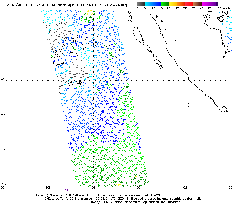
That blank area represents the total amount of brain cells used by the JTWC and BoM in placing Mangga’s position.
0 likes
Re: SIO: Mangga - Tropical Cyclone
StormTracker89 wrote:15Z ASCAT data supports placing the center in the clear area, though the center is further east than JTWC's initial position. I'm sure that the 12Z best track position will be updated to reflect the new ASCAT data for the 18Z cycle.That blank area represents the total amount of brain cells used by the JTWC and BoM in placing Mangga’s position.
https://manati.star.nesdis.noaa.gov/ascat_images/cur_25km_METB/zooms/WMBas222.png
I thought it had just about completely dissipated, judging by satellite images from earlier...apparently not. It seems to have made a surprise comeback now.
0 likes
Irene '11 Sandy '12 Hermine '16 5/15/2018 Derecho Fay '20 Isaias '20 Elsa '21 Henri '21 Ida '21
I am only a meteorology enthusiast who knows a decent amount about tropical cyclones. Look to the professional mets, the NHC, or your local weather office for the best information.
I am only a meteorology enthusiast who knows a decent amount about tropical cyclones. Look to the professional mets, the NHC, or your local weather office for the best information.
-
1900hurricane

- Category 5
- Posts: 6063
- Age: 34
- Joined: Fri Feb 06, 2015 12:04 pm
- Location: Houston, TX
- Contact:
Re: SIO: Mangga - Tropical Cyclone
StormTracker89 wrote:15Z ASCAT data supports placing the center in the clear area, though the center is further east than JTWC's initial position. I'm sure that the 12Z best track position will be updated to reflect the new ASCAT data for the 18Z cycle.That blank area represents the total amount of brain cells used by the JTWC and BoM in placing Mangga’s position.
https://manati.star.nesdis.noaa.gov/ascat_images/cur_25km_METB/zooms/WMBas222.png
I'd argue for an 18Z intensity estimate of 40 kt based on the work of Chou, Wu, & Lin, but the ASCAT low bias in TCs only just stats around that intensity, so I'm probably just splitting hairs.
0 likes
Contract Meteorologist. TAMU & MSST. Fiercely authentic, one of a kind. We are all given free will, so choose a life meant to be lived. We are the Masters of our own Stories.
Opinions expressed are mine alone.
Follow me on Twitter at @1900hurricane : Read blogs at https://1900hurricane.wordpress.com/
Opinions expressed are mine alone.
Follow me on Twitter at @1900hurricane : Read blogs at https://1900hurricane.wordpress.com/

Re: SIO: Mangga - Tropical Cyclone
Last advisory issued by the JTWC. They were overoptimistic about the potential of this storm from the start.
WTXS31 PGTW 232100
MSGID/GENADMIN/JOINT TYPHOON WRNCEN PEARL HARBOR HI//
SUBJ/TROPICAL CYCLONE 27S (MANGGA) WARNING NR 012//
RMKS/
1. TROPICAL CYCLONE 27S (MANGGA) WARNING NR 012
01 ACTIVE TROPICAL CYCLONE IN SOUTHIO
MAX SUSTAINED WINDS BASED ON ONE-MINUTE AVERAGE
WIND RADII VALID OVER OPEN WATER ONLY
---
WARNING POSITION:
231800Z --- NEAR 21.6S 104.7E
MOVEMENT PAST SIX HOURS - 125 DEGREES AT 44 KTS
POSITION ACCURATE TO WITHIN 090 NM
POSITION BASED ON CENTER LOCATED BY SATELLITE
PRESENT WIND DISTRIBUTION:
MAX SUSTAINED WINDS - 035 KT, GUSTS 045 KT
WIND RADII VALID OVER OPEN WATER ONLY
EXTRATROPICAL
RADIUS OF 034 KT WINDS - 205 NM NORTHEAST QUADRANT
155 NM SOUTHEAST QUADRANT
000 NM SOUTHWEST QUADRANT
000 NM NORTHWEST QUADRANT
REPEAT POSIT: 21.6S 104.7E
---
FORECASTS:
12 HRS, VALID AT:
240600Z --- 26.3S 110.7E
MAX SUSTAINED WINDS - 040 KT, GUSTS 050 KT
WIND RADII VALID OVER OPEN WATER ONLY
EXTRATROPICAL
RADIUS OF 034 KT WINDS - 220 NM NORTHEAST QUADRANT
350 NM SOUTHEAST QUADRANT
350 NM SOUTHWEST QUADRANT
240 NM NORTHWEST QUADRANT
---
REMARKS:
232100Z POSITION NEAR 22.8S 106.2E.
23MAY20. TROPICAL CYCLONE (TC) 27S (MANGGA), LOCATED APPROXIMATELY
525 NM WEST OF LEARMONTH, AUSTRALIA, HAS TRACKED SOUTHEASTWARD AT
44 KNOTS (KTS) OVER THE PAST SIX HOURS. ANIMATED ENHANCED INFRARED
SATELLITE IMAGERY REVEALS AN ELONGATED CONVECTIVE REGION WITH NO
CLEAR LOW LEVEL CIRCULATION CENTER. THERE IS ALSO A LARGE
STRATOCUMULUS FIELD TO THE WEST OF THE CONVECTIVE REGION,
SUGGESTING COLD AIR IS WRAPPING INTO THE CIRCULATION. THE LACK OF
A CLEAR LOW LEVEL CIRCULATION PROVIDES VERY LOW CONFIDENCE IN THE
INITIAL POSITION. THE 35 KT INITIAL INTENSITY STEMS FROM A PARTIAL
231502Z METOP-B ASCAT PASS THAT SHOWS A FEW 35 KT WIND BARBS TO
THE NORTHEAST OF THE CENTER. THE PGTW DVORAK FIX INTENSITY IS T1.0
(25 KTS), BELOW THE CURRENT INTENSITY. HIGH (35-40 KT) VERTICAL
WIND SHEAR AND COOL (25-26 CELSIUS) SEA SURFACE TEMPERATURE OFFSET
EXCELLENT POLEWARD OUTFLOW TO MAKE THE ENVIRONMENT UNFAVORABLE FOR
A TROPICAL CYCLONE. BASED ON THE CLOUD SIGNATURE AND ENVIRONMENT,
TC 27S IS ASSESSED AS EXTRATROPICAL. TC 27S WILL CONTINUE ALONG
THE SOUTHEASTERN PERIPHERY OF A MIDLATITUDE SHORTWAVE TROUGH AND
INTENSIFY SLIGHTLY, WITH AN EXPANDING 34-KT WIND FIELD, AS IT
TRACKS SOUTHEASTWARD TOWARDS WESTERN AUSTRALIA. THE TRACK FORECAST
IS HEDGED SLIGHTLY TO THE NORTH OF THE MODEL CONSENSUS, CONSISTENT
WITH THE CURRENT TRACK. WITH TAU 12 SPREAD AT ALMOST 290 NM AND
THE HIGH UNCERTAINTY IN THE INITIAL POSITION, THERE IS LOW
CONFIDENCE IN THE JTWC TRACK FORECAST. THIS IS THE FINAL WARNING
ON THIS SYSTEM BY THE JOINT TYPHOON WRNCEN PEARL HARBOR HI. THE
SYSTEM WILL BE CLOSELY MONITORED FOR SIGNS OF REGENERATION.
MAXIMUM SIGNIFICANT WAVE HEIGHT AT 231800Z IS 25 FEET.//
NNNN
0 likes
Who is online
Users browsing this forum: No registered users and 24 guests