Only model runs.
https://twitter.com/MJVentrice/status/1267084924840001538
ATL: CRISTOBAL - Models
Moderator: S2k Moderators
-
cycloneye

- Admin

- Posts: 149275
- Age: 69
- Joined: Thu Oct 10, 2002 10:54 am
- Location: San Juan, Puerto Rico
ATL: CRISTOBAL - Models
2 likes
Visit the Caribbean-Central America Weather Thread where you can find at first post web cams,radars
and observations from Caribbean basin members Click Here
and observations from Caribbean basin members Click Here

Re: ATL: INVEST 93L - Models
Quite a lot of ensemble members showing a strong TS or a minimal hurricane in the Gulf. Based on currently expected conditions, how likely is this? Gulf waters are warm enough but I think I recall that shear will be high.
0 likes
Irene '11 Sandy '12 Hermine '16 5/15/2018 Derecho Fay '20 Isaias '20 Elsa '21 Henri '21 Ida '21
I am only a meteorology enthusiast who knows a decent amount about tropical cyclones. Look to the professional mets, the NHC, or your local weather office for the best information.
I am only a meteorology enthusiast who knows a decent amount about tropical cyclones. Look to the professional mets, the NHC, or your local weather office for the best information.
Re: ATL: INVEST 93L - Models
HWRF develops Tropical Storm Cristobal in the BOC by Wednesday.
0 likes
Irene '11 Sandy '12 Hermine '16 5/15/2018 Derecho Fay '20 Isaias '20 Elsa '21 Henri '21 Ida '21
I am only a meteorology enthusiast who knows a decent amount about tropical cyclones. Look to the professional mets, the NHC, or your local weather office for the best information.
I am only a meteorology enthusiast who knows a decent amount about tropical cyclones. Look to the professional mets, the NHC, or your local weather office for the best information.
-
PTrackerLA

- Category 5

- Posts: 5281
- Age: 42
- Joined: Thu Oct 10, 2002 8:40 pm
- Location: Lafayette, LA
Re: ATL: INVEST 93L - Models
I know the ICON performed terribly last year with Dorian but the 12z ICON is rather alarming. Would fit in with some of the Euro ensembles
0 likes
Re: ATL: INVEST 93L - Models
PTrackerLA wrote:I know the ICON performed terribly last year with Dorian but the 12z ICON is rather alarming. Would fit in with some of the Euro ensembles
https://imgur.com/53lPgmp
The ICON was the only model insisting that Dorian would not make landfall in the DR or Puerto Rico. It was right, and its safe passage between some of the islands was what allowed it to eventually go berserk near the Bahamas. Since it did that well with Dorian’s earlier track and since this run is close to the Euro ensembles, I think it’s reliable enough to keep an eye on.
2 likes
Irene '11 Sandy '12 Hermine '16 5/15/2018 Derecho Fay '20 Isaias '20 Elsa '21 Henri '21 Ida '21
I am only a meteorology enthusiast who knows a decent amount about tropical cyclones. Look to the professional mets, the NHC, or your local weather office for the best information.
I am only a meteorology enthusiast who knows a decent amount about tropical cyclones. Look to the professional mets, the NHC, or your local weather office for the best information.
-
PTrackerLA
- Category 5
- Posts: 5281
- Age: 42
- Joined: Thu Oct 10, 2002 8:40 pm
- Location: Lafayette, LA
Re: ATL: INVEST 93L - Models
0 likes

-
Ivanhater

- Storm2k Moderator

- Posts: 11221
- Age: 39
- Joined: Fri Jul 01, 2005 8:25 am
- Location: Pensacola
Re: ATL: INVEST 93L - Models
If anything, this looks to bring much needed rain to the northern gulf coast
1 likes
Michael
-
SouthDadeFish

- Professional-Met

- Posts: 2835
- Joined: Thu Sep 23, 2010 2:54 pm
- Location: Miami, FL
- Contact:
Re: ATL: INVEST 93L - Models
I think focusing on any particular landfall location at this point in time is a futile endeavor. The long-term details of the storm are highly sensitive to which vorticity maximum becomes dominant over the next 2-3 days. Will TS Amanda remain the dominant vorticity maximum in the Gulf? The 12Z GFS suggests no. The 00Z EC suggests maybe. The 12Z GEM suggests yes. This has large implications on track, intensity, and most of all, timing.
I would imagine which vorticity max becomes dominant out of the gyre is highly sensitive to diabatic (convective) processes which are notoriously challenging to predict. Just keep this all in mind when you view model forecasts over the next 1-2 days. I imagine we will see lots of waffling.
I would imagine which vorticity max becomes dominant out of the gyre is highly sensitive to diabatic (convective) processes which are notoriously challenging to predict. Just keep this all in mind when you view model forecasts over the next 1-2 days. I imagine we will see lots of waffling.
10 likes

Re: ATL: INVEST 93L - Models
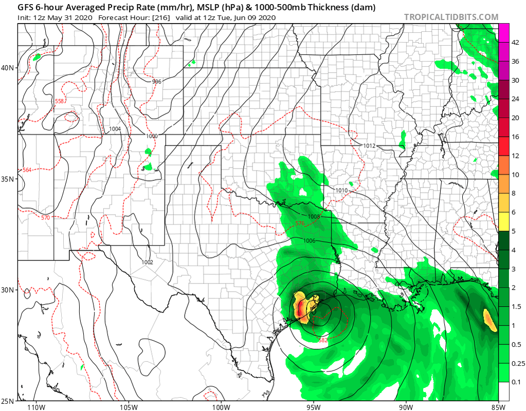
PTrackerLA wrote:12z GFS out to 180 hrs. Stronger and more in line with other models now.
https://imgur.com/tQtjIlm
Definately more inline with ICON and CMC though perhaps still about 24 hours slower then those models. This GFS run certainly shows organization far sooner then the previous two GFS model runs. If the EURO today continues to come in line with the overall timing, then this looks to be a pretty reasonable outcome. I'll be curious to see if the EURO 12Z run show's a deeper and more organized system AND if it suggests any bit more of a track to the left as i'm assuming.
0 likes
Andy D
(For official information, please refer to the NHC and NWS products.)
(For official information, please refer to the NHC and NWS products.)

Re: ATL: INVEST 93L - Models
SouthDadeFish wrote:I think focusing on any particular landfall location at this point in time is a futile endeavor. The long-term details of the storm are highly sensitive to which vorticity maximum becomes dominant over the next 2-3 days. Will TS Amanda remain the dominant vorticity maximum in the Gulf? The 12Z GFS suggests no. The 00Z EC suggests maybe. The 12Z GEM suggests yes. This has large implications on track, intensity, and most of all, timing.
I would imagine which vorticity max becomes dominant out of the gyre is highly sensitive to diabatic (convective) processes which are notoriously challenging to predict. Just keep this all in mind when you view model forecasts over the next 1-2 days. I imagine we will see lots of waffling.
But the consensus in all models right now is the TX/LA border even though some of the models are developing different areas of low pressure in different areas.
0 likes
Re: ATL: INVEST 93L - Models
SouthDadeFish wrote:I think focusing on any particular landfall location at this point in time is a futile endeavor. The long-term details of the storm are highly sensitive to which vorticity maximum becomes dominant over the next 2-3 days. Will TS Amanda remain the dominant vorticity maximum in the Gulf? The 12Z GFS suggests no. The 00Z EC suggests maybe. The 12Z GEM suggests yes. This has large implications on track, intensity, and most of all, timing.
I would imagine which vorticity max becomes dominant out of the gyre is highly sensitive to diabatic (convective) processes which are notoriously challenging to predict. Just keep this all in mind when you view model forecasts over the next 1-2 days. I imagine we will see lots of waffling.
Great point & pretty much what I surmised in the Amanda thread (which is why I don't like having two distinct 93L & Amanda threads, where folks understandably are discussing the same thing in each)
0 likes
Andy D
(For official information, please refer to the NHC and NWS products.)
(For official information, please refer to the NHC and NWS products.)
-
Aric Dunn
- Category 5
- Posts: 21238
- Age: 43
- Joined: Sun Sep 19, 2004 9:58 pm
- Location: Ready for the Chase.
- Contact:
ATL: INVEST 93L - Discussion
12z UKMET is rather interesting..

0 likes
Note: If I make a post that is brief. Please refer back to previous posts for the analysis or reasoning. I do not re-write/qoute what my initial post said each time.
If there is nothing before... then just ask
Space & Atmospheric Physicist, Embry-Riddle Aeronautical University,
I believe the sky is falling...
If there is nothing before... then just ask
Space & Atmospheric Physicist, Embry-Riddle Aeronautical University,
I believe the sky is falling...
-
Ivanhater
- Storm2k Moderator
- Posts: 11221
- Age: 39
- Joined: Fri Jul 01, 2005 8:25 am
- Location: Pensacola
Re: ATL: INVEST 93L - Models
Some models are starting to show a new eastern low development or the boc low rotating east then heading north. Something to keep an eye on
0 likes
Michael

Re: ATL: INVEST 93L - Models
Once the models have a better handle on Amanda they may shift left a little initially.
The shear forecast in the northern and central gulf appears to call for improving conditions for development.
Might even get a high pressure dome building from the outflow.
The shear forecast in the northern and central gulf appears to call for improving conditions for development.
Might even get a high pressure dome building from the outflow.
0 likes
Re: ATL: INVEST 93L - Discussion
Aric Dunn wrote:12z UKMET is rather interesting..
https://i.ibb.co/vqz871z/modgbr-20200531-1200-animation.gif
That looks NOLA bound.
1 likes
-
stormlover2013
-
MississippiWx

- S2K Supporter

- Posts: 1720
- Joined: Sat Aug 14, 2010 1:44 pm
- Location: Hattiesburg, Mississippi
Re: ATL: INVEST 93L - Models
Very complex scenario here. Amanda could possibly survive well enough to redevelop in the BOC as the Euro/CMC/HWRF suggest. Even the GFS and Ukmet suggest this occurs. The difference is the way they move it back into Mexico. After this occurs, another lobe of energy (remnants?) rotate around the east side of the CAG and develops yet another storm off the Northern Yucatán.
Many different outcomes at play here, all feasible. Regardless, I’d say the chances of a tropical cyclone somewhere in the GOM are fairly high this upcoming week.
Many different outcomes at play here, all feasible. Regardless, I’d say the chances of a tropical cyclone somewhere in the GOM are fairly high this upcoming week.
2 likes
This post is not an official forecast and should not be used as such. It is just the opinion of MississippiWx and may or may not be backed by sound meteorological data. It is not endorsed by any professional institution including storm2k.org. For Official Information please refer to the NHC and NWS products.
-
wxman22

- Category 5
- Posts: 1891
- Joined: Mon Jan 30, 2006 12:39 am
- Location: Wichita Falls, TX
- Contact:
Re: ATL: INVEST 93L - Models
Cpv17 wrote:SouthDadeFish wrote:I think focusing on any particular landfall location at this point in time is a futile endeavor. The long-term details of the storm are highly sensitive to which vorticity maximum becomes dominant over the next 2-3 days. Will TS Amanda remain the dominant vorticity maximum in the Gulf? The 12Z GFS suggests no. The 00Z EC suggests maybe. The 12Z GEM suggests yes. This has large implications on track, intensity, and most of all, timing.
I would imagine which vorticity max becomes dominant out of the gyre is highly sensitive to diabatic (convective) processes which are notoriously challenging to predict. Just keep this all in mind when you view model forecasts over the next 1-2 days. I imagine we will see lots of waffling.
But the consensus in all models right now is the TX/LA border even though some of the models are developing different areas of low pressure in different areas.
There really is no consensus yet, models and there ensembles show anything from the upper Texas coast to southeast Louisiana that's a pretty broad area . It will be a few more days before we have a true consensus as center relocation is likely at this point which will have large impacts on landfall location.
0 likes
Who is online
Users browsing this forum: No registered users and 77 guests