ATL: CRISTOBAL - Models

Moderator: S2k Moderators

Message
Author
User avatar
NDG
S2K Supporter
S2K Supporter
Posts: 15446
Joined: Sun Jul 09, 2006 10:14 pm
Location: Orlando, FL

Re: ATL: CRISTOBAL - Models

#521 Postby NDG » Thu Jun 04, 2020 1:58 pm

gatorcane wrote:Doesn’t even look tropical when it landfalls in LA as shown by 12Z GFS simulation. All the rainfall and any winds are hundreds of miles east of landfall over Florida:

https://i.postimg.cc/dQxNBKcN/gfs-ir-watl-14.png


Unlike the 12z Euro which paints a different picture.

Image
2 likes   

User avatar
MississippiWx
S2K Supporter
S2K Supporter
Posts: 1696
Joined: Sat Aug 14, 2010 1:44 pm
Location: Hattiesburg, Mississippi

Re: ATL: CRISTOBAL - Models

#522 Postby MississippiWx » Thu Jun 04, 2020 2:06 pm

NDG wrote:
gatorcane wrote:Doesn’t even look tropical when it landfalls in LA as shown by 12Z GFS simulation. All the rainfall and any winds are hundreds of miles east of landfall over Florida:

https://i.postimg.cc/dQxNBKcN/gfs-ir-watl-14.png


Unlike the 12z Euro which paints a different picture.

https://i.imgur.com/uvOgO23.gif


I think the GFS is overdoing the shear just a bit. The storm will be moving in the same direction as the upper level winds which would limit total impact.
1 likes   
This post is not an official forecast and should not be used as such. It is just the opinion of MississippiWx and may or may not be backed by sound meteorological data. It is not endorsed by any professional institution including storm2k.org. For Official Information please refer to the NHC and NWS products.

Wx_Warrior
Category 5
Category 5
Posts: 2718
Joined: Thu Aug 03, 2006 3:58 pm
Location: Beaumont, TX

Re: ATL: CRISTOBAL - Models

#523 Postby Wx_Warrior » Thu Jun 04, 2020 2:08 pm

Rain event.
1 likes   

Wx_Warrior
Category 5
Category 5
Posts: 2718
Joined: Thu Aug 03, 2006 3:58 pm
Location: Beaumont, TX

Re: ATL: CRISTOBAL - Models

#524 Postby Wx_Warrior » Thu Jun 04, 2020 2:56 pm

Euro 12z ensembles

Image
1 likes   

User avatar
dantonlsu
Tropical Depression
Tropical Depression
Posts: 95
Joined: Wed Aug 24, 2016 9:59 am

Re: ATL: CRISTOBAL - Models

#525 Postby dantonlsu » Thu Jun 04, 2020 3:03 pm


Scooting left..
0 likes   

User avatar
Cpv17
Category 5
Category 5
Posts: 4915
Joined: Wed Dec 07, 2016 2:24 pm
Location: Wharton/El Campo, TX

Re: ATL: CRISTOBAL - Models

#526 Postby Cpv17 » Thu Jun 04, 2020 3:08 pm

dantonlsu wrote:


Scooting left..


Sometimes tropical systems never cease to amaze me. They’re so fun to track. I’d say we no longer have a tight consensus like we did yesterday.
0 likes   

User avatar
NDG
S2K Supporter
S2K Supporter
Posts: 15446
Joined: Sun Jul 09, 2006 10:14 pm
Location: Orlando, FL

Re: ATL: CRISTOBAL - Models

#527 Postby NDG » Thu Jun 04, 2020 3:33 pm

A closer look at the 12z Euro ensembles with their shift to the left.

Image
2 likes   

TheStormExpert

Re: ATL: CRISTOBAL - Models

#528 Postby TheStormExpert » Thu Jun 04, 2020 3:59 pm

Most 12z Euro Ensembles keep Cristobal as a TS heading into coastal Louisiana. As someone said on the discussion page TS Cindy from 2017 is also a good analog in terms of likely strength at landfall.

Image
1 likes   

User avatar
Steve
S2K Supporter
S2K Supporter
Posts: 9591
Joined: Sat Apr 05, 2003 11:41 pm
Location: Not a state-caster

Re: ATL: CRISTOBAL - Models

#529 Postby Steve » Thu Jun 04, 2020 4:33 pm

Cpv17 wrote:
dantonlsu wrote:


Scooting left..


Sometimes tropical systems never cease to amaze me. They’re so fun to track. I’d say we no longer have a tight consensus like we did yesterday.


Maybe not among the ensemble members, but I think the consensus is still there largely between Terrebonne Bay and Vermilion Bay but some models a little farther east or west than that.

SFMWD
https://www.sfwmd.gov/weather-radar/hur ... odel-plots

TT
https://www.tropicaltidbits.com/stormin ... latest.png
0 likes   

Stormcenter
S2K Supporter
S2K Supporter
Posts: 6677
Joined: Wed Sep 03, 2003 11:27 am
Location: Houston, TX

Re: ATL: CRISTOBAL - Models

#530 Postby Stormcenter » Thu Jun 04, 2020 4:36 pm

ICON stronger on this run and still headed for LA.
2 likes   

User avatar
tarheelprogrammer
S2K Supporter
S2K Supporter
Posts: 1793
Joined: Mon Mar 28, 2016 9:25 pm
Location: Raleigh, NC area (Garner, NC)

Re: ATL: CRISTOBAL - Models

#531 Postby tarheelprogrammer » Thu Jun 04, 2020 4:44 pm

Stormcenter wrote:ICON stronger on this run and still headed for LA.


Same with the GFS. If shear is close to non-existent and dry air is limited, this thing could make a run at hurricane strength. TS is the likely outcome, but it doesn't mean that is what it is going to happen. GFS is much more organized with the system through 42 hours on the 18z run.
1 likes   
My posts are not official forecasts. They are just my opinion and may or may not be backed by sound meteorological data. They are NOT endorsed by any professional institution or storm2k.org. For official information, please refer to the NHC and NWS products.

User avatar
toad strangler
S2K Supporter
S2K Supporter
Posts: 4543
Joined: Sun Jul 28, 2013 3:09 pm
Location: Earth
Contact:

Re: ATL: CRISTOBAL - Models

#532 Postby toad strangler » Thu Jun 04, 2020 5:09 pm

tarheelprogrammer wrote:
Stormcenter wrote:ICON stronger on this run and still headed for LA.


Same with the GFS. If shear is close to non-existent and dry air is limited, this thing could make a run at hurricane strength. TS is the likely outcome, but it doesn't mean that is what it is going to happen. GFS is much more organized with the system through 42 hours on the 18z run.


Set up isn't there per NHC. This won't be a hurricane.
0 likes   

bella_may
Category 4
Category 4
Posts: 908
Joined: Wed Dec 22, 2010 2:13 pm
Location: SE Mississippi coast

Re: ATL: CRISTOBAL - Models

#533 Postby bella_may » Thu Jun 04, 2020 5:13 pm

toad strangler wrote:
tarheelprogrammer wrote:
Stormcenter wrote:ICON stronger on this run and still headed for LA.


Same with the GFS. If shear is close to non-existent and dry air is limited, this thing could make a run at hurricane strength. TS is the likely outcome, but it doesn't mean that is what it is going to happen. GFS is much more organized with the system through 42 hours on the 18z run.


Set up isn't there per NHC. This won't be a hurricane.


You’re probably right but the NHC hasn’t ruled a hurricane out
2 likes   

User avatar
Steve
S2K Supporter
S2K Supporter
Posts: 9591
Joined: Sat Apr 05, 2003 11:41 pm
Location: Not a state-caster

Re: ATL: CRISTOBAL - Models

#534 Postby Steve » Thu Jun 04, 2020 5:18 pm

toad strangler wrote:
tarheelprogrammer wrote:
Stormcenter wrote:ICON stronger on this run and still headed for LA.


Same with the GFS. If shear is close to non-existent and dry air is limited, this thing could make a run at hurricane strength. TS is the likely outcome, but it doesn't mean that is what it is going to happen. GFS is much more organized with the system through 42 hours on the 18z run.


Set up isn't there per NHC. This won't be a hurricane.


Yeah, it's pretty unlikely, but I wouldn't say it's 0%. I haven't really thought about it because mid-grade TS seemed most likely since Tuesday's runs. You'd have to think with some of the globals ticking up a little in strength (980's-low 990's) that there would be a shot if the landfall was closer to Cameron Parish or Jefferson County and it got another 1/2 day or so and a possible burst at landfall. But because of the expanded windfield, it's got to be over 90% that there won't be sufficient time for it to be able to transfer enough energy for it to strengthen to H status.
2 likes   

sphelps8681
Category 2
Category 2
Posts: 785
Joined: Thu Aug 16, 2007 5:37 pm
Location: Somewhere over the rainbow

Re: ATL: CRISTOBAL - Models

#535 Postby sphelps8681 » Thu Jun 04, 2020 5:19 pm

bella_may wrote:
toad strangler wrote:
tarheelprogrammer wrote:
Same with the GFS. If shear is close to non-existent and dry air is limited, this thing could make a run at hurricane strength. TS is the likely outcome, but it doesn't mean that is what it is going to happen. GFS is much more organized with the system through 42 hours on the 18z run.


Set up isn't there per NHC. This won't be a hurricane.


I think Levi Cowan said shear would not be that bad once it got in to the Gulf. Correct me if I am wrong.
0 likes   

TheStormExpert

Re: ATL: CRISTOBAL - Models

#536 Postby TheStormExpert » Thu Jun 04, 2020 5:20 pm

sphelps8681 wrote:
bella_may wrote:
toad strangler wrote:
Set up isn't there per NHC. This won't be a hurricane.


I think Levi Cowan said shear would not be that bad once it got in to the Gulf. Correct me if I am wrong.

Even if there wasn't shear (which there will be) you still have continental dry air that will entrained into the storm from the NW.
0 likes   

User avatar
Steve
S2K Supporter
S2K Supporter
Posts: 9591
Joined: Sat Apr 05, 2003 11:41 pm
Location: Not a state-caster

Re: ATL: CRISTOBAL - Models

#537 Postby Steve » Thu Jun 04, 2020 5:29 pm

Stormcenter wrote:ICON stronger on this run and still headed for LA.


Hey Stormcenter. Good to see you again this year as well. Your posts the last few days have been on point as usual.

The 18Z runs

ICON - Landfall 7am Monday Morning Vermilion Parish @ 989. Moves almost inland and cuts left along the LA Coast slightly intensifying but mostly maintaining.

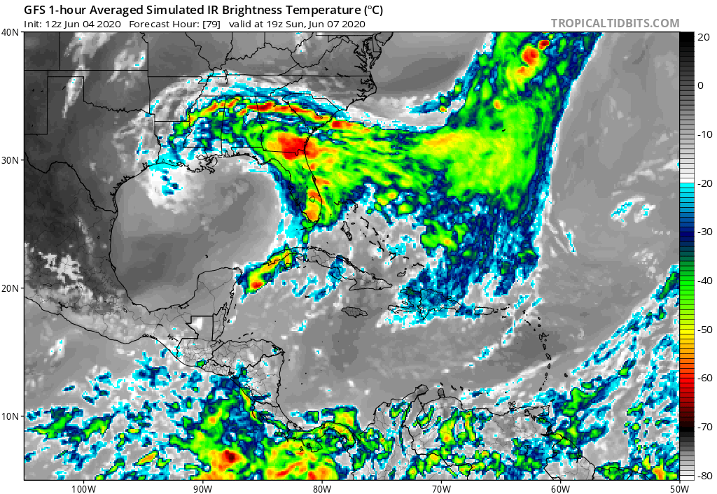
GFS - Landfall Sunday 7pm Plaquemines Parish (mouth of the MS River) at 992. GFS doesn't cut hard and moves NW then NNW to be over Monroe 24 hours later. Hopefully that means parts of MS and AL and possibly FL don't get too many training bands or a 24 hour shield.

NAM 12km Res - Approaches Terrebonne Parish coast Sunday night at 995 but then cuts left. It just bout landfalls and bounces off to the just-south-of-due-West and is still offshore at the end of its run almost to Cameron (TX/LA border at the Gulf)

HMON and HWRF are running now. If anyone looks at the 18z EC, please compare it to the 12. Thanks.
1 likes   

Aric Dunn
Category 5
Category 5
Posts: 21238
Age: 42
Joined: Sun Sep 19, 2004 9:58 pm
Location: Ready for the Chase.
Contact:

Re: ATL: CRISTOBAL - Models

#538 Postby Aric Dunn » Thu Jun 04, 2020 5:31 pm

twiddling thy thumbs in anticipation of the models going to the dark side... :P
0 likes   
Note: If I make a post that is brief. Please refer back to previous posts for the analysis or reasoning. I do not re-write/qoute what my initial post said each time.
If there is nothing before... then just ask :)

Space & Atmospheric Physicist, Embry-Riddle Aeronautical University,
I believe the sky is falling...

sphelps8681
Category 2
Category 2
Posts: 785
Joined: Thu Aug 16, 2007 5:37 pm
Location: Somewhere over the rainbow

Re: ATL: CRISTOBAL - Models

#539 Postby sphelps8681 » Thu Jun 04, 2020 5:33 pm

TheStormExpert wrote:
sphelps8681 wrote:
bella_may wrote:


I think Levi Cowan said shear would not be that bad once it got in to the Gulf. Correct me if I am wrong.

Even if there wasn't shear (which there will be) you still have continental dry air that will entrained into the storm from the NW.


But if it is a tighter storm and not so broad won't that help keep the dry air from being entrained into the storm. Just trying to learn all the ends and outs. Sorry if it is a stupid question. Just wondering.
0 likes   

User avatar
Gums
S2K Supporter
S2K Supporter
Posts: 169
Age: 82
Joined: Sun Oct 07, 2018 7:30 pm
Location: Niceville, FL

Re: ATL: CRISTOBAL - Models

#540 Postby Gums » Thu Jun 04, 2020 5:35 pm

Salute!

Looking more and more like Audrey 1957, but hopefully more rain and lots less surge.

Being some distance to the east, I had to pedal against the wind the afternoon it was coming ashore - was on a paper route to get spending money. Next day I had a hard time after seeing the early news.

Same place, years later and different storm, but you get the idea, courtesy of "hurricane city", see: http://www.sluf.org/misc_pages/cameron.jpg

And more pics.... https://archive.usgs.gov/archive/sites/ ... arish.html


Gums sends...
2 likes   


Return to “2020”

Who is online

Users browsing this forum: No registered users and 43 guests