Speaking of SFMR, check this out!
https://twitter.com/burgwx/status/1262898526457139202
Discussion of Intense Tropical Cyclones
Moderator: S2k Moderators
Forum rules

The posts in this forum are NOT official forecasts and should not be used as such. They are just the opinion of the poster and may or may not be backed by sound meteorological data. They are NOT endorsed by any professional institution or STORM2K. For official information, please refer to products from the National Hurricane Center and National Weather Service.
-
1900hurricane

- Category 5

- Posts: 6063
- Age: 34
- Joined: Fri Feb 06, 2015 12:04 pm
- Location: Houston, TX
- Contact:
Re: Discussion of Intense Tropical Cyclones
5 likes
Contract Meteorologist. TAMU & MSST. Fiercely authentic, one of a kind. We are all given free will, so choose a life meant to be lived. We are the Masters of our own Stories.
Opinions expressed are mine alone.
Follow me on Twitter at @1900hurricane : Read blogs at https://1900hurricane.wordpress.com/
Opinions expressed are mine alone.
Follow me on Twitter at @1900hurricane : Read blogs at https://1900hurricane.wordpress.com/
Re: Discussion of Intense Tropical Cyclones
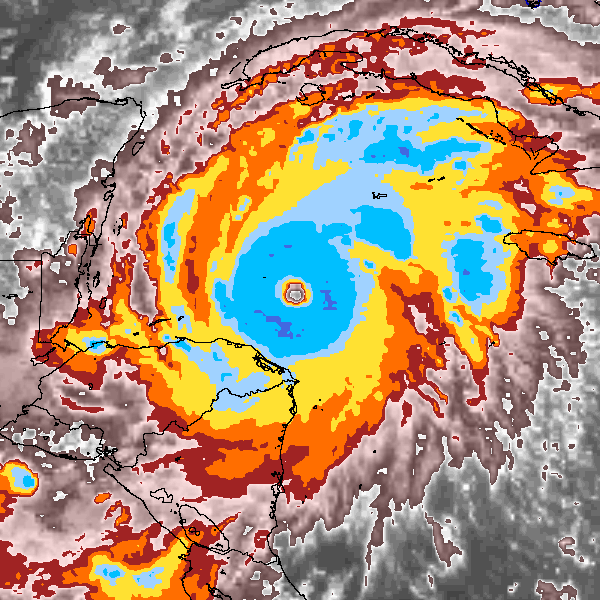
Thanks for posting that graphic from twitter over here 1900hurricane, that's a really interesting look at the wind swaths. I know I read an article a couple years back about the 2017 season, and I know they were timing some recon missions to coincide with CYGNSS overpasses.
For anyone unfamiliar with CYGNSS, the simple way of putting it is that it is a family of satellites that basically act like SFMR in space, measuring surface winds, but what sets it apart from ASCAT is that they are able to much more efficiently resolve higher wind speeds, so it gives greater detail of maximum wind intensity, and how the winds are spread out. I also believe there are 8 satellites measuring winds worldwide, and they measure between something like 38°S to 38°N I think.
But anyways, back to my original train of thought, they were corroborating data between SFMR and CYGNSS from what I understand so they could make any necessary adjustments to CYGNSS, and I believe that SFMR and CYGNSS were fairly well matched in their measurements. It'd be interesting to see CYGNSS wind swaths for Irma compared to the SFMR swaths.
There isn't a lot of available data sources that I've found for CYGNSS though, I had one but I lost it when I switched phones. I think I posted it in the forum at one point though, maybe I'll go look for it later.
3 likes
Solar Aquarian
Lunar Cancerian
 Sagittarian
Lunar Cancerian
-
1900hurricane
- Category 5
- Posts: 6063
- Age: 34
- Joined: Fri Feb 06, 2015 12:04 pm
- Location: Houston, TX
- Contact:
Re: Discussion of Intense Tropical Cyclones
CYGNSS is very interesting! However, I really haven't heard about much use of the data either operationally or in post-analysis, and I'm not sure why that is. Like you said, data for it does appear to be somewhat scarce. I know the NESDIS STAR site does provide it (although not early enough to be used operationally), but I wonder if it isn't at full resolution, especially since the value bar only goes up to 50 kt. You can also find data from NASA, although you might have to work harder to unpack it from there. I might have to up my Python game if I want to use that data.
One storm I'm curious to see full-resolution data from is Hagibis '19. CYGNSS got it at basically peak intensity. Here's what the data looks like from the STAR page, which again only goes up to 50 kt. Even in full resolution, I do wonder if CYGNSS would be able to catch and resolve the small core of the powerful typhoon.

One storm I'm curious to see full-resolution data from is Hagibis '19. CYGNSS got it at basically peak intensity. Here's what the data looks like from the STAR page, which again only goes up to 50 kt. Even in full resolution, I do wonder if CYGNSS would be able to catch and resolve the small core of the powerful typhoon.
3 likes
Contract Meteorologist. TAMU & MSST. Fiercely authentic, one of a kind. We are all given free will, so choose a life meant to be lived. We are the Masters of our own Stories.
Opinions expressed are mine alone.
Follow me on Twitter at @1900hurricane : Read blogs at https://1900hurricane.wordpress.com/
Opinions expressed are mine alone.
Follow me on Twitter at @1900hurricane : Read blogs at https://1900hurricane.wordpress.com/

Re: Discussion of Intense Tropical Cyclones
Thought I'd randomly bring up this blast from the past...

This is 1996's Hurricane Edouard, one of the strongest hurricanes far out east in the MDR in recent decades. This storm was estimated to have peaked as a 933 mb Cat 4, but I've always suspected he might have attained Cat 5, especially around the time this image was captured late on Aug 25, 1996. What do you guys think?
This is 1996's Hurricane Edouard, one of the strongest hurricanes far out east in the MDR in recent decades. This storm was estimated to have peaked as a 933 mb Cat 4, but I've always suspected he might have attained Cat 5, especially around the time this image was captured late on Aug 25, 1996. What do you guys think?
4 likes
Georges '98, Irene '99, Frances '04, Jeanne '04, Katrina '05, Wilma '05, Gustav '08, Isaac '12, Matthew '16, Florence '18, Michael '18, Ian '22
-
HurricaneEnzo

- Category 2

- Posts: 743
- Joined: Wed Mar 14, 2018 12:18 pm
- Location: Newport, NC (Hurricane Alley)
Re: Discussion of Intense Tropical Cyclones
FireRat wrote:Thought I'd randomly bring up this blast from the past...
http://ibtracs.unca.edu/hursat/1996/1996233N12340.EDOUARD.1996.08.25.0600.56.MET-5.110.hursat-b1.v07.png
This is 1996's Hurricane Edouard, one of the strongest hurricanes far out east in the MDR in recent decades. This storm was estimated to have peaked as a 933 mb Cat 4, but I've always suspected he might have attained Cat 5, especially around the time this image was captured late on Aug 25, 1996. What do you guys think?
We obviously can't say with any certainty but I feel like it is pretty likely. If it had recon I think they would have found sustained winds of no less than 155mph. I definitely feel 100% it was stronger than advisories indicated at the least.
1 likes
Bertha 96' - Fran 96' - Bonnie 98' - Dennis 99' - Floyd 99' - Isabel 03' - Alex 04' - Ophelia 05' - Irene 11' - Arthur 14' - Matthew 16' - Florence 18' - Dorian 19' - Isaias 20' (countless other tropical storms and Hurricane swipes)
I am not a Professional Met just an enthusiast. Get your weather forecasts from the Pros!
I am not a Professional Met just an enthusiast. Get your weather forecasts from the Pros!
Re: Discussion of Intense Tropical Cyclones
right! I wish it had recon, it was such a nice symmetrical hurricane and one which lasted 8 days as a major too, probably a huge ACE maker too!
1 likes
Georges '98, Irene '99, Frances '04, Jeanne '04, Katrina '05, Wilma '05, Gustav '08, Isaac '12, Matthew '16, Florence '18, Michael '18, Ian '22
-
BYG Jacob
Re: Discussion of Intense Tropical Cyclones
Another blast from the past that I've always been interested in
His stall and maintaining tropical characteristics into the North Sea have always fascinated me.
His stall and maintaining tropical characteristics into the North Sea have always fascinated me.
10 likes
-
SconnieCane
- Category 5
- Posts: 1013
- Joined: Thu Aug 02, 2018 5:29 pm
- Location: Madison, WI
Re: Discussion of Intense Tropical Cyclones
I was 10/12 in 1996/'98. I remember being glued to TWC, tracking Edouard as it teased the Eastern Seaboard. Not long after that we left on a trip to Florida and kept a wary eye on Fran from our hotel rooms (at least my parents did, I was more excited. It seemed such a quintessentially Floridian thing, especially just four years after Andrew).
In 1998 I watched and geeked out along with the great John Hope over Mitch's awesome satellite presentation.
In 1998 I watched and geeked out along with the great John Hope over Mitch's awesome satellite presentation.
2 likes
Re: Discussion of Intense Tropical Cyclones
Man, what a hauntingly beautiful image of Mitch!!
I also remember watching the Great John Hope on TWC back in the day, covering that behemoth. I was also around the same age in 96/98. 1996 was like the year of the scares when I lived in FL. Forecasts weren't as accurate as today, so for a time Bertha, Fran, Edouard and Hortense looked like they could come close to FL or even strike us! Fran brought us some of the largest waves I've ever seen in Ft Lauderdale, as high as the friggin pier!
It's crazy how in that year, 5 big hurricanes crossed each other's paths in a 'South Florida-sized' patch of sea east of the Bahamas. Imagine if that cluster had been a few hundred miles to the west! We would've been absolutely pulverized!
2 likes
Georges '98, Irene '99, Frances '04, Jeanne '04, Katrina '05, Wilma '05, Gustav '08, Isaac '12, Matthew '16, Florence '18, Michael '18, Ian '22


Re: Discussion of Intense Tropical Cyclones
Sorry to be somewhat off topic... but I think with this post, I'm officially a Category 5. It took 16 years but I'm finally the highest level of intense tropical cyclone.
13 likes
Re: Discussion of Intense Tropical Cyclones
haha congrats Buck!
I've been stuck at Cat 2 for for like forever! It was quick intensification at first from TD to TS to Cat 1 but now I must have ingested some dry air.
I've been stuck at Cat 2 for for like forever! It was quick intensification at first from TD to TS to Cat 1 but now I must have ingested some dry air.
8 likes
Georges '98, Irene '99, Frances '04, Jeanne '04, Katrina '05, Wilma '05, Gustav '08, Isaac '12, Matthew '16, Florence '18, Michael '18, Ian '22
-
1900hurricane
- Category 5
- Posts: 6063
- Age: 34
- Joined: Fri Feb 06, 2015 12:04 pm
- Location: Houston, TX
- Contact:
Re: Discussion of Intense Tropical Cyclones
FireRat wrote:Thought I'd randomly bring up this blast from the past...
http://ibtracs.unca.edu/hursat/1996/1996233N12340.EDOUARD.1996.08.25.0600.56.MET-5.110.hursat-b1.v07.png
This is 1996's Hurricane Edouard, one of the strongest hurricanes far out east in the MDR in recent decades. This storm was estimated to have peaked as a 933 mb Cat 4, but I've always suspected he might have attained Cat 5, especially around the time this image was captured late on Aug 25, 1996. What do you guys think?
I mentioned it a little bit on an earlier page in this thread, but if there was one system in the NAtl that I would consider the possibility of being a C5 without having recon data near peak, it would most definitely be Edouard '96. I think it has an even stronger case than the oft-mentioned borderline cases like Igor '10 or Lorenzo '19 due to a more stable eye and a more stable axisymmetrical CDO that featured a white ring on BD IR at apparent peak intensity.

8 likes
Contract Meteorologist. TAMU & MSST. Fiercely authentic, one of a kind. We are all given free will, so choose a life meant to be lived. We are the Masters of our own Stories.
Opinions expressed are mine alone.
Follow me on Twitter at @1900hurricane : Read blogs at https://1900hurricane.wordpress.com/
Opinions expressed are mine alone.
Follow me on Twitter at @1900hurricane : Read blogs at https://1900hurricane.wordpress.com/
Re: Discussion of Intense Tropical Cyclones
Wow 1900, all I can say is WOW. That's probably the best black & white peak intensity image of 1996 Edouard I've seen, he definitely has that annular 'Donut of Doom' physique, and probably was among the strongest hurricanes on record east of the Islands. Just by that image alone I'd estimate his peak at about 165-170 MPH, with a pres likely around 915 or so. What a beast!
0 likes
Georges '98, Irene '99, Frances '04, Jeanne '04, Katrina '05, Wilma '05, Gustav '08, Isaac '12, Matthew '16, Florence '18, Michael '18, Ian '22

Re: Discussion of Intense Tropical Cyclones
1900hurricane wrote:FireRat wrote:Thought I'd randomly bring up this blast from the past...
http://ibtracs.unca.edu/hursat/1996/1996233N12340.EDOUARD.1996.08.25.0600.56.MET-5.110.hursat-b1.v07.png
This is 1996's Hurricane Edouard, one of the strongest hurricanes far out east in the MDR in recent decades. This storm was estimated to have peaked as a 933 mb Cat 4, but I've always suspected he might have attained Cat 5, especially around the time this image was captured late on Aug 25, 1996. What do you guys think?
I mentioned it a little bit on an earlier page in this thread, but if there was one system in the NAtl that I would consider the possibility of being a C5 without having recon data near peak, it would most definitely be Edouard '96. I think it has an even stronger case than the oft-mentioned borderline cases like Igor '10 or Lorenzo '19 due to a more stable eye and a more stable axisymmetrical CDO that featured a white ring on BD IR at apparent peak intensity.
https://www1.ncdc.noaa.gov/pub/data/satellite/hursat/1996/1996233N12340/AVHRR-IR-BD/1996233N12340.EDOUARD.1996.08.25.0506.110.NOAA-14.18.AVHRR-IR-BD.png
That’s some of the best Dvorak imagery I’ve seen from the Atlantic basin, especially from a storm well outside the Caribbean or Gulf. When comparing it to recent Cat 5s, it looks better than every one except for Irma (and I guess Dorian, despite warmer convection, because of how incredibly well-organized it was and how warm its eye got). I’m going to go out on a limb here and suggest a possible max intensity of 155 kt (T#7.5), due to its similarities to storms of that intensity including Irma and Mangkhut, but since the CDO is slightly jagged, it could be 150 kt instead.
5 likes
Irene '11 Sandy '12 Hermine '16 5/15/2018 Derecho Fay '20 Isaias '20 Elsa '21 Henri '21 Ida '21
I am only a meteorology enthusiast who knows a decent amount about tropical cyclones. Look to the professional mets, the NHC, or your local weather office for the best information.
I am only a meteorology enthusiast who knows a decent amount about tropical cyclones. Look to the professional mets, the NHC, or your local weather office for the best information.
Re: Discussion of Intense Tropical Cyclones
You might actually be right aspen, Edouard '96 probably was closer to the 155 kt/ 180 MPH level. Looking closer at that insane dvorak image, I could tell that the shot was taken at a bit of an angle (satellite was prob not directly overhead), so you can actually see the side of the western/northern eyewall pretty well and see a much more perfectly circular eye deeper at the bottom. This tells me the eye of the storm was likely perfectly circular and the CDO even less jagged. This storm indeed was a hell of a buzz saw, the whole thing beautifully symmetric too. Brutal and Beautiful, you could say it was 'Brutiful'. 
170-180 MPH might be a better estimate, with 175 mph being best IMO. I bet this storm gets upgraded to Cat 5 during reanalysis.
170-180 MPH might be a better estimate, with 175 mph being best IMO. I bet this storm gets upgraded to Cat 5 during reanalysis.
3 likes
Georges '98, Irene '99, Frances '04, Jeanne '04, Katrina '05, Wilma '05, Gustav '08, Isaac '12, Matthew '16, Florence '18, Michael '18, Ian '22
-
CrazyC83
- Professional-Met

- Posts: 34315
- Joined: Tue Mar 07, 2006 11:57 pm
- Location: Deep South, for the first time!
Re: Discussion of Intense Tropical Cyclones
FireRat wrote:Thought I'd randomly bring up this blast from the past...
http://ibtracs.unca.edu/hursat/1996/1996233N12340.EDOUARD.1996.08.25.0600.56.MET-5.110.hursat-b1.v07.png
This is 1996's Hurricane Edouard, one of the strongest hurricanes far out east in the MDR in recent decades. This storm was estimated to have peaked as a 933 mb Cat 4, but I've always suspected he might have attained Cat 5, especially around the time this image was captured late on Aug 25, 1996. What do you guys think?
If I used that satellite image alone, I'd go with 145 kt - solid T7.0 with a well-defined structure. Similar to Isabel when Recon found 140-145 kt (although not as strong as peak intensity Isabel). If 145 kt was the peak intensity, I'd estimate a pressure of 919 mb.
2 likes
Re: Discussion of Intense Tropical Cyclones
Thanks for the input CrazyC83!!
Seems like a great estimate, 145kt, so about 165-170 mph, that's was what I had in mind earlier too. Mean looking CV monster indeed!
0 likes
Georges '98, Irene '99, Frances '04, Jeanne '04, Katrina '05, Wilma '05, Gustav '08, Isaac '12, Matthew '16, Florence '18, Michael '18, Ian '22
-
CrazyC83
- Professional-Met
- Posts: 34315
- Joined: Tue Mar 07, 2006 11:57 pm
- Location: Deep South, for the first time!
Re: Discussion of Intense Tropical Cyclones
The posts in this forum are NOT official forecasts and should not be used as such. They are just the opinion of the poster and may or may not be backed by sound meteorological data. They are NOT endorsed by any professional institution or STORM2K. For official information, please refer to products from the NHC and NWS.
Here's how I would revise Edouard's BT personally (red - stronger, green - weaker):
AL051996, EDOUARD, 73,
19960819, 1800, , TD, 12.4N, 19.9W, 25, 1007, -999, -999, -999, -999, -999, -999, -999, -999, -999, -999, -999, -999,
19960820, 0000, , TD, 12.4N, 20.7W, 25, 1007, -999, -999, -999, -999, -999, -999, -999, -999, -999, -999, -999, -999,
19960820, 0600, , TD, 12.4N, 21.6W, 25, 1007, -999, -999, -999, -999, -999, -999, -999, -999, -999, -999, -999, -999,
19960820, 1200, , TD, 12.5N, 22.6W, 25, 1007, -999, -999, -999, -999, -999, -999, -999, -999, -999, -999, -999, -999,
19960820, 1800, , TD, 12.6N, 23.8W, 25, 1007, -999, -999, -999, -999, -999, -999, -999, -999, -999, -999, -999, -999,
19960821, 0000, , TD, 12.6N, 25.3W, 25, 1007, -999, -999, -999, -999, -999, -999, -999, -999, -999, -999, -999, -999,
19960821, 0600, , TD, 12.8N, 26.7W, 25, 1007, -999, -999, -999, -999, -999, -999, -999, -999, -999, -999, -999, -999,
19960821, 1200, , TD, 12.9N, 27.9W, 25, 1007, -999, -999, -999, -999, -999, -999, -999, -999, -999, -999, -999, -999,
19960821, 1800, , TD, 13.0N, 29.2W, 25, 1006, -999, -999, -999, -999, -999, -999, -999, -999, -999, -999, -999, -999,
19960822, 0000, , TD, 13.1N, 30.3W, 30, 1006, -999, -999, -999, -999, -999, -999, -999, -999, -999, -999, -999, -999,
19960822, 0600, , TS, 13.2N, 31.6W, 35, 1005, -999, -999, -999, -999, -999, -999, -999, -999, -999, -999, -999, -999,
19960822, 1200, , TS, 13.4N, 32.9W, 40, 1003, -999, -999, -999, -999, -999, -999, -999, -999, -999, -999, -999, -999,
19960822, 1800, , TS, 13.5N, 34.4W, 40, 1002, -999, -999, -999, -999, -999, -999, -999, -999, -999, -999, -999, -999,
19960823, 0000, , TS, 13.7N, 35.8W, 45, 1000, -999, -999, -999, -999, -999, -999, -999, -999, -999, -999, -999, -999,
19960823, 0600, , TS, 13.8N, 37.0W, 50, 996, -999, -999, -999, -999, -999, -999, -999, -999, -999, -999, -999, -999,
19960823, 1200, , HU, 13.9N, 38.3W, 65, 988, -999, -999, -999, -999, -999, -999, -999, -999, -999, -999, -999, -999,
19960823, 1800, , HU, 14.0N, 39.8W, 65, 986, -999, -999, -999, -999, -999, -999, -999, -999, -999, -999, -999, -999,
19960824, 0000, , HU, 14.1N, 41.1W, 70, 983, -999, -999, -999, -999, -999, -999, -999, -999, -999, -999, -999, -999,
19960824, 0600, , HU, 14.1N, 42.4W, 75, 980, -999, -999, -999, -999, -999, -999, -999, -999, -999, -999, -999, -999,
19960824, 1200, , HU, 14.4N, 43.6W, 95, 970, -999, -999, -999, -999, -999, -999, -999, -999, -999, -999, -999, -999,
19960824, 1800, , HU, 14.6N, 44.7W, 110, 955, -999, -999, -999, -999, -999, -999, -999, -999, -999, -999, -999, -999,
19960825, 0000, , HU, 15.0N, 45.8W, 125, 939, -999, -999, -999, -999, -999, -999, -999, -999, -999, -999, -999, -999,
19960825, 0600, , HU, 15.4N, 47.0W, 145, 919, -999, -999, -999, -999, -999, -999, -999, -999, -999, -999, -999, -999,
19960825, 1200, , HU, 15.9N, 48.3W, 140, 923, -999, -999, -999, -999, -999, -999, -999, -999, -999, -999, -999, -999,
19960825, 1800, , HU, 16.5N, 49.6W, 140, 924, -999, -999, -999, -999, -999, -999, -999, -999, -999, -999, -999, -999,
19960826, 0000, , HU, 17.0N, 50.9W, 135, 929, -999, -999, -999, -999, -999, -999, -999, -999, -999, -999, -999, -999,
19960826, 0600, , HU, 17.5N, 52.0W, 130, 933, -999, -999, -999, -999, -999, -999, -999, -999, -999, -999, -999, -999,
19960826, 1200, , HU, 17.9N, 53.2W, 130, 933, -999, -999, -999, -999, -999, -999, -999, -999, -999, -999, -999, -999,
19960826, 1800, , HU, 18.4N, 54.5W, 125, 936, -999, -999, -999, -999, -999, -999, -999, -999, -999, -999, -999, -999,
19960827, 0000, , HU, 18.9N, 55.6W, 125, 940, -999, -999, -999, -999, -999, -999, -999, -999, -999, -999, -999, -999,
19960827, 0600, , HU, 19.5N, 56.9W, 120, 944, -999, -999, -999, -999, -999, -999, -999, -999, -999, -999, -999, -999,
19960827, 1200, , HU, 20.0N, 58.1W, 115, 949, -999, -999, -999, -999, -999, -999, -999, -999, -999, -999, -999, -999,
19960827, 1800, , HU, 20.4N, 59.3W, 120, 947, -999, -999, -999, -999, -999, -999, -999, -999, -999, -999, -999, -999,
19960828, 0000, , HU, 20.9N, 60.4W, 130, 942, -999, -999, -999, -999, -999, -999, -999, -999, -999, -999, -999, -999,
19960828, 0600, , HU, 21.3N, 61.7W, 115, 950, -999, -999, -999, -999, -999, -999, -999, -999, -999, -999, -999, -999,
19960828, 1200, , HU, 21.9N, 63.2W, 105, 956, -999, -999, -999, -999, -999, -999, -999, -999, -999, -999, -999, -999,
19960828, 1800, , HU, 22.3N, 64.6W, 100, 956, -999, -999, -999, -999, -999, -999, -999, -999, -999, -999, -999, -999,
19960829, 0000, , HU, 22.9N, 65.9W, 100, 958, -999, -999, -999, -999, -999, -999, -999, -999, -999, -999, -999, -999,
19960829, 0600, , HU, 23.4N, 67.1W, 105, 959, -999, -999, -999, -999, -999, -999, -999, -999, -999, -999, -999, -999,
19960829, 1200, , HU, 24.0N, 68.1W, 110, 950, -999, -999, -999, -999, -999, -999, -999, -999, -999, -999, -999, -999,
19960829, 1800, , HU, 24.7N, 69.0W, 115, 945, -999, -999, -999, -999, -999, -999, -999, -999, -999, -999, -999, -999,
19960830, 0000, , HU, 25.5N, 69.5W, 125, 938, -999, -999, -999, -999, -999, -999, -999, -999, -999, -999, -999, -999,
19960830, 0600, , HU, 26.4N, 69.9W, 120, 940, -999, -999, -999, -999, -999, -999, -999, -999, -999, -999, -999, -999,
19960830, 1200, , HU, 27.4N, 70.2W, 120, 938, -999, -999, -999, -999, -999, -999, -999, -999, -999, -999, -999, -999,
19960830, 1800, , HU, 28.5N, 70.5W, 125, 934, -999, -999, -999, -999, -999, -999, -999, -999, -999, -999, -999, -999,
19960831, 0000, , HU, 29.5N, 70.5W, 110, 944, -999, -999, -999, -999, -999, -999, -999, -999, -999, -999, -999, -999,
19960831, 0600, , HU, 30.4N, 70.6W, 100, 948, -999, -999, -999, -999, -999, -999, -999, -999, -999, -999, -999, -999,
19960831, 1200, , HU, 31.6N, 70.3W, 100, 950, -999, -999, -999, -999, -999, -999, -999, -999, -999, -999, -999, -999,
19960831, 1800, , HU, 32.7N, 70.1W, 95, 952, -999, -999, -999, -999, -999, -999, -999, -999, -999, -999, -999, -999,
19960901, 0000, , HU, 34.0N, 70.1W, 90, 955, -999, -999, -999, -999, -999, -999, -999, -999, -999, -999, -999, -999,
19960901, 0600, , HU, 35.2N, 70.1W, 90, 957, -999, -999, -999, -999, -999, -999, -999, -999, -999, -999, -999, -999,
19960901, 1200, , HU, 36.5N, 70.2W, 85, 958, -999, -999, -999, -999, -999, -999, -999, -999, -999, -999, -999, -999,
19960901, 1800, , HU, 37.5N, 70.0W, 80, 959, -999, -999, -999, -999, -999, -999, -999, -999, -999, -999, -999, -999,
19960902, 0000, , HU, 38.7N, 69.5W, 75, 961, -999, -999, -999, -999, -999, -999, -999, -999, -999, -999, -999, -999,
19960902, 0600, , HU, 39.8N, 69.4W, 75, 961, -999, -999, -999, -999, -999, -999, -999, -999, -999, -999, -999, -999,
19960902, 1200, , HU, 40.5N, 68.3W, 70, 962, -999, -999, -999, -999, -999, -999, -999, -999, -999, -999, -999, -999,
19960902, 1800, , HU, 41.3N, 67.3W, 65, 969, -999, -999, -999, -999, -999, -999, -999, -999, -999, -999, -999, -999,
19960903, 0000, , TS, 42.0N, 66.8W, 60, 974, -999, -999, -999, -999, -999, -999, -999, -999, -999, -999, -999, -999,
19960903, 0600, , EX, 42.2N, 66.0W, 55, 982, -999, -999, -999, -999, -999, -999, -999, -999, -999, -999, -999, -999,
19960903, 1200, , EX, 42.5N, 65.0W, 50, 989, -999, -999, -999, -999, -999, -999, -999, -999, -999, -999, -999, -999,
19960903, 1800, , EX, 42.7N, 63.0W, 50, 995, -999, -999, -999, -999, -999, -999, -999, -999, -999, -999, -999, -999,
19960904, 0000, , EX, 43.2N, 59.8W, 50, 997, -999, -999, -999, -999, -999, -999, -999, -999, -999, -999, -999, -999,
19960904, 0600, , EX, 43.3N, 57.5W, 50, 994, -999, -999, -999, -999, -999, -999, -999, -999, -999, -999, -999, -999,
19960904, 1200, , EX, 43.4N, 55.5W, 50, 994, -999, -999, -999, -999, -999, -999, -999, -999, -999, -999, -999, -999,
19960904, 1800, , EX, 43.5N, 53.5W, 50, 995, -999, -999, -999, -999, -999, -999, -999, -999, -999, -999, -999, -999,
19960905, 0000, , EX, 43.5N, 51.5W, 50, 995, -999, -999, -999, -999, -999, -999, -999, -999, -999, -999, -999, -999,
19960905, 0600, , EX, 43.5N, 50.0W, 45, 994, -999, -999, -999, -999, -999, -999, -999, -999, -999, -999, -999, -999,
19960905, 1200, , EX, 43.5N, 48.5W, 45, 994, -999, -999, -999, -999, -999, -999, -999, -999, -999, -999, -999, -999,
19960905, 1800, , EX, 43.7N, 47.5W, 45, 995, -999, -999, -999, -999, -999, -999, -999, -999, -999, -999, -999, -999,
19960906, 0000, , EX, 44.5N, 46.0W, 40, 995, -999, -999, -999, -999, -999, -999, -999, -999, -999, -999, -999, -999,
19960906, 0600, , EX, 46.0N, 44.0W, 40, 994, -999, -999, -999, -999, -999, -999, -999, -999, -999, -999, -999, -999,
19960906, 1200, , EX, 48.0N, 43.0W, 40, 992, -999, -999, -999, -999, -999, -999, -999, -999, -999, -999, -999, -999,
19960906, 1800, , EX, 50.0N, 41.0W, 40, 990, -999, -999, -999, -999, -999, -999, -999, -999, -999, -999, -999, -999,
3 likes
Re: Discussion of Intense Tropical Cyclones
That's quite awesome CC83!
btw, that was some crazy RI from 8/24/96 thru the peak on 8/25/96.
btw, that was some crazy RI from 8/24/96 thru the peak on 8/25/96.
0 likes
Georges '98, Irene '99, Frances '04, Jeanne '04, Katrina '05, Wilma '05, Gustav '08, Isaac '12, Matthew '16, Florence '18, Michael '18, Ian '22
-
CrazyC83
- Professional-Met
- Posts: 34315
- Joined: Tue Mar 07, 2006 11:57 pm
- Location: Deep South, for the first time!
Re: Discussion of Intense Tropical Cyclones
FireRat wrote:That's quite awesome CC83!
btw, that was some crazy RI from 8/24/96 thru the peak on 8/25/96.
Yeah, admittedly that is entirely based on Dvorak analyses - once the eye popped out, it was off to the races. Not unlike Ike in 2008 and Igor in 2010. The Recon trends were tweaked based on better understanding of the 90% rule (and lower rules after its final peak - the intensities were mostly decreased as it went off the east coast).
2 likes
Who is online
Users browsing this forum: No registered users and 49 guests