2020 EPAC Season
Moderator: S2k Moderators
Forum rules

The posts in this forum are NOT official forecasts and should not be used as such. They are just the opinion of the poster and may or may not be backed by sound meteorological data. They are NOT endorsed by any professional institution or STORM2K. For official information, please refer to products from the National Hurricane Center and National Weather Service.
-
Yellow Evan

- Professional-Met

- Posts: 16238
- Age: 27
- Joined: Fri Jul 15, 2011 12:48 pm
- Location: Henderson, Nevada/Honolulu, HI
- Contact:
Re: 2020 EPAC Season
Not sure why the NHC has the second AOI so high at 0/40 tbh given how erratic models have been for now 3 weeks. Especially given the UKMET continues to show nothing.
0 likes


Re: 2020 EPAC Season
0/40 AOI develops in 120-126 hours in the 12z GFS run.
0 likes
Irene '11 Sandy '12 Hermine '16 5/15/2018 Derecho Fay '20 Isaias '20 Elsa '21 Henri '21 Ida '21
I am only a meteorology enthusiast who knows a decent amount about tropical cyclones. Look to the professional mets, the NHC, or your local weather office for the best information.
I am only a meteorology enthusiast who knows a decent amount about tropical cyclones. Look to the professional mets, the NHC, or your local weather office for the best information.
-
cycloneye

- Admin

- Posts: 149431
- Age: 69
- Joined: Thu Oct 10, 2002 10:54 am
- Location: San Juan, Puerto Rico
Re: 2020 EPAC Season
Tropical Weather Outlook
NWS National Hurricane Center Miami FL
1100 AM PDT Fri Jul 3 2020
For the eastern North Pacific...east of 140 degrees west longitude:
1. Disorganized showers and a few thunderstorms continue in
association with a broad area of low pressure located several
hundred miles south of Manzanillo, Mexico. Some gradual development
of this system is possible during the next few days while it moves
west-northwestward at around 10 mph.
* Formation chance through 48 hours...low...20 percent.
* Formation chance through 5 days...low...30 percent.
2. An area of low pressure is forecast to form south of the coast of
southern Mexico in a couple of days. Environmental conditions are
expected to be conducive for gradual development of the system
during the early and middle portions of next week while it moves
west-northwestward, well south of the coast of southern Mexico.
* Formation chance through 48 hours...low...near 0 percent.
* Formation chance through 5 days...medium...40 percent.
Forecaster Cangialosi
0 likes
Visit the Caribbean-Central America Weather Thread where you can find at first post web cams,radars
and observations from Caribbean basin members Click Here
and observations from Caribbean basin members Click Here
-
Yellow Evan
- Professional-Met
- Posts: 16238
- Age: 27
- Joined: Fri Jul 15, 2011 12:48 pm
- Location: Henderson, Nevada/Honolulu, HI
- Contact:


Re: 2020 EPAC Season
Yellow Evan wrote:https://i.imgur.com/oifjUDL.png
https://i.imgur.com/gYuUIFb.png
Most encouraging ECMWF run in a while.
The 12z Euro also develops the 0/40 AOI in only 96 hours.
0 likes
Irene '11 Sandy '12 Hermine '16 5/15/2018 Derecho Fay '20 Isaias '20 Elsa '21 Henri '21 Ida '21
I am only a meteorology enthusiast who knows a decent amount about tropical cyclones. Look to the professional mets, the NHC, or your local weather office for the best information.
I am only a meteorology enthusiast who knows a decent amount about tropical cyclones. Look to the professional mets, the NHC, or your local weather office for the best information.
-
Kingarabian

- S2K Supporter

- Posts: 16360
- Joined: Sat Aug 08, 2009 3:06 am
- Location: Honolulu, Hawaii
Re: 2020 EPAC Season
0 likes
RIP Kobe Bryant
-
Kingarabian
- S2K Supporter
- Posts: 16360
- Joined: Sat Aug 08, 2009 3:06 am
- Location: Honolulu, Hawaii
Re: 2020 EPAC Season
NHC needs a circle for the area near 130W. Similar situation to pre-genesis Boric. Models do spin this up and keep it around although they keep it weak.

0 likes
RIP Kobe Bryant
-
Kingarabian
- S2K Supporter
- Posts: 16360
- Joined: Sat Aug 08, 2009 3:06 am
- Location: Honolulu, Hawaii

-
Yellow Evan
- Professional-Met
- Posts: 16238
- Age: 27
- Joined: Fri Jul 15, 2011 12:48 pm
- Location: Henderson, Nevada/Honolulu, HI
- Contact:

-
cycloneye
- Admin
- Posts: 149431
- Age: 69
- Joined: Thu Oct 10, 2002 10:54 am
- Location: San Juan, Puerto Rico
Re: 2020 EPAC Season
Tropical Weather Outlook
NWS National Hurricane Center Miami FL
500 PM PDT Fri Jul 3 2020
For the eastern North Pacific...east of 140 degrees west longitude:
1. Showers and thunderstorms have become less organized during the past
24 hours in association with a broad area of low pressure located
several hundred miles south-southwest of Manzanillo, Mexico. Some
slow development of this system is still possible during the next
few days while it moves west-northwestward at about 10 mph.
* Formation chance through 48 hours...low...10 percent.
* Formation chance through 5 days...low...30 percent.
2. An area of low pressure is forecast to form south of the coast of
southern Mexico in a couple of days. Environmental conditions are
expected to be conducive for gradual development, and a tropical
depression could form by the middle of next week while it moves
west-northwestward, well south of the coast of southern Mexico.
* Formation chance through 48 hours...low...near 0 percent.
* Formation chance through 5 days...medium...50 percent.
Forecaster Blake
0 likes
Visit the Caribbean-Central America Weather Thread where you can find at first post web cams,radars
and observations from Caribbean basin members Click Here
and observations from Caribbean basin members Click Here
-
Yellow Evan
- Professional-Met
- Posts: 16238
- Age: 27
- Joined: Fri Jul 15, 2011 12:48 pm
- Location: Henderson, Nevada/Honolulu, HI
- Contact:
Re: 2020 EPAC Season

Favorable pattern if anything seems on its way out after next week. Late July is likely to be at least somewhat less favorable.
0 likes
-
gatorcane

- S2K Supporter
- Posts: 23708
- Age: 48
- Joined: Sun Mar 13, 2005 3:54 pm
- Location: Boca Raton, FL
Re: 2020 EPAC Season
The EPAC appears it may be cranking up just like clockwork as we start the month of July.
In the super long range it has yet another one in the far eastern EPAC:
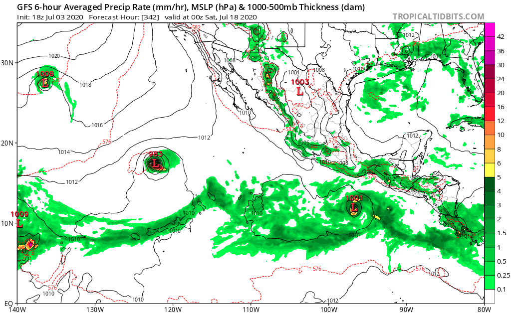
In the super long range it has yet another one in the far eastern EPAC:
0 likes
-
Kingarabian
- S2K Supporter
- Posts: 16360
- Joined: Sat Aug 08, 2009 3:06 am
- Location: Honolulu, Hawaii

-
cycloneye
- Admin
- Posts: 149431
- Age: 69
- Joined: Thu Oct 10, 2002 10:54 am
- Location: San Juan, Puerto Rico
Re: 2020 EPAC Season
Tropical Weather Outlook
NWS National Hurricane Center Miami FL
500 AM PDT Sat Jul 4 2020
For the eastern North Pacific...east of 140 degrees west longitude:
1. A broad area of low pressure located several hundred miles
southwest of Manzanillo, Mexico, continues to produce disorganized
showers and thunderstorms. Some slow development of this system is
still possible during the next few days while it moves
west-northwestward at about 10 mph.
* Formation chance through 48 hours...low...10 percent.
* Formation chance through 5 days...low...30 percent.
2. An area of low pressure is forecast to form south of the coast of
southern Mexico in a couple of days. Environmental conditions are
expected to be conducive for gradual development, and a tropical
depression could form by the middle of next week while it moves
west-northwestward, well south of the coast of southern Mexico.
* Formation chance through 48 hours...low...near 0 percent.
* Formation chance through 5 days...medium...60 percent.
Forecaster Cangialosi
0 likes
Visit the Caribbean-Central America Weather Thread where you can find at first post web cams,radars
and observations from Caribbean basin members Click Here
and observations from Caribbean basin members Click Here
Re: 2020 EPAC Season
The latest model trends are very promising for the 0/60 AOI. Not only is their a multiple model consensus, but they continue to show development by Wednesday, and suggest it could start developing as early as Tuesday. The GFS, Euro, and CMC also have a quick spin-up of the 10/30 AOI by Tuesday/Wednesday as well.
0 likes
Irene '11 Sandy '12 Hermine '16 5/15/2018 Derecho Fay '20 Isaias '20 Elsa '21 Henri '21 Ida '21
I am only a meteorology enthusiast who knows a decent amount about tropical cyclones. Look to the professional mets, the NHC, or your local weather office for the best information.
I am only a meteorology enthusiast who knows a decent amount about tropical cyclones. Look to the professional mets, the NHC, or your local weather office for the best information.
Re: 2020 EPAC Season
Here are the most recent model solutions for the 0/60 area of interest and potential long-tracking storm.
06z GFS: first signs of formation as early as 78 hours (early-mid Tuesday), before it fully pulls itself together by 96 hours (early Wednesday). It nears hurricane status in 132 hours (Thursday afternoon) and peaks at 957 mbar in 162 hours (Friday night).
00z ECMWF: vorticity starts to concentrate by 72 hours (Monday night), and by 96-120 hours (no later than early Thursday), there is a fully-fledged TC. Being the Euro model, it doesn’t get as strong as the GFS but still reaches hurricane status.
00z CMC: it starts to form way closer to the Mexican Coast than the other models, and also later, around 108 hours out (early-mid Wednesday). The system takes a more NW path instead of WNW.
06z ICON: looks to start pulling itself together by 72 hours, but it doesn’t get strong at all during the model’s 120 hour time span. Still there, though.
0 likes
Irene '11 Sandy '12 Hermine '16 5/15/2018 Derecho Fay '20 Isaias '20 Elsa '21 Henri '21 Ida '21
I am only a meteorology enthusiast who knows a decent amount about tropical cyclones. Look to the professional mets, the NHC, or your local weather office for the best information.
I am only a meteorology enthusiast who knows a decent amount about tropical cyclones. Look to the professional mets, the NHC, or your local weather office for the best information.
-
cycloneye
- Admin
- Posts: 149431
- Age: 69
- Joined: Thu Oct 10, 2002 10:54 am
- Location: San Juan, Puerto Rico
Re: 2020 EPAC Season
aspen wrote:Here are the most recent model solutions for the 0/60 area of interest and potential long-tracking storm.
06z GFS: first signs of formation as early as 78 hours (early-mid Tuesday), before it fully pulls itself together by 96 hours (early Wednesday). It nears hurricane status in 132 hours (Thursday afternoon) and peaks at 957 mbar in 162 hours (Friday night).
00z ECMWF: vorticity starts to concentrate by 72 hours (Monday night), and by 96-120 hours (no later than early Thursday), there is a fully-fledged TC. Being the Euro model, it doesn’t get as strong as the GFS but still reaches hurricane status.
00z CMC: it starts to form way closer to the Mexican Coast than the other models, and also later, around 108 hours out (early-mid Wednesday). The system takes a more NW path instead of WNW.
06z ICON: looks to start pulling itself together by 72 hours, but it doesn’t get strong at all during the model’s 120 hour time span. Still there, though.
Very soon you will be doing this same analysis of the models for the strongest one that GFS and ECMWF have behind the 0/60.
0 likes
Visit the Caribbean-Central America Weather Thread where you can find at first post web cams,radars
and observations from Caribbean basin members Click Here
and observations from Caribbean basin members Click Here
Re: 2020 EPAC Season
cycloneye wrote:aspen wrote:Here are the most recent model solutions for the 0/60 area of interest and potential long-tracking storm.
06z GFS: first signs of formation as early as 78 hours (early-mid Tuesday), before it fully pulls itself together by 96 hours (early Wednesday). It nears hurricane status in 132 hours (Thursday afternoon) and peaks at 957 mbar in 162 hours (Friday night).
00z ECMWF: vorticity starts to concentrate by 72 hours (Monday night), and by 96-120 hours (no later than early Thursday), there is a fully-fledged TC. Being the Euro model, it doesn’t get as strong as the GFS but still reaches hurricane status.
00z CMC: it starts to form way closer to the Mexican Coast than the other models, and also later, around 108 hours out (early-mid Wednesday). The system takes a more NW path instead of WNW.
06z ICON: looks to start pulling itself together by 72 hours, but it doesn’t get strong at all during the model’s 120 hour time span. Still there, though.
Very soon you will be doing this same analysis of the models for the strongest one that GFS and ECMWF have behind the 0/60.
If that’s the case, then I would’ve given up on the EPac and I wouldn’t even bother.
0 likes
Irene '11 Sandy '12 Hermine '16 5/15/2018 Derecho Fay '20 Isaias '20 Elsa '21 Henri '21 Ida '21
I am only a meteorology enthusiast who knows a decent amount about tropical cyclones. Look to the professional mets, the NHC, or your local weather office for the best information.
I am only a meteorology enthusiast who knows a decent amount about tropical cyclones. Look to the professional mets, the NHC, or your local weather office for the best information.
Re: 2020 EPAC Season
12z GFS still shows development on Wednesday. Very good consistency these last few days. Fingers crossed....
0 likes
Irene '11 Sandy '12 Hermine '16 5/15/2018 Derecho Fay '20 Isaias '20 Elsa '21 Henri '21 Ida '21
I am only a meteorology enthusiast who knows a decent amount about tropical cyclones. Look to the professional mets, the NHC, or your local weather office for the best information.
I am only a meteorology enthusiast who knows a decent amount about tropical cyclones. Look to the professional mets, the NHC, or your local weather office for the best information.
-
cycloneye
- Admin
- Posts: 149431
- Age: 69
- Joined: Thu Oct 10, 2002 10:54 am
- Location: San Juan, Puerto Rico
Re: 2020 EPAC Season
Tropical Weather Outlook
NWS National Hurricane Center Miami FL
1100 AM PDT Sat Jul 4 2020
For the eastern North Pacific...east of 140 degrees west longitude:
1. A broad area of low pressure located several hundred miles
south of the southern tip of the Baja California peninsula continues
to produce disorganized showers and thunderstorms. Development, if
any, of this system should be slow to occur during the next few
days while it moves west-northwestward at about 10 mph.
* Formation chance through 48 hours...low...10 percent.
* Formation chance through 5 days...low...20 percent.
2. An area of low pressure is forecast to form south of the coast of
southern Mexico in a couple of days. Environmental conditions are
expected to be conducive for gradual development, and a tropical
depression could form by the middle of next week while it moves
west-northwestward, well south of the coast of southern Mexico.
* Formation chance through 48 hours...low...near 0 percent.
* Formation chance through 5 days...medium...60 percent.
Forecaster Cangialosi
0 likes
Visit the Caribbean-Central America Weather Thread where you can find at first post web cams,radars
and observations from Caribbean basin members Click Here
and observations from Caribbean basin members Click Here
Who is online
Users browsing this forum: gib and 102 guests