Texas Summer 2020

U.S. & Caribbean Weather Discussions and Severe Weather Events

Moderator: S2k Moderators

Forum rules

The posts in this forum are NOT official forecast and should not be used as such. They are just the opinion of the poster and may or may not be backed by sound meteorological data. They are NOT endorsed by any professional institution or STORM2K.

Help Support Storm2K
Message
Author
User avatar
captainbarbossa19
Professional-Met
Professional-Met
Posts: 1092
Age: 27
Joined: Wed Aug 21, 2019 11:09 pm
Location: Beaumont, TX

Re: Texas Summer 2020

#201 Postby captainbarbossa19 » Wed Jul 08, 2020 12:30 pm

South Texas Storms wrote:
jasons2k wrote:
cheezyWXguy wrote:This 60% chance of rain is not panning out for dfw

Today was supposed to be the day. Last Thursday, they had an 80% chance of rain forecast for me today. Then Friday, it dropped to 70%, then 60% all weekend, and finally down to 50% by yesterday. I fully expected to wake-up to 30% but they held it at 50%, giving me a chance. Stared at dark clouds all day to my north - close enough to hear thunder at times. But in the end, I got nothing. Not a drop.


Yep and unfortunately that's likely it for our chances for a while. Heat ridge really builds in this weekend with much of the state seeing high temps above 100F. Hopefully the high shifts north like some of the longer range guidance indicates during the second half of July. That should get us in easterly flow and hopefully bring some tropical moisture in.


I hope it builds north fairly soon as well. I have had very little rain since the fourth week of June. With the heat that will be building, it won't take long before the grass will start to die in spots. I suspect the pattern will change later this month. It often is dry and hot the first half of July. In the second half, it's often much stormier and cooler in my area.
2 likes   

User avatar
vbhoutex
Storm2k Executive
Storm2k Executive
Posts: 29112
Age: 73
Joined: Wed Oct 09, 2002 11:31 pm
Location: Cypress, TX
Contact:

Re: Texas Summer 2020

#202 Postby vbhoutex » Wed Jul 08, 2020 1:36 pm

From Jeff Lindner:
Heat wave likely across much of Texas this weekend into early next week.

Building and expanding area of high pressure over the SW US and northern Mexico will bring increasing heat to much of Texas late this week into early next week. 500mb heights over the SW US pushing into the 590-600dm range suggest this is an impressive heat ridge for this time of year. SE TX will lay on the eastern edge of this ridge, but come under the influence of this ridge and its associated subsidence to limit rain chances and result in rising temperatures.

With surface high pressure over the SW Atlantic helping to maintain a SSW to SW wind and influx of low level moisture, expect dewpoints to remain in the mid to upper 70’s and this combined with rising temperatures into the mid and upper 90’s by early this weekend will likely push heat index values into the mid to upper 100’s or even low 110’s. A heat advisory will likely be needed by Friday and into the weekend once widespread heat index of 108 becomes likely. Additionally, overnight lows will struggle to fall much below 80 and these warm overnight temperatures will offer little relief and increase heat stress over time.

High temperatures late in the weekend into early next week may approach 100-103 over the region, especially west of I-45 and north of I-10 and this will likely push heat index values close to 110 if low level moisture and dewpoints do not mix out in the afternoon.

Persons across the region should be prepared for high heat index values and increasing heat stress and take to proper precautions.
1 likes   
Skywarn, C.E.R.T.
Please click below to donate to STORM2K to help with the expenses of keeping the site going:
Image

weatherdude1108
Category 5
Category 5
Posts: 4228
Joined: Tue Dec 13, 2011 1:04 pm
Location: Northwest Austin/Cedar Park, TX

Re: Texas Summer 2020

#203 Postby weatherdude1108 » Wed Jul 08, 2020 3:27 pm

:onfire: :firedevil:

Area Forecast Discussion
National Weather Service Austin/San Antonio TX
222 PM CDT Wed Jul 8 2020

.SHORT TERM (Tonight through Thursday Night)...
Hot and humid today as the subtropical ridge continues to build and
strengthen over the region. Temperatures this afternoon reside
mostly in the mid 90s with heat indices ranging from around 100 to a
max of 108 at Del Rio. A few locations (primarily in the Coastal
Plains) may flirt with or even reach heat advisory criteria for an
hour or two later this afternoon. An SPS had been issued for most of
South Central Texas (except for the Hill Country counties) to handle
this. We cannot completely rule out an isolated shower or
thunderstorm at peak heating this afternoon
across. Warm and humid
conditions are expected for tonight with morning low clouds
developing again by early Thursday morning. High temperatures for
tomorrow will be a degree or two warmer, although dew points will
likely be a degree or two cooler in the afternoon thanks to better
mixing. However, max heat indices will still range from 103 to 108
for most locations.

&&

.LONG TERM (Friday through Wednesday)...
Heat will remain the only story for the long term with the
subtropical ridge expanding over the state and remaining anchored in
place. Afternoon high temperatures will climb this weekend into the
low 100s for much of the I-35 corridor
and Coastal Plains, and the
mid 100s for the Rio Grande Plains. The heat will only continue to
build early next week as the center of the mid level ridge works it`s
way eastward over west TX. Potentially record setting temperatures
are in store next week
, especially for our western zones. Southeast
winds at the surface will keep dewpoints elevated early in the long
term period. Heat indices will be something to monitor closely with
the Coastal Plains reaching 109+ degrees and heat advisories look
likely for those areas if not the entire region early next week.
Sufficient mixing in the boundary layer later on in the period should
lower heat index values by mid week. Remember to stay hydrated,
avoid outdoor strenuous activities during peak heating, and never
leave children or pets in a car.
0 likes   
The preceding post is NOT an official forecast, and should not be used as such. It is only the opinion of the poster and may or may not be backed by sound meteorological data. It is NOT endorsed by any professional institution including storm2k.org. For Official Information please refer to the NHC and NWS products.

User avatar
bubba hotep
S2K Supporter
S2K Supporter
Posts: 5837
Joined: Wed Dec 28, 2016 1:00 am
Location: Collin County Texas

Re: Texas Summer 2020

#204 Postby bubba hotep » Wed Jul 08, 2020 9:07 pm

South Texas Storms wrote:
jasons2k wrote:
cheezyWXguy wrote:This 60% chance of rain is not panning out for dfw

Today was supposed to be the day. Last Thursday, they had an 80% chance of rain forecast for me today. Then Friday, it dropped to 70%, then 60% all weekend, and finally down to 50% by yesterday. I fully expected to wake-up to 30% but they held it at 50%, giving me a chance. Stared at dark clouds all day to my north - close enough to hear thunder at times. But in the end, I got nothing. Not a drop.


Yep and unfortunately that's likely it for our chances for a while. Heat ridge really builds in this weekend with much of the state seeing high temps above 100F. Hopefully the high shifts north like some of the longer range guidance indicates during the second half of July. That should get us in easterly flow and hopefully bring some tropical moisture in.


Weeklies showed that but let's wait and see what tomorrow shows. As of right now, it looks like this will be a mini heatwave for Texas with the biggest anomalies eventually shifting to our NE. The background state looks to favor an active period of AEW but a mostly suppressed Atlantic. That might allow for some surges of tropical moisture to make their way into Texas starting after 10 days or so.
3 likes   
Winter time post are almost exclusively focused on the DFW area.

utpmg
S2K Supporter
S2K Supporter
Posts: 230
Age: 66
Joined: Thu Jan 03, 2013 12:07 am
Location: East Austin

Re: Texas Summer 2020

#205 Postby utpmg » Thu Jul 09, 2020 10:36 am

Not sure where to put this, but what happened to NWS forecast site? Suddenly the multi-day forecast with Hi/Low/precip just disappeared.
Image
Also, it's hot.
1 likes   

User avatar
bubba hotep
S2K Supporter
S2K Supporter
Posts: 5837
Joined: Wed Dec 28, 2016 1:00 am
Location: Collin County Texas

Re: Texas Summer 2020

#206 Postby bubba hotep » Thu Jul 09, 2020 10:54 am

Who is ready for a run of 100's in DFW? The good news, we are about 10 days late for our first 100. The bad news, we will probably see temps pushing 105 next week :sun: :sun:
2 likes   
Winter time post are almost exclusively focused on the DFW area.

Yukon Cornelius
S2K Supporter
S2K Supporter
Posts: 1798
Age: 41
Joined: Thu Dec 20, 2012 9:23 pm
Location: Dean, TX/Westcliffe, CO

Re: Texas Summer 2020

#207 Postby Yukon Cornelius » Thu Jul 09, 2020 3:26 pm

116 heat index. :wall:
1 likes   
#neversummer

User avatar
South Texas Storms
Professional-Met
Professional-Met
Posts: 4224
Joined: Thu Jun 24, 2010 12:28 am
Location: Houston, TX

Re: Texas Summer 2020

#208 Postby South Texas Storms » Thu Jul 09, 2020 3:39 pm

utpmg wrote:Not sure where to put this, but what happened to NWS forecast site? Suddenly the multi-day forecast with Hi/Low/precip just disappeared.
https://i.imgur.com/VWt9YmG.png
Also, it's hot.


They are having some tech issues that they're working on. Hopefully it will be fixed soon.
2 likes   

Brent
S2K Supporter
S2K Supporter
Posts: 38088
Age: 36
Joined: Sun May 16, 2004 10:30 pm
Location: Tulsa Oklahoma
Contact:

Re: Texas Summer 2020

#209 Postby Brent » Thu Jul 09, 2020 4:40 pm

at least we're losing daylight now.. :spam: about the only positive I see about the next few days
1 likes   
#neversummer

User avatar
Cpv17
Category 5
Category 5
Posts: 4975
Joined: Wed Dec 07, 2016 2:24 pm
Location: Wharton/El Campo, TX

Re: Texas Summer 2020

#210 Postby Cpv17 » Thu Jul 09, 2020 6:55 pm

Brent wrote:at least we're losing daylight now.. :spam: about the only positive I see about the next few days


That’s a positive for you lol not for me! Haha
1 likes   

User avatar
bubba hotep
S2K Supporter
S2K Supporter
Posts: 5837
Joined: Wed Dec 28, 2016 1:00 am
Location: Collin County Texas

Re: Texas Summer 2020

#211 Postby bubba hotep » Thu Jul 09, 2020 8:43 pm

Time to start watching for a Gulf system in the 7 - 14 day range with a big ridge over the top and lowering pressures across the Gulf. Any potential system would track westward into Texas.

12z EPS

Image

Image
1 likes   
Winter time post are almost exclusively focused on the DFW area.

User avatar
bubba hotep
S2K Supporter
S2K Supporter
Posts: 5837
Joined: Wed Dec 28, 2016 1:00 am
Location: Collin County Texas

Re: Texas Summer 2020

#212 Postby bubba hotep » Fri Jul 10, 2020 12:57 pm

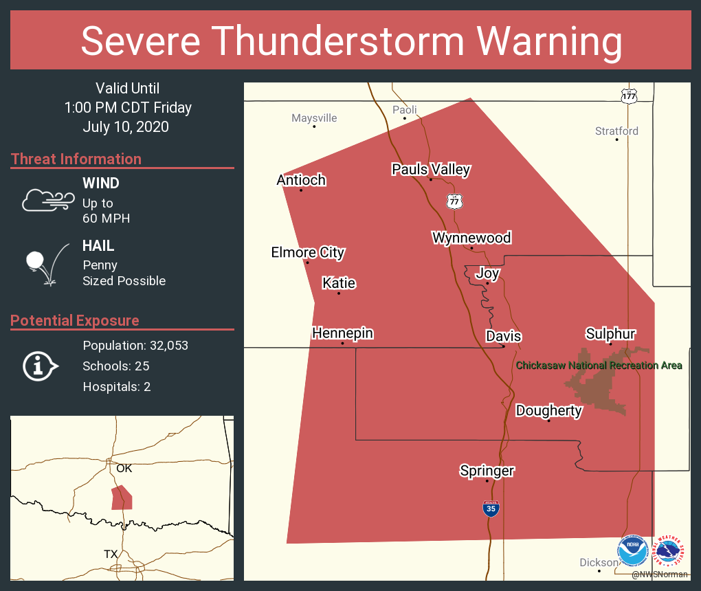
The CAMs have been trying to kill this complex off since early this morning but the storms just keep on keeping on. I wonder if they can make it south of the Red River?

Image
0 likes   
Winter time post are almost exclusively focused on the DFW area.

User avatar
South Texas Storms
Professional-Met
Professional-Met
Posts: 4224
Joined: Thu Jun 24, 2010 12:28 am
Location: Houston, TX

Re: Texas Summer 2020

#213 Postby South Texas Storms » Fri Jul 10, 2020 3:20 pm

bubba hotep wrote:The CAMs have been trying to kill this complex off since early this morning but the storms just keep on keeping on. I wonder if they can make it south of the Red River?

https://pbs.twimg.com/media/EclSZ6GVAAEgy13?format=png&name=medium


And poof. Get ready for the worst weather week of the year coming up. Sigh...
0 likes   

weatherdude1108
Category 5
Category 5
Posts: 4228
Joined: Tue Dec 13, 2011 1:04 pm
Location: Northwest Austin/Cedar Park, TX

Re: Texas Summer 2020

#214 Postby weatherdude1108 » Fri Jul 10, 2020 3:46 pm

This is dangerous heat, even by Texas July standards. Be careful if you have to be outside during the day!

Maybe we'll get a pattern change late next week. One can only hope!


Area Forecast Discussion
National Weather Service Austin/San Antonio TX
240 PM CDT Fri Jul 10 2020

.SHORT TERM (Today through Saturday)...
The upper level ridge continues to expand and fill with midday
analyses indicating ~598-600 decameter H5 heights over NM and AZ.
Per NAEFS, this ridge will be near record values for a July
subtropical ridge over the southwestern US tonight through early
Sunday.


The result is clear skies with well advertised hot and humid
weather. As of 18Z most locations are in the 91-97 degree range with
heat indices ranging from 99-108 except cooler in the Hill Country.
The Heat Advisory will remain in place for the Coastal Plains and
Rio Grande Plains through 00Z with several locations likely to see
heat indices of 108-112. An SPS covers the I-35 corridor and
counties westward (not including Edwards through Gillespie) for heat
indices topping out in the 102-108 degree range.

As the ridge expands aloft and the sfc high over the gulf
retrogrades westward closer to the TX coast, low level flow will
take on more of a southwesterly component on Saturday. Slightly
better mixing and drier air intruding from the west will lead to
lower Td values tomorrow afternoon, but ambient temperatures will
soar into the 100s for the majority of the region
save Edwards to
Gillespie County corridor which will still likely top out right at
99-100. Although the lower dew points may prevent many locations
from reaching the heat index thresholds for a heat advisory, ambient
T will come near 103 across a significant portion of the area. Have
opted to go ahead and hoist an advisory beginning at 16Z Saturday
and running right into the long term period as the heat worsens by
Sunday. Despite forecast low temperatures back into the 70s tomorrow
night, the extended period of dangerous heat warrants attention.

&&

.LONG TERM (Saturday Night through Thursday)...
South-Central Texas will remain under the eastern side of a strong
500mb ridge Sunday and Monday. The NAEFS indicates 500mb heights,
along with 700mb and 850mb Temps, in the 99th percentile to max
values over this region for this time in July. Sunday and Monday
will be the hottest days, with daily records likely broken in many
locations. There is a chance at Del Rio and San Antonio for all time
July max temperature records to be tied or broken
. See climate
section below.

Forecast air temperatures alone will be well into the Heat Advisory
criteria range. Due to the confidence in the heat we have issued the
Heat Advisory through Sunday, with a high likelihood that it will
also go into Monday. Some locations could actually be near or into
Excessive Heat Warning criteria both days,
and we will monitor this
closely through upcoming forecast packages.

From a messaging standpoint:
- Dangerous heat will build over the weekend and into early next week
- Stay hydrated and take frequent breaks in the shade or air
conditioning
- Limit strenuous outdoor activities
- Check on elderly and those without air conditioning
- Never leave children or pets unattended in vehicles

The ridge will weaken and flatten slightly Tuesday through Thursday,
but still maintain above normal temperatures and dry conditions.
Heat Advisory conditions could linger into Tuesday. The ridge is
forecast to weaken further Friday into next weekend as an inverted
upper level trough moves west underneath the ridge
.
1 likes   
The preceding post is NOT an official forecast, and should not be used as such. It is only the opinion of the poster and may or may not be backed by sound meteorological data. It is NOT endorsed by any professional institution including storm2k.org. For Official Information please refer to the NHC and NWS products.

User avatar
bubba hotep
S2K Supporter
S2K Supporter
Posts: 5837
Joined: Wed Dec 28, 2016 1:00 am
Location: Collin County Texas

Re: Texas Summer 2020

#215 Postby bubba hotep » Fri Jul 10, 2020 5:23 pm

The models appear to agree on the core of the heatwave being from Saturday to Tuesday for N. Texas. However, if the 18z 3k NAM is right, then portions of N. Texas might have a hard time realizing the max heat potential is looks like there will be a chance for convective debris to be moving through the area pretty much each afternoon. Today the point forecast for MBY was 97 but we only hit 93 and have now dropped back down to 90 under a thick cover of high clouds.
1 likes   
Winter time post are almost exclusively focused on the DFW area.

User avatar
bubba hotep
S2K Supporter
S2K Supporter
Posts: 5837
Joined: Wed Dec 28, 2016 1:00 am
Location: Collin County Texas

Re: Texas Summer 2020

#216 Postby bubba hotep » Sat Jul 11, 2020 7:22 am

Welp, no nocturnal complex of storms coming down out of Oklahoma today. Looks like a scorcher for DFW! Maybe we can get lucky tomorrow.
1 likes   
Winter time post are almost exclusively focused on the DFW area.

weatherdude1108
Category 5
Category 5
Posts: 4228
Joined: Tue Dec 13, 2011 1:04 pm
Location: Northwest Austin/Cedar Park, TX

Re: Texas Summer 2020

#217 Postby weatherdude1108 » Sat Jul 11, 2020 2:28 pm

Don't see Excessive Heat Warnings here very often.

Excessive Heat Warning
URGENT - WEATHER MESSAGE
National Weather Service Austin/San Antonio TX
214 PM CDT Sat Jul 11 2020

TXZ171>173-191>193-203>208-219>223-121000-
/O.NEW.KEWX.EH.W.0001.200712T1800Z-200713T0100Z/
/O.EXT.KEWX.HT.Y.0003.000000T0000Z-200712T0100Z/
Llano-Burnet-Williamson-Hays-Travis-Bastrop-Uvalde-Medina-Bexar-
Comal-Guadalupe-Caldwell-Frio-Atascosa-Wilson-Karnes-Gonzales-
Including the cities of Llano, Burnet, Georgetown, San Marcos,
Austin, Bastrop, Uvalde, Hondo, San Antonio, New Braunfels,
Seguin, Lockhart, Pearsall, Pleasanton, Floresville, Karnes City,
and Gonzales
214 PM CDT Sat Jul 11 2020

...HEAT ADVISORY NOW IN EFFECT UNTIL 8 PM CDT THIS EVENING...
...EXCESSIVE HEAT WARNING IN EFFECT FROM 1 PM TO 8 PM CDT
SUNDAY...

* WHAT...For the Heat Advisory this afternoon and early evening,
air temperature values of 100 to 105 and heat index values of
105 to 110 in some areas. For the Excessive Heat Warning Sunday,
dangerously hot conditions with air temperature values of 105 to
108 expected in some areas.

* WHERE...Portions of south central Texas.

* WHEN...For the Heat Advisory, until 8 PM CDT this evening. For
the Excessive Heat Warning, from 1 PM to 8 PM CDT Sunday.

* IMPACTS...Extreme heat will significantly increase the
potential for heat related illnesses, particularly for those
working or participating in outdoor activities.

PRECAUTIONARY/PREPAREDNESS ACTIONS...

Drink plenty of fluids, stay in an air-conditioned room, stay out
of the sun, and check up on relatives and neighbors. Young
children and pets should never be left unattended in vehicles
under any circumstances.

Take extra precautions if you work or spend time outside. When
possible reschedule strenuous activities to early morning or
evening. Know the signs and symptoms of heat exhaustion and heat
stroke. Wear lightweight and loose fitting clothing when
possible. To reduce risk during outdoor work, the Occupational
Safety and Health Administration recommends scheduling frequent
rest breaks in shaded or air conditioned environments. Anyone
overcome by heat should be moved to a cool and shaded location.
Heat stroke is an emergency! Call 9 1 1.
0 likes   
The preceding post is NOT an official forecast, and should not be used as such. It is only the opinion of the poster and may or may not be backed by sound meteorological data. It is NOT endorsed by any professional institution including storm2k.org. For Official Information please refer to the NHC and NWS products.

cstrunk
Category 2
Category 2
Posts: 635
Joined: Sat Jul 04, 2020 10:38 am
Location: Longview, TX

Re: Texas Summer 2020

#218 Postby cstrunk » Sat Jul 11, 2020 4:52 pm

Well i got lucky last week. Ended up getting a really good soaker and about 3.25" of rain at my house in Longview. My grass has really enjoyed the weather this summer. And yes - it is very hot and humid now. Just miserable. And here I am mowing my lawn in the middle of the afternoon. :double: Definitely having to take a few breaks in the AC.
1 likes   

Brent
S2K Supporter
S2K Supporter
Posts: 38088
Age: 36
Joined: Sun May 16, 2004 10:30 pm
Location: Tulsa Oklahoma
Contact:

Re: Texas Summer 2020

#219 Postby Brent » Sat Jul 11, 2020 4:54 pm

Somehow DFW still hasn't hit 100 :spam:
0 likes   
#neversummer

User avatar
South Texas Storms
Professional-Met
Professional-Met
Posts: 4224
Joined: Thu Jun 24, 2010 12:28 am
Location: Houston, TX

Re: Texas Summer 2020

#220 Postby South Texas Storms » Sat Jul 11, 2020 5:21 pm

Brent wrote:Somehow DFW still hasn't hit 100 :spam:


Yeah but does it really matter when the heat index is a stupid 111F? Didn't think so :lol:
3 likes   


Return to “USA & Caribbean Weather”

Who is online

Users browsing this forum: cajungal, utpmg and 11 guests