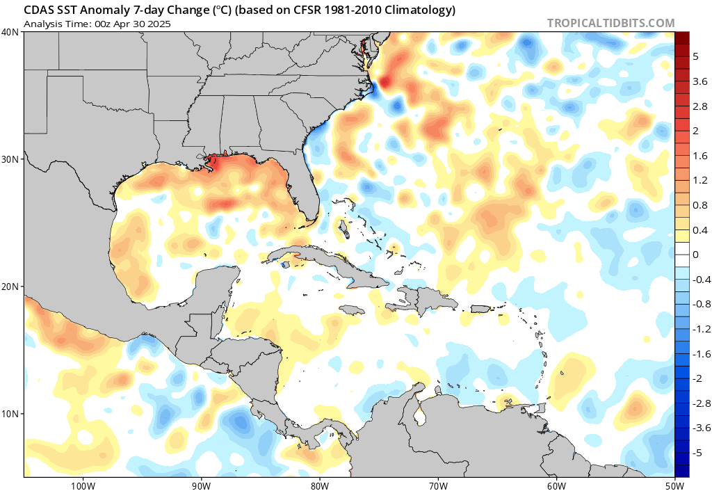
Big warm up coming across the main development region!
2020 Indicators: SST's / SAL / MSLP / Steering / Shear / Instability / Sat Images
Moderator: S2k Moderators
Forum rules

The posts in this forum are NOT official forecasts and should not be used as such. They are just the opinion of the poster and may or may not be backed by sound meteorological data. They are NOT endorsed by any professional institution or STORM2K. For official information, please refer to products from the National Hurricane Center and National Weather Service.
-
SFLcane

- S2K Supporter

- Posts: 10281
- Age: 48
- Joined: Sat Jun 05, 2010 1:44 pm
- Location: Lake Worth Florida
Re: 2020 Indicators: SST's / SAL / MSLP / Steering / Shear / Instability / Sat Images
Big warm up coming across the main development region!
0 likes
-
AxaltaRacing24
- Category 5

- Posts: 1774
- Age: 25
- Joined: Wed Jul 27, 2016 11:14 am
- Location: Jupiter, FL
Re: 2020 Indicators: SST's / SAL / MSLP / Steering / Shear / Instability / Sat Images
TheStormExpert wrote:Hammy wrote:Any clue as to what's causing the nonstop lack of instability/dryness in the Atlantic? This seems like an ongoing factor since 2011.
Where seasons like 2017, 2018, and 2019 not enough to prove that the instability graphic is flawed?
people pull it up every season to give credence to their skeptical outlooks only to get proven wrong by peak season.
1 likes
-
Kingarabian

- S2K Supporter
- Posts: 16360
- Joined: Sat Aug 08, 2009 3:06 am
- Location: Honolulu, Hawaii
Re: 2020 Indicators: SST's / SAL / MSLP / Steering / Shear / Instability / Sat Images
Yeah no offense those instability charts have been pretty wrong in the past few years and I think they should be discontinued.
8 likes
RIP Kobe Bryant
-
SFLcane
- S2K Supporter
- Posts: 10281
- Age: 48
- Joined: Sat Jun 05, 2010 1:44 pm
- Location: Lake Worth Florida
Re: 2020 Indicators: SST's / SAL / MSLP / Steering / Shear / Instability / Sat Images
Kingarabian wrote:Yeah no offense those instability charts have been pretty wrong in the past few years and I think they should be discontinued.
How were they wrong? Nothing developed in the MDR the last two years. Dorian, Florence, all outside the MDR. 2017 the stability changed. Notice how despite all those westerlies, no TCs. We won't get MDR TCs til the stability/subsidence improves.
0 likes


Re: 2020 Indicators: SST's / SAL / MSLP / Steering / Shear / Instability / Sat Images
SFLcane wrote:
Big warm up coming across the main development region!
Looks true, we are ahead of 2017 for sst anomaly in the MDR at the same time that year. Even More so across to the Caribbean to the Florida straits.
0 likes
-
CyclonicFury

- Category 5
- Posts: 2033
- Age: 27
- Joined: Sun Jul 02, 2017 12:32 pm
- Location: NC
- Contact:
Re: 2020 Indicators: SST's / SAL / MSLP / Steering / Shear / Instability / Sat Images
SFLcane wrote:Kingarabian wrote:Yeah no offense those instability charts have been pretty wrong in the past few years and I think they should be discontinued.
How were they wrong? Nothing developed in the MDR the last two years. Dorian, Florence, all outside the MDR. 2017 the stability changed. Notice how despite all those westerlies, no TCs. We won't get MDR TCs til the stability/subsidence improves.
This statement is completely false. The Atlantic had 4 tropical cyclones reach hurricane strength in the MDR in 2018 (Beryl, Florence, Helene and Isaac), and 2 in 2019 (Jerry and Lorenzo). Lorenzo became a high-end Category 4 in the MDR last year. Just because it recurved doesn't mean it doesn't count. Florence also reached Category 4 just north of the MDR.
Last edited by CyclonicFury on Thu Jul 09, 2020 8:18 pm, edited 1 time in total.
11 likes
NCSU B.S. in Meteorology Class of 2021. Tropical weather blogger at http://www.cyclonicfury.com. My forecasts and thoughts are NOT official, for official forecasts please consult the National Hurricane Center.

Re: 2020 Indicators: SST's / SAL / MSLP / Steering / Shear / Instability / Sat Images
SFLcane wrote:
Big warm up coming across the main development region!
This warming could erase the stability perhaps come peak season, once very warm sea surface temps help destabilize the atmosphere. SAL would be the only main inhibitor by then and this too usually drops after 8/15. My guesstimate is that the MDR will awaken around 8/20, like it did in 2017.
Btw guys, this lack of strong TC's in the other parts of the northern hemisphere is getting creepy. Will the Atlantic make up for the lower levels of activity elsewhere? Seems like the 'calm before the storm'
0 likes
Georges '98, Irene '99, Frances '04, Jeanne '04, Katrina '05, Wilma '05, Gustav '08, Isaac '12, Matthew '16, Florence '18, Michael '18, Ian '22

Re: 2020 Indicators: SST's / SAL / MSLP / Steering / Shear / Instability / Sat Images
SFLcane wrote:Kingarabian wrote:Yeah no offense those instability charts have been pretty wrong in the past few years and I think they should be discontinued.
How were they wrong? Nothing developed in the MDR the last two years. Dorian, Florence, all outside the MDR. 2017 the stability changed. Notice how despite all those westerlies, no TCs. We won't get MDR TCs til the stability/subsidence improves.
Those instability charts have been broken for a while.
2017 below normal most of the season. We know that was garbage.
Source: http://rammb.cira.colostate.edu/project ... tatins.gif

4 likes
The following post is NOT an official forecast and should not be used as such. It is just the opinion of the poster and may or may not be backed by sound meteorological data. It is NOT endorsed by any professional institution including storm2k.org For Official Information please refer to the NHC and NWS products.
-
ScottNAtlanta

- Category 5
- Posts: 2535
- Joined: Sat May 25, 2013 3:11 pm
- Location: Atlanta, GA
Re: 2020 Indicators: SST's / SAL / MSLP / Steering / Shear / Instability / Sat Images
Something I have noticed is the Euro out into August has been forecasting higher pressures in Columbia. That would indicate a weaker heat low, which in turn would slow the easterlies in the Caribbean. That would make the area more conducive to development should something get into the area.
3 likes
The posts in this forum are NOT official forecast and should not be used as such. They are just the opinion of the poster and may or may not be backed by sound meteorological data. They are NOT endorsed by any professional institution or storm2k.org. For official information, please refer to the NHC and NWS products.

Re: 2020 Indicators: SST's / SAL / MSLP / Steering / Shear / Instability / Sat Images
FireRat wrote:SFLcane wrote:
Big warm up coming across the main development region!
This warming could erase the stability perhaps come peak season, once very warm sea surface temps help destabilize the atmosphere. SAL would be the only main inhibitor by then and this too usually drops after 8/15. My guesstimate is that the MDR will awaken around 8/20, like it did in 2017.
Btw guys, this lack of strong TC's in the other parts of the northern hemisphere is getting creepy. Will the Atlantic make up for the lower levels of activity elsewhere? Seems like the 'calm before the storm'
I think the struggle the Pacific has been having these past few weeks is a really good real time indicator showing the way the ATL could be favored. That wave that has been making its way through the Caribbean headed for the EPAC is a good indicator too. Really good convection and a possible closed circulation earlier too. If this wave also struggles in the EPAC when it gets there after what it managed in the Caribbean, I think it'll be a further indicator showing how conditions are setting themselves up, favoring the Atlantic.
I know comparisons to 2005 have been running rampant due to the fact that we keep breaking records for earliest named storms, and then it gets mentioned that we're not getting the same intensity July 2005 had. This is true. July 2005 produced 2 major hurricanes, really astounding. Consider the fact that the season produced a total of 7 majors though. If you cut the 2 anomalous majors in July that year, leaves you with 5. 2017 produced 6 majors, none of them in July, all during peak, in fact, September 2017 was a record breaker for ACE.
If there was some kind of Olympics for ATL hurricane seasons, 2005 would be a gold medalist for a 400m sprint, but 2017 would take the gold for a 100m dash.
I say this just because I'm mulling over the idea of a 2005/2017 hybrid in my head. Maybe we're not getting July majors like 2005 (although we have 2/3 of the month left, it's still possible), but storms keep coming. If they keep it up this way, I think the Greek alphabet is definitely a possibility, maybe we could even potentially break the named storm record from 2005. Then, if we have an intense peak of major ACE generation like September 2017, just longer duration, maybe encompassing all of ASO, I think it's also possible we could squeeze out 8 majors, also breaking the record of 7 from 2005.
I need to be clear though, I'm not explicitly forecasting this, breaking records from 2005 is a really tall order, I just think there's a possibility that ASO could exceed everyone's already high expectations. The way the ATL has been producing while the entire Pacific has been riding the struggle bus has me pondering. I definitely think the 18 part of my 18/11/6 numbers is going to bust, I still feel pretty good about the 11 and 6 though.
6 likes
Solar Aquarian
Lunar Cancerian
 Sagittarian
Lunar Cancerian
-
Shell Mound
- Category 5
- Posts: 2432
- Age: 33
- Joined: Thu Sep 07, 2017 3:39 pm
- Location: St. Petersburg, FL → Scandinavia
Re: 2020 Indicators: SST's / SAL / MSLP / Steering / Shear / Instability / Sat Images
Shell Mound wrote:AutoPenalti wrote:That's a lot of shear for August... what MDR system is going to survive that trek?
What’s even more surprising is that no one is really mentioning it, much less probing for causes. The shear even shows at 200 mb over the western MDR:
https://www.tropicaltidbits.com/analysis/models/cfs-mon/2020070900/cfs-mon_01_u200a_atl_1.png
https://www.tropicaltidbits.com/analysis/models/cfs-mon/2020070900/cfs-mon_01_ashear_atl_1.png
https://www.tropicaltidbits.com/analysis/models/cfs-mon/2020070900/cfs-mon_01_ashear_epac_1.png
Also, that strong subtropical jet extending from the eastern North Pacific all the way over the Atlantic seems more like an El Niño-type setup. Strange!
Does anyone have an explanation for this? Also:
https://twitter.com/AndyHazelton/status/1281319374612242447
https://twitter.com/AndyHazelton/status/1281328570606981121
https://twitter.com/ToddKimberlain/status/1281310639328239616
https://twitter.com/antmasiello/status/1280990512846196736
https://twitter.com/antmasiello/status/1281008286842654720
0 likes
CVW / MiamiensisWx / Shell Mound
The posts in this forum are NOT official forecasts and should not be used as such. They are just the opinion of the poster and may or may not be backed by sound meteorological data. They are NOT endorsed by any professional institution or STORM2K. For official information, please refer to products from the NHC and NWS.
-
AutoPenalti
- Category 5
- Posts: 4091
- Age: 29
- Joined: Mon Aug 17, 2015 4:16 pm
- Location: Ft. Lauderdale, Florida
Re: 2020 Indicators: SST's / SAL / MSLP / Steering / Shear / Instability / Sat Images
I’m starting to think that a short, yet intense, season is possible if this sinking air in the MDR keeps propagating into ASO.
It’s strange. Really strange. I highly doubt it though.
It’s strange. Really strange. I highly doubt it though.
0 likes
The posts in this forum are NOT official forecasts and should not be used as such. They are just the opinion of the poster and may or may not be backed by sound meteorological data. They are NOT endorsed by any professional institution or STORM2K. For official information, please refer to products from the NHC and NWS.
Model Runs Cheat Sheet:
GFS (5:30 AM/PM, 11:30 AM/PM)
HWRF, GFDL, UKMET, NAVGEM (6:30-8:00 AM/PM, 12:30-2:00 AM/PM)
ECMWF (1:45 AM/PM)
TCVN is a weighted averaged
-
TheStormExpert
Re: 2020 Indicators: SST's / SAL / MSLP / Steering / Shear / Instability / Sat Images
Yes the background state in the Atlantic is more favorable this year than last but until I see something form in the MDR especially in July I’m not buying a hyperactive season like 2017. Five of the six storms that formed this year so far have done so in the Subtropical Atlantic off the U.S. East Coast with Cristobal forming at 19.6°N in the Bay of Campeche. So maybe the Subtropics are once again more favorable than the Tropics especially just off the U.S. East Coast.
0 likes
Re: 2020 Indicators: SST's / SAL / MSLP / Steering / Shear / Instability / Sat Images
Chris90 wrote:I think the struggle the Pacific has been having these past few weeks is a really good real time indicator showing the way the ATL could be favored. That wave that has been making its way through the Caribbean headed for the EPAC is a good indicator too. Really good convection and a possible closed circulation earlier too. If this wave also struggles in the EPAC when it gets there after what it managed in the Caribbean, I think it'll be a further indicator showing how conditions are setting themselves up, favoring the Atlantic.
I know comparisons to 2005 have been running rampant due to the fact that we keep breaking records for earliest named storms, and then it gets mentioned that we're not getting the same intensity July 2005 had. This is true. July 2005 produced 2 major hurricanes, really astounding. Consider the fact that the season produced a total of 7 majors though. If you cut the 2 anomalous majors in July that year, leaves you with 5. 2017 produced 6 majors, none of them in July, all during peak, in fact, September 2017 was a record breaker for ACE.
If there was some kind of Olympics for ATL hurricane seasons, 2005 would be a gold medalist for a 400m sprint, but 2017 would take the gold for a 100m dash.
I say this just because I'm mulling over the idea of a 2005/2017 hybrid in my head. Maybe we're not getting July majors like 2005 (although we have 2/3 of the month left, it's still possible), but storms keep coming. If they keep it up this way, I think the Greek alphabet is definitely a possibility, maybe we could even potentially break the named storm record from 2005. Then, if we have an intense peak of major ACE generation like September 2017, just longer duration, maybe encompassing all of ASO, I think it's also possible we could squeeze out 8 majors, also breaking the record of 7 from 2005.
I need to be clear though, I'm not explicitly forecasting this, breaking records from 2005 is a really tall order, I just think there's a possibility that ASO could exceed everyone's already high expectations. The way the ATL has been producing while the entire Pacific has been riding the struggle bus has me pondering. I definitely think the 18 part of my 18/11/6 numbers is going to bust, I still feel pretty good about the 11 and 6 though.
Well said Chris! Yeah It's going to be really interesting as we head into ASO, with 2017 potentially being the best recent year analog to 2020. It's a wait and see how and when the first MDR storm takes shape, it could give us more clues on how peak season may behave. I also feel my 19 in the 19/9/6 prediction I made a while back could be a bit low, but do stick with the 9 Hurricanes and 6 majors part especially. Imagine if this year ends up being something like 25/11/8, I'll be doggone!
1 likes
Georges '98, Irene '99, Frances '04, Jeanne '04, Katrina '05, Wilma '05, Gustav '08, Isaac '12, Matthew '16, Florence '18, Michael '18, Ian '22
-
toad strangler

- S2K Supporter
- Posts: 4546
- Joined: Sun Jul 28, 2013 3:09 pm
- Location: Earth
- Contact:
Re: 2020 Indicators: SST's / SAL / MSLP / Steering / Shear / Instability / Sat Images
TheStormExpert wrote::uarrow: If that’s the case then we may not see the high number of hurricanes and major hurricanes that most are forecasting. Maybe it’ll be more like last season.
Yes the background state in the Atlantic is more favorable this year than last but until I see something form in the MDR especially in July I’m not buying a hyperactive season like 2017. Five of the six storms that formed this year so far have done so in the Subtropical Atlantic off the U.S. East Coast with Cristobal forming at 19.6°N in the Bay of Campeche. So maybe the Subtropics are once again more favorable than the Tropics especially just off the U.S. East Coast.
Good Lord, the sub tropical Atlantic off the US E coast is a climo HOT SPOT in June and July for genesis.
5 likes
My Weather Station
https://www.wunderground.com/dashboard/pws/KFLPORTS603
https://www.wunderground.com/dashboard/pws/KFLPORTS603

Re: 2020 Indicators: SST's / SAL / MSLP / Steering / Shear / Instability / Sat Images
TheStormExpert wrote::uarrow: If that’s the case then we may not see the high number of hurricanes and major hurricanes that most are forecasting. Maybe it’ll be more like last season.
Yes the background state in the Atlantic is more favorable this year than last but until I see something form in the MDR especially in July I’m not buying a hyperactive season like 2017. Five of the six storms that formed this year so far have done so in the Subtropical Atlantic off the U.S. East Coast with Cristobal forming at 19.6°N in the Bay of Campeche. So maybe the Subtropics are once again more favorable than the Tropics especially just off the U.S. East Coast.
Fair. But you don't need an active MDR to have a hyperactive season. Look at 2005. Sure there were some tracks across it when systems were weak - but not that many. And it was the preeminent season of any of our lifetimes so far.
6 likes
-
TheStormExpert
Re: 2020 Indicators: SST's / SAL / MSLP / Steering / Shear / Instability / Sat Images
toad strangler wrote:TheStormExpert wrote::uarrow: If that’s the case then we may not see the high number of hurricanes and major hurricanes that most are forecasting. Maybe it’ll be more like last season.
Yes the background state in the Atlantic is more favorable this year than last but until I see something form in the MDR especially in July I’m not buying a hyperactive season like 2017. Five of the six storms that formed this year so far have done so in the Subtropical Atlantic off the U.S. East Coast with Cristobal forming at 19.6°N in the Bay of Campeche. So maybe the Subtropics are once again more favorable than the Tropics especially just off the U.S. East Coast.
Good Lord, the sub tropical Atlantic off the US E coast is a climo HOT SPOT in June and July for genesis.
Well so is the Tropical Atlantic.
0 likes
-
MarioProtVI
- Category 5
- Posts: 1034
- Age: 24
- Joined: Sun Sep 29, 2019 7:33 pm
- Location: New Jersey
Re: 2020 Indicators: SST's / SAL / MSLP / Steering / Shear / Instability / Sat Images
TheStormExpert wrote:toad strangler wrote:TheStormExpert wrote::uarrow: If that’s the case then we may not see the high number of hurricanes and major hurricanes that most are forecasting. Maybe it’ll be more like last season.
Yes the background state in the Atlantic is more favorable this year than last but until I see something form in the MDR especially in July I’m not buying a hyperactive season like 2017. Five of the six storms that formed this year so far have done so in the Subtropical Atlantic off the U.S. East Coast with Cristobal forming at 19.6°N in the Bay of Campeche. So maybe the Subtropics are once again more favorable than the Tropics especially just off the U.S. East Coast.
Good Lord, the sub tropical Atlantic off the US E coast is a climo HOT SPOT in June and July for genesis.
Well so is the Tropical Atlantic.
But less so then the East Coast at this time. Late July - early August is when we start seeing tropical origins really start appearing.
4 likes
Re: 2020 Indicators: SST's / SAL / MSLP / Steering / Shear / Instability / Sat Images

Absolutely boiling around the southern tip of the Florida peninsula and Bahamas. And this is despite marginal cooling in the last couple days, as there was a 32C reading recently in the Straits, still anomalously warm for this time of year
0 likes
Andrew (1992), Irene (1999), Frances (2004), Katrina (2005), Wilma (2005), Fay (2008), Irma (2017), Eta (2020), Ian (2022)
Who is online
Users browsing this forum: No registered users and 56 guests