#829 Postby Aric Dunn » Thu Jul 16, 2020 11:43 am
Ivanhater wrote:Aric Dunn wrote:Ivanhater wrote:While the Euro does show a reflection of the wave you are pointing out on the gfs Aric, the Euro wave is the one behind it at 240 hours approaching S Florida
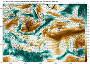
The euro also tries to develop the wave behind it.. whereas the GFS does not..
im talking about the first wave..
Got you. I believe most of us this morning were referring to the latter wave at 240 hour on the Euro.
yeah, that is too far out to really dig into.
I was more interested in the next 5 days. both models have something. both have land interaction. but if that is just a little farther north of both of them.. then things may get interesting..
the Euro brings the wave into the northern gulf coast.
0 likes
Note: If I make a post that is brief. Please refer back to previous posts for the analysis or reasoning. I do not re-write/qoute what my initial post said each time.
If there is nothing before... then just ask

Space & Atmospheric Physicist, Embry-Riddle Aeronautical University,
I believe the sky is falling...


