ATL: ISAIAS - Models

Moderator: S2k Moderators

Message
Author
User avatar
toad strangler
S2K Supporter
S2K Supporter
Posts: 4543
Joined: Sun Jul 28, 2013 3:09 pm
Location: Earth
Contact:

Re: ATL: INVEST 92L - Models

#361 Postby toad strangler » Sun Jul 26, 2020 10:56 am

SFLcane wrote:
HurricaneFrances04 wrote:12Z GFS coming in much stronger through 42 hours

And also looks further north. Assuming nothing changes, may not impact any land on this run
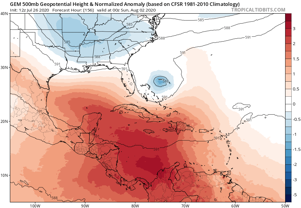

No ridging.


Western flank of ridge will send this to the fishies at 12z
0 likes   

HurricaneFrances04
Category 2
Category 2
Posts: 597
Joined: Mon Jun 25, 2012 8:09 am
Location: Fort Lauderdale, Florida

Re: ATL: INVEST 92L - Models

#362 Postby HurricaneFrances04 » Sun Jul 26, 2020 11:02 am

Moving WNW at 114 hrs. Hopefully the ridge breaks down.
0 likes   

AutoPenalti
Category 5
Category 5
Posts: 4030
Age: 29
Joined: Mon Aug 17, 2015 4:16 pm
Location: Ft. Lauderdale, Florida

Re: ATL: INVEST 92L - Models

#363 Postby AutoPenalti » Sun Jul 26, 2020 11:04 am

Image
0 likes   
The posts in this forum are NOT official forecasts and should not be used as such. They are just the opinion of the poster and may or may not be backed by sound meteorological data. They are NOT endorsed by any professional institution or STORM2K. For official information, please refer to products from the NHC and NWS.


Model Runs Cheat Sheet:
GFS (5:30 AM/PM, 11:30 AM/PM)
HWRF, GFDL, UKMET, NAVGEM (6:30-8:00 AM/PM, 12:30-2:00 AM/PM)
ECMWF (1:45 AM/PM)

TCVN
is a weighted averaged

HurricaneFrances04
Category 2
Category 2
Posts: 597
Joined: Mon Jun 25, 2012 8:09 am
Location: Fort Lauderdale, Florida

Re: ATL: INVEST 92L - Models

#364 Postby HurricaneFrances04 » Sun Jul 26, 2020 11:08 am

Looks a little weaker, but I'm not sure its going out to sea here. Ridge looks further west vs 6z.
0 likes   

User avatar
Evil Jeremy
S2K Supporter
S2K Supporter
Posts: 5463
Age: 32
Joined: Mon Apr 10, 2006 2:10 pm
Location: Los Angeles, CA

Re: ATL: INVEST 92L - Models

#365 Postby Evil Jeremy » Sun Jul 26, 2020 11:09 am

GFS greatly picking up the pace on this run. It's a solid 3 degrees further West on this run than the last run through 138 hours. More North as well, but the jump W, the faster overall motion, is notable. Weaker, too.
2 likes   
Frances 04 / Jeanne 04 / Katrina 05 / Wilma 05 / Fay 08 / Debby 12 / Andrea 13 / Colin 16 / Hermine 16 / Matthew 16 / Irma 17

AutoPenalti
Category 5
Category 5
Posts: 4030
Age: 29
Joined: Mon Aug 17, 2015 4:16 pm
Location: Ft. Lauderdale, Florida

Re: ATL: INVEST 92L - Models

#366 Postby AutoPenalti » Sun Jul 26, 2020 11:11 am

Looks like the cutoff low near the valley is left behind...

Image
0 likes   
The posts in this forum are NOT official forecasts and should not be used as such. They are just the opinion of the poster and may or may not be backed by sound meteorological data. They are NOT endorsed by any professional institution or STORM2K. For official information, please refer to products from the NHC and NWS.


Model Runs Cheat Sheet:
GFS (5:30 AM/PM, 11:30 AM/PM)
HWRF, GFDL, UKMET, NAVGEM (6:30-8:00 AM/PM, 12:30-2:00 AM/PM)
ECMWF (1:45 AM/PM)

TCVN
is a weighted averaged

User avatar
gatorcane
S2K Supporter
S2K Supporter
Posts: 23691
Age: 47
Joined: Sun Mar 13, 2005 3:54 pm
Location: Boca Raton, FL

Re: ATL: INVEST 92L - Models

#367 Postby gatorcane » Sun Jul 26, 2020 11:13 am

Looks like conditions may not be as favorable in the SW Atlantic as I previously thought for 92l...if 92l even makes it there:

Image
Last edited by gatorcane on Sun Jul 26, 2020 11:17 am, edited 2 times in total.
0 likes   

AutoPenalti
Category 5
Category 5
Posts: 4030
Age: 29
Joined: Mon Aug 17, 2015 4:16 pm
Location: Ft. Lauderdale, Florida

Re: ATL: INVEST 92L - Models

#368 Postby AutoPenalti » Sun Jul 26, 2020 11:14 am

Not as favorable conditions, shear/dry air really going to undercut Isaias. Maybe this season may not be as active as we previously thought, just saying... I kid, it’s only July. :spam: :lol:

Image
Last edited by AutoPenalti on Sun Jul 26, 2020 11:18 am, edited 3 times in total.
0 likes   
The posts in this forum are NOT official forecasts and should not be used as such. They are just the opinion of the poster and may or may not be backed by sound meteorological data. They are NOT endorsed by any professional institution or STORM2K. For official information, please refer to products from the NHC and NWS.


Model Runs Cheat Sheet:
GFS (5:30 AM/PM, 11:30 AM/PM)
HWRF, GFDL, UKMET, NAVGEM (6:30-8:00 AM/PM, 12:30-2:00 AM/PM)
ECMWF (1:45 AM/PM)

TCVN
is a weighted averaged

User avatar
SFLcane
S2K Supporter
S2K Supporter
Posts: 10163
Age: 47
Joined: Sat Jun 05, 2010 1:44 pm
Location: Lake Worth Florida

Re: ATL: INVEST 92L - Models

#369 Postby SFLcane » Sun Jul 26, 2020 11:15 am

AutoPenalti wrote:Looks like the cutoff low near the valley is left behind...

https://tropicaltidbits.com/analysis/models/gfs/2020072612/gfs_z500a_atl_25.png


Na recurves anyway big hole in the ridge. Sheared mess
0 likes   

HurricaneFrances04
Category 2
Category 2
Posts: 597
Joined: Mon Jun 25, 2012 8:09 am
Location: Fort Lauderdale, Florida

Re: ATL: INVEST 92L - Models

#370 Postby HurricaneFrances04 » Sun Jul 26, 2020 11:16 am

Image
0 likes   

User avatar
tiger_deF
Category 1
Category 1
Posts: 468
Age: 24
Joined: Tue Sep 27, 2016 11:47 am

Re: ATL: INVEST 92L - Models

#371 Postby tiger_deF » Sun Jul 26, 2020 11:25 am

It's a single model run of the GFS where we are looking 5-10 days ahead, a little premature for season cancel posts. While it's important to look at trends in model runs, the 18z run could go bonkers and this would be almost totally forgotten
2 likes   

User avatar
aspen
Category 5
Category 5
Posts: 8818
Joined: Sat Oct 12, 2019 7:10 pm
Location: Connecticut, USA

Re: ATL: INVEST 92L - Models

#372 Postby aspen » Sun Jul 26, 2020 11:26 am

HurricaneFrances04 wrote:https://i.imgur.com/6jF38IE.gif

Looks like 92L’s own moisture bubble could force a dry pocket in the Caribbean, if I’m interpreting that right. I’m not sure if it would be under threat from sucking that pocket if its moisture bubble is strong enough.
0 likes   
Irene '11 Sandy '12 Hermine '16 5/15/2018 Derecho Fay '20 Isaias '20 Elsa '21 Henri '21 Ida '21

I am only a meteorology enthusiast who knows a decent amount about tropical cyclones. Look to the professional mets, the NHC, or your local weather office for the best information.

NewEnglandWX
Tropical Wave
Tropical Wave
Posts: 3
Joined: Sun Sep 02, 2018 7:46 pm

Re: ATL: INVEST 92L - Models

#373 Postby NewEnglandWX » Sun Jul 26, 2020 11:26 am

gatorcane wrote:Looks like conditions may not be as favorable in the SW Atlantic as I previously thought for 92l...if 92l even makes it there:

https://i.postimg.cc/GphYddQv/gfs-shear-watl-21.png


Based off of one run? The problem this run is that it accelerates too fast into the dry air and becomes decoupled thus not allowing it to form a ULAC because it stays too weak.
2 likes   

User avatar
gatorcane
S2K Supporter
S2K Supporter
Posts: 23691
Age: 47
Joined: Sun Mar 13, 2005 3:54 pm
Location: Boca Raton, FL

Re: ATL: INVEST 92L - Models

#374 Postby gatorcane » Sun Jul 26, 2020 11:29 am

NewEnglandWX wrote:
gatorcane wrote:Looks like conditions may not be as favorable in the SW Atlantic as I previously thought for 92l...if 92l even makes it there:

https://i.postimg.cc/GphYddQv/gfs-shear-watl-21.png


Based off of one run? The problem this run is that it accelerates too fast into the dry air and becomes decoupled thus not allowing it to form a ULAC because it stays too weak.


Based also on yesterday’s JMA which showed weakening between hours 168 and 192 in the same general area.
0 likes   

HurricaneFrances04
Category 2
Category 2
Posts: 597
Joined: Mon Jun 25, 2012 8:09 am
Location: Fort Lauderdale, Florida

Re: ATL: INVEST 92L - Models

#375 Postby HurricaneFrances04 » Sun Jul 26, 2020 11:30 am

CMC is a bit faster through 90 hours. Could be a trend of a faster moving disturbance in the short term.
0 likes   

User avatar
gatorcane
S2K Supporter
S2K Supporter
Posts: 23691
Age: 47
Joined: Sun Mar 13, 2005 3:54 pm
Location: Boca Raton, FL

Re: ATL: INVEST 92L - Models

#376 Postby gatorcane » Sun Jul 26, 2020 11:34 am

HurricaneFrances04 wrote:CMC is a bit faster through 90 hours. Could be a trend of a faster moving disturbance in the short term.


Looks like the TUTT, albeit weakening, is shearing it and keeping it from really deepening at least through 102 hours.

Edit: through 132 hours CMC is weaker than the 00Z and recurving it.

Image
Last edited by gatorcane on Sun Jul 26, 2020 11:39 am, edited 2 times in total.
0 likes   

NewEnglandWX
Tropical Wave
Tropical Wave
Posts: 3
Joined: Sun Sep 02, 2018 7:46 pm

Re: ATL: INVEST 92L - Models

#377 Postby NewEnglandWX » Sun Jul 26, 2020 11:37 am

gatorcane wrote:
NewEnglandWX wrote:
gatorcane wrote:Looks like conditions may not be as favorable in the SW Atlantic as I previously thought for 92l...if 92l even makes it there:

https://i.postimg.cc/GphYddQv/gfs-shear-watl-21.png


Based off of one run? The problem this run is that it accelerates too fast into the dry air and becomes decoupled thus not allowing it to form a ULAC because it stays too weak.


Based also on yesterday’s JMA which showed weakening between hours 168 and 192 in the same general area.


My point is that it's way too early to look at any of the intensity trends. Should've learned that from Gonzalo and Hanna but here you are using the models to predict and storm without an LLC out at 120 something hours. There is a reason the NHC doesn't do cones for invests. Please at least wait until we have a Depression to start doubting the Tropical cyclone.
5 likes   

User avatar
mitchell
Category 1
Category 1
Posts: 408
Joined: Wed Mar 19, 2003 8:22 am
Location: Delaware
Contact:

Re: ATL: INVEST 92L - Models

#378 Postby mitchell » Sun Jul 26, 2020 11:41 am

Evil Jeremy wrote:GFS greatly picking up the pace on this run. It's a solid 3 degrees further West on this run than the last run through 138 hours. More North as well, but the jump W, the faster overall motion, is notable. Weaker, too.

Pretty amazing difference between the 06 z and 12 z GFS. Almost same track, 12z much faster and recurves off North Carolina as a remnant low, rather than a Cat 2 hurricane. Stay tuned!
0 likes   

User avatar
gatorcane
S2K Supporter
S2K Supporter
Posts: 23691
Age: 47
Joined: Sun Mar 13, 2005 3:54 pm
Location: Boca Raton, FL

Re: ATL: INVEST 92L - Models

#379 Postby gatorcane » Sun Jul 26, 2020 11:41 am

12Z CMC 132 hours weaker than the 00Z and recurving:

Image
0 likes   

TheStormExpert

Re: ATL: INVEST 92L - Models

#380 Postby TheStormExpert » Sun Jul 26, 2020 11:41 am

Yep Dry Air and SAL along with shear get the best of 92L on the 12z GFS. Surprised it doesn’t just plow straight into Hispaniola on this run. Of course we had weak little Gonzalo and Hurricane Hanna but everyone thought the lid was ready to come off and there’s also a favorable Kelvin Wave this week passing the Atlantic so I don’t know what to think. :lol:
2 likes   


Return to “2020”

Who is online

Users browsing this forum: No registered users and 6 guests