
Sent from my iPhone using Tapatalk
Moderator: S2k Moderators


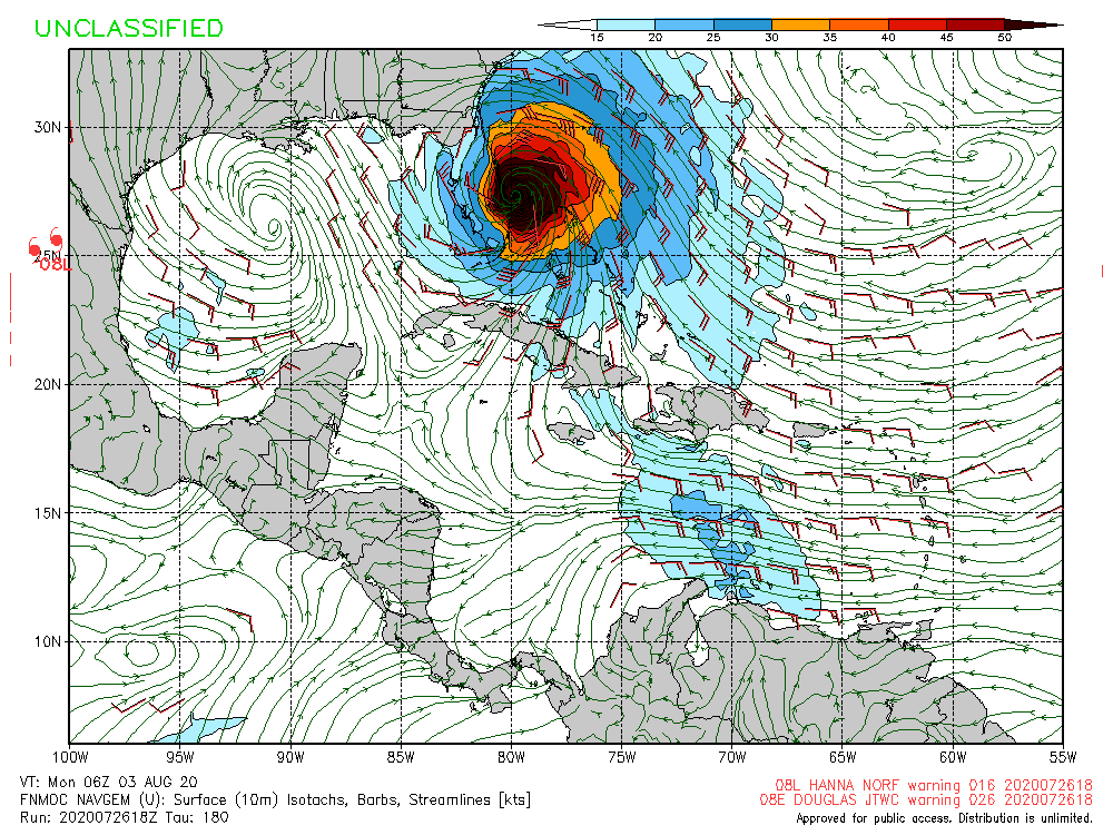
WeatherEmperor wrote:FWIW, here is the 18z Navgem. Looks to be headinh WNW in the last frames of the run
https://uploads.tapatalk-cdn.com/20200727/008c7e67328cf8708eb37329483d9635.jpg
Sent from my iPhone using Tapatalk


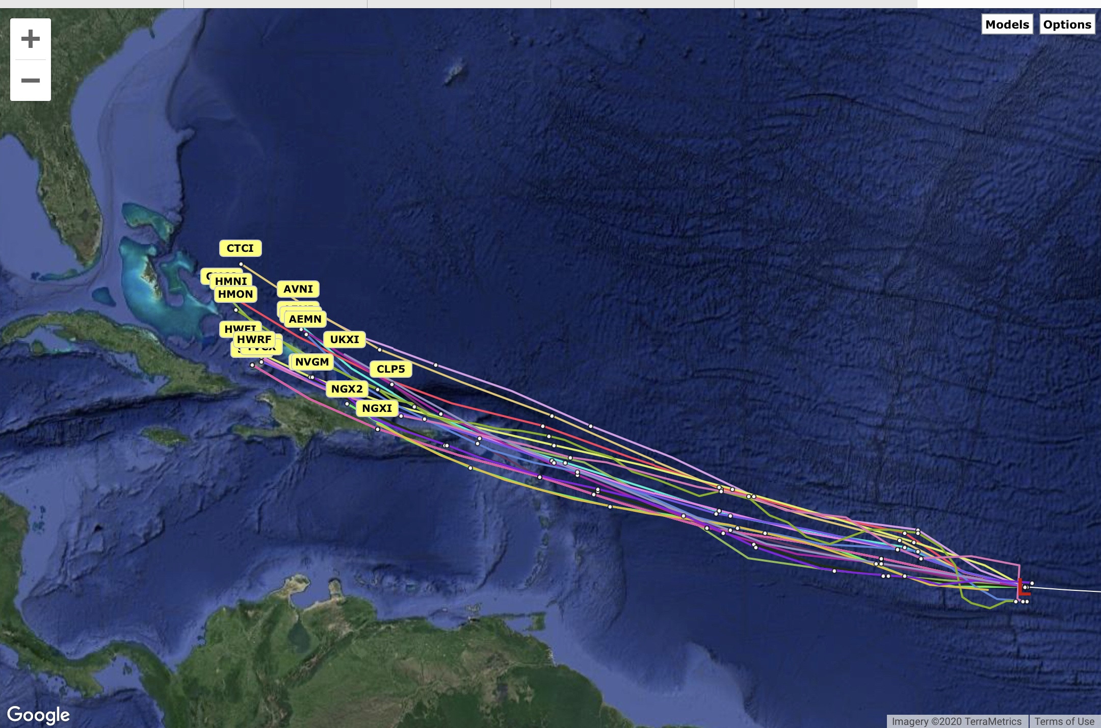
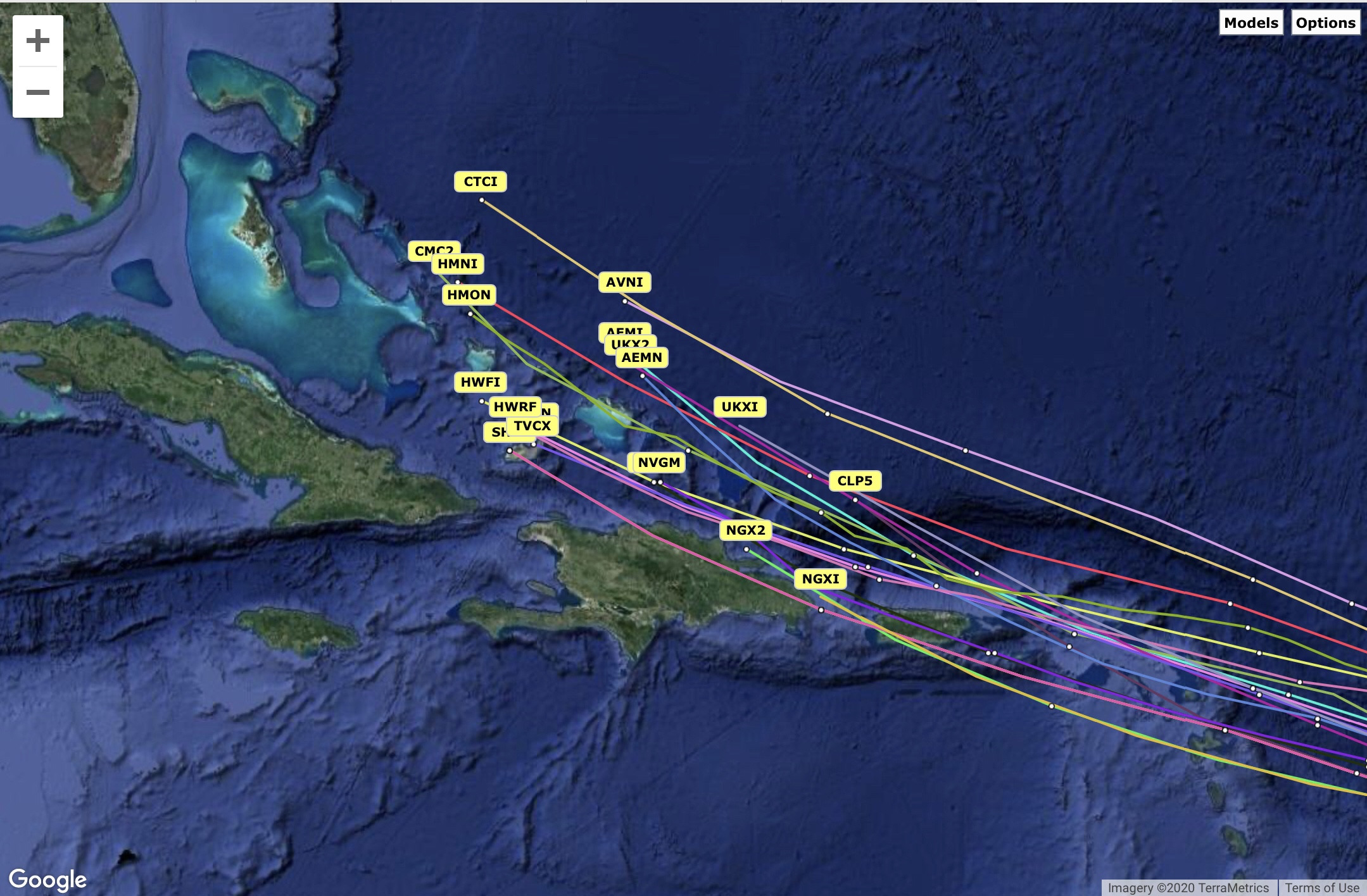
Kazmit wrote:Guidance has shifting north since this morning with all now clearing the Caribbean islands.
https://i.imgur.com/Q05yP0n.png

TheProfessor wrote:WeatherEmperor wrote:FWIW, here is the 18z Navgem. Looks to be headinh WNW in the last frames of the run
https://uploads.tapatalk-cdn.com/20200727/008c7e67328cf8708eb37329483d9635.jpg
Sent from my iPhone using Tapatalk
There's a general rule, when you're east of the NAVGEM you might be doing something wrong. Obviously that's not quite a rule you can use on every basis, but the NAVGEM is one of the most progressive models and is nearly always on the east side of guidance. It will be interesting to see if it begins to show re-curve as well over the next couple of days.

ConvergenceZone wrote:I think Euro is being stupid making it that weak. I could be wrong, but that's just my opinion...
ConvergenceZone wrote:I think Euro is being stupid making it that weak. I could be wrong, but that's just my opinion...
Kazmit wrote:Guidance has shifting north since this morning with all now clearing the Caribbean islands.
https://i.imgur.com/Q05yP0n.png


TheProfessor wrote:WeatherEmperor wrote:FWIW, here is the 18z Navgem. Looks to be headinh WNW in the last frames of the run
https://uploads.tapatalk-cdn.com/20200727/008c7e67328cf8708eb37329483d9635.jpg
Sent from my iPhone using Tapatalk
There's a general rule, when you're east of the NAVGEM you might be doing something wrong. Obviously that's not quite a rule you can use on every basis, but the NAVGEM is one of the most progressive models and is nearly always on the east side of guidance. It will be interesting to see if it begins to show re-curve as well over the next couple of days.
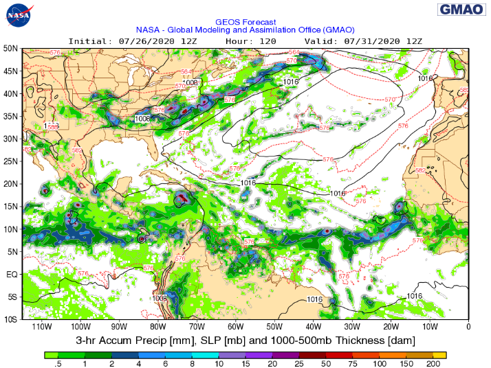
blp wrote:Flashback:
Future Dorian Invesr 99l Euro Ensembles showing most of them dissipating in the Carribean
https://i.ibb.co/7gfVXXf/Ad-ZAl-Gg-d.webp
92L today:
https://i.ibb.co/7VPYkJs/us-cyclone-en-087-0-euro-2020072612-15844-481-240.png
blp wrote:Flashback:
Future Dorian Invesr 99l Euro Ensembles showing most of them dissipating in the Carribean
https://i.ibb.co/7gfVXXf/Ad-ZAl-Gg-d.webp
92L today:
https://i.ibb.co/7VPYkJs/us-cyclone-en-087-0-euro-2020072612-15844-481-240.png
DestinHurricane wrote:TheProfessor wrote:WeatherEmperor wrote:FWIW, here is the 18z Navgem. Looks to be headinh WNW in the last frames of the run
https://uploads.tapatalk-cdn.com/20200727/008c7e67328cf8708eb37329483d9635.jpg
Sent from my iPhone using Tapatalk
There's a general rule, when you're east of the NAVGEM you might be doing something wrong. Obviously that's not quite a rule you can use on every basis, but the NAVGEM is one of the most progressive models and is nearly always on the east side of guidance. It will be interesting to see if it begins to show re-curve as well over the next couple of days.
Interesting. I always heard on this site that the NAVGEM has a left bias. I remember it kept putting Irma in the panhandle when all the other models correctly showed it going up the spine of FL.


Users browsing this forum: No registered users and 12 guests


