ATL: ISAIAS - Post-Tropical - Discussion

Moderator: S2k Moderators

Message
Author
User avatar
SFLcane
S2K Supporter
S2K Supporter
Posts: 10163
Age: 47
Joined: Sat Jun 05, 2010 1:44 pm
Location: Lake Worth Florida

Re: ATL: INVEST 92L - Discussion

#301 Postby SFLcane » Mon Jul 27, 2020 9:06 am

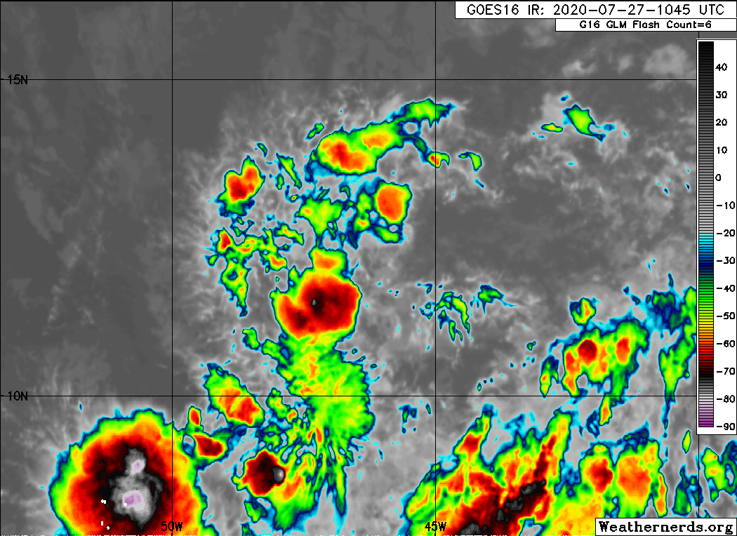
wxman57 wrote:It is failing to consolidate. Ingesting a lot of dry Saharan air. Moving too quickly. Less model support for development and strengthening today. NHC will begin gradually lowering development chances, which I agree with. Perhaps I will be able to take some of the 5 comp days I've accrued over the past 2 weeks.


And there she goes... That dust has been a killer which it usually is this time of the year. Let’s see if it can pop some convection today. Area around the LLC is fairly moist.
Last edited by SFLcane on Mon Jul 27, 2020 9:08 am, edited 1 time in total.
0 likes   

Aric Dunn
Category 5
Category 5
Posts: 21238
Age: 42
Joined: Sun Sep 19, 2004 9:58 pm
Location: Ready for the Chase.
Contact:

Re: ATL: INVEST 92L - Discussion

#302 Postby Aric Dunn » Mon Jul 27, 2020 9:06 am

Looks like everything is consolidating around that LLC.

it has started tapping into that huge moisture plume from the South.

seeing increasing curved low level cloud lines feeding into that area.

looks like only a matter of time now.
8 likes   
Note: If I make a post that is brief. Please refer back to previous posts for the analysis or reasoning. I do not re-write/qoute what my initial post said each time.
If there is nothing before... then just ask :)

Space & Atmospheric Physicist, Embry-Riddle Aeronautical University,
I believe the sky is falling...

User avatar
SFLcane
S2K Supporter
S2K Supporter
Posts: 10163
Age: 47
Joined: Sat Jun 05, 2010 1:44 pm
Location: Lake Worth Florida

Re: ATL: INVEST 92L - Discussion

#303 Postby SFLcane » Mon Jul 27, 2020 9:13 am

Aric Dunn wrote:Looks like everything is consolidating around that LLC.

it has started tapping into that huge moisture plume from the South.

seeing increasing curved low level cloud lines feeding into that area.

looks like only a matter of time now.


Aric you might be on to something here..

Image
2 likes   

MJGarrison
Tropical Storm
Tropical Storm
Posts: 146
Joined: Wed Aug 30, 2017 7:26 pm

Re: ATL: INVEST 92L - Discussion

#304 Postby MJGarrison » Mon Jul 27, 2020 9:15 am

I was able to see on the water vapor loop where dry air was causing an issue.
But could someone point out the coordinates of the possible consolidation? I’m having trouble seeing that.


Sent from my iPad using Tapatalk
0 likes   

Aric Dunn
Category 5
Category 5
Posts: 21238
Age: 42
Joined: Sun Sep 19, 2004 9:58 pm
Location: Ready for the Chase.
Contact:

Re: ATL: INVEST 92L - Discussion

#305 Postby Aric Dunn » Mon Jul 27, 2020 9:17 am

SFLcane wrote:
Aric Dunn wrote:Looks like everything is consolidating around that LLC.

it has started tapping into that huge moisture plume from the South.

seeing increasing curved low level cloud lines feeding into that area.

looks like only a matter of time now.


Aric you might be on to something here..

https://iili.io/duauQS.gif


https://re.ssec.wisc.edu/s/c1uCUG


Image
Last edited by Aric Dunn on Mon Jul 27, 2020 9:19 am, edited 1 time in total.
6 likes   
Note: If I make a post that is brief. Please refer back to previous posts for the analysis or reasoning. I do not re-write/qoute what my initial post said each time.
If there is nothing before... then just ask :)

Space & Atmospheric Physicist, Embry-Riddle Aeronautical University,
I believe the sky is falling...

Shell Mound
Category 5
Category 5
Posts: 2434
Age: 32
Joined: Thu Sep 07, 2017 3:39 pm
Location: St. Petersburg, FL → Scandinavia

Re: ATL: INVEST 92L - Discussion

#306 Postby Shell Mound » Mon Jul 27, 2020 9:17 am

HurricaneEnzo wrote:
Shell Mound wrote:Let’s assume, hypothetically, that 92L somehow ends up doing nothing. If that were the case, then why would the global models overestimate 92L but underestimate the precursor to Hanna, which was similarly expansive? Why, for instance, would the GFS consistently underestimate Hanna but overestimate 92L, given that PWATs were generally higher in association with Hanna’s vs. 92L’s environment? So far I can’t find a logical explanation for this discrepancy. Given that Hanna presumably was in a more conducive environment than 92L has been, why would the global models underestimate Hanna but overestimate 92L? Something doesn’t add up.


My theory is the models are missing a huge portion of data because of significantly reduced flights because of the pandemic and it is causing them some big issues. Sure they have hit on some stuff but also been wildly inconsistent lately.

On the other hand:

 https://twitter.com/AndyHazelton/status/1287714862949425152


 https://twitter.com/cyclonicwx/status/1287743979510009856


 https://twitter.com/MJVentrice/status/1287720862788071424


 https://twitter.com/MJVentrice/status/1287721618916225030


0 likes   
CVW / MiamiensisWx / Shell Mound
The posts in this forum are NOT official forecasts and should not be used as such. They are just the opinion of the poster and may or may not be backed by sound meteorological data. They are NOT endorsed by any professional institution or STORM2K. For official information, please refer to products from the NHC and NWS.

User avatar
HurricaneEnzo
Category 2
Category 2
Posts: 739
Joined: Wed Mar 14, 2018 12:18 pm
Location: Newport, NC (Hurricane Alley)

Re: ATL: INVEST 92L - Discussion

#307 Postby HurricaneEnzo » Mon Jul 27, 2020 9:20 am

Shell Mound wrote:
HurricaneEnzo wrote:
Shell Mound wrote:Let’s assume, hypothetically, that 92L somehow ends up doing nothing. If that were the case, then why would the global models overestimate 92L but underestimate the precursor to Hanna, which was similarly expansive? Why, for instance, would the GFS consistently underestimate Hanna but overestimate 92L, given that PWATs were generally higher in association with Hanna’s vs. 92L’s environment? So far I can’t find a logical explanation for this discrepancy. Given that Hanna presumably was in a more conducive environment than 92L has been, why would the global models underestimate Hanna but overestimate 92L? Something doesn’t add up.


My theory is the models are missing a huge portion of data because of significantly reduced flights because of the pandemic and it is causing them some big issues. Sure they have hit on some stuff but also been wildly inconsistent lately.

On the other hand:

https://twitter.com/AndyHazelton/status/1287714862949425152
https://twitter.com/cyclonicwx/status/1287743979510009856
https://twitter.com/MJVentrice/status/1287720862788071424
https://twitter.com/MJVentrice/status/1287721618916225030


Sure but it is going to wrap around.... Might be moist now, wouldn't count on that much longer given the huge amount of SAL it sucked in.
0 likes   
Bertha 96' - Fran 96' - Bonnie 98' - Dennis 99' - Floyd 99' - Isabel 03' - Alex 04' - Ophelia 05' - Irene 11' - Arthur 14' - Matthew 16' - Florence 18' - Dorian 19' - Isaias 20' (countless other tropical storms and Hurricane swipes)

I am not a Professional Met just an enthusiast. Get your weather forecasts from the Pros!

User avatar
StruThiO
Category 3
Category 3
Posts: 821
Age: 25
Joined: Fri Sep 15, 2017 5:51 am
Location: Currently Portland, OR. Raised in Jax, FL.

Re: ATL: INVEST 92L - Discussion

#308 Postby StruThiO » Mon Jul 27, 2020 9:23 am

I know it's been pointed out repeatedly already, but I cannot get over the areal extent of this thing. Tropical waves the size of Texas in July, folks.

Image
11 likes   

User avatar
chaser1
S2K Supporter
S2K Supporter
Posts: 5464
Age: 64
Joined: Sat Oct 15, 2005 5:59 pm
Location: Longwood, Fl

Re: ATL: INVEST 92L - Discussion

#309 Postby chaser1 » Mon Jul 27, 2020 9:28 am

I think we are reaching a point with this particular disturbance that I was most concerned about prior to the start of the season. Particularly strong easterly trades resulting in potent tropical disturbances to remain low latitude until reaching a point further west in the basin. Then, given more conducive conditions development begins to occur resulting in a greater number of storms to develop or track into the Caribbean thus posing an increased landfall threat to the Greater Antilles, Yucatan, and CONUS. 92L has plenty of time to develop and still pose a primary threat to the Leewards and Puerto Rico but I'm worried that the greater threat may be to Cuba and GOM.
7 likes   
Andy D

(For official information, please refer to the NHC and NWS products.)

User avatar
HurricaneEnzo
Category 2
Category 2
Posts: 739
Joined: Wed Mar 14, 2018 12:18 pm
Location: Newport, NC (Hurricane Alley)

Re: ATL: INVEST 92L - Discussion

#310 Postby HurricaneEnzo » Mon Jul 27, 2020 9:31 am

chaser1 wrote:I think we are reaching a point with this particular disturbance that I was most concerned about prior to the start of the season. Particularly strong easterly trades resulting in potent tropical disturbances to remain low latitude until reaching a point further west in the basin. Then, given more conducive conditions development begins to occur resulting in a greater number of storms to develop or track into the Caribbean thus posing an increased landfall threat to the Greater Antilles, Yucatan, and CONUS. 92L has plenty of time to develop and still pose a primary threat to the Leewards and Puerto Rico but I'm worried that the greater threat may be to Cuba and GOM.


Maybe we will have to see. It it gets to the E Carib and is still this disorganized I think it gets shredded or suffers a fate similar to Gonzalo.
0 likes   
Bertha 96' - Fran 96' - Bonnie 98' - Dennis 99' - Floyd 99' - Isabel 03' - Alex 04' - Ophelia 05' - Irene 11' - Arthur 14' - Matthew 16' - Florence 18' - Dorian 19' - Isaias 20' (countless other tropical storms and Hurricane swipes)

I am not a Professional Met just an enthusiast. Get your weather forecasts from the Pros!

User avatar
toad strangler
S2K Supporter
S2K Supporter
Posts: 4543
Joined: Sun Jul 28, 2013 3:09 pm
Location: Earth
Contact:

Re: ATL: INVEST 92L - Discussion

#311 Postby toad strangler » Mon Jul 27, 2020 9:33 am

HurricaneEnzo wrote:
chaser1 wrote:I think we are reaching a point with this particular disturbance that I was most concerned about prior to the start of the season. Particularly strong easterly trades resulting in potent tropical disturbances to remain low latitude until reaching a point further west in the basin. Then, given more conducive conditions development begins to occur resulting in a greater number of storms to develop or track into the Caribbean thus posing an increased landfall threat to the Greater Antilles, Yucatan, and CONUS. 92L has plenty of time to develop and still pose a primary threat to the Leewards and Puerto Rico but I'm worried that the greater threat may be to Cuba and GOM.


Maybe we will have to see. It it gets to the E Carib and is still this disorganized I think it gets shredded or suffers a fate similar to Gonzalo.


Disorganized waves are already shredded. They may float right on by.
3 likes   

curtadams
S2K Supporter
S2K Supporter
Posts: 1122
Joined: Sun Aug 28, 2005 7:57 pm
Location: Orange, California
Contact:

Re: ATL: INVEST 92L - Discussion

#312 Postby curtadams » Mon Jul 27, 2020 9:40 am

These huge systems always look really impressive, but they tend to take a long time to get going and often never do. Sometimes even when they look like tropical cyclones they have a hard time forming. I remember when Dolly 2008 looked like a cyclone all the way across the Atlantic, with strong model support, but couldn't actually close off a circulation until it reached the Bay of Campeche. That was also in July, BTW. We all jumped when the NHC raised the chances so quickly but I think they just fell into that same trap.
5 likes   

User avatar
ouragans
Category 1
Category 1
Posts: 490
Age: 53
Joined: Sun Jun 12, 2011 12:09 pm
Location: Abymes, Guadeloupe F.W.I
Contact:

Re: ATL: INVEST 92L - Discussion

#313 Postby ouragans » Mon Jul 27, 2020 9:44 am

Aric Dunn wrote:Looks like everything is consolidating around that LLC.

it has started tapping into that huge moisture plume from the South.

seeing increasing curved low level cloud lines feeding into that area.

looks like only a matter of time now.


I would say tomorrow with it gets to 50W with SSTs around 28c
1 likes   
Personal forecast disclaimer
This post is a personal point of view, not an information. Please refer to official statements for life-threatening decisions.

David '79, Frederic '79, Hugo '89, Iris, Luis & Marilyn '95, Georges '98, Lenny '99, Dean '07, Irma '17, Maria '17, Fiona '22, Philippe '23, Tammy '23
16°13'33.3,"6N -61°36'39.5"W

User avatar
HurricaneEnzo
Category 2
Category 2
Posts: 739
Joined: Wed Mar 14, 2018 12:18 pm
Location: Newport, NC (Hurricane Alley)

Re: ATL: INVEST 92L - Discussion

#314 Postby HurricaneEnzo » Mon Jul 27, 2020 9:45 am

Shell Mound wrote:
HurricaneEnzo wrote:
Shell Mound wrote:Let’s assume, hypothetically, that 92L somehow ends up doing nothing. If that were the case, then why would the global models overestimate 92L but underestimate the precursor to Hanna, which was similarly expansive? Why, for instance, would the GFS consistently underestimate Hanna but overestimate 92L, given that PWATs were generally higher in association with Hanna’s vs. 92L’s environment? So far I can’t find a logical explanation for this discrepancy. Given that Hanna presumably was in a more conducive environment than 92L has been, why would the global models underestimate Hanna but overestimate 92L? Something doesn’t add up.


My theory is the models are missing a huge portion of data because of significantly reduced flights because of the pandemic and it is causing them some big issues. Sure they have hit on some stuff but also been wildly inconsistent lately.

On the other hand:

https://twitter.com/AndyHazelton/status/1287714862949425152
https://twitter.com/cyclonicwx/status/1287743979510009856
https://twitter.com/MJVentrice/status/1287720862788071424
https://twitter.com/MJVentrice/status/1287721618916225030


Also, could just be a case of 'the models aren't always right'. Particuarly when it comes to formation and strength. Sure they are a good guide but often miss the mark. Florence was supposed to hit NC as a Cat 4. Michael wasn't supposed to hit Florida as a Cat 5. Harvey wasn't supposed to explode into a Cat 4. Joaquin was supposed to stay weak. The list goes on and on.
Last edited by HurricaneEnzo on Mon Jul 27, 2020 9:47 am, edited 1 time in total.
3 likes   
Bertha 96' - Fran 96' - Bonnie 98' - Dennis 99' - Floyd 99' - Isabel 03' - Alex 04' - Ophelia 05' - Irene 11' - Arthur 14' - Matthew 16' - Florence 18' - Dorian 19' - Isaias 20' (countless other tropical storms and Hurricane swipes)

I am not a Professional Met just an enthusiast. Get your weather forecasts from the Pros!

User avatar
StruThiO
Category 3
Category 3
Posts: 821
Age: 25
Joined: Fri Sep 15, 2017 5:51 am
Location: Currently Portland, OR. Raised in Jax, FL.

Re: ATL: INVEST 92L - Discussion

#315 Postby StruThiO » Mon Jul 27, 2020 9:46 am

4 likes   

supercane4867
Category 5
Category 5
Posts: 4966
Joined: Wed Nov 14, 2012 10:43 am

Re: ATL: INVEST 92L - Discussion

#316 Postby supercane4867 » Mon Jul 27, 2020 9:49 am

It's organized enough to be classified as a TD. Systems like this are fairly common in the WPAC.
2 likes   

psyclone
S2K Supporter
S2K Supporter
Posts: 4762
Joined: Wed Aug 24, 2005 9:04 pm
Location: palm harbor fl

Re: ATL: INVEST 92L - Discussion

#317 Postby psyclone » Mon Jul 27, 2020 9:50 am

Another system that did this was the precursor to Hermine in 2016. It was a broad, largely convection free swirl all the way to the Gulf. But spinning is winning in this game. I certainly wouldn't write the potential off. It is fair to say development chances have decreased...but from a high baseline. Out of respect for SAL, the calendar, and the present disarray...reduced development odds are highly likely. But out of respect for the season to date, keep checking back.
2 likes   

User avatar
HurricaneEnzo
Category 2
Category 2
Posts: 739
Joined: Wed Mar 14, 2018 12:18 pm
Location: Newport, NC (Hurricane Alley)

Re: ATL: INVEST 92L - Discussion

#318 Postby HurricaneEnzo » Mon Jul 27, 2020 9:51 am

supercane4867 wrote:It's organized enough to be classified as a TD. Systems like this are fairly common in the WPAC.


With all due respect they are pretty lenient with the TD classification over there. The NHC wants to see something significantly better organized than this.
2 likes   
Bertha 96' - Fran 96' - Bonnie 98' - Dennis 99' - Floyd 99' - Isabel 03' - Alex 04' - Ophelia 05' - Irene 11' - Arthur 14' - Matthew 16' - Florence 18' - Dorian 19' - Isaias 20' (countless other tropical storms and Hurricane swipes)

I am not a Professional Met just an enthusiast. Get your weather forecasts from the Pros!

User avatar
aspen
Category 5
Category 5
Posts: 8818
Joined: Sat Oct 12, 2019 7:10 pm
Location: Connecticut, USA

Re: ATL: INVEST 92L - Discussion

#319 Postby aspen » Mon Jul 27, 2020 9:55 am

Could the large size of 92L and the nearby dry air potentially cause it to fragment into two or more areas of vorticity, with one taking over to eventually become a TC?
2 likes   
Irene '11 Sandy '12 Hermine '16 5/15/2018 Derecho Fay '20 Isaias '20 Elsa '21 Henri '21 Ida '21

I am only a meteorology enthusiast who knows a decent amount about tropical cyclones. Look to the professional mets, the NHC, or your local weather office for the best information.

User avatar
SFLcane
S2K Supporter
S2K Supporter
Posts: 10163
Age: 47
Joined: Sat Jun 05, 2010 1:44 pm
Location: Lake Worth Florida

Re: ATL: INVEST 92L - Discussion

#320 Postby SFLcane » Mon Jul 27, 2020 9:57 am

Only a matter of time per Levi. Very impressive circulation with this wave indeed.
4 likes   


Return to “2020”

Who is online

Users browsing this forum: No registered users and 4 guests