#548 Postby ScottNAtlanta » Mon Jul 27, 2020 10:58 am
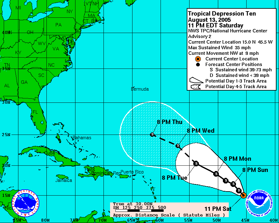
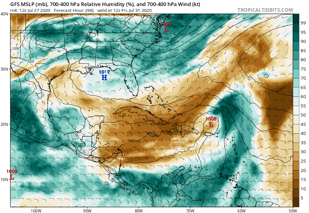
Ok, I'm going to reference 2005, but the pattern is a bit similar so, here it goes.
In 2005 we had systems like this that struggled the entire way across moving very quickly like this is doing. They never looked like anything would become of them. The models were not initially anything but mildly interested, but once they got to a certain point where the trade wins relaxed near or north of the Islands where you get natural convergence due to the winds slowing down...boom! You're going to have a troff split with one part backing SW and the other part going out with heights building behind. I would not be surprised to see this come up north of the islands and through the Florida Straits.
Look at what you see...
before at what will be.
Last edited by
ScottNAtlanta on Mon Jul 27, 2020 11:02 am, edited 1 time in total.
1 likes
The posts in this forum are NOT official forecast and should not be used as such. They are just the opinion of the poster and may or may not be backed by sound meteorological data. They are NOT endorsed by any professional institution or storm2k.org. For official information, please refer to the NHC and NWS products.


