ATL: ISAIAS - Models

Moderator: S2k Moderators

Message
Author
User avatar
STRiZZY
Category 1
Category 1
Posts: 276
Joined: Fri Aug 05, 2016 6:01 pm
Location: Largo, FL

Re: ATL: INVEST 92L - Models

#801 Postby STRiZZY » Tue Jul 28, 2020 2:15 am

CM2 wrote:
STRiZZY wrote:The Euro went completely wacko? It was maybe 50mi north of 12z. That's not far off of it's previous few runs tbh.
It's just those 50 some odd miles put in it a more favorable position in regards to the Greater Antilles and gave it a little room to breathe.

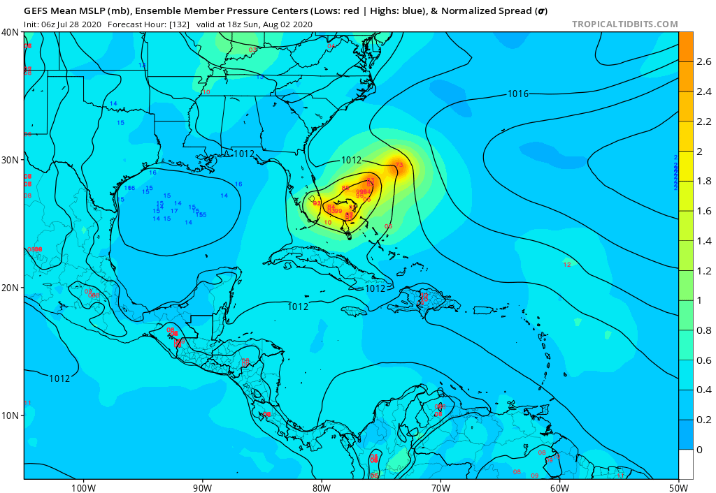
Well granted there is a 400 mile difference when it's sitting off Tampa Bay vs Cancun in the 12z. The behavior is quite different between the 2 runs, the euro also bumped it's intensity quite a bit compared to previous runs even in the short term. The entire agenda the models gave to us about the storm has now been flipped on it's head.


You'll have that when one run is 50 mi's south and traverses 1,100mi + of land and dies and the other traverses just north of that and stays alive.
0 likes   

User avatar
STRiZZY
Category 1
Category 1
Posts: 276
Joined: Fri Aug 05, 2016 6:01 pm
Location: Largo, FL

Re: ATL: INVEST 92L - Models

#802 Postby STRiZZY » Tue Jul 28, 2020 2:46 am

0z Drenched the Tampa Bay area with anywhere from 3in up to 1ft of rain ( highest where Pinellas/Hillsborough/Pasco meet).
0 likes   

lando
Tropical Storm
Tropical Storm
Posts: 196
Joined: Wed Aug 31, 2016 11:44 am
Location: Tampa

Re: ATL: INVEST 92L - Models

#803 Postby lando » Tue Jul 28, 2020 3:22 am

STRiZZY wrote:0z Drenched the Tampa Bay area with anywhere from 3in up to 1ft of rain ( highest where Pinellas/Hillsborough/Pasco meet).


Although the likely hood of this is so small given how far out and just one run, this would be catastrophic for the South Tampa area, which is extremely low lying and prone to flooding from just normal afternoon thunderstorms
1 likes   

FixySLN
Tropical Storm
Tropical Storm
Posts: 136
Joined: Wed Oct 05, 2016 3:22 pm
Location: Ocean Springs, MS

Re: ATL: INVEST 92L - Models

#804 Postby FixySLN » Tue Jul 28, 2020 3:23 am

Back to 90%

[imgur]https://i.imgur.com/vEEIM3t.png[/imgur]
0 likes   

USTropics
Professional-Met
Professional-Met
Posts: 2651
Joined: Sun Aug 12, 2007 3:45 am
Location: Florida State University

Re: ATL: INVEST 92L - Models

#805 Postby USTropics » Tue Jul 28, 2020 3:41 am

You'll see a trend started in yesterday's runs that are favoring the SW lobe a bit more:

GFS
Image

ECMWF
Image
4 likes   

User avatar
STRiZZY
Category 1
Category 1
Posts: 276
Joined: Fri Aug 05, 2016 6:01 pm
Location: Largo, FL

Re: ATL: INVEST 92L - Models

#806 Postby STRiZZY » Tue Jul 28, 2020 3:43 am

lando wrote:
STRiZZY wrote:0z Drenched the Tampa Bay area with anywhere from 3in up to 1ft of rain ( highest where Pinellas/Hillsborough/Pasco meet).


Although the likely hood of this is so small given how far out and just one run, this would be catastrophic for the South Tampa area, which is extremely low lying and prone to flooding from just normal afternoon thunderstorms


Not to mention Pasco is super susceptible to river flooding.
0 likes   

User avatar
SouthFLTropics
Category 5
Category 5
Posts: 4236
Age: 50
Joined: Thu Aug 14, 2003 8:04 am
Location: Port St. Lucie, Florida

Re: ATL: INVEST 92L - Models

#807 Postby SouthFLTropics » Tue Jul 28, 2020 3:58 am

Well I wake up this morning to some
very interesting overnight model runs. I’m very much looking forward to these upcoming 06z runs to see if the strengthening and track trend from 00z continues. If the SW lobe of 92L forms, and IF it doesn’t get too tangled up in the big islands, it could pose a big problem this coming weekend. Regardless of development, PR, the LA and GA need to be ready for some substantial weather coming their way over the next few days.


Sent from my iPhone using Tapatalk
3 likes   
Fourth Generation Florida Native

Personal Storm History: David 79, Andrew 92, Erin 95, Floyd 99, Irene 99, Frances 04, Jeanne 04, Wilma 05, Matthew 16, Irma 17, Ian 22, Nicole 22, Milton 24

User avatar
STRiZZY
Category 1
Category 1
Posts: 276
Joined: Fri Aug 05, 2016 6:01 pm
Location: Largo, FL

Re: ATL: INVEST 92L - Models

#808 Postby STRiZZY » Tue Jul 28, 2020 4:50 am

92l roughly in the same spot/strength on the GFS 6z as the 0z through 72hrs.

6z
Image

0z
Image
1 likes   

User avatar
SouthFLTropics
Category 5
Category 5
Posts: 4236
Age: 50
Joined: Thu Aug 14, 2003 8:04 am
Location: Port St. Lucie, Florida

Re: ATL: INVEST 92L - Models

#809 Postby SouthFLTropics » Tue Jul 28, 2020 5:11 am

The 06z GFS brings the track further west once again, almost to the Florida coastline. While it continues to show a significant weakening trend in the Bahamas, I would take the intensity forecasts with a boulder sized grain of salt at this time.
0 likes   
Fourth Generation Florida Native

Personal Storm History: David 79, Andrew 92, Erin 95, Floyd 99, Irene 99, Frances 04, Jeanne 04, Wilma 05, Matthew 16, Irma 17, Ian 22, Nicole 22, Milton 24

User avatar
STRiZZY
Category 1
Category 1
Posts: 276
Joined: Fri Aug 05, 2016 6:01 pm
Location: Largo, FL

Re: ATL: INVEST 92L - Models

#810 Postby STRiZZY » Tue Jul 28, 2020 5:14 am

GFS 156hr weak mess into Palm Beach/Martin county

Image
0 likes   

jlauderdal
S2K Supporter
S2K Supporter
Posts: 7183
Joined: Wed May 19, 2004 5:46 am
Location: NE Fort Lauderdale
Contact:

Re: ATL: INVEST 92L - Models

#811 Postby jlauderdal » Tue Jul 28, 2020 5:40 am

SouthFLTropics wrote:The 06z GFS brings the track further west once again, almost to the Florida coastline. While it continues to show a significant weakening trend in the Bahamas, I would take the intensity forecasts with a boulder sized grain of salt at this time.
weakinging in the virgin waters of the Bahamas seems odd, gfs once again underestimating ridges? A southerly route through the straits seems as likely as anything else...euro has liked the southerly idea all along
0 likes   

User avatar
northjaxpro
S2K Supporter
S2K Supporter
Posts: 8900
Joined: Mon Sep 27, 2010 11:21 am
Location: Jacksonville, FL

Re: ATL: INVEST 92L - Models

#812 Postby northjaxpro » Tue Jul 28, 2020 5:52 am

SouthFLTropics wrote:The 06z GFS brings the track further west once again, almost to the Florida coastline. While it continues to show a significant weakening trend in the Bahamas, I would take the intensity forecasts with a boulder sized grain of salt at this time.


I agree SFTropics. Yeah the sea surface temps are boling all over the Greater Antilles area, and around the Bahamas and off the Florida East and Gulf Coasts. Also, I am afraid that that some of the models, like the 06Z GFS this morning, just may be underdoing the intensity of this system this weekend . The main takeaway I am seeing is that the GFS is caving to the EURO, showing more ridging and moving this system through the Bahanas and approaching the Florida East Coast this weekend.
1 likes   
NEVER, EVER SAY NEVER in the tropics and weather in general, and most importantly, with life itself!!

________________________________________________________________________________________

Fay 2008 Beryl 2012 Debby 2012 Colin 2016 Hermine 2016 Julia 2016 Matthew 2016 Irma 2017 Dorian 2019

USTropics
Professional-Met
Professional-Met
Posts: 2651
Joined: Sun Aug 12, 2007 3:45 am
Location: Florida State University

Re: ATL: INVEST 92L - Models

#813 Postby USTropics » Tue Jul 28, 2020 6:01 am

USTropics wrote:Something I've noticed over the past 2 days of runs, the low-level axis has been tilted NE to SW currently, and we're left with two areas where air flow becomes divergent (or a NE lobe and a SW lobe attached to the wave axis).

https://i.imgur.com/iZqTmcc.png

https://i.imgur.com/9NZ8jHc.png

In the short term, we'll have to see if the SW lobe of the wave becomes the dominant feature. You can see currently there's a bit of a boxing match going on at the low levels between these two lobes:

https://i.imgur.com/J5EQHez.gif

As the axis approaches the Caribbean, if one of the lobes does not become the dominant feature, you'll notice the axis (blue) becomes more N to S oriented (natural process as these tropical waves enter the Caribbean due to low-level flow). Low-level easterly flow is cutting straight through the eastern Caribbean (red) which reduces the chance of the southern lobe developing. This easterly flow is also on the northern axis of the wave, but due to the proximity to the upper-level trough, the wind direction change from lower to upper levels is favoring development on the northern side of the axis now.
https://i.imgur.com/SxeBCQ2.png


Once we establish genesis, intensity becomes important. Levi does a great job of explaining this on his video (https://www.tropicaltidbits.com/), but essentially you can see the trough axis (yellow gradient) directly to the NW:
https://i.imgur.com/xx9EDc6.png

Through diabatic outflow, a tropical system can actually impinge on this trough axis, and essentially move it out of the way (or in some cases, even create ideal upper-level outflow, as we saw with Dorian last year). Previous runs that showed a more developed system were essentially strengthening here due to the storm having a protective bubble and impressive outflow. If you remove those conditions, a weaker tropical system will be sheared by the trough axis (as some model solutions now show).


The 00z GFS-para forecast shows what a well-organized system with enhanced diabatic outflow can do:
Image
3 likes   

User avatar
Nimbus
Category 5
Category 5
Posts: 5301
Joined: Mon Jul 19, 2004 10:54 am

Re: ATL: INVEST 92L - Models

#814 Postby Nimbus » Tue Jul 28, 2020 6:06 am

jlauderdal wrote:
SouthFLTropics wrote:The 06z GFS brings the track further west once again, almost to the Florida coastline. While it continues to show a significant weakening trend in the Bahamas, I would take the intensity forecasts with a boulder sized grain of salt at this time.
weakinging in the virgin waters of the Bahamas seems odd, gfs once again underestimating ridges? A southerly route through the straits seems as likely as anything else...euro has liked the southerly idea all along


Sunny78 said it won't go over cat 2 due to climo/dry conditions.
If it spins up early it probably won't go south through the straits.

The elongation in the circulation will probably continue for at least a few days.
So of course it still could track through the big islands of the Caribbean in later runs.
See where the models are at the end of the day.
0 likes   

User avatar
SouthFLTropics
Category 5
Category 5
Posts: 4236
Age: 50
Joined: Thu Aug 14, 2003 8:04 am
Location: Port St. Lucie, Florida

Re: ATL: INVEST 92L - Models

#815 Postby SouthFLTropics » Tue Jul 28, 2020 6:24 am

Shouldn’t the 06z HWRF and HMON have come out by now? Are they just randomly running those at certain times?


Sent from my iPhone using Tapatalk
0 likes   
Fourth Generation Florida Native

Personal Storm History: David 79, Andrew 92, Erin 95, Floyd 99, Irene 99, Frances 04, Jeanne 04, Wilma 05, Matthew 16, Irma 17, Ian 22, Nicole 22, Milton 24

OuterBanker
S2K Supporter
S2K Supporter
Posts: 1731
Joined: Wed Feb 26, 2003 10:53 am
Location: Nags Head, NC
Contact:

Re: ATL: INVEST 92L - Models

#816 Postby OuterBanker » Tue Jul 28, 2020 6:37 am

If you want some pure entertainment look at the 0z Navgem.
A monster coast hugger from Florida to Maine.
Pure fantasy, but entertainment for shure.
0 likes   

Aric Dunn
Category 5
Category 5
Posts: 21238
Age: 42
Joined: Sun Sep 19, 2004 9:58 pm
Location: Ready for the Chase.
Contact:

Re: ATL: INVEST 92L - Models

#817 Postby Aric Dunn » Tue Jul 28, 2020 6:38 am

One thing to remember is that all this recurve talk is all dependent of that weak cut off low over the central US/ohio valley.

well that feature does not exist yet..

So we know the drill..
1 likes   
Note: If I make a post that is brief. Please refer back to previous posts for the analysis or reasoning. I do not re-write/qoute what my initial post said each time.
If there is nothing before... then just ask :)

Space & Atmospheric Physicist, Embry-Riddle Aeronautical University,
I believe the sky is falling...

User avatar
gatorcane
S2K Supporter
S2K Supporter
Posts: 23691
Age: 47
Joined: Sun Mar 13, 2005 3:54 pm
Location: Boca Raton, FL

Re: ATL: INVEST 92L - Models

#818 Postby gatorcane » Tue Jul 28, 2020 6:40 am

I am not likIng how this may get into the Bahamas and the more bullish models coming in. By the way, the GFS ensembles that do develop are in good agreement into the Bahamas but look how some are turning it west into South Florida now. Others try to recurve. That is a change from prior runs:

Image
1 likes   

AutoPenalti
Category 5
Category 5
Posts: 4030
Age: 29
Joined: Mon Aug 17, 2015 4:16 pm
Location: Ft. Lauderdale, Florida

Re: ATL: INVEST 92L - Models

#819 Postby AutoPenalti » Tue Jul 28, 2020 6:49 am

gatorcane wrote:I am not likIng how this may get into the Bahamas and the more bullish models coming in. By the way, the GFS ensembles that do develop are in good agreement into the Bahamas but look how some are turning it west into South Florida now. Others try to recurve. That is a change from prior runs:

https://i.postimg.cc/N061Ht4C/gfs-ememb-lowlocs-watl-23.png

West turn at the end of the run implies that the shortwave that’s been trying to develop by the GFS seems to be non existent or too slow by the time it approaches the Bahamas...
0 likes   
The posts in this forum are NOT official forecasts and should not be used as such. They are just the opinion of the poster and may or may not be backed by sound meteorological data. They are NOT endorsed by any professional institution or STORM2K. For official information, please refer to products from the NHC and NWS.


Model Runs Cheat Sheet:
GFS (5:30 AM/PM, 11:30 AM/PM)
HWRF, GFDL, UKMET, NAVGEM (6:30-8:00 AM/PM, 12:30-2:00 AM/PM)
ECMWF (1:45 AM/PM)

TCVN
is a weighted averaged

Shell Mound
Category 5
Category 5
Posts: 2434
Age: 32
Joined: Thu Sep 07, 2017 3:39 pm
Location: St. Petersburg, FL → Scandinavia

Re: ATL: INVEST 92L - Models

#820 Postby Shell Mound » Tue Jul 28, 2020 6:50 am

AutoPenalti wrote:
gatorcane wrote:I am not likIng how this may get into the Bahamas and the more bullish models coming in. By the way, the GFS ensembles that do develop are in good agreement into the Bahamas but look how some are turning it west into South Florida now. Others try to recurve. That is a change from prior runs:

https://i.postimg.cc/N061Ht4C/gfs-ememb-lowlocs-watl-23.png

West turn at the end of the run implies that the shortwave that’s been trying to develop by the GFS seems to be non existent or too slow by the time it approaches the Bahamas...

Note, however, that the most intense (rightward) members show a NW turn near the northern Bahamas, implying a track toward either GA or the Carolinas.

The biggest trend on both the G(E)FS and EC/EPS runs, however, has been favouring a slower, deeper shortwave trough over time, with ridging near FL.
0 likes   
CVW / MiamiensisWx / Shell Mound
The posts in this forum are NOT official forecasts and should not be used as such. They are just the opinion of the poster and may or may not be backed by sound meteorological data. They are NOT endorsed by any professional institution or STORM2K. For official information, please refer to products from the NHC and NWS.


Return to “2020”

Who is online

Users browsing this forum: No registered users and 4 guests