https://twitter.com/webberweather/status/1288093706940276737
ATL: ISAIAS - Post-Tropical - Discussion
Moderator: S2k Moderators
-
cycloneye

- Admin

- Posts: 149291
- Age: 69
- Joined: Thu Oct 10, 2002 10:54 am
- Location: San Juan, Puerto Rico
Re: ATL: INVEST 92L - Discussion
0 likes
Visit the Caribbean-Central America Weather Thread where you can find at first post web cams,radars
and observations from Caribbean basin members Click Here
and observations from Caribbean basin members Click Here
-
cycloneye
- Admin
- Posts: 149291
- Age: 69
- Joined: Thu Oct 10, 2002 10:54 am
- Location: San Juan, Puerto Rico
Re: ATL: INVEST 92L - Discussion
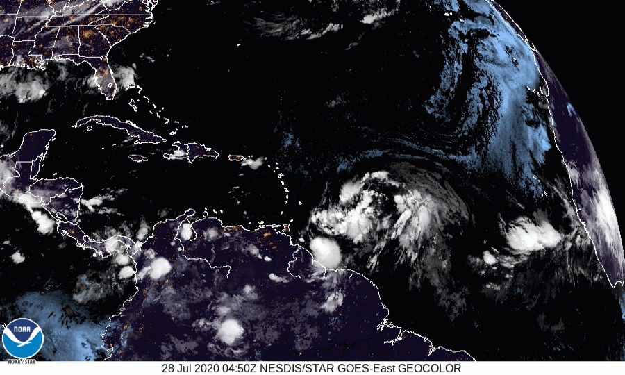
PTC at 11 AM.
92L INVEST 200728 1200 13.5N 52.8W ATL 35 1007
8 likes
Visit the Caribbean-Central America Weather Thread where you can find at first post web cams,radars
and observations from Caribbean basin members Click Here
and observations from Caribbean basin members Click Here


Re: ATL: INVEST 92L - Discussion
cycloneye wrote:PTC at 11 AM.92L INVEST 200728 1200 13.5N 52.8W ATL 35 1007
Does that not simply indicate an invest with TS winds? Don't they renumber for a PTC?
7 likes
-
Evil Jeremy

- S2K Supporter

- Posts: 5463
- Age: 32
- Joined: Mon Apr 10, 2006 2:10 pm
- Location: Los Angeles, CA
Re: ATL: INVEST 92L - Discussion
What time is recon?
0 likes
Frances 04 / Jeanne 04 / Katrina 05 / Wilma 05 / Fay 08 / Debby 12 / Andrea 13 / Colin 16 / Hermine 16 / Matthew 16 / Irma 17

-
tropicwatch

- Category 5

- Posts: 3426
- Age: 62
- Joined: Sat Jun 02, 2007 10:01 am
- Location: Panama City Florida
- Contact:
Re: ATL: INVEST 92L - Discussion
RT23 wrote:Evil Jeremy wrote:What time is recon?
1800z
Takes off at 1500Z.
0 likes
Tropicwatch
Agnes 72', Eloise 75, Elena 85', Kate 85', Charley 86', Florence 88', Beryl 94', Dean 95', Erin 95', Opal 95', Earl 98', Georges 98', Ivan 2004', Arlene 2005', Dennis 2005', Ida 2009' Debby 2012' Irma 2017' Michael 2018'
Agnes 72', Eloise 75, Elena 85', Kate 85', Charley 86', Florence 88', Beryl 94', Dean 95', Erin 95', Opal 95', Earl 98', Georges 98', Ivan 2004', Arlene 2005', Dennis 2005', Ida 2009' Debby 2012' Irma 2017' Michael 2018'
-
Evil Jeremy
- S2K Supporter
- Posts: 5463
- Age: 32
- Joined: Mon Apr 10, 2006 2:10 pm
- Location: Los Angeles, CA
Re: ATL: INVEST 92L - Discussion
panamatropicwatch wrote:RT23 wrote:Evil Jeremy wrote:What time is recon?
1800z
Takes off at 1500Z.
Thank you both. Will be a fun flight to follow.
0 likes
Frances 04 / Jeanne 04 / Katrina 05 / Wilma 05 / Fay 08 / Debby 12 / Andrea 13 / Colin 16 / Hermine 16 / Matthew 16 / Irma 17
-
EquusStorm
- Category 5
- Posts: 1649
- Age: 35
- Joined: Thu Nov 07, 2013 1:04 pm
- Location: Jasper, AL
- Contact:
Re: ATL: INVEST 92L - Discussion
We're focused on tropical cyclogenesis but that track is highly dangerous regardless of development for flooding and mudslides across the Caribbean; it certainly would have been far better to have been stronger earlier and successfully stay well north, this low latitude track is substantially worse... perhaps not so much for the US, but still
3 likes
Colors of lost purpose on the canvas of irrelevance
Not a meteorologist, in fact more of an idiot than anything. You should probably check with the NHC or a local NWS office for official information.
Not a meteorologist, in fact more of an idiot than anything. You should probably check with the NHC or a local NWS office for official information.
-
northjaxpro

- S2K Supporter
- Posts: 8900
- Joined: Mon Sep 27, 2010 11:21 am
- Location: Jacksonville, FL
Re: ATL: INVEST 92L - Discussion
EquusStorm wrote:We're focused on tropical cyclogenesis but that track is highly dangerous regardless of development for flooding and mudslides across the Caribbean; it certainly would have been far better to have been stronger earlier and successfully stay well north, this low latitude track is substantially worse... perhaps not so much for the US, but still
Because of the system's enormous size, virtually everyone in the Greater Antilles is going to get some potential major significant impacts for sure!
3 likes
NEVER, EVER SAY NEVER in the tropics and weather in general, and most importantly, with life itself!!
________________________________________________________________________________________
Fay 2008 Beryl 2012 Debby 2012 Colin 2016 Hermine 2016 Julia 2016 Matthew 2016 Irma 2017 Dorian 2019
________________________________________________________________________________________
Fay 2008 Beryl 2012 Debby 2012 Colin 2016 Hermine 2016 Julia 2016 Matthew 2016 Irma 2017 Dorian 2019
-
HurricaneEnzo

- Category 2

- Posts: 743
- Joined: Wed Mar 14, 2018 12:18 pm
- Location: Newport, NC (Hurricane Alley)
Re: ATL: INVEST 92L - Discussion
Looks like the energy on the eastern side of this monster is where its at. Impressive amount of convection on western side but doesn't appear to be coalescing into anything at the moment. Looks like the eastern side has an llc with some convection. Euro might be on the money showing a very 'Georges-esque' track currently.
0 likes
Bertha 96' - Fran 96' - Bonnie 98' - Dennis 99' - Floyd 99' - Isabel 03' - Alex 04' - Ophelia 05' - Irene 11' - Arthur 14' - Matthew 16' - Florence 18' - Dorian 19' - Isaias 20' (countless other tropical storms and Hurricane swipes)
I am not a Professional Met just an enthusiast. Get your weather forecasts from the Pros!
I am not a Professional Met just an enthusiast. Get your weather forecasts from the Pros!
-
Aric Dunn
- Category 5
- Posts: 21238
- Age: 43
- Joined: Sun Sep 19, 2004 9:58 pm
- Location: Ready for the Chase.
- Contact:
Re: ATL: INVEST 92L - Discussion
HurricaneEnzo wrote:Looks like the energy on the eastern side of this monster is where its at. Impressive amount of convection on western side but doesn't appear to be coalescing into anything at the moment. Looks like the eastern side has an llc with some convection. Euro might be on the money showing a very 'Georges-esque' track currently.
it is not possible to be the eastern lobe.
5 likes
Note: If I make a post that is brief. Please refer back to previous posts for the analysis or reasoning. I do not re-write/qoute what my initial post said each time.
If there is nothing before... then just ask
Space & Atmospheric Physicist, Embry-Riddle Aeronautical University,
I believe the sky is falling...
If there is nothing before... then just ask
Space & Atmospheric Physicist, Embry-Riddle Aeronautical University,
I believe the sky is falling...
-
NotSparta

- Professional-Met

- Posts: 1677
- Age: 24
- Joined: Fri Aug 18, 2017 8:24 am
- Location: Naples, FL
- Contact:
Re: ATL: INVEST 92L - Discussion
Shell Mound wrote:supercane4867 wrote:https://i.imgur.com/pA8R0fR.gif
Didn’t the precursors to Wilma ‘05, Matthew ‘16, and/or Dorian ‘18 also feature sprawling, monsoonal circulations interacting with an AEW?
Also, I’m starting to see signs of a convergent band on the northern side that is “linking up” with the deeper convection nearer the SW lobe.
Except this time the AEW is the sprawling monsoonal circulation
3 likes
This post was probably an opinion of mine, and in no way is official. Please refer to http://www.hurricanes.gov for official tropical analysis and advisories.
My website, with lots of tropical wx graphics, including satellite and recon: http://cyclonicwx.com
My website, with lots of tropical wx graphics, including satellite and recon: http://cyclonicwx.com
Re: ATL: INVEST 92L - Discussion
I swear it looks like the western lobe is moving due west while the CoC between the western and eastern lobes has a northerly component and is gaining latitude. Probably why the models are all over the map. Is this thing supposed to slow down any?
Last edited by Vdogg on Tue Jul 28, 2020 8:44 am, edited 1 time in total.
2 likes

Re: ATL: INVEST 92L - Discussion

SW side clearly dominant
12 likes
Kendall -> SLO -> PBC
Memorable Storms: Katrina (for its Florida landfall...) Wilma Matthew Irma
Memorable Storms: Katrina (for its Florida landfall...) Wilma Matthew Irma
-
gatorcane

- S2K Supporter
- Posts: 23708
- Age: 48
- Joined: Sun Mar 13, 2005 3:54 pm
- Location: Boca Raton, FL
Re: ATL: INVEST 92L - Discussion
Saved loop. Looks to be big and gradually organizing while moving quickly. Still a lot of SAL around it:
Last edited by gatorcane on Tue Jul 28, 2020 8:49 am, edited 2 times in total.
1 likes
-
HurricaneEnzo
- Category 2
- Posts: 743
- Joined: Wed Mar 14, 2018 12:18 pm
- Location: Newport, NC (Hurricane Alley)
Re: ATL: INVEST 92L - Discussion
Aric Dunn wrote:HurricaneEnzo wrote:Looks like the energy on the eastern side of this monster is where its at. Impressive amount of convection on western side but doesn't appear to be coalescing into anything at the moment. Looks like the eastern side has an llc with some convection. Euro might be on the money showing a very 'Georges-esque' track currently.
it is not possible to be the eastern lobe.
Sure it is possible. E Carib is gonna shred the western lobe while the eastern gains lat and takes over.
Not possible is something you don't use with weather....
0 likes
Bertha 96' - Fran 96' - Bonnie 98' - Dennis 99' - Floyd 99' - Isabel 03' - Alex 04' - Ophelia 05' - Irene 11' - Arthur 14' - Matthew 16' - Florence 18' - Dorian 19' - Isaias 20' (countless other tropical storms and Hurricane swipes)
I am not a Professional Met just an enthusiast. Get your weather forecasts from the Pros!
I am not a Professional Met just an enthusiast. Get your weather forecasts from the Pros!
-
ScottNAtlanta

- Category 5
- Posts: 2535
- Joined: Sat May 25, 2013 3:11 pm
- Location: Atlanta, GA
Re: ATL: INVEST 92L - Discussion
Is it possible the two lobes detach? One goes nw the other west?
1 likes
The posts in this forum are NOT official forecast and should not be used as such. They are just the opinion of the poster and may or may not be backed by sound meteorological data. They are NOT endorsed by any professional institution or storm2k.org. For official information, please refer to the NHC and NWS products.

Re: ATL: INVEST 92L - Discussion
Ubuntwo wrote:https://media.discordapp.net/attachments/289981599448039425/737666568183349260/LATEST.png?width=677&height=677
SW side clearly dominant
But still looks elongated.
0 likes
-
Aric Dunn
- Category 5
- Posts: 21238
- Age: 43
- Joined: Sun Sep 19, 2004 9:58 pm
- Location: Ready for the Chase.
- Contact:
Re: ATL: INVEST 92L - Discussion
NDG wrote:Ubuntwo wrote:https://media.discordapp.net/attachments/289981599448039425/737666568183349260/LATEST.png?width=677&height=677
SW side clearly dominant
But still looks elongated.
yeah.. but again far better than last nights ASCAT.. the western has most of the energy. eastern lobe will likely be dead soon.
4 likes
Note: If I make a post that is brief. Please refer back to previous posts for the analysis or reasoning. I do not re-write/qoute what my initial post said each time.
If there is nothing before... then just ask
Space & Atmospheric Physicist, Embry-Riddle Aeronautical University,
I believe the sky is falling...
If there is nothing before... then just ask
Space & Atmospheric Physicist, Embry-Riddle Aeronautical University,
I believe the sky is falling...
Re: ATL: INVEST 92L - Discussion
gatorcane wrote:Saved loop. Looks to be big and gradually organizing while moving quickly. Still a lot of SAL around it:
https://i.postimg.cc/zBKtGCng/BC63-A42-C-B225-4-BFF-BDC6-EA1-A8-D1-B0-F48.gif
Nice image. The circulation on this system is a bit larger than Gonzalo, no?
1 likes
Who is online
Users browsing this forum: No registered users and 9 guests