2020 Indicators: SST's / SAL / MSLP / Steering / Shear / Instability / Sat Images

This is the general tropical discussion area. Anyone can take their shot at predicting a storms path.

Moderator: S2k Moderators

Forum rules

The posts in this forum are NOT official forecasts and should not be used as such. They are just the opinion of the poster and may or may not be backed by sound meteorological data. They are NOT endorsed by any professional institution or STORM2K. For official information, please refer to products from the National Hurricane Center and National Weather Service.

Help Support Storm2K
Message
Author
User avatar
chaser1
S2K Supporter
S2K Supporter
Posts: 5464
Age: 64
Joined: Sat Oct 15, 2005 5:59 pm
Location: Longwood, Fl

Re: 2020 Indicators: SST's / SAL / MSLP / Steering / Shear / Instability / Sat Images

#2001 Postby chaser1 » Wed Jul 29, 2020 8:29 pm

Shell Mound wrote:Personally, I’m starting to think that the subtropical North Atlantic is too warm for an active peak season (August through early September). The emergence of the warm pool, combined with a lingering +PMM, implies a stronger TUTT and also weaker instability over the MDR/Caribbean during the aforementioned timeframe. A “back-loaded” season (from mid-September on) is less likely to be hyperactive, given that late September and October would have to perform as the de facto “peak,” that is, feature record-breaking activity/ACE by a large margin. I think the most bullish forecasts are going to bust. I know, I’ve changed my earlier views, but the recent warming of the subtropics over the past few weeks is dramatic. Note that the subtropical Atlantic is now substantially warmer than the MDR/Caribbean:

https://coralreefwatch.noaa.gov/data/5km/v3.1/current/daily/gif/cur_coraltemp5km_ssta_large.gif
https://coralreefwatch.noaa.gov/data/5km/v3.1/current/daily/gif/cur_coraltemp5km_ssttrend_007d_large.gif


Interesting perspective. I attribute the excess heat to underwater volcano's. That and, bovine flatulence.
2 likes   
Andy D

(For official information, please refer to the NHC and NWS products.)

User avatar
chaser1
S2K Supporter
S2K Supporter
Posts: 5464
Age: 64
Joined: Sat Oct 15, 2005 5:59 pm
Location: Longwood, Fl

Re: 2020 Indicators: SST's / SAL / MSLP / Steering / Shear / Instability / Sat Images

#2002 Postby chaser1 » Wed Jul 29, 2020 8:32 pm

hurricaneCW wrote:I think we're entering a lull period until August 15-20 and then we'll see a huge burst of activity.

Expecting hyperactive season here. Also the lack of Pacific activity is usually a red flag for an active season for us.


Agree on all three points. At this point I'd happily welcome a brief lull too :uarrow:
1 likes   
Andy D

(For official information, please refer to the NHC and NWS products.)

User avatar
Steve
S2K Supporter
S2K Supporter
Posts: 9621
Joined: Sat Apr 05, 2003 11:41 pm
Location: Not a state-caster

Re: 2020 Indicators: SST's / SAL / MSLP / Steering / Shear / Instability / Sat Images

#2003 Postby Steve » Wed Jul 29, 2020 8:46 pm

TheStormExpert wrote:
cheezyWXguy wrote:
DestinHurricane wrote:
I read somewhere that the tradewinds wont be conductive for development in the MDR. Also shear looks like it could be a problem long term. Also the activity that we have had has been mostly storms that barley got a name. It seems impressive to be at the I storm in July but when you consider the previous storms it seems less impressive.


I have a feeling this is going to age about as well as that “Why is it so quiet?” thread that got brought back up from August 20th, 2005

Well you’d HOPE this aged well but I hope you didn’t just jinx us all!

All I know is something seems off this season and I don’t know what?


What does this even mean at all? There’s no jinx first of all. And “off” as a gut feeling doesn’t mean anything.
Last edited by Steve on Wed Jul 29, 2020 10:12 pm, edited 1 time in total.
0 likes   

AxaltaRacing24
Category 5
Category 5
Posts: 1753
Age: 25
Joined: Wed Jul 27, 2016 11:14 am
Location: Jupiter, FL

Re: 2020 Indicators: SST's / SAL / MSLP / Steering / Shear / Instability / Sat Images

#2004 Postby AxaltaRacing24 » Wed Jul 29, 2020 8:51 pm

CyclonicFury wrote:
TheStormExpert wrote:
cheezyWXguy wrote:
I have a feeling this is going to age about as well as that “Why is it so quiet?” thread that got brought back up from August 20th, 2005

Well you’d HOPE this aged well but I hope you didn’t just jinx us all!

All I know is something seems off this season and I don’t know what?

What? The Atlantic is at a record pace in named storms, has had a hurricane more than 2 weeks before the average first hurricane date, and ACE is the 6th-highest through this date in the satellite era?

seems that unless we get cat 5's in july, 2013-like concerns are bound to follow. :roll:
12 likes   

User avatar
aspen
Category 5
Category 5
Posts: 8818
Joined: Sat Oct 12, 2019 7:10 pm
Location: Connecticut, USA

Re: 2020 Indicators: SST's / SAL / MSLP / Steering / Shear / Instability / Sat Images

#2005 Postby aspen » Wed Jul 29, 2020 9:36 pm

With the formation of Isaias, 2020 has hit two new records: the earliest ninth named storm in the Atlantic (beating Irene ‘05 by 8 days) and the highest amount of named storms in July (5, tied with 2005).
6 likes   
Irene '11 Sandy '12 Hermine '16 5/15/2018 Derecho Fay '20 Isaias '20 Elsa '21 Henri '21 Ida '21

I am only a meteorology enthusiast who knows a decent amount about tropical cyclones. Look to the professional mets, the NHC, or your local weather office for the best information.

User avatar
Steve
S2K Supporter
S2K Supporter
Posts: 9621
Joined: Sat Apr 05, 2003 11:41 pm
Location: Not a state-caster

Re: 2020 Indicators: SST's / SAL / MSLP / Steering / Shear / Instability / Sat Images

#2006 Postby Steve » Wed Jul 29, 2020 9:55 pm

aspen wrote:With the formation of Isaias, 2020 has hit two new records: the earliest ninth named storm in the Atlantic (beating Irene ‘05 by 8 days) and the highest amount of named storms in July (5, tied with 2005).


Yo aspen, continuously beating or tying records held by 2005 is as extreme as it gets. I probably have 5 posts in the preseason in various threads saying you never want to see comparisons with years like ‘33 or ‘05. I think everyone would agree with that. And I still doubt we would match ACE or NS from those years. I’d bet money on it. But close to the worst ever is also bad. I don’t completely buy into any predetermined aspects of a season based on where we are at this early. Wildcards happen in the tropics all the time. Literally almost everything but a below average season is possible and still on the table. Best hope that maybe there are a couple of underperforming landfalls if we get hit by any more hurricanes. But I don’t have any confidence in that. Clearly we are in a very western biased season. And we all know that in the coming weeks, the big stuff is going to form. Worst case is that we break 2005’s record for landfalls. We had Cindy, Dennis, Katrina 2x, Rita, Wilma (among other hits) in the US alone. And there were other hurricanes that caused problems elsewhere.
4 likes   

User avatar
JetFuel_SE
Category 1
Category 1
Posts: 282
Age: 25
Joined: Thu Apr 30, 2020 3:57 pm

Re: 2020 Indicators: SST's / SAL / MSLP / Steering / Shear / Instability / Sat Images

#2007 Postby JetFuel_SE » Thu Jul 30, 2020 2:03 am

Steve wrote:
aspen wrote:With the formation of Isaias, 2020 has hit two new records: the earliest ninth named storm in the Atlantic (beating Irene ‘05 by 8 days) and the highest amount of named storms in July 卌I.


Yo aspen, continuously beating or tying records held by 2005 is as extreme as it gets. I probably have 5 posts in the preseason in various threads saying you never want to see comparisons with years like ‘33 or ‘05. I think everyone would agree with that. And I still doubt we would match ACE or NS from those years. I’d bet money on it. But close to the worst ever is also bad. I don’t completely buy into any predetermined aspects of a season based on where we are at this early. Wildcards happen in the tropics all the time. Literally almost everything but a below average season is possible and still on the table. Best hope that maybe there are a couple of underperforming landfalls if we get hit by any more hurricanes. But I don’t have any confidence in that. Clearly we are in a very western biased season. And we all know that in the coming weeks, the big stuff is going to form. Worst case is that we break 2005’s record for landfalls. We had Cindy, Dennis, Katrina 2x, Rita, Wilma (among other hits) in the US alone. And there were other hurricanes that caused problems elsewhere.


I'd say it's almost certain that we'll beat 1933 in named storms at this point.
1 likes   

Chris90
Category 2
Category 2
Posts: 646
Age: 35
Joined: Thu Jun 01, 2017 9:36 pm

Re: 2020 Indicators: SST's / SAL / MSLP / Steering / Shear / Instability / Sat Images

#2008 Postby Chris90 » Thu Jul 30, 2020 5:24 am

I am starting to think that we might get a lull for the next couple weeks before it picks up again, purely in terms of storm formations, I'm not including Isaias and whatever he may do in terms of intensity in that "lull." There's some indications from what I can see that a stronger suppressive Kelvin wave may transit through the basin, stronger than the one Gonzalo formed during, so it might actually be strong enough to suppress the obviously favorable base state the basin is working with, but we'll see what actually happens.

In regards to matching 1933 and 2005, I posted in the thread regarding reaching the Greeks that I'm leaning towards reaching the Greeks, but the hang up I have right now is I'm uncertain about the niña. A big difference between something like a 2010 and a 2017 is 2010 had a stronger, longer duration niña than 2017, and I think that's why 2010 was able to have a longer season in general than 2017. 2017's niña is what I'd call a "flash in the pan" ENSO event, it came on quick, had a quick peak, and then started heading back to warmer territory which helped the Pacific go nuts in 2018.

We've had a record breaking early season this year, but I'm wondering how the ASO portion is going to behave, and how ENSO might affect it. 2010 went a while, which is why we had storms like Tomas forming in late October, and I think a good part of this can be attributed to the fact that it had a stronger, longer duration niña event to help it. 2017 on the other hand, with the quick niña, basically flew right off the handle at the end of August, had a month long temper tantrum, and then dramatically slowed down, possibly in part to atmospheric conditions starting to transition back towards a warmer ENSO state.

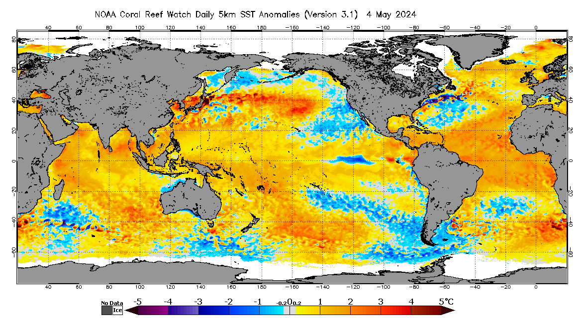
I posted a few months ago in the ENSO thread with comparisons between this year and 2010, but I'm starting to think this is going to end up as another very quick niña. The subsurface anomalies for the Top 300m of the ENSO regions actually warmed from May to June. They measure 3 different areas, 130E-
80W, 160E-80W, and 180W-100W.
All 3 areas warmed. I'll have to wait a few days for the July data to come out, as the month isn't quite over yet, but I'm interested to see what it has, and if there has been cooling or warming between June-July.

I'm starting to think we might have a very intense 4-6week peak season from the 2nd half of August to the first half of October, but I'm not sure if the season will keep up the crazy pace throughout October and November. Having something like 2005 would require that. Regardless, I still think reaching the Greeks is quite possible, but I think it might be a barely there, we only get one.

But at the end of the day, I still think peak is going to be nuts, and getting hyperactive numbers isn't going to be as hard as it typically is.
5 likes   
Solar Aquarian
Lunar Cancerian
:uarrow: Sagittarian

User avatar
Steve
S2K Supporter
S2K Supporter
Posts: 9621
Joined: Sat Apr 05, 2003 11:41 pm
Location: Not a state-caster

Re: 2020 Indicators: SST's / SAL / MSLP / Steering / Shear / Instability / Sat Images

#2009 Postby Steve » Thu Jul 30, 2020 7:20 am

JetFuel_SE wrote:
Steve wrote:
aspen wrote:With the formation of Isaias, 2020 has hit two new records: the earliest ninth named storm in the Atlantic (beating Irene ‘05 by 8 days) and the highest amount of named storms in July 卌I.


Yo aspen, continuously beating or tying records held by 2005 is as extreme as it gets. I probably have 5 posts in the preseason in various threads saying you never want to see comparisons with years like ‘33 or ‘05. I think everyone would agree with that. And I still doubt we would match ACE or NS from those years. I’d bet money on it. But close to the worst ever is also bad. I don’t completely buy into any predetermined aspects of a season based on where we are at this early. Wildcards happen in the tropics all the time. Literally almost everything but a below average season is possible and still on the table. Best hope that maybe there are a couple of underperforming landfalls if we get hit by any more hurricanes. But I don’t have any confidence in that. Clearly we are in a very western biased season. And we all know that in the coming weeks, the big stuff is going to form. Worst case is that we break 2005’s record for landfalls. We had Cindy, Dennis, Katrina 2x, Rita, Wilma (among other hits) in the US alone. And there were other hurricanes that caused problems elsewhere.


I'd say it's almost certain that we'll beat 1933 in named storms at this point.


Considering they didn’t name then back then, we already have. Haha. But yeah, we might beat 20 or 21 or however many they knew about that year. 33 is that nuts ACE year so top 1 or 2 seasons ever because of that. I should have been more clear with “NS or ACE.”
1 likes   

User avatar
CyclonicFury
Category 5
Category 5
Posts: 2025
Age: 26
Joined: Sun Jul 02, 2017 12:32 pm
Location: NC
Contact:

Re: 2020 Indicators: SST's / SAL / MSLP / Steering / Shear / Instability / Sat Images

#2010 Postby CyclonicFury » Thu Jul 30, 2020 10:07 am

7 likes   
NCSU B.S. in Meteorology Class of 2021. Tropical weather blogger at http://www.cyclonicfury.com. My forecasts and thoughts are NOT official, for official forecasts please consult the National Hurricane Center.

User avatar
Steve
S2K Supporter
S2K Supporter
Posts: 9621
Joined: Sat Apr 05, 2003 11:41 pm
Location: Not a state-caster

Re: 2020 Indicators: SST's / SAL / MSLP / Steering / Shear / Instability / Sat Images

#2011 Postby Steve » Thu Jul 30, 2020 10:12 am

TheStormExpert wrote:
hurricaneCW wrote:I think we're entering a lull period until August 15-20 and then we'll see a huge burst of activity.

Expecting hyperactive season here. Also the lack of Pacific activity is usually a red flag for an active season for us.

Just about ready to say a lull after PTC-9/Isaias is expected until about mid-late August before the real games begin!


I do agree with this. Maybe something spins up in the deep tropics coming across, but most of the MJO models think we are going into Phases 4/5 over the next week or so. JMA is the exception, but it always wants to keep it in Phase 2 or 3 lately. It's one of the better MJO models, but I feel like it has some kind of bias there.
0 likes   

User avatar
cycloneye
Admin
Admin
Posts: 145324
Age: 68
Joined: Thu Oct 10, 2002 10:54 am
Location: San Juan, Puerto Rico

Re: 2020 Indicators: SST's / SAL / MSLP / Steering / Shear / Instability / Sat Images

#2012 Postby cycloneye » Thu Jul 30, 2020 10:32 am


Oh boy. Adrian I had to put those eyes :eek:
2 likes   
Visit the Caribbean-Central America Weather Thread where you can find at first post web cams,radars
and observations from Caribbean basin members Click Here

User avatar
StruThiO
Category 3
Category 3
Posts: 821
Age: 25
Joined: Fri Sep 15, 2017 5:51 am
Location: Currently Portland, OR. Raised in Jax, FL.

Re: 2020 Indicators: SST's / SAL / MSLP / Steering / Shear / Instability / Sat Images

#2013 Postby StruThiO » Thu Jul 30, 2020 10:35 am

CyclonicFury wrote:tweet


:eek: :eek: :eek:
0 likes   

St0rmTh0r
Category 1
Category 1
Posts: 369
Joined: Tue Jul 14, 2020 8:04 pm

Re: 2020 Indicators: SST's / SAL / MSLP / Steering / Shear / Instability / Sat Images

#2014 Postby St0rmTh0r » Thu Jul 30, 2020 11:27 am


It doesn't get any more favorable than that. If this verifies
There will be an explosion of storms the likes of which we have probably never seen!
0 likes   


TheStormExpert

Re: 2020 Indicators: SST's / SAL / MSLP / Steering / Shear / Instability / Sat Images

#2016 Postby TheStormExpert » Thu Jul 30, 2020 1:48 pm

2 likes   

hurricaneCW
Category 5
Category 5
Posts: 1794
Joined: Wed Mar 03, 2010 6:20 am
Location: Toms River, NJ

Re: 2020 Indicators: SST's / SAL / MSLP / Steering / Shear / Instability / Sat Images

#2017 Postby hurricaneCW » Thu Jul 30, 2020 1:57 pm

St0rmTh0r wrote:

It doesn't get any more favorable than that. If this verifies
There will be an explosion of storms the likes of which we have probably never seen!


It's gonna get wild. The only question is where these storms will go. Early steering indicators are not good for the US.
0 likes   

caneseddy
Category 5
Category 5
Posts: 1172
Joined: Fri Sep 03, 2004 9:31 pm
Location: Plantation, FL

Re: 2020 Indicators: SST's / SAL / MSLP / Steering / Shear / Instability / Sat Images

#2018 Postby caneseddy » Thu Jul 30, 2020 2:45 pm

hurricaneCW wrote:
St0rmTh0r wrote:

It doesn't get any more favorable than that. If this verifies
There will be an explosion of storms the likes of which we have probably never seen!


It's gonna get wild. The only question is where these storms will go. Early steering indicators are not good for the US.


Up to this point, pending on what Isaias ends up doing...5 of the first 9 storms formed have already made landfall in the US or skirted the coast (Arthur, Bertha, Cristobal, Fay and Hanna); and we are not even in August yet. At this time in 2005 only three storms had impacted the US directly (Arlene, Cindy and Dennis).

As you said above the steering indicators are not looking too positive for us.
0 likes   

User avatar
toad strangler
S2K Supporter
S2K Supporter
Posts: 4543
Joined: Sun Jul 28, 2013 3:09 pm
Location: Earth
Contact:

Re: 2020 Indicators: SST's / SAL / MSLP / Steering / Shear / Instability / Sat Images

#2019 Postby toad strangler » Thu Jul 30, 2020 2:50 pm

Steering later in the season will have little to do with what has already transpired.
0 likes   

User avatar
FireRat
Category 5
Category 5
Posts: 1246
Age: 38
Joined: Sun Sep 26, 2010 11:38 pm
Location: North Carolina

Re: 2020 Indicators: SST's / SAL / MSLP / Steering / Shear / Instability / Sat Images

#2020 Postby FireRat » Thu Jul 30, 2020 4:52 pm

for those dissing the 2020 season already on this Late JULY, based on weak storms and such, I gotta feeling ISASIAS is about to put this to the test (assuming Hanna didn't already). After seeing how well he is doing with the interaction with Hispaniola, this thing could go beyond Cat 1 as we begin August... near the US/Bahamas.

2020 will do its own thing, but when Nov 30 arrives, we'll likely be looking back on a season that competed with 2017/2010/2005/1933.
2 likes   
Georges '98, Irene '99, Frances '04, Jeanne '04, Katrina '05, Wilma '05, Gustav '08, Isaac '12, Matthew '16, Florence '18, Michael '18, Ian '22


Return to “Talkin' Tropics”

Who is online

Users browsing this forum: abajan, AnnularCane, cycloneye, Google Adsense [Bot], Ian2401, NotSparta and 58 guests