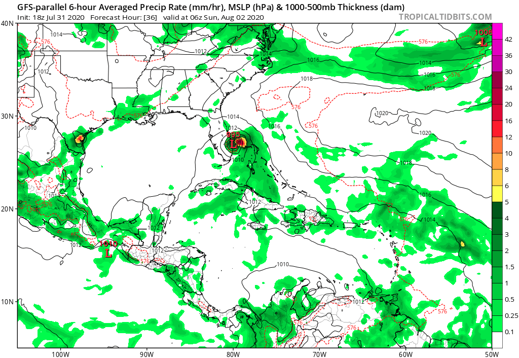
gatorcane wrote:The right-biased GFS parallel with a big shift west considering the timeframe, shows a Florida landfall for the first time I think:
https://i.postimg.cc/bYZ6pghN/gfsp-mslp-pcpn-watl-6.png
Yes first time I see that from that model.
Moderator: S2k Moderators


gatorcane wrote:The right-biased GFS parallel with a big shift west considering the timeframe, shows a Florida landfall for the first time I think:
https://i.postimg.cc/bYZ6pghN/gfsp-mslp-pcpn-watl-6.png


MoliNuno wrote:With so many models showing Isaias moving inland within 36 hours, why is the NHC consistently hugging the right side of guidance?
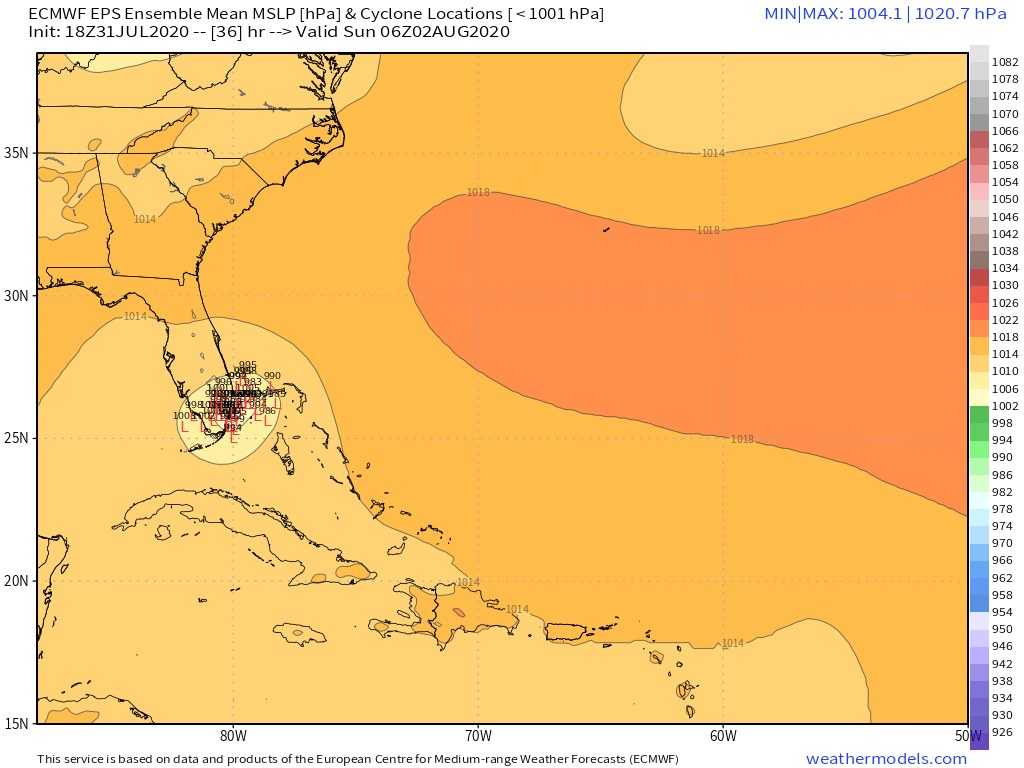
NDG wrote:A closer look at the 18z Euro.
I really doubt it will loose strength as it tracks over the Gulf Stream before making landfall in Palm Beach County.
https://i.imgur.com/pNaTyMk.gif
MoliNuno wrote:With so many models showing Isaias moving inland within 36 hours, why is the NHC consistently hugging the right side of guidance?
ronjon wrote:MoliNuno wrote:With so many models showing Isaias moving inland within 36 hours, why is the NHC consistently hugging the right side of guidance?
They probably won't after the 11 p.m. Advisory. Enough guidance like HWRF, GFS, and GFS para have shifted west. TVCN which is usually close to NHC track would have also shifted West from last advisory since it uses a combination of UKMET, ECM, GFS, and HWRF tracks for its consensus. Plus NHC is very conservation with track adjustments to avoid windshield wiper effect in track forecasts.


Evil Jeremy wrote:MoliNuno wrote:With so many models showing Isaias moving inland within 36 hours, why is the NHC consistently hugging the right side of guidance?
NHC doesn't move their forecast as quickly as the models move around. NHC was on the left side of the guidance I believe on Wednesday when the models shifted from the Florida west coast back to the East coast, or even offshore entirely.


TheStormExpert wrote:The TVCN nudges right a little on 00z.
https://i.ibb.co/z709th6/01-B5-FA9-A-F548-4639-B0-E8-4-E1-EC544-BE36.png
Hurrilurker wrote:
It also seems like they always have an early bias away from Florida, are hesitant to show landfall there, triggering warnings and let’s face it, panic in some cases. Obviously they’re not going to keep it offshore if the models are showing a sustained track that does strike, but I think they like to have high confidence before they go there.

Hurrilurker wrote:Evil Jeremy wrote:MoliNuno wrote:With so many models showing Isaias moving inland within 36 hours, why is the NHC consistently hugging the right side of guidance?
NHC doesn't move their forecast as quickly as the models move around. NHC was on the left side of the guidance I believe on Wednesday when the models shifted from the Florida west coast back to the East coast, or even offshore entirely.
It also seems like they always have an early bias away from Florida, are hesitant to show landfall there, triggering warnings and let’s face it, panic in some cases. Obviously they’re not going to keep it offshore if the models are showing a sustained track that does strike, but I think they like to have high confidence before they go there.
TheStormExpert wrote:NDG wrote:A closer look at the 18z Euro.
I really doubt it will loose strength as it tracks over the Gulf Stream before making landfall in Palm Beach County.
https://i.imgur.com/pNaTyMk.gif
I wouldn’t doubt it, there’s shear out ahead of Isaias.

MoliNuno wrote:With so many models showing Isaias moving inland within 36 hours, why is the NHC consistently hugging the right side of guidance?

AutoPenalti wrote:TheStormExpert wrote:NDG wrote:A closer look at the 18z Euro.
I really doubt it will loose strength as it tracks over the Gulf Stream before making landfall in Palm Beach County.
https://i.imgur.com/pNaTyMk.gif
I wouldn’t doubt it, there’s shear out ahead of Isaias.
That’s the outflow.
Users browsing this forum: No registered users and 48 guests


