DestinHurricane wrote:artist wrote:DestinHurricane wrote:
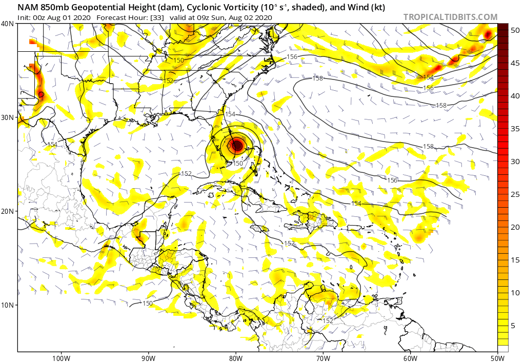
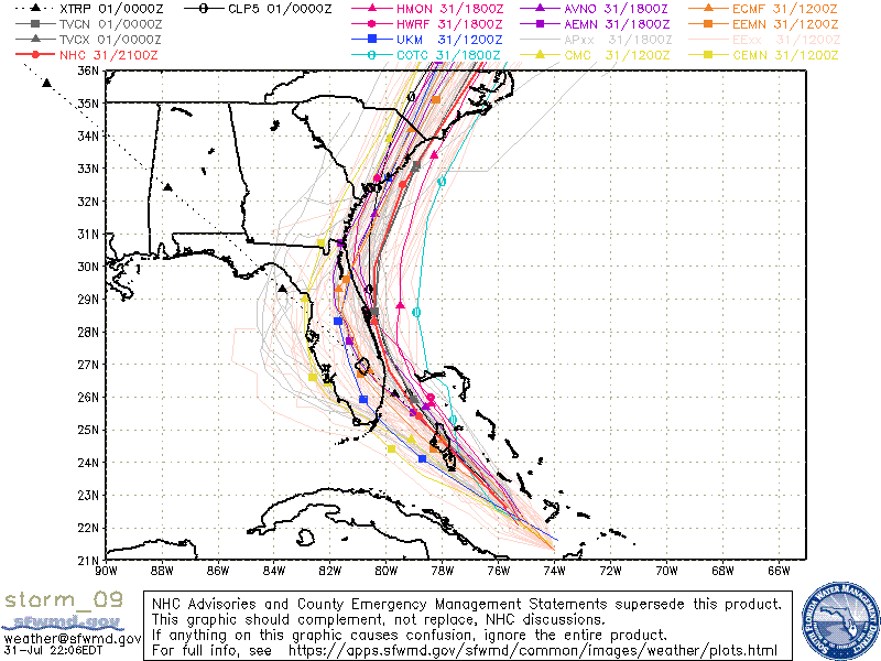
Consensus is still a storm just offshore. Likely to follow the NAM and shift east at 0Z. Florida may just get some breeze and a few showers after all.
Destin, people are here for serious discussion as they have to make plans for their safety. Randomly throwing out cliches without a basis you actually understand, is hot helpful to people. I do feel you would like to learn. If you have questions, ask. Someone with experience will be more than happy to help you understand the why’s. That is what is great about this place. The pro’s and great seasoned amateurs are usually willing to help anyone learn the why’s and wherefore’s.
I am here for serious discussion. It could still hit S FL but it is my opinion that a S FL hit is looking less likely. We shall see how it plays out.
I get that. But I have seen you waffle back and forth echoing others opinions. If you really want to learn, ask and listen, and one day you will be able to help others to understand, too. It’s good to see those eager to learn here.

Not trying to cause a problem. Just asking. Now back to the discussion.