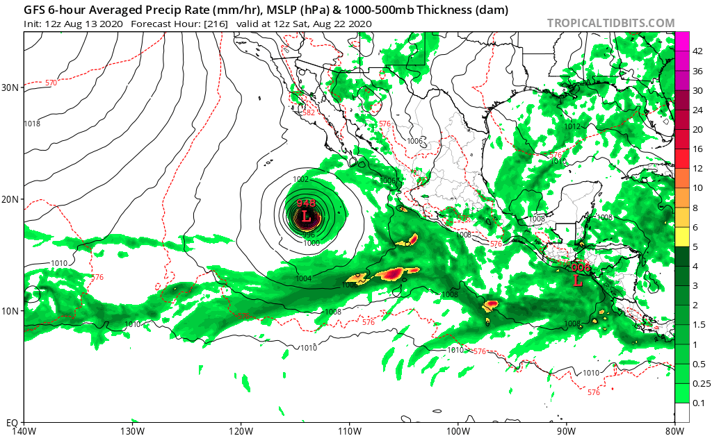
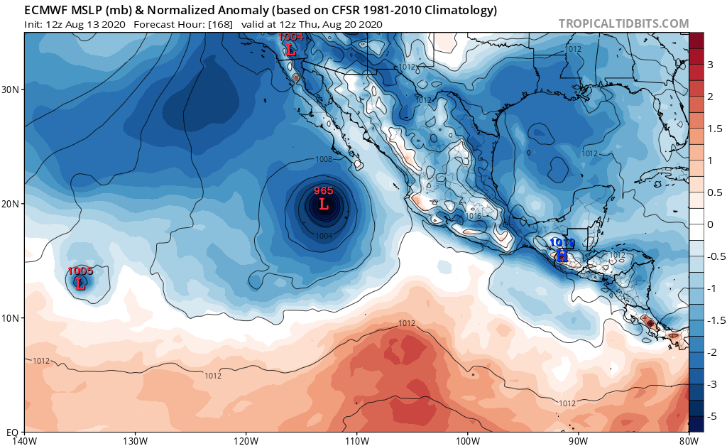
2. A large area of disturbed weather associated with a trough of low
pressure extends from just west of the Gulf of Tehuantepec
southwestward for several hundred miles. Environmental conditions
appear conducive for gradual development over the next several days,
and this system will likely become a tropical depression by late
this week while it moves generally west-northwestward away from the
coast of southwest Mexico.
* Formation chance through 48 hours...medium...40 percent.
* Formation chance through 5 days...high...80 percent.
3. Another area of low pressure is expected to form in a few days over
the far eastern portion of the basin to the south of the coast of
Central America. Conditions are expected to be conducive for
development, and a tropical depression could form this weekend while
it moves generally west-northwestward.
* Formation chance through 48 hours...low...near 0 percent.
* Formation chance through 5 days...medium...60 percent.
4. Another area of disturbed weather is forecast to form over the far
western portion of the eastern Pacific basin within the next couple
of days. Some subsequent gradual development of this system is
possible later this week while the system moves slowly westward
into the central Pacific basin.
* Formation chance through 48 hours...low...near 0 percent.
* Formation chance through 5 days...low...30 percent.