2020 Global Model Runs Discussion (Out thru day 16)

This is the general tropical discussion area. Anyone can take their shot at predicting a storms path.

Moderator: S2k Moderators

Forum rules

The posts in this forum are NOT official forecasts and should not be used as such. They are just the opinion of the poster and may or may not be backed by sound meteorological data. They are NOT endorsed by any professional institution or STORM2K. For official information, please refer to products from the National Hurricane Center and National Weather Service.

Help Support Storm2K
Message
Author
User avatar
Hammy
Category 5
Category 5
Posts: 5849
Age: 41
Joined: Fri May 25, 2012 5:25 pm
Contact:

Re: 2020 Global Model Runs Discussion (Out thru day 16)

#1461 Postby Hammy » Mon Aug 17, 2020 1:52 am

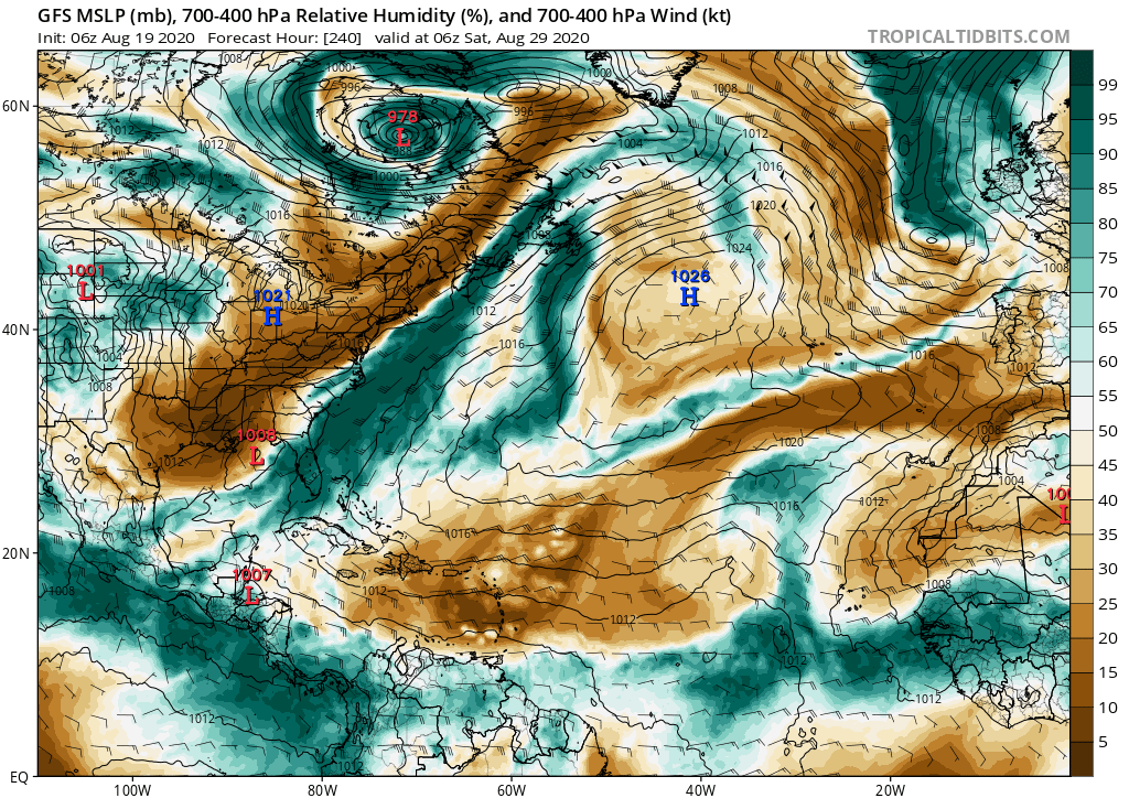
gatorcane wrote:Same story with the 18Z GFS, keeps significant activity in the EPAC and weak development to very little on the Atlantic side with timeframe coming in. I am not saying it is right but it is very persistent and still one of the best models in the world so can’t be completely discarded. Maybe we will see some more EPAC storms and some development on the Atlantic side too, but maybe not major hurricanes or high ACE storms just yet in the Atlantic.


GFS has been, by far, the worst of the models this year and has been outperformed on numerous occasions by the ICON, and even several pro mets have said to disregard the GFS output. For one reason or another it's not in any way getting an accurate read on the atmosphere.
6 likes   
The above post is not official and should not be used as such. It is the opinion of the poster and may or may not be backed by sound meteorological data. It is not endorsed by any professional institution or storm2k.org. For official information, please refer to the NHC and NWS products.

Hurricane Mike
Category 2
Category 2
Posts: 644
Joined: Tue Apr 10, 2018 7:44 am

Re: 2020 Global Model Runs Discussion (Out thru day 16)

#1462 Postby Hurricane Mike » Mon Aug 17, 2020 2:10 am

That CMC run is terrifying.
3 likes   

User avatar
toad strangler
S2K Supporter
S2K Supporter
Posts: 4543
Joined: Sun Jul 28, 2013 3:09 pm
Location: Earth
Contact:

Re: 2020 Global Model Runs Discussion (Out thru day 16)

#1463 Postby toad strangler » Mon Aug 17, 2020 2:16 am

Oy vey, we have two possible big problems inbound. :eek: Posting here because It applies in both of the other threads. That CMC run hones in on nearly the same spot. Shades of Frances and Jeanne, different location.... but BAM BAM. Rare... plenty of time fore changes
2 likes   

User avatar
aspen
Category 5
Category 5
Posts: 8818
Joined: Sat Oct 12, 2019 7:10 pm
Location: Connecticut, USA

Re: 2020 Global Model Runs Discussion (Out thru day 16)

#1464 Postby aspen » Mon Aug 17, 2020 2:16 pm

Hey guys, whatever you do, don’t look at the 12z NAVGEM model if you want to sleep well tonight.
4 likes   
Irene '11 Sandy '12 Hermine '16 5/15/2018 Derecho Fay '20 Isaias '20 Elsa '21 Henri '21 Ida '21

I am only a meteorology enthusiast who knows a decent amount about tropical cyclones. Look to the professional mets, the NHC, or your local weather office for the best information.

User avatar
Blinhart
Category 5
Category 5
Posts: 2081
Age: 48
Joined: Thu Sep 08, 2011 3:13 pm
Location: Crowley, La.

Re: 2020 Global Model Runs Discussion (Out thru day 16)

#1465 Postby Blinhart » Mon Aug 17, 2020 3:05 pm

aspen wrote:Hey guys, whatever you do, don’t look at the 12z NAVGEM model if you want to sleep well tonight.


What does it show 2 Cat 5's in the Gulf and another 2 or 3 in the Atlantic.
0 likes   
Personal Forecast Disclaimer:
The posts in this forum are NOT official forecast and should not be used as such. They are just the opinion of the poster and may or may not be backed by sound meteorological data. They are NOT endorsed by any professional institution or storm2k.org. For official information, please refer to the NHC and NWS products.

User avatar
aspen
Category 5
Category 5
Posts: 8818
Joined: Sat Oct 12, 2019 7:10 pm
Location: Connecticut, USA

Re: 2020 Global Model Runs Discussion (Out thru day 16)

#1466 Postby aspen » Mon Aug 17, 2020 3:16 pm

Blinhart wrote:
aspen wrote:Hey guys, whatever you do, don’t look at the 12z NAVGEM model if you want to sleep well tonight.


What does it show 2 Cat 5's in the Gulf and another 2 or 3 in the Atlantic.

A hurricane in the Gulf and a hurricane off the coast of Florida...at the same time.
0 likes   
Irene '11 Sandy '12 Hermine '16 5/15/2018 Derecho Fay '20 Isaias '20 Elsa '21 Henri '21 Ida '21

I am only a meteorology enthusiast who knows a decent amount about tropical cyclones. Look to the professional mets, the NHC, or your local weather office for the best information.

User avatar
gatorcane
S2K Supporter
S2K Supporter
Posts: 23691
Age: 47
Joined: Sun Mar 13, 2005 3:54 pm
Location: Boca Raton, FL

Re: 2020 Global Model Runs Discussion (Out thru day 16)

#1467 Postby gatorcane » Wed Aug 19, 2020 9:43 am

The GFS continues with no love for the Atlantic. Look out at 10 days at all of that dry air while the EPAC side is moist:

Image
3 likes   

User avatar
aspen
Category 5
Category 5
Posts: 8818
Joined: Sat Oct 12, 2019 7:10 pm
Location: Connecticut, USA

Re: 2020 Global Model Runs Discussion (Out thru day 16)

#1468 Postby aspen » Wed Aug 19, 2020 5:18 pm

Well, the 12z GFS-Para is tons of “fun”.
—97L bombs out to a 959 mbar Cat 3 in the Gulf near landfall in Louisiana
—98L runs over the Greater Antilles, but becomes a moderate to strong TS in the Gulf
—The new AEW quickly develops and becomes a long tracking MDR hurricane, taking an Irma-like track and peaking as a Cat 1 before quickly recurving once it reaches the Bahamas. It scrapes the Outer Banks and heads out to sea

Now that several models have started developing the third AEW, and show a new TC not long after it gets off the coast and a long track as well, it could be something to start watching in a few days.
3 likes   
Irene '11 Sandy '12 Hermine '16 5/15/2018 Derecho Fay '20 Isaias '20 Elsa '21 Henri '21 Ida '21

I am only a meteorology enthusiast who knows a decent amount about tropical cyclones. Look to the professional mets, the NHC, or your local weather office for the best information.

User avatar
Steve
S2K Supporter
S2K Supporter
Posts: 9621
Joined: Sat Apr 05, 2003 11:41 pm
Location: Not a state-caster

Re: 2020 Global Model Runs Discussion (Out thru day 16)

#1469 Postby Steve » Wed Aug 19, 2020 5:32 pm

Lol at the Para vs the OG. OG says not to worry the rest of August. Not even a depression!
https://www.tropicaltidbits.com/analysi ... 918&fh=210
0 likes   

User avatar
gatorcane
S2K Supporter
S2K Supporter
Posts: 23691
Age: 47
Joined: Sun Mar 13, 2005 3:54 pm
Location: Boca Raton, FL

Re: 2020 Global Model Runs Discussion (Out thru day 16)

#1470 Postby gatorcane » Fri Aug 21, 2020 6:45 am

The overnight runs of the GFS and Euro don’t show any development beyond the current TD 13 and 14 rest of August. Considering both of these TDS look like low ACE struggling systems due to only marginally conducive conditions, so far the globals have been handling the Atlantic well in not showing any big ACE producing systems. The GFS has a new hurricane showing up in the EPAC.

The ECMWF and GFS one week from now as we approach peak, looks very quiet:

Image
Image
1 likes   

User avatar
Extratropical94
Professional-Met
Professional-Met
Posts: 3538
Age: 30
Joined: Wed Oct 20, 2010 6:36 am
Location: Hamburg, Germany
Contact:

Re: 2020 Global Model Runs Discussion (Out thru day 16)

#1471 Postby Extratropical94 » Fri Aug 21, 2020 6:58 am

The Canadian ensemble lights up the MDR with 3-4 waves developing during the next 2 weeks.

Image
5 likes   
54° 11' 59'' N, 9° 9' 20'' E
Boomer Sooner!
Go Broncos! Go Cards! Go Niners!
- Daniel

shiny-pebble
Category 1
Category 1
Posts: 299
Joined: Thu Jul 05, 2018 1:38 pm

Re: RE: Re: 2020 Global Model Runs Discussion (Out thru day 16)

#1472 Postby shiny-pebble » Fri Aug 21, 2020 7:05 am

Extratropical94 wrote:The Canadian ensemble lights up the MDR with 3-4 waves developing during the next 2 weeks.

Image
CMC has been spot on with MDR TC genesis this season.... So that is concerning to say the least!!

Sent from my SM-G970U using Tapatalk
6 likes   
Not an meteorologist! Just someone who is interested in weather. Please refer to the NHC and local weather officials to make decisions.
-Jack 8-)

sma10
Category 5
Category 5
Posts: 1710
Joined: Tue Aug 02, 2005 1:13 pm

Re: 2020 Global Model Runs Discussion (Out thru day 16)

#1473 Postby sma10 » Fri Aug 21, 2020 2:08 pm

12z 21 Aug Euro has two developing central atlantic waves heading westward under strong ridging by the end of Aug
5 likes   

User avatar
MetroMike
Category 4
Category 4
Posts: 952
Joined: Sun Aug 29, 2004 8:13 pm
Location: Tampa Bay
Contact:

Re: 2020 Global Model Runs Discussion (Out thru day 16)

#1474 Postby MetroMike » Fri Aug 21, 2020 2:22 pm

sma10 wrote:12z 21 Aug Euro has two developing central atlantic waves heading westward under strong ridging by the end of Aug

That is the way things are supposed to happen. About time given the plethora of strange model issues and unknown inhibiting factors that seem to be present in the Atlantic basin.
0 likes   

User avatar
DorkyMcDorkface
Category 3
Category 3
Posts: 888
Age: 27
Joined: Mon Sep 30, 2019 1:32 pm
Location: Mid-Atlantic

Re: 2020 Global Model Runs Discussion (Out thru day 16)

#1475 Postby DorkyMcDorkface » Fri Aug 21, 2020 2:22 pm

Not to take away from our two current systems but the Euro appears to really get the wave train going to close out the month. This will be around the time the MJO begins to linger over Africa, so I am not surprised that it is picking up on this. Continue to watch for signals on the models, especially since there have been several instances where they have had to play catch-up this year.

Image
7 likes   
Please note the thougths expressed by this account are solely those of the user and are from a hobbyist perspective. For more comprehensive analysis, consult an actual professional meteorologist or meteorology agency.


Floyd 1999 | Isabel 2003 | Hanna 2008 | Irene 2011 | Sandy 2012 | Isaias 2020

User avatar
Hammy
Category 5
Category 5
Posts: 5849
Age: 41
Joined: Fri May 25, 2012 5:25 pm
Contact:

Re: 2020 Global Model Runs Discussion (Out thru day 16)

#1476 Postby Hammy » Fri Aug 21, 2020 2:45 pm

DorkyMcDorkface wrote:Not to take away from our two current systems but the Euro appears to really get the wave train going to close out the month. This will be around the time the MJO begins to linger over Africa, so I am not surprised that it is picking up on this. Continue to watch for signals on the models, especially since there have been several instances where they have had to play catch-up this year.

https://i.ibb.co/k1qSKRj/ecmwf-uv850-vort-eatl-fh96-240.gif


I'm skeptical this far out given how things have performed in the MDR so far, but it's interesting given the Euro tends to struggle terribly with MDR systems--if this becomes a trend on the Euro then we could end up seeing something along the lines of what the CFS was showing, which was pretty much nonstop activity for the first half of September.
0 likes   
The above post is not official and should not be used as such. It is the opinion of the poster and may or may not be backed by sound meteorological data. It is not endorsed by any professional institution or storm2k.org. For official information, please refer to the NHC and NWS products.

User avatar
CyclonicFury
Category 5
Category 5
Posts: 2025
Age: 26
Joined: Sun Jul 02, 2017 12:32 pm
Location: NC
Contact:

Re: 2020 Global Model Runs Discussion (Out thru day 16)

#1477 Postby CyclonicFury » Fri Aug 21, 2020 2:50 pm

Hammy wrote:
DorkyMcDorkface wrote:Not to take away from our two current systems but the Euro appears to really get the wave train going to close out the month. This will be around the time the MJO begins to linger over Africa, so I am not surprised that it is picking up on this. Continue to watch for signals on the models, especially since there have been several instances where they have had to play catch-up this year.

https://i.ibb.co/k1qSKRj/ecmwf-uv850-vort-eatl-fh96-240.gif


I'm skeptical this far out given how things have performed in the MDR so far, but it's interesting given the Euro tends to struggle terribly with MDR systems--if this becomes a trend on the Euro then we could end up seeing something along the lines of what the CFS was showing, which was pretty much nonstop activity for the first half of September.

Conditions in the MDR can change quickly. 2017 had nothing stronger than 45 kt in the MDR prior to August 30. 2019 had no hurricanes in the MDR prior to September 19 and still managed to produce Jerry (a Category 2) and Lorenzo (a high end Category 4) in the latter half of September. Even 2010 didn't have any MDR hurricanes until August 23. We have, however, had 4 TCs form in the MDR so far, which is well above average through this date even if none have been hurricanes yet.
5 likes   
NCSU B.S. in Meteorology Class of 2021. Tropical weather blogger at http://www.cyclonicfury.com. My forecasts and thoughts are NOT official, for official forecasts please consult the National Hurricane Center.

User avatar
lrak
S2K Supporter
S2K Supporter
Posts: 1770
Age: 58
Joined: Thu Jun 21, 2007 2:48 pm
Location: Corpus Christi, TX

Re: 2020 Global Model Runs Discussion (Out thru day 16)

#1478 Postby lrak » Fri Aug 21, 2020 2:56 pm

The Sun's cycles have an affect also on the seasons per Jeff Masters...https://www.wunderground.com/blog/JeffMasters/solar-impacts-on-hurricanes.html#:~:text=Near%20the%20peak%20of%20the,surface%20temperature%20and%20El%20Ni%C3%B1o.

I haven't researched any of this, I only know the Sun is completely void of any activity last year and 2020 YTD...wanted to through it out there so everyone else would do the work for me. :D
0 likes   
AKA karl

Also
Personal Forecast Disclaimer:
My posts on this forum are NOT official forecast and should not be used as such. My posts are my basic observations and are definitely not backed by any "well some" meteorological knowledge. For official information, please refer to the NHC and NWS products.

User avatar
EquusStorm
Category 5
Category 5
Posts: 1649
Age: 34
Joined: Thu Nov 07, 2013 1:04 pm
Location: Jasper, AL
Contact:

Re: 2020 Global Model Runs Discussion (Out thru day 16)

#1479 Postby EquusStorm » Fri Aug 21, 2020 7:15 pm

Given that the 12z Euro is showing MDR activity, and the 18z GFS shows at least weak but definitely still present MDR storms going into September and isn't ignoring Laura, fingers crossed they're starting to improve in the Atlantic as we ramp up toward peak. Now to see if that disappears at 0z or they double down...
0 likes   
Colors of lost purpose on the canvas of irrelevance

Not a meteorologist, in fact more of an idiot than anything. You should probably check with the NHC or a local NWS office for official information.

St0rmTh0r
Category 1
Category 1
Posts: 369
Joined: Tue Jul 14, 2020 8:04 pm

Re: 2020 Global Model Runs Discussion (Out thru day 16)

#1480 Postby St0rmTh0r » Fri Aug 21, 2020 8:20 pm

Dangerous landfall pattern stubbornly stuck in place as the peak approaches and wave train cranks up
0 likes   


Return to “Talkin' Tropics”

Who is online

Users browsing this forum: Cdenton12, kevin and 32 guests