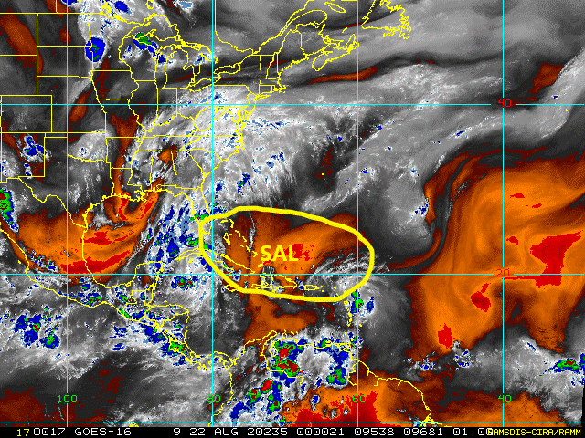
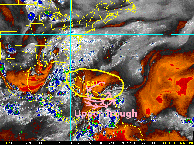
ATL: LAURA - Post-Tropical - Discussion

Moderator: S2k Moderators

Message
Author
User avatar
Hammy
Category 5
Category 5
Posts: 5849
Age: 42
Joined: Fri May 25, 2012 5:25 pm
Contact:

Re: ATL: LAURA - Tropical Storm - Discussion

#1901 Postby Hammy » Fri Aug 21, 2020 8:55 pm

AutoPenalti wrote:
CrazyC83 wrote:I'm starting to get Erika vibes...with the difference being a bomb factory awaits downstream, IF it can get there.

Which Erika?


2015 presumably. Setup is remarkably similar though the tilt of the trough and Pacific convection were, if I'm not mistaken, producing more westerly shear where Laura is dealing with more southerly shear.

Image
Image

Regarding the track, the CMC appears that it's forecasting Laura to pick up some vorticity from Hispaniola which is where the direction of approach matters--Erika came in from the southeast and moved in right over the highest terrain.

Image
Last edited by Hammy on Fri Aug 21, 2020 8:56 pm, edited 1 time in total.
2 likes   
The above post is not official and should not be used as such. It is the opinion of the poster and may or may not be backed by sound meteorological data. It is not endorsed by any professional institution or storm2k.org. For official information, please refer to the NHC and NWS products.

psyclone
S2K Supporter
S2K Supporter
Posts: 4769
Joined: Wed Aug 24, 2005 9:04 pm
Location: palm harbor fl

Re: ATL: LAURA - Tropical Storm - Discussion

#1902 Postby psyclone » Fri Aug 21, 2020 8:55 pm

Levi's video definitely makes you not want to ignore this system. the old "keep checking back" philosophy definitely applies.
5 likes   

CrazyC83
Professional-Met
Professional-Met
Posts: 34002
Joined: Tue Mar 07, 2006 11:57 pm
Location: Deep South, for the first time!

Re: ATL: LAURA - Tropical Storm - Discussion

#1903 Postby CrazyC83 » Fri Aug 21, 2020 8:57 pm

Hammy wrote:
AutoPenalti wrote:
CrazyC83 wrote:I'm starting to get Erika vibes...with the difference being a bomb factory awaits downstream, IF it can get there.

Which Erika?


2015 presumably. Setup is remarkably similar though the tilt of the trough and Pacific convection were, if I'm not mistaken, producing more westerly shear where Laura is dealing with more southerly shear.

https://rammb-data.cira.colostate.edu/tc_realtime/products/storms/2015al05/16kmgwvp/2015al05_16kmgwvp_201508272045.gif
https://rammb-data.cira.colostate.edu/tc_realtime/products/storms/2020al13/16kmgwvp/2020al13_16kmgwvp_202008220010.gif

Regarding the track, the CMC appears that it's forecasting Laura to pick up some vorticity from Hispaniola which is where the direction of approach matters--Erika came in from the southeast and moved in right over the highest terrain.

https://i.imgur.com/SoXrf8n.gif


Correct 2015 was what my thought was. But as we saw with Harvey, we can't rule anything out even if it enters the Gulf as a wave.
0 likes   

User avatar
Hammy
Category 5
Category 5
Posts: 5849
Age: 42
Joined: Fri May 25, 2012 5:25 pm
Contact:

Re: ATL: LAURA - Tropical Storm - Discussion

#1904 Postby Hammy » Fri Aug 21, 2020 9:01 pm

CrazyC83 wrote:
Hammy wrote:
AutoPenalti wrote:Which Erika?


2015 presumably. Setup is remarkably similar though the tilt of the trough and Pacific convection were, if I'm not mistaken, producing more westerly shear where Laura is dealing with more southerly shear.

https://rammb-data.cira.colostate.edu/tc_realtime/products/storms/2015al05/16kmgwvp/2015al05_16kmgwvp_201508272045.gif
https://rammb-data.cira.colostate.edu/tc_realtime/products/storms/2020al13/16kmgwvp/2020al13_16kmgwvp_202008220010.gif

Regarding the track, the CMC appears that it's forecasting Laura to pick up some vorticity from Hispaniola which is where the direction of approach matters--Erika came in from the southeast and moved in right over the highest terrain.

https://i.imgur.com/SoXrf8n.gif


Correct 2015 was what my thought was. But as we saw with Harvey, we can't rule anything out even if it enters the Gulf as a wave.


It's always interesting though to see how similar patterns can end up with completely different solutions. Having two systems possibly interacting adds another interesting ingredient.
1 likes   
The above post is not official and should not be used as such. It is the opinion of the poster and may or may not be backed by sound meteorological data. It is not endorsed by any professional institution or storm2k.org. For official information, please refer to the NHC and NWS products.

User avatar
Steve
S2K Supporter
S2K Supporter
Posts: 9623
Joined: Sat Apr 05, 2003 11:41 pm
Location: Not a state-caster

Re: ATL: LAURA - Tropical Storm - Discussion

#1905 Postby Steve » Fri Aug 21, 2020 9:07 pm

gatorcane wrote:
gatorcane wrote:Laura is not looking good tonight that is for sure. Take a look at the SAL that is ahead and that she is surrounded by currently. Notice the deep reds indicating a very dry and stable airmass. That SAL was noticeable in South Florida today with widespread hazy skies so it is expansive. I do believe mid-level shear is allowing this SAL to infiltrate the system dissipating convection. Land interaction comes next. It is quite possible not much will be left if she makes it into the Gulf between land interaction and the SAL:

https://i.postimg.cc/ZndyB8Hr/tropical-ge-14km-wv.gif


Updated image with the upper trough to the west of Laura the NHC mentioned in the discussion. That is also giving her problems with SW winds penetrating the dry air into any "center" that exists though she may not even have one at this point, likely a wave.

Loop image to see this all in motion:
http://rammb.cira.colostate.edu/ramsdis ... display=24

https://i.postimg.cc/4dKDrPXk/tropical-ge-14km-wv.gif


Levi was more wait until around Puerto Rico to see what happens. Nothing is unexpected right now.
1 likes   

stormwatcher95
Tropical Low
Tropical Low
Posts: 27
Joined: Tue Sep 10, 2019 1:01 pm

Re: ATL: LAURA - Tropical Storm - Discussion

#1906 Postby stormwatcher95 » Fri Aug 21, 2020 9:12 pm

Image
1 likes   

CrazyC83
Professional-Met
Professional-Met
Posts: 34002
Joined: Tue Mar 07, 2006 11:57 pm
Location: Deep South, for the first time!

Re: ATL: LAURA - Tropical Storm - Discussion

#1907 Postby CrazyC83 » Fri Aug 21, 2020 9:18 pm

stormwatcher95 wrote:https://i.imgur.com/73sA6z5.jpg


Center looks to be at 16.4N 60.7W if that accurately shows it.
5 likes   

wjs3
S2K Supporter
S2K Supporter
Posts: 633
Joined: Sat Aug 14, 2004 7:57 am

Re: ATL: LAURA - Tropical Storm - Discussion

#1908 Postby wjs3 » Fri Aug 21, 2020 9:21 pm

CrazyC83 wrote:
stormwatcher95 wrote:https://i.imgur.com/73sA6z5.jpg


Center looks to be at 16.4N 60.7W if that accurately shows it.


Yeah...recon really wouldn't confirm that.
0 likes   

DocB
Tropical Low
Tropical Low
Posts: 14
Joined: Mon Aug 17, 2020 7:25 pm

Re: ATL: LAURA - Tropical Storm - Discussion

#1909 Postby DocB » Fri Aug 21, 2020 9:28 pm

Oh my gosh, I post NOTHING and feel compelled to post this ( not only because of repeated questions here but because of ridiculous nonsense on other social media platforms).

The Fujhiwara Effect is a NON-ISSUE with these storms. It is a phenomenon RARELY seen when Pacific tropical cyclones track in close proximity in the absence of other predominant steering forces.

In the GOM, with ridges, troughs, land interaction...NOT going to happen.

That is all.

Sorry for the interruption


Sent from my iPhone using Tapatalk
9 likes   

User avatar
Steve
S2K Supporter
S2K Supporter
Posts: 9623
Joined: Sat Apr 05, 2003 11:41 pm
Location: Not a state-caster

Re: ATL: LAURA - Tropical Storm - Discussion

#1910 Postby Steve » Fri Aug 21, 2020 9:32 pm

DocB wrote:Oh my gosh, I post NOTHING and feel compelled to post this ( not only because of repeated questions here but because of ridiculous nonsense on other social media platforms).

The Fujhiwara Effect is a NON-ISSUE with these storms. It is a phenomenon RARELY seen when Pacific tropical cyclones track in close proximity in the absence of other predominant steering forces.

In the GOM, with ridges, troughs, land interaction...NOT going to happen.

That is all.

Sorry for the interruption


Sent from my iPhone using Tapatalk


You safely on the road to the white-hot dessert yet Doc?
0 likes   

DocB
Tropical Low
Tropical Low
Posts: 14
Joined: Mon Aug 17, 2020 7:25 pm

Re: ATL: LAURA - Tropical Storm - Discussion

#1911 Postby DocB » Fri Aug 21, 2020 9:33 pm

Tomorrow. I’m going to stay 24-36 hours ahead of both of them barring a mechanical problem. What could possibly go wrong?!


Sent from my iPhone using Tapatalk
5 likes   

Aric Dunn
Category 5
Category 5
Posts: 21238
Age: 42
Joined: Sun Sep 19, 2004 9:58 pm
Location: Ready for the Chase.
Contact:

Re: ATL: LAURA - Tropical Storm - Discussion

#1912 Postby Aric Dunn » Fri Aug 21, 2020 9:38 pm

There are eddys everywhere. just have to keep watching. the circ from earlier east of Guadelupe is still rotating north. but that convection east of PR looks like some increasing low level curvature.

so we wait..
6 likes   
Note: If I make a post that is brief. Please refer back to previous posts for the analysis or reasoning. I do not re-write/qoute what my initial post said each time.
If there is nothing before... then just ask :)

Space & Atmospheric Physicist, Embry-Riddle Aeronautical University,
I believe the sky is falling...

User avatar
StPeteMike
Category 2
Category 2
Posts: 633
Joined: Thu Jun 07, 2018 11:26 pm

Re: ATL: LAURA - Tropical Storm - Discussion

#1913 Postby StPeteMike » Fri Aug 21, 2020 9:45 pm

Steve wrote:
gatorcane wrote:
gatorcane wrote:Laura is not looking good tonight that is for sure. Take a look at the SAL that is ahead and that she is surrounded by currently. Notice the deep reds indicating a very dry and stable airmass. That SAL was noticeable in South Florida today with widespread hazy skies so it is expansive. I do believe mid-level shear is allowing this SAL to infiltrate the system dissipating convection. Land interaction comes next. It is quite possible not much will be left if she makes it into the Gulf between land interaction and the SAL:

https://i.postimg.cc/ZndyB8Hr/tropical-ge-14km-wv.gif


Updated image with the upper trough to the west of Laura the NHC mentioned in the discussion. That is also giving her problems with SW winds penetrating the dry air into any "center" that exists though she may not even have one at this point, likely a wave.

Loop image to see this all in motion:
http://rammb.cira.colostate.edu/ramsdis ... display=24

https://i.postimg.cc/4dKDrPXk/tropical-ge-14km-wv.gif


Levi was more wait until around Puerto Rico to see what happens. Nothing is unexpected right now.

Irene suffered through the same at the very beginning, then the SAL cleared out pretty fast and she got going just near PR. Same will likely happen with Laura.
1 likes   
The above post is not official and should not be used as such. It is the opinion of the poster and may or may not be backed by sound meteorological data. It is not endorsed by any professional institution or storm2k.org. For official information, please refer to the NHC and NWS products.

User avatar
Hammy
Category 5
Category 5
Posts: 5849
Age: 42
Joined: Fri May 25, 2012 5:25 pm
Contact:

Re: ATL: LAURA - Tropical Storm - Discussion

#1914 Postby Hammy » Fri Aug 21, 2020 9:48 pm

StPeteMike wrote:
Steve wrote:
gatorcane wrote:
Updated image with the upper trough to the west of Laura the NHC mentioned in the discussion. That is also giving her problems with SW winds penetrating the dry air into any "center" that exists though she may not even have one at this point, likely a wave.

Loop image to see this all in motion:
http://rammb.cira.colostate.edu/ramsdis ... display=24

https://i.postimg.cc/4dKDrPXk/tropical-ge-14km-wv.gif


Levi was more wait until around Puerto Rico to see what happens. Nothing is unexpected right now.

Irene suffered through the same at the very beginning, then the SAL cleared out pretty fast and she got going just near PR. Same will likely happen with Laura.


Nice thing is we'll have high resolution radar coverage now for the next day which should capture whatever changes it goes through--and tomorrow seems like it's the make or break day.
4 likes   
The above post is not official and should not be used as such. It is the opinion of the poster and may or may not be backed by sound meteorological data. It is not endorsed by any professional institution or storm2k.org. For official information, please refer to the NHC and NWS products.

supercane4867
Category 5
Category 5
Posts: 4966
Joined: Wed Nov 14, 2012 10:43 am

Re: ATL: LAURA - Tropical Storm - Discussion

#1915 Postby supercane4867 » Fri Aug 21, 2020 9:50 pm

This may end up heading south of Cuba or crossing the entire island.
1 likes   

User avatar
Steve
S2K Supporter
S2K Supporter
Posts: 9623
Joined: Sat Apr 05, 2003 11:41 pm
Location: Not a state-caster

Re: ATL: LAURA - Tropical Storm - Discussion

#1916 Postby Steve » Fri Aug 21, 2020 10:00 pm

Slight track nudge south moving the end of the run from the Mouth of the MS River to around Grand Isle
https://www.nhc.noaa.gov/refresh/graphi ... e#contents
0 likes   

User avatar
gfsperpendicular
Category 1
Category 1
Posts: 383
Age: 21
Joined: Mon Jun 19, 2017 3:04 pm
Location: Northern Virginia

Re: ATL: LAURA - Tropical Storm - Discussion

#1917 Postby gfsperpendicular » Fri Aug 21, 2020 10:02 pm

Darn I wish recon had gone to the east a bit. Doesn't look like the current plane is gonna be very helpful so we might not have information on that for a while.
0 likes   
I'm not sleeping, I'm waiting for the 0900 UTC advisory!

#1 CMC stan

CrazyC83
Professional-Met
Professional-Met
Posts: 34002
Joined: Tue Mar 07, 2006 11:57 pm
Location: Deep South, for the first time!

Re: ATL: LAURA - Tropical Storm - Discussion

#1918 Postby CrazyC83 » Fri Aug 21, 2020 10:02 pm

Even if it opens up into a wave, we still need to monitor what would be the remnants of Laura. There's no reason why it couldn't redevelop in the Gulf...
2 likes   

User avatar
Kazmit
Category 5
Category 5
Posts: 2125
Age: 22
Joined: Mon Jul 25, 2016 8:49 am
Location: Williamsburg, VA / Bermuda

Re: ATL: LAURA - Tropical Storm - Discussion

#1919 Postby Kazmit » Fri Aug 21, 2020 10:02 pm

Another south shift.

Image
0 likes   
Igor 2010, Sandy 2012, Fay 2014, Gonzalo 2014, Joaquin 2015, Nicole 2016, Humberto 2019

I am only a tropical weather enthusiast. My predictions are not official and may or may not be backed by sound meteorological data. For official information, please refer to the NHC and NWS products.

User avatar
ElectricStorm
Category 5
Category 5
Posts: 5059
Age: 24
Joined: Tue Aug 13, 2019 11:23 pm
Location: Skiatook, OK / Norman, OK

Re: ATL: LAURA - Tropical Storm - Discussion

#1920 Postby ElectricStorm » Fri Aug 21, 2020 10:05 pm


wow NHC has it going right over the islands, yet still getting to hurricane strength in the gulf...interesting
0 likes   
B.S Meteorology, University of Oklahoma '25

Please refer to the NHC, NWS, or SPC for official information.


Return to “2020”

Who is online

Users browsing this forum: No registered users and 3 guests