TheStormExpert wrote:Might be a good time to post this humorous yet true graph.
https://i.ibb.co/RjqF8cP/18-F6-BBEA-392-F-4-E86-9-A1-B-12-D290606-AFB.jpg
Didn't the ECMWF Ensembles have Laura headed towards Houston though? lol
Moderator: S2k Moderators


TheStormExpert wrote:Might be a good time to post this humorous yet true graph.
https://i.ibb.co/RjqF8cP/18-F6-BBEA-392-F-4-E86-9-A1-B-12-D290606-AFB.jpg


gatorcane wrote::uarrow: We may see more than one recurving Typhoon which could cause some perturbations in the jet stream over North America and Atlantic downstream. There is a second Typhoon which global models are starting to latch onto. See WPAC thread for models: viewtopic.php?f=31&t=120758&start=280


EquusStorm wrote:Ok but recurving last minute before Florida is just another way of saying trashes the Bahamas hard only a year after Dorian, so hopefully a little further off the coast than that


toad strangler wrote:
That will shut the whole basin down. See you all in 2021
toad strangler wrote:EquusStorm wrote:Ok but recurving last minute before Florida is just another way of saying trashes the Bahamas hard only a year after Dorian, so hopefully a little further off the coast than that
It's Alice in Wonderland range.

AutoPenalti wrote:That’s almost El Niño-esque LMFAO
SFLcane wrote:AutoPenalti wrote:That’s almost El Niño-esque LMFAO
No, El Nino doesn't cause troughs. 2010 was a huge La Nina and had those troughs.
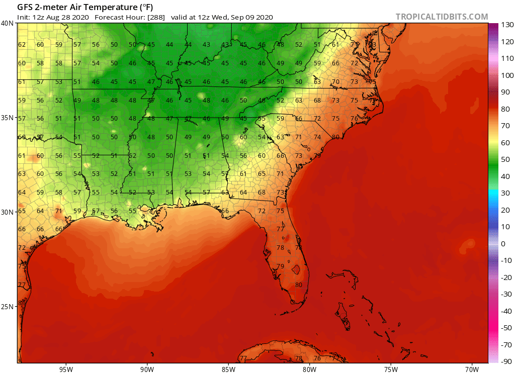
60's into northern FL. on the latest GFS.
AutoPenalti wrote:SFLcane wrote:AutoPenalti wrote:That’s almost El Niño-esque LMFAO
No, El Nino doesn't cause troughs. 2010 was a huge La Nina and had those troughs.
60's into northern FL. on the latest GFS.
True, but I'm so used to those kinds of troughs happening during El Nino years.

SFLcane wrote:AutoPenalti wrote:That’s almost El Niño-esque LMFAO
No, El Nino doesn't cause troughs. 2010 was a huge La Nina and had those troughs.
60's into northern FL. on the latest GFS.
Hypercane_Kyle wrote:SFLcane wrote:AutoPenalti wrote:That’s almost El Niño-esque LMFAO
No, El Nino doesn't cause troughs. 2010 was a huge La Nina and had those troughs.
60's into northern FL. on the latest GFS.
60's in Florida in early-September?
Not happening. Trough is overdone.
Users browsing this forum: No registered users and 192 guests


