#2919 Postby Shell Mound » Fri Sep 04, 2020 2:52 am
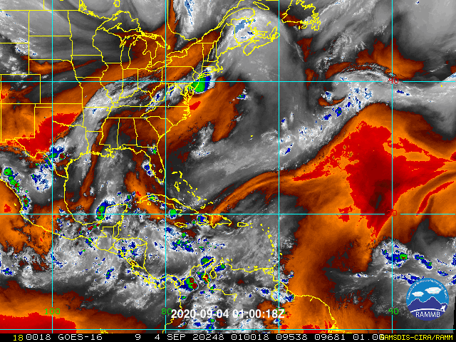
The 09:00 UTC TWO graphic looks like a plot of updraft signatures for long-tracking, tornado-producing supercells over the Plains/Dixie Alley. This is the first time I’ve ever found myself comparing the Atlantic hurricane season to a major tornado outbreak, but there’s so much activity on the docket that I think the comparison is apt for once. We’ve seen a lot of EF0s and EF1s up to this point, but peak heating hasn’t arrived yet, so the ferocious clusters of EF4s/EF5s, for the most part, are yet to come. Given that the WAR has consistently been very strong so far in 2020, I would be shocked if not one of all the upcoming storms managed to hit the U.S. At this point, the main determinants will be a) timing and position and b) wavelength. If the ridge is too far north, then weaknesses and TUTTs underneath will combine with climatology to draw several of these storms northward. However, I have a sneaking suspicion that, even if most systems manage to curve OTS, at least one long-tracking CV system that originates in the MDR will find a way to strike the U.S., given how many solid TS/(M)H landfalls we’ve already seen up to this point: Bertha, Cristobal, Fay, Hanna, Isaias, and Laura. This indicates that the prevailing steering currents thus far have definitely favoured landfalls, to not mention the fact that the sprawling precursor disturbances, even under the best conditions, usually take time to develop, so systems haven’t really “taken off” prior to reaching the western MDR, Caribbean, and/or nearshore environs in the subtropics. Based on the overall pattern, I think one of the upcoming CV systems could be a long-tracking MH that threatens the Mid-Atlantic and/or Northeastern U.S. (New England): a system that initially tries to curve OTS, but gets blocked beneath ridging and heads up the coast. Systems that develop farther south and west, of course, would be more likely to threaten the Gulf and/or FL, regardless of steering. However, we would definitely need to see a period of blocking rather than the progressive pattern we’ve witnessed over the past week or so.
2 likes
CVW / MiamiensisWx / Shell MoundThe posts in this forum are NOT official forecasts and should not be used as such. They are just the opinion of the poster and may or may not be backed by sound meteorological data. They are NOT endorsed by any professional institution or
STORM2K. For official information, please refer to products from the
NHC and
NWS.