ATL: BETA - Remnants - Discussion
Moderator: S2k Moderators
-
wxman57

- Moderator-Pro Met

- Posts: 23170
- Age: 68
- Joined: Sat Jun 21, 2003 8:06 pm
- Location: Houston, TX (southwest)
Re: ATL: INVEST 90L - Discussion
I'm thinking it starts out as a frontal low this weekend, ingesting lots of cool, dry air behind the front that will be accelerating down the western Gulf. It may not have much to steer it for 5-6 days. Levi has a good video up discussing the possibilities. If it is to become a hurricane, it is going to have to be out in the Gulf for quite a while, until all the dry air is mixed out. My thinking would be landfall in NE Mexico or south TX next Tue-Thu. Oh, and getting the forecast correct wins you no money, it can only cost you if you're wrong. 
15 likes
Re: ATL: INVEST 90L - Discussion
wxman57 wrote:I'm thinking it starts out as a frontal low this weekend, ingesting lots of cool, dry air behind the front that will be accelerating down the western Gulf. It may not have much to steer it for 5-6 days. Levi has a good video up discussing the possibilities. If it is to become a hurricane, it is going to have to be out in the Gulf for quite a while, until all the dry air is mixed out. My thinking would be landfall in NE Mexico or south TX next Tue-Thu. Oh, and getting the forecast correct wins you no money, it can only cost you if you're wrong.
But this is the only profession where you can be wrong and not lose your job!!!
0 likes
-
toad strangler

- S2K Supporter

- Posts: 4546
- Joined: Sun Jul 28, 2013 3:09 pm
- Location: Earth
- Contact:
Re: ATL: INVEST 90L - Discussion
wxman57 wrote:I'm thinking it starts out as a frontal low this weekend, ingesting lots of cool, dry air behind the front that will be accelerating down the western Gulf. It may not have much to steer it for 5-6 days. Levi has a good video up discussing the possibilities. If it is to become a hurricane, it is going to have to be out in the Gulf for quite a while, until all the dry air is mixed out. My thinking would be landfall in NE Mexico or south TX next Tue-Thu. Oh, and getting the forecast correct wins you no money, it can only cost you if you're wrong.
The last part of this post is true no matter what one does in life. Good luck on your forecast. It's an unorthodox set up so I imagine confidence will be low for awhile.
0 likes
My Weather Station
https://www.wunderground.com/dashboard/pws/KFLPORTS603
https://www.wunderground.com/dashboard/pws/KFLPORTS603

Re: ATL: INVEST 90L - Discussion
toad strangler wrote:wxman57 wrote:Models may be having trouble with all the cool, dry air flowing down the western Gulf along the coast of Mexico this weekend. Such flow naturally forms a wave on any cold front. Most models, at least initially, have the low as frontal. Some detach it from the front and drive it west to Texas next Wed-Thu-Fri. I'd much prefer that they are all wrong and nothing but a frontal wave develops. Who wants to come up with a 7-day forecast for me to issue to hundreds of clients tomorrow? Millions of dollars will depend on what is forecast. So much for any time off post-Sally.
Why would you plan for time off August through October in this business? That's like Santa taking December off. Or an accountant taking March and April off.
A person can dream!
0 likes
-
cheezyWXguy

- Category 5

- Posts: 6280
- Joined: Mon Feb 13, 2006 12:29 am
- Location: Dallas, TX
Re: ATL: INVEST 90L - Discussion
us89 wrote:wxman57 wrote:I'm thinking it starts out as a frontal low this weekend, ingesting lots of cool, dry air behind the front that will be accelerating down the western Gulf. It may not have much to steer it for 5-6 days. Levi has a good video up discussing the possibilities. If it is to become a hurricane, it is going to have to be out in the Gulf for quite a while, until all the dry air is mixed out. My thinking would be landfall in NE Mexico or south TX next Tue-Thu. Oh, and getting the forecast correct wins you no money, it can only cost you if you're wrong.
But this is the only profession where you can be wrong and not lose your job!!!
Haha, that has to be the meteorology equivalent of being a cashier and having a customer say “ohp, it didn’t scan, so it must be free!”
5 likes
Re: ATL: INVEST 90L - Discussion
Shawee wrote:toad strangler wrote:wxman57 wrote:Models may be having trouble with all the cool, dry air flowing down the western Gulf along the coast of Mexico this weekend. Such flow naturally forms a wave on any cold front. Most models, at least initially, have the low as frontal. Some detach it from the front and drive it west to Texas next Wed-Thu-Fri. I'd much prefer that they are all wrong and nothing but a frontal wave develops. Who wants to come up with a 7-day forecast for me to issue to hundreds of clients tomorrow? Millions of dollars will depend on what is forecast. So much for any time off post-Sally.
Why would you plan for time off August through October in this business? That's like Santa taking December off. Or an accountant taking March and April off.
A person can dream!
A tropical meteorologist can take September off. They just need to move to Australia.
7 likes

Re: ATL: INVEST 90L - Discussion
stormlover2013 wrote:Blinhart wrote:wxman57 wrote:Models may be having trouble with all the cool, dry air flowing down the western Gulf along the coast of Mexico this weekend. Such flow naturally forms a wave on any cold front. Most models, at least initially, have the low as frontal. Some detach it from the front and drive it west to Texas next Wed-Thu-Fri. I'd much prefer that they are all wrong and nothing but a frontal wave develops. Who wants to come up with a 7-day forecast for me to issue to hundreds of clients tomorrow? Millions of dollars will depend on what is forecast. So much for any time off post-Sally.
Ok, if I get it correct do I get a share??? Of course I'm just kidding. This is my thinking of this system is that it will take about 36 hours for it to get fully organized and be declared a TD or skip that and be a TS about a 75-100 miles East of where the weak LLC is currently, then will slowly move north towards New Orleans at around 8-10 mph before slowing down after 36 to 48 hours after formation. After this which is about about 80 hours from now, it will be a Cat 2 Hurricane about 150-200 miles due South of New Orleans and will turn NorthEast towards Vermillion Bay and slowly crawl up to the coast continuously strengthening to either a strong Cat 4 or Cat 5 at landfall. I really do hate saying this but this is what I'm feeling will be happening.
If it’s south of New Orl and goes ne isn’t that towards fl lol
I made a mistake while typing, I meant NW. I edited it.
1 likes
Personal Forecast Disclaimer:
The posts in this forum are NOT official forecast and should not be used as such. They are just the opinion of the poster and may or may not be backed by sound meteorological data. They are NOT endorsed by any professional institution or storm2k.org. For official information, please refer to the NHC and NWS products.
The posts in this forum are NOT official forecast and should not be used as such. They are just the opinion of the poster and may or may not be backed by sound meteorological data. They are NOT endorsed by any professional institution or storm2k.org. For official information, please refer to the NHC and NWS products.

Re: ATL: INVEST 90L - Discussion
us89 wrote:wxman57 wrote:I'm thinking it starts out as a frontal low this weekend, ingesting lots of cool, dry air behind the front that will be accelerating down the western Gulf. It may not have much to steer it for 5-6 days. Levi has a good video up discussing the possibilities. If it is to become a hurricane, it is going to have to be out in the Gulf for quite a while, until all the dry air is mixed out. My thinking would be landfall in NE Mexico or south TX next Tue-Thu. Oh, and getting the forecast correct wins you no money, it can only cost you if you're wrong.
But this is the only profession where you can be wrong and not lose your job!!!
Sarcasm? Because we all know this is very wrong.
wxman, I hope that "forecast" is correct, and it's a very sparsely populated area.
0 likes
Personal Forecast Disclaimer:
The posts in this forum are NOT official forecast and should not be used as such. They are just the opinion of the poster and may or may not be backed by sound meteorological data. They are NOT endorsed by any professional institution or storm2k.org. For official information, please refer to the NHC and NWS products.
The posts in this forum are NOT official forecast and should not be used as such. They are just the opinion of the poster and may or may not be backed by sound meteorological data. They are NOT endorsed by any professional institution or storm2k.org. For official information, please refer to the NHC and NWS products.
-
UTSARoadrunner4
- Category 1

- Posts: 264
- Age: 29
- Joined: Wed Aug 26, 2020 11:19 pm
Re: ATL: INVEST 90L - Discussion
edu2703 wrote:ConvergenceZone wrote:Would this be moving into non populated areas of Mexico? I hope?
The NE coast of Mexico is sparsely populated. The biggest cities in this region are located near the border with US, 22 miles from the coast
Models are showing landfall near Playa Badgad, which population consists of a few dozen people.
Hi y'all, first time posting here. Anyways, wouldn't a landfall near Playa Bagdad be a worst case scenario landfall for Brownsville, SPI and the rest of the RGV if 90L intensifies into a hurricane (Between Playa Bagdad and the mouth of the Rio Grande).
0 likes
-
bob rulz
- Category 5
- Posts: 1711
- Age: 35
- Joined: Sat Jan 28, 2006 7:30 pm
- Location: Salt Lake City, Utah
Re: ATL: INVEST 90L - Discussion
That would be a pretty rare landfall location for this late in the year, no?
0 likes
Re: ATL: INVEST 90L - Discussion
I really do hope it stays down there and never really strengthens, just don't see it happening right now.
0 likes
Personal Forecast Disclaimer:
The posts in this forum are NOT official forecast and should not be used as such. They are just the opinion of the poster and may or may not be backed by sound meteorological data. They are NOT endorsed by any professional institution or storm2k.org. For official information, please refer to the NHC and NWS products.
The posts in this forum are NOT official forecast and should not be used as such. They are just the opinion of the poster and may or may not be backed by sound meteorological data. They are NOT endorsed by any professional institution or storm2k.org. For official information, please refer to the NHC and NWS products.

Re: ATL: INVEST 90L - Discussion
I'd agree with the dry shear infusion but if that isn't enough to kill the circulation this area might get dragged east and the dry shear might only be a deterent for a few days in that scenario. They are thinking like the model that brings it in as a sheared mess west of Louisiana in the short run, or landfall east of Louisiana later and stronger.
That is as much as can be analyzed now.
That is as much as can be analyzed now.
0 likes
-
UTSARoadrunner4
- Category 1
- Posts: 264
- Age: 29
- Joined: Wed Aug 26, 2020 11:19 pm
Re: ATL: INVEST 90L - Discussion
bob rulz wrote:That would be a pretty rare landfall location for this late in the year, no?
Typically, yes. Most storms that hit around that location are usually a July/August affair. However, this is 2020, so anything goes at this point.
With that being said, 3 of the 4 worst storms to hit or get close to the Brownsville/RGV area have occurred in September (1933 Cuba-Brownsville, 1967 Beulah, and close call with Gilbert in 1988). These are also some of the most notable storms in history, but y'all already knew that.
1 likes

Re: ATL: INVEST 90L - Discussion
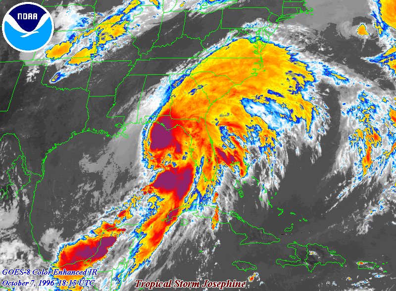
A bit old of an example, but could a Josephine 1996 type setup come out of this, where you have a low stall for a few days, develop into a tropical system, and then head towards the coast as a hybrid sort?
1 likes
The above post is not official and should not be used as such. It is the opinion of the poster and may or may not be backed by sound meteorological data. It is not endorsed by any professional institution or storm2k.org. For official information, please refer to the NHC and NWS products.
Re: ATL: INVEST 90L - Discussion
SoupBone wrote:us89 wrote:But this is the only profession where you can be wrong and not lose your job!!!
Sarcasm? Because we all know this is very wrong.
Yes. Hence the multiple exclamation marks and the eye roll smiley.
1 likes
-
Craters
- Category 1
- Posts: 428
- Joined: Sat Aug 24, 2013 2:34 pm
- Location: Alvin, TX (south of Houston)
Re: ATL: INVEST 90L - Discussion
TallyTracker wrote:I’m thinking something like Alex 2010 could be very possible out of this. Hopefully it stays weak!
Now, there's something. The 6,748th Atlantic storm of 2020 being compared to the first one of 2010! Who'da thunk it?
0 likes
Nothing that I post here should ever be treated as a forecast or anything resembling one. Please check with your local NWS office or the NHC for forecasts, watches, and warnings.
-
Craters
- Category 1
- Posts: 428
- Joined: Sat Aug 24, 2013 2:34 pm
- Location: Alvin, TX (south of Houston)
Re: ATL: INVEST 90L - Discussion
St0rmTh0r wrote:This season has really been crazy 2020 is an unbelievable year. I remember when the Gulf went over a decade without a major hurricane landfall 2005-2017.
I have to say, though, that there are a few million people who were under the heel of Ike (for what seemed like an eternity) who might disagree with the "major landfall" part of that...
3 likes
Nothing that I post here should ever be treated as a forecast or anything resembling one. Please check with your local NWS office or the NHC for forecasts, watches, and warnings.
-
Extratropical94

- Professional-Met

- Posts: 3545
- Age: 31
- Joined: Wed Oct 20, 2010 6:36 am
- Location: Hamburg, Germany
- Contact:
Re: ATL: INVEST 90L - Discussion
70/90
Thunderstorm activity associated with a low pressure system located
over the southwestern Gulf of Mexico has increased in coverage and
organization this morning. In addition, recent satellite-derived
surface wind data indicate that the low has become better defined.
Upper-level winds are expected to gradually become more conducive
for development, and a tropical depression is likely to form during
the next day or so while the low meanders over the southwestern Gulf
of Mexico. An Air Force Reserve reconnaissance aircraft is scheduled
to investigate the disturbance later today, if necessary.
* Formation chance through 48 hours...high...70 percent.
* Formation chance through 5 days...high...90 percent.
3 likes
54° 11' 59'' N, 9° 9' 20'' E
Boomer Sooner!
Go Broncos! Go Cards!
Clinching counties, one at a time: https://mob-rule.com/user-gifs/USA/xtrp94.gif
- Daniel
Boomer Sooner!
Go Broncos! Go Cards!
Clinching counties, one at a time: https://mob-rule.com/user-gifs/USA/xtrp94.gif
- Daniel
-
Craters
- Category 1
- Posts: 428
- Joined: Sat Aug 24, 2013 2:34 pm
- Location: Alvin, TX (south of Houston)
Re: ATL: INVEST 90L - Discussion
GCANE wrote:High-helicity towers going up.
Didn't I just say this yesterday?
GCANE, every time you start saying stuff like this, nasty things invariably start to happen. Who are you really?...
3 likes
Nothing that I post here should ever be treated as a forecast or anything resembling one. Please check with your local NWS office or the NHC for forecasts, watches, and warnings.

Re: ATL: INVEST 90L - Discussion
sighhhh...slow, meandering, and almost surely another pain in the @$$ to track.
0 likes
Who is online
Users browsing this forum: No registered users and 13 guests