TheStormExpert wrote:Another thing I’ve noticed is the GFS has pushed back development of this a few days since the overnight 00z run for what it’s worth.
Wrong
Moderator: S2k Moderators


TheStormExpert wrote:Another thing I’ve noticed is the GFS has pushed back development of this a few days since the overnight 00z run for what it’s worth.


AutoPenalti wrote:This looks to book it NE, looking at the H500, that ain't happening.

toad strangler wrote:TheStormExpert wrote:Another thing I’ve noticed is the GFS has pushed back development of this a few days since the overnight 00z run for what it’s worth.
Wrong

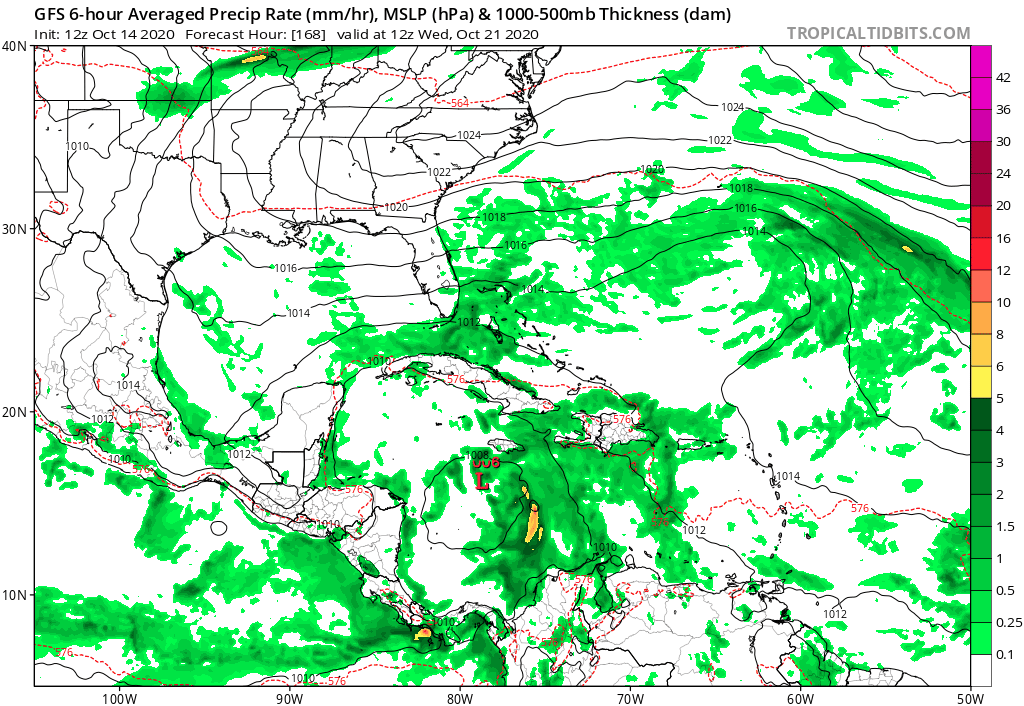
TheStormExpert wrote:GFS is MUCH weaker this run. Doesn’t even show a hurricane crossing Cuba while ejecting NE.
TheStormExpert wrote:toad strangler wrote:TheStormExpert wrote:Another thing I’ve noticed is the GFS has pushed back development of this a few days since the overnight 00z run for what it’s worth.
Wrong
How is this wrong!? I’m just stating a tiny fact!


toad strangler wrote:TheStormExpert wrote:toad strangler wrote:
Wrong
How is this wrong!? I’m just stating a tiny fact!
It's completely wrong. GFS has not pushed this back a few days
Emmett_Brown wrote:Just an unscientific observation, but I've noticed a tendency for the GFS to show a strong storm at long range, then weaken it as it gets closer to the event. Then, the storm that actually forms ends up being intense similar to the older runs. I guess this is why we depend more on HWRF and HMON for intensity.
TheStormExpert wrote:GFS is MUCH weaker this run. Doesn’t even show a hurricane crossing Cuba while ejecting NE.

gatorcane wrote:Saved GFS loop:
No more 929MB CAT 5. Track and intensity look more realistic
https://i.postimg.cc/FRtzrDhC/gfs-mslp-pcpn-watl-fh168-252.gif

Users browsing this forum: Blown Away, mixedDanilo.E, WaveBreaking and 40 guests
