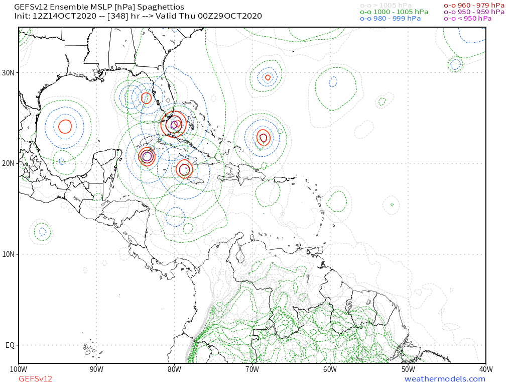
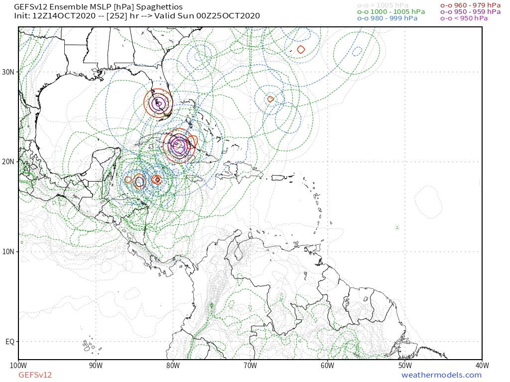
2020 Global Model Runs Discussion (Out thru day 16)

This is the general tropical discussion area. Anyone can take their shot at predicting a storms path.

Moderator: S2k Moderators

Forum rules

The posts in this forum are NOT official forecasts and should not be used as such. They are just the opinion of the poster and may or may not be backed by sound meteorological data. They are NOT endorsed by any professional institution or STORM2K. For official information, please refer to products from the National Hurricane Center and National Weather Service.

Help Support Storm2K
Message
Author
User avatar
toad strangler
S2K Supporter
S2K Supporter
Posts: 4543
Joined: Sun Jul 28, 2013 3:09 pm
Location: Earth
Contact:

Re: 2020 Global Model Runs Discussion (Out thru day 16)

#3601 Postby toad strangler » Wed Oct 14, 2020 1:01 pm

TheStormExpert wrote:
toad strangler wrote:


Woooo baby can you imagine a member like that one into the Tampa area verifying? :eek:

That's Ft. Myers. :lol:


yep, my bad. either way that's a member we don't want!
0 likes   

User avatar
SFLcane
S2K Supporter
S2K Supporter
Posts: 10163
Age: 47
Joined: Sat Jun 05, 2010 1:44 pm
Location: Lake Worth Florida

Re: 2020 Global Model Runs Discussion (Out thru day 16)

#3602 Postby SFLcane » Wed Oct 14, 2020 1:27 pm

Image
0 likes   

User avatar
aspen
Category 5
Category 5
Posts: 8818
Joined: Sat Oct 12, 2019 7:10 pm
Location: Connecticut, USA

Re: 2020 Global Model Runs Discussion (Out thru day 16)

#3603 Postby aspen » Wed Oct 14, 2020 2:04 pm

What are the GEFS/EPS ensembles saying about the potential central Atlantic TC?
0 likes   
Irene '11 Sandy '12 Hermine '16 5/15/2018 Derecho Fay '20 Isaias '20 Elsa '21 Henri '21 Ida '21

I am only a meteorology enthusiast who knows a decent amount about tropical cyclones. Look to the professional mets, the NHC, or your local weather office for the best information.

User avatar
Emmett_Brown
Category 5
Category 5
Posts: 1432
Joined: Wed Aug 24, 2005 9:10 pm
Location: Sarasota FL

Re: 2020 Global Model Runs Discussion (Out thru day 16)

#3604 Postby Emmett_Brown » Wed Oct 14, 2020 2:06 pm

Call me weird but I have always had a fondness for TC's that happen around Halloween. Adds to the vibe.
6 likes   

User avatar
Gums
S2K Supporter
S2K Supporter
Posts: 170
Age: 82
Joined: Sun Oct 07, 2018 7:30 pm
Location: Niceville, FL

Re: 2020 Global Model Runs Discussion (Out thru day 16)

#3605 Postby Gums » Wed Oct 14, 2020 2:29 pm

Salute!

I see no problem speculating more than a few days ahead.
We all learn about the modeling world and if our memory ain't shot up too bad we can correlate our basic weather patterns with what the storm does or does not. It's what our ancestors did for many years, and every technological advace helped going back to that gadget Marconi came up with.
=============
This dude heading wnw is gonna meet a cold front in a few days, and I am rooting for the front to heavily influence it. Have seen too many the last 35 years here in the Panhandle that severely dimish after contact. Many get "hooked" on the front whether it stalls or not, and turn northeast. And one thing for sure is that the fall fronts bring lottsa dry air.

Gums sends...
1 likes   

User avatar
FireRat
Category 5
Category 5
Posts: 1246
Age: 38
Joined: Sun Sep 26, 2010 11:38 pm
Location: North Carolina

Re: 2020 Global Model Runs Discussion (Out thru day 16)

#3606 Postby FireRat » Wed Oct 14, 2020 2:35 pm

Emmett_Brown wrote:Call me weird but I have always had a fondness for TC's that happen around Halloween. Adds to the vibe.


Same here!.Halloween wouldn't be complete without having to look out for these kinds of Monsters!
:craz:

Those October monsters have been some of the greatest of all time too...Sandy for size, Wilma & Mitch for intensity, as recent examples. Boo!!
1 likes   
Georges '98, Irene '99, Frances '04, Jeanne '04, Katrina '05, Wilma '05, Gustav '08, Isaac '12, Matthew '16, Florence '18, Michael '18, Ian '22

User avatar
aspen
Category 5
Category 5
Posts: 8818
Joined: Sat Oct 12, 2019 7:10 pm
Location: Connecticut, USA

Re: 2020 Global Model Runs Discussion (Out thru day 16)

#3607 Postby aspen » Wed Oct 14, 2020 2:46 pm

The Euro has really taken a liking to the subtropical system/"future Epsilon", which also appears on the CMC run. Both show it developing by 72 hours out and tracking SW, then nearly due W. After a week or so, there are diverging solutions over whether it gets uncomfortably close to the Carolinas or curves out to sea. What's concerning is that Epsilon could track into SSTs as high as 29C, and could potentially end up as a threat to Bermuda, the Bahamas, and/or the SEUS coast. I've also marked the Euro's rough track of the gyre/low pressure area that spawns the Caribbean system, which would be named Zeta if this subtropical area develops.
Image
1 likes   
Irene '11 Sandy '12 Hermine '16 5/15/2018 Derecho Fay '20 Isaias '20 Elsa '21 Henri '21 Ida '21

I am only a meteorology enthusiast who knows a decent amount about tropical cyclones. Look to the professional mets, the NHC, or your local weather office for the best information.

User avatar
SFLcane
S2K Supporter
S2K Supporter
Posts: 10163
Age: 47
Joined: Sat Jun 05, 2010 1:44 pm
Location: Lake Worth Florida

Re: 2020 Global Model Runs Discussion (Out thru day 16)

#3608 Postby SFLcane » Wed Oct 14, 2020 2:52 pm

0 likes   

User avatar
gatorcane
S2K Supporter
S2K Supporter
Posts: 23691
Age: 47
Joined: Sun Mar 13, 2005 3:54 pm
Location: Boca Raton, FL

Re: 2020 Global Model Runs Discussion (Out thru day 16)

#3609 Postby gatorcane » Wed Oct 14, 2020 3:03 pm

If the Euro is correct with the subtropical TC that might be enough to shear anything in the WCAR keeping it weak.

Interesting wrinkle which may throw a wrench in the GFS monster Caribbean storm idea:

Image
1 likes   

User avatar
toad strangler
S2K Supporter
S2K Supporter
Posts: 4543
Joined: Sun Jul 28, 2013 3:09 pm
Location: Earth
Contact:

Re: 2020 Global Model Runs Discussion (Out thru day 16)

#3610 Postby toad strangler » Wed Oct 14, 2020 3:06 pm

gatorcane wrote:If the Euro is correct with the subtropical TC that might be enough to shear anything in the WCAR keeping it weak.

Interesting wrinkle which may throw a wrench in the GFS monster Caribbean storm idea:

https://i.postimg.cc/d0gQcTp9/ecmwf-uv850-vort-watl-fh120-240-2.gif


It goes against NOAA's two week forecast for the Caribbean but something to watch. I'm not one to start believing the Euro in the long range all of the sudden when it's been atrocious all season.
4 likes   

User avatar
aspen
Category 5
Category 5
Posts: 8818
Joined: Sat Oct 12, 2019 7:10 pm
Location: Connecticut, USA

Re: 2020 Global Model Runs Discussion (Out thru day 16)

#3611 Postby aspen » Wed Oct 14, 2020 3:07 pm

gatorcane wrote:If the Euro is correct with the subtropical TC that might be enough to shear anything in the WCAR keeping it weak.

Interesting wrinkle which may throw a wrench in the GFS monster Caribbean storm idea:

https://i.postimg.cc/d0gQcTp9/ecmwf-uv850-vort-watl-fh120-240-2.gif

I don’t think a TS that far north would impart enough shear to keep anything in the Caribbean weak, especially if there’s already a defined TC by the time Epsilon reaches 65-70W.
1 likes   
Irene '11 Sandy '12 Hermine '16 5/15/2018 Derecho Fay '20 Isaias '20 Elsa '21 Henri '21 Ida '21

I am only a meteorology enthusiast who knows a decent amount about tropical cyclones. Look to the professional mets, the NHC, or your local weather office for the best information.

plasticup

Re: 2020 Global Model Runs Discussion (Out thru day 16)

#3612 Postby plasticup » Wed Oct 14, 2020 3:45 pm

TheStormExpert wrote:Honestly you’re nuts if you believe those absurd Cat.5 intensities the GFS shows with systems all the time. I’ll never forget the sub-900mb Irma it was forecasting to slam into SE Florida for several runs. Fortunately that wasn’t the case.


Hahahaha yeah, sub-900, so crazy, when it only got to... *checks notes* 914 mbar

:think:
4 likes   

AutoPenalti
Category 5
Category 5
Posts: 4030
Age: 29
Joined: Mon Aug 17, 2015 4:16 pm
Location: Ft. Lauderdale, Florida

Re: 2020 Global Model Runs Discussion (Out thru day 16)

#3613 Postby AutoPenalti » Wed Oct 14, 2020 3:45 pm

plasticup wrote:
TheStormExpert wrote:Honestly you’re nuts if you believe those absurd Cat.5 intensities the GFS shows with systems all the time. I’ll never forget the sub-900mb Irma it was forecasting to slam into SE Florida for several runs. Fortunately that wasn’t the case.


Hahahaha yeah, sub-900, so crazy, when it only got to... *checks notes* 914 mbar

:think:

sub-900 was certainly possible if it didn't hit Cuba.
5 likes   
The posts in this forum are NOT official forecasts and should not be used as such. They are just the opinion of the poster and may or may not be backed by sound meteorological data. They are NOT endorsed by any professional institution or STORM2K. For official information, please refer to products from the NHC and NWS.


Model Runs Cheat Sheet:
GFS (5:30 AM/PM, 11:30 AM/PM)
HWRF, GFDL, UKMET, NAVGEM (6:30-8:00 AM/PM, 12:30-2:00 AM/PM)
ECMWF (1:45 AM/PM)

TCVN
is a weighted averaged

User avatar
SouthFLTropics
Category 5
Category 5
Posts: 4236
Age: 50
Joined: Thu Aug 14, 2003 8:04 am
Location: Port St. Lucie, Florida

Re: 2020 Global Model Runs Discussion (Out thru day 16)

#3614 Postby SouthFLTropics » Wed Oct 14, 2020 4:04 pm

plasticup wrote:
TheStormExpert wrote:Honestly you’re nuts if you believe those absurd Cat.5 intensities the GFS shows with systems all the time. I’ll never forget the sub-900mb Irma it was forecasting to slam into SE Florida for several runs. Fortunately that wasn’t the case.


Hahahaha yeah, sub-900, so crazy, when it only got to... *checks notes* 914 mbar

:think:


The 914mb reading was when it was close to Puerto Rico but regardless, the 925mb upon approach to South Florida is still respectable...

BULLETIN
Hurricane Irma Advisory Number 39
NWS National Hurricane Center Miami FL AL112017
500 PM EDT Fri Sep 08 2017

...HURRICANE CONDITIONS SPREADING WESTWARD OVER PORTIONS OF CUBA AND
THE CENTRAL BAHAMAS...
...HURRICANE WARNINGS EXTENDED NORTHWARD ALONG THE FLORIDA
PENINSULA...


SUMMARY OF 500 PM EDT...2100 UTC...INFORMATION
----------------------------------------------
LOCATION...22.1N 76.5W
ABOUT 195 MI...310 KM E OF CAIBARIEN CUBA
ABOUT 345 MI...555 KM SE OF MIAMI FLORIDA
MAXIMUM SUSTAINED WINDS...155 MPH...250 KM/H
PRESENT MOVEMENT...W OR 280 DEGREES AT 12 MPH...19 KM/H
MINIMUM CENTRAL PRESSURE...925 MB...27.32 INCHES
2 likes   
Fourth Generation Florida Native

Personal Storm History: David 79, Andrew 92, Erin 95, Floyd 99, Irene 99, Frances 04, Jeanne 04, Wilma 05, Matthew 16, Irma 17, Ian 22, Nicole 22, Milton 24

User avatar
aspen
Category 5
Category 5
Posts: 8818
Joined: Sat Oct 12, 2019 7:10 pm
Location: Connecticut, USA

Re: 2020 Global Model Runs Discussion (Out thru day 16)

#3615 Postby aspen » Wed Oct 14, 2020 4:04 pm

AutoPenalti wrote:
plasticup wrote:
TheStormExpert wrote:Honestly you’re nuts if you believe those absurd Cat.5 intensities the GFS shows with systems all the time. I’ll never forget the sub-900mb Irma it was forecasting to slam into SE Florida for several runs. Fortunately that wasn’t the case.


Hahahaha yeah, sub-900, so crazy, when it only got to... *checks notes* 914 mbar

:think:

sub-900 was certainly possible if it didn't hit Cuba.

At the very least, it could’ve regained its peak intensity of 155 kt and 914 mbar. The eye was clearing out quick, Dmax was arriving, convection around the eye was quickly deepening, and winds quickly shot up from 130-135 kt to 145 kt at landfall. I’m not sure about sub-900 because Irma’s new eye was quite large, so the pressure gradient wasn’t as tight as before.

It’s crazy to think that Irma could’ve somehow ended up even more intense and destructive, which is hard to believe when it was a 66 ACE, 180 mph monster that bulldozed everything from Barbuda to the Keys.
Last edited by aspen on Wed Oct 14, 2020 4:10 pm, edited 1 time in total.
4 likes   
Irene '11 Sandy '12 Hermine '16 5/15/2018 Derecho Fay '20 Isaias '20 Elsa '21 Henri '21 Ida '21

I am only a meteorology enthusiast who knows a decent amount about tropical cyclones. Look to the professional mets, the NHC, or your local weather office for the best information.

LarryWx
S2K Supporter
S2K Supporter
Posts: 6305
Joined: Sun Sep 07, 2003 2:04 pm
Location: GA

Re: 2020 Global Model Runs Discussion (Out thru day 16)

#3616 Postby LarryWx » Wed Oct 14, 2020 4:06 pm

AutoPenalti wrote:
plasticup wrote:
TheStormExpert wrote:Honestly you’re nuts if you believe those absurd Cat.5 intensities the GFS shows with systems all the time. I’ll never forget the sub-900mb Irma it was forecasting to slam into SE Florida for several runs. Fortunately that wasn’t the case.


Hahahaha yeah, sub-900, so crazy, when it only got to... *checks notes* 914 mbar

:think:

sub-900 was certainly possible if it didn't hit Cuba.


But the GFS had sub 900 after hitting Cuba on several runs! It was clearly overdoing it by ~30-35 mb. The GFS was overdoing many storms back then.
0 likes   
Personal Forecast Disclaimer:
The posts in this forum are NOT official forecasts and should not be used as such. They are just the opinion of the poster and may or may not be backed by sound meteorological data. They are NOT endorsed by any professional institution or storm2k.org. For official information, please refer to the NHC and NWS products.

User avatar
SouthFLTropics
Category 5
Category 5
Posts: 4236
Age: 50
Joined: Thu Aug 14, 2003 8:04 am
Location: Port St. Lucie, Florida

Re: 2020 Global Model Runs Discussion (Out thru day 16)

#3617 Postby SouthFLTropics » Wed Oct 14, 2020 4:14 pm

There's no question that the GFS of old could have a tendency to overcook some storms. However, recently, I haven't seen it perform like that. This is what made the recent 929mb run it showed much more eye opening. Time will tell, but given the right environment, the waters down there right now are more than capable of supporting low 900mb storms.
3 likes   
Fourth Generation Florida Native

Personal Storm History: David 79, Andrew 92, Erin 95, Floyd 99, Irene 99, Frances 04, Jeanne 04, Wilma 05, Matthew 16, Irma 17, Ian 22, Nicole 22, Milton 24

User avatar
SFLcane
S2K Supporter
S2K Supporter
Posts: 10163
Age: 47
Joined: Sat Jun 05, 2010 1:44 pm
Location: Lake Worth Florida

Re: 2020 Global Model Runs Discussion (Out thru day 16)

#3618 Postby SFLcane » Wed Oct 14, 2020 4:44 pm

*****Happy Hour Time ********

Let’s see if weakening trend continues.
0 likes   

User avatar
SFLcane
S2K Supporter
S2K Supporter
Posts: 10163
Age: 47
Joined: Sat Jun 05, 2010 1:44 pm
Location: Lake Worth Florida

Re: 2020 Global Model Runs Discussion (Out thru day 16)

#3619 Postby SFLcane » Wed Oct 14, 2020 5:28 pm

18z GFS stronger and further west... :eek:
0 likes   

User avatar
cycloneye
Admin
Admin
Posts: 145299
Age: 68
Joined: Thu Oct 10, 2002 10:54 am
Location: San Juan, Puerto Rico

Re: 2020 Global Model Runs Discussion (Out thru day 16)

#3620 Postby cycloneye » Wed Oct 14, 2020 5:29 pm

Down to 5 days.

Image
2 likes   
Visit the Caribbean-Central America Weather Thread where you can find at first post web cams,radars
and observations from Caribbean basin members Click Here


Return to “Talkin' Tropics”

Who is online

Users browsing this forum: kevin, Ulf and 18 guests