chris_fit wrote:06z GFS so far.... much stronger than 00Z but moving EAST into Jamaica!
https://i.imgur.com/qkAd9QV.gif
9 days out. Yawn. Alot will change that far out. The chances of it being accurate I would say are around 20%.
Moderator: S2k Moderators

chris_fit wrote:06z GFS so far.... much stronger than 00Z but moving EAST into Jamaica!
https://i.imgur.com/qkAd9QV.gif


SouthFLTropics wrote:The overnight GFS-Para, just for fun!!!
If we were playing $10,000 Pyramid, this would get filed under the category of "Things not likely to happen". Pays a visit to Havana and has a Mojito and then pulls a Crazy Ivan and comes back for more. Then for good measure heads into the GOM towards Louisiana.
This run was definitely one of the more entertaining ones this year...
https://i.imgur.com/KibtcPM.gif


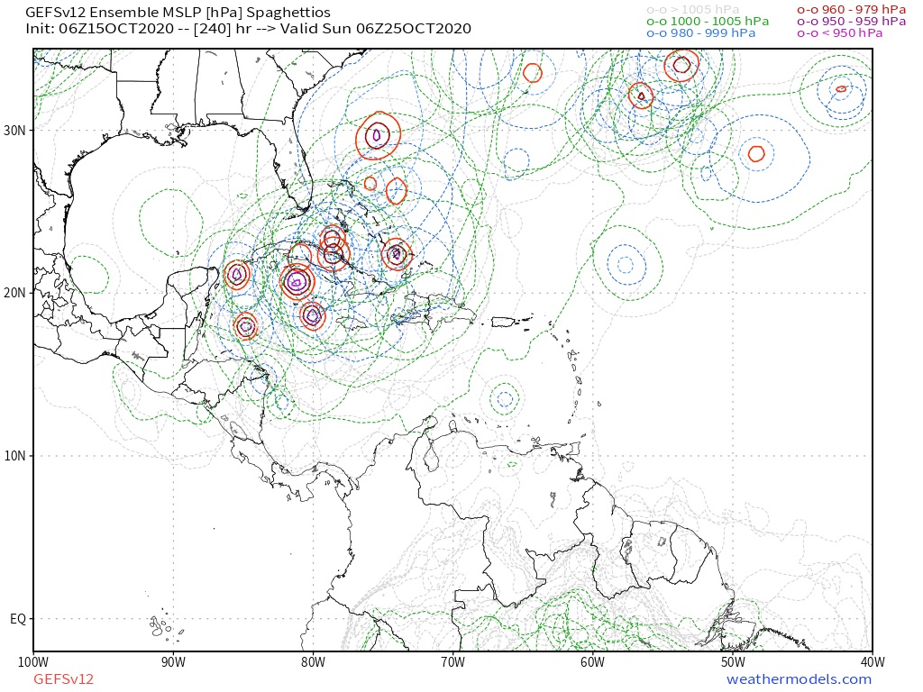
gatorcane wrote:Like the 00Z GEFS, the 06Z shows most ensembles turning a strong hurricane NE towards Cuba and the Bahamas. There are a few ensembles that make it to South Florida though. I would rather be in the bullseye now (which we are not) because we all know these can shift a lot this far out.
https://i.postimg.cc/52HbD11w/gfs-ememb-lowlos-watl-fh150-240.gif

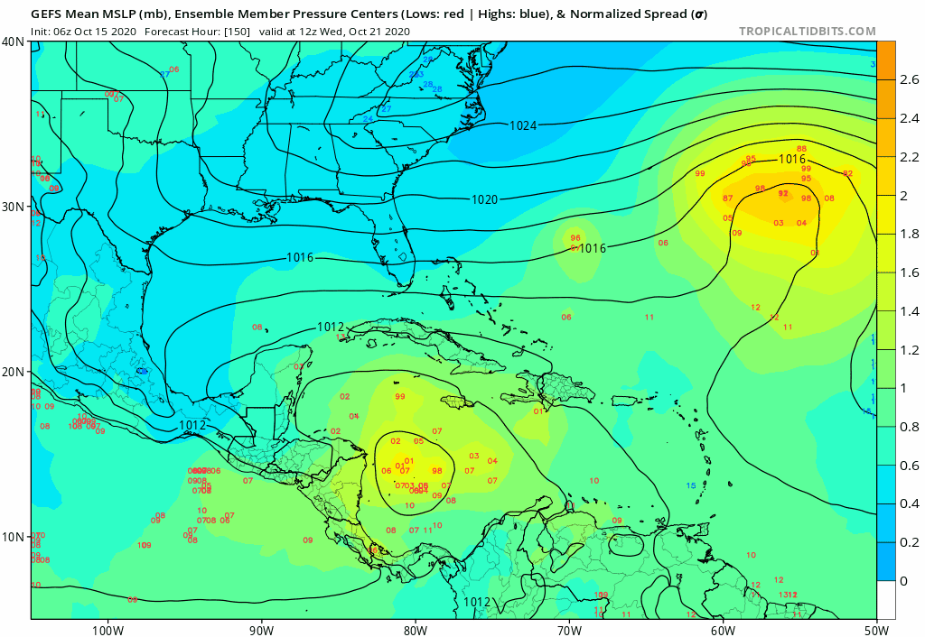
GeneratorPower wrote:
Stronger solutions are further west.
Frank2 wrote:The 00z synoptic run showed a strong N/S front moving quickly towards the EC in 8 or 9 days, and picks up whatever forms and moves it NE - towards the end of October that's the most likely outcome.
SFLcane wrote:GeneratorPower wrote:
Stronger solutions are further west.
Yep
chaser1 wrote:Frank2 wrote:The 00z synoptic run showed a strong N/S front moving quickly towards the EC in 8 or 9 days, and picks up whatever forms and moves it NE - towards the end of October that's the most likely outcome.
I would agree except if in fact this was the synoptic pattern as the GFS suggests. 5-7 days ago the GFS was advertising high temps in the low 80's again for us here in Central Florida with this latest short wave, but each day passing it is clear that the progressive mid level pattern has high pressure in control east of Georgia and Florida and all the energy will already have swung northeast leaving Florida with little more then a surface wind shift from the NE for a couple days and perhaps slightly lower dew points for this weekend. So looking forward I continue to look at the GFS trying to dig a sharper trough down into the N. Gulf and it's attendant front into Florida, but then take a look at the synoptic pattern that the EURO is showing and it does not suggest a short wave pushing toward the EC at all. In fact, a large sub-tropical low east of the Outer Banks appears trapped or moves northwest (rather then phasing in with any apparent short wave along the CONUS seaboard). If the present GFS long range forecast were to not verify and again evolve into a pattern showing the Long wave remains further west and equally northeast/southwest tilted with high pressure remaining dominant over the far W. Atlantic and near the Bahamas...... then I think we're apt to see an increased threat to Florida as time continues rolling forward during the next 10 days.


Users browsing this forum: Blown Away, mixedDanilo.E and 43 guests


