Area of disturbed weather entering the Caribbean (Is Invest 96L)
Moderator: S2k Moderators
Forum rules

The posts in this forum are NOT official forecasts and should not be used as such. They are just the opinion of the poster and may or may not be backed by sound meteorological data. They are NOT endorsed by any professional institution or STORM2K. For official information, please refer to products from the National Hurricane Center and National Weather Service.
-
ElectricStorm

- Category 5

- Posts: 5157
- Age: 25
- Joined: Tue Aug 13, 2019 11:23 pm
- Location: Norman, OK
Re: Potential Eta's early November ETA (Let's break a forum record!)
Honestly if Zeta wasn't out there we would definitely hit 60 pages on this thread but since Zeta is out there, depending it what it does over the next several days, it will be close to hit 60
2 likes
B.S Meteorology, University of Oklahoma '25
Please refer to the NHC, NWS, or SPC for official information.
Please refer to the NHC, NWS, or SPC for official information.
-
toad strangler

- S2K Supporter

- Posts: 4546
- Joined: Sun Jul 28, 2013 3:09 pm
- Location: Earth
- Contact:
Re: Potential Eta's early November ETA (Let's break a forum record!)
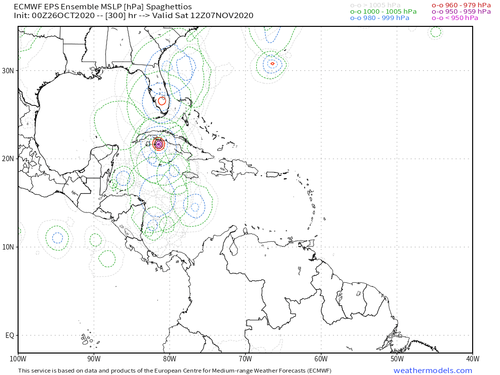
SFLcane wrote::eek: Cuts up the spin.
https://i.postimg.cc/FFT5jkW7/69-AE8115-8254-49-CD-8-E2-E-106139-DB5322.png
384 HOUR MAP. meh
0 likes
My Weather Station
https://www.wunderground.com/dashboard/pws/KFLPORTS603
https://www.wunderground.com/dashboard/pws/KFLPORTS603
-
SFLcane

- S2K Supporter
- Posts: 10281
- Age: 48
- Joined: Sat Jun 05, 2010 1:44 pm
- Location: Lake Worth Florida
Re: Potential Eta's early November ETA (Let's break a forum record!)
toad strangler wrote:SFLcane wrote::eek: Cuts up the spin.
https://i.postimg.cc/FFT5jkW7/69-AE8115-8254-49-CD-8-E2-E-106139-DB5322.png
384 HOUR MAP. meh
@ 168hrs it’s already showing up in the GEFS ensembles.
0 likes
-
SFLcane
- S2K Supporter
- Posts: 10281
- Age: 48
- Joined: Sat Jun 05, 2010 1:44 pm
- Location: Lake Worth Florida
Re: Potential Eta's early November ETA (Let's break a forum record!)
toad strangler wrote:SFLcane wrote::eek: Cuts up the spin.
https://i.postimg.cc/FFT5jkW7/69-AE8115-8254-49-CD-8-E2-E-106139-DB5322.png
384 HOUR MAP. meh
How about 1-3 more Caribbean tc’s?
https://twitter.com/jacksillin/status/1320471702044872704
0 likes

Re: Potential Eta's early November ETA (Let's break a forum record!)
Even if Zeta bombs out into a major, it won’t be as significant of an ACE maker as Delta or Epsilon. Eta, on the other hand, has a chance to become another 15-25 ACE major if it has multiple days over WCar waters. It could potentially be some late-season slop, or it could be comparable to the 1932 Cuba hurricane.
0 likes
Irene '11 Sandy '12 Hermine '16 5/15/2018 Derecho Fay '20 Isaias '20 Elsa '21 Henri '21 Ida '21
I am only a meteorology enthusiast who knows a decent amount about tropical cyclones. Look to the professional mets, the NHC, or your local weather office for the best information.
I am only a meteorology enthusiast who knows a decent amount about tropical cyclones. Look to the professional mets, the NHC, or your local weather office for the best information.
-
Spacecoast

- Category 2

- Posts: 773
- Joined: Thu Aug 31, 2017 2:03 pm
Re: Potential Eta's early November ETA (Let's break a forum record!)
Can someone explain the west to east movement of some members?
I've never seen such a contraflow before.

I've never seen such a contraflow before.
0 likes
-
CyclonicFury

- Category 5
- Posts: 2038
- Age: 27
- Joined: Sun Jul 02, 2017 12:32 pm
- Location: NC
- Contact:
Re: Potential Eta's early November ETA (Let's break a forum record!)
Spacecoast wrote:Can someone explain the west to east movement of some members?
I've never seen such a contraflow before.
https://i.ibb.co/jkrMYcd/gfs-ememb-lowlocs-watl-fh318-372-1.gif
Caribbean storms that form in November are often very erratic and occasionally move eastward. See Lenny in 1999 for an example.
1 likes
NCSU B.S. in Meteorology Class of 2021. Tropical weather blogger at http://www.cyclonicfury.com. My forecasts and thoughts are NOT official, for official forecasts please consult the National Hurricane Center.
-
Spacecoast
- Category 2
- Posts: 773
- Joined: Thu Aug 31, 2017 2:03 pm
Re: Potential Eta's early November ETA (Let's break a forum record!)
CyclonicFury wrote:Spacecoast wrote:Can someone explain the west to east movement of some members?
I've never seen such a contraflow before.
https://i.ibb.co/jkrMYcd/gfs-ememb-lowlocs-watl-fh318-372-1.gif
Caribbean storms that form in November are often very erratic and occasionally move eastward. See Lenny in 1999 for an example.
Thanks CF, I've looked at Lenny track before, but never realized it actually started out in Western Caribbean and tracked east past Leewards.
I just assumed it was the other way around as an african wave.
Very unusual.
0 likes
-
cycloneye

- Admin

- Posts: 149734
- Age: 69
- Joined: Thu Oct 10, 2002 10:54 am
- Location: San Juan, Puerto Rico
Re: Potential Eta's early November ETA (Let's break a forum record!)
Forgot something important and is that I started the Pre Zeta thread with a TWO while this one with 6 pages has not seen a TWO so it began with an advantage.
3 likes
Visit the Caribbean-Central America Weather Thread where you can find at first post web cams,radars
and observations from Caribbean basin members Click Here
and observations from Caribbean basin members Click Here


Re: Potential Eta's early November ETA (Let's break a forum record!)
cycloneye wrote:Forgot something important and is that I started the Pre Zeta thread with a TWO while this one with 6 pages has not seen a TWO so it began with an advantage.
Fair point! Yes, I'm pretty certain your thread will remain the most legendary pre-Invest thread in Storm2k history
2 likes
-
TheStormExpert
Re: Potential Eta's early November ETA (Let's break a forum record!)
SFLcane wrote::eek: Cuts up the spin.
https://i.postimg.cc/FFT5jkW7/69-AE8115-8254-49-CD-8-E2-E-106139-DB5322.png
Well we know this won’t happen!
Probably YET ANOTHER Northern Gulf Threat threat if I had to guess. Teleconnections do not support a deep trough drawing NE towards the Florida peninsula anytime soon. That SE Ridge will hold firm.
2020 is the Northern Gulf Coasts 2004 for Florida.
0 likes
-
SFLcane
- S2K Supporter
- Posts: 10281
- Age: 48
- Joined: Sat Jun 05, 2010 1:44 pm
- Location: Lake Worth Florida
Re: Potential Eta's early November ETA (Let's break a forum record!)
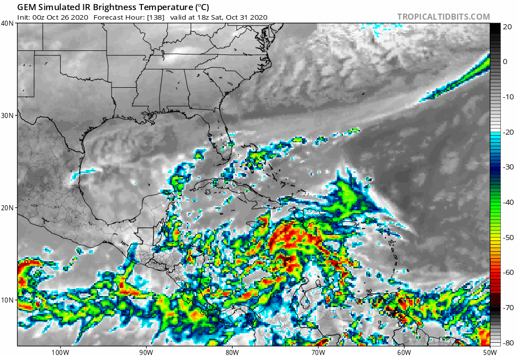
Here is your culprit the models are developing in the Caribbean.

0 likes
Re: Potential Eta's early November ETA (Let's break a forum record!)
18z GFS-P is another Hispaniola slop storm. I think the difference between the Euro/CMC solutions (WCar/SWCar development) and the GFS/GFS-P solutions (central/eastern Caribbean development) are due to the speed of the precursor wave after it reaches the Lesser Antilles. It’s important to note that the GFS models have Eta around Hispaniola at the same time the Euro and CMC have it developing in the WCar.
0 likes
Irene '11 Sandy '12 Hermine '16 5/15/2018 Derecho Fay '20 Isaias '20 Elsa '21 Henri '21 Ida '21
I am only a meteorology enthusiast who knows a decent amount about tropical cyclones. Look to the professional mets, the NHC, or your local weather office for the best information.
I am only a meteorology enthusiast who knows a decent amount about tropical cyclones. Look to the professional mets, the NHC, or your local weather office for the best information.
-
ElectricStorm
- Category 5
- Posts: 5157
- Age: 25
- Joined: Tue Aug 13, 2019 11:23 pm
- Location: Norman, OK
Re: Potential Eta's early November ETA
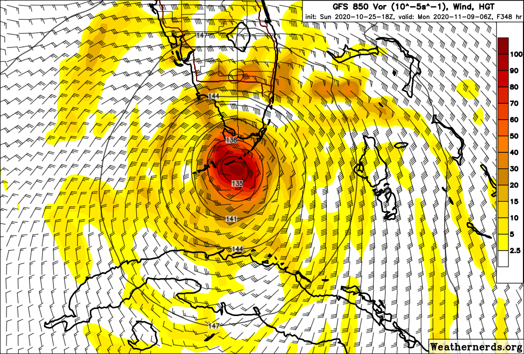
I haven't looked at the CMC as much as the other models but the 0z run has an intensifying storm at 963mb in the western Caribbean at the end of the run.
0z GFS has a Cat 2 grazing Jamaica before landfalling in Cuba.
0z GFS has a Cat 2 grazing Jamaica before landfalling in Cuba.
0 likes
B.S Meteorology, University of Oklahoma '25
Please refer to the NHC, NWS, or SPC for official information.
Please refer to the NHC, NWS, or SPC for official information.
-
CrazyC83
- Professional-Met

- Posts: 34316
- Joined: Tue Mar 07, 2006 11:57 pm
- Location: Deep South, for the first time!
Re: Potential Eta's early November ETA (Let's break a forum record!)
TheStormExpert wrote:SFLcane wrote::eek: Cuts up the spin.
https://i.postimg.cc/FFT5jkW7/69-AE8115-8254-49-CD-8-E2-E-106139-DB5322.png
Well we know this won’t happen!
Probably YET ANOTHER Northern Gulf Threat threat if I had to guess. Teleconnections do not support a deep trough drawing NE towards the Florida peninsula anytime soon. That SE Ridge will hold firm.
2020 is the Northern Gulf Coasts 2004 for Florida.
That would completely deviate from climatology. I can't think of a storm ever hitting Texas or Louisiana in November.
0 likes
Re: Tropical wave to move into the Caribbean for possible development
Still more likely to be Eta if named but it could be Theta if the low pressure near Bermuda birthes Eta instead. Credit to @aspen for reminding me of this area of possibility cyclogenesis.
0 likes
-
SFLcane
- S2K Supporter
- Posts: 10281
- Age: 48
- Joined: Sat Jun 05, 2010 1:44 pm
- Location: Lake Worth Florida
Re: Tropical wave to move into the Caribbean for possible early-November development
EPS had quite a few members hitting Florida.
https://twitter.com/mjventrice/status/1320680065064226817
https://twitter.com/mjventrice/status/1320680065064226817
0 likes
Who is online
Users browsing this forum: No registered users and 128 guests