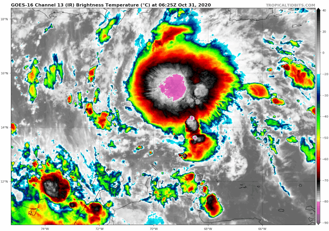
kevin wrote:Had to post this loop so it would be saved somewhere in the archives. I can't remember having seen this much pink before for a system that wasn't even designated as a TD or PTC yet.
https://imgur.com/jzOEtpJ
Shear clearly appears to be lessening, based on the “feathery” outflow concomitant with expansion and diffusion of the temperature gradient. The vector of the shear also appears to be changing from westerly to southerly, or at least seems to be backing. Given these trends, I think a depression or even a marginal storm could form overnight. This would clearly favour the HWRF and certain GFS ensemble members that show more organisation in the short term. This trend would also favour a slower, deeper system that curves earlier and does not track well inland from coastal Central America, given that the EC members both a) take 96L well inland over Central America and b) are generally weaker with 96L in the short term vs. the HWRF and some of the GFS ensemble members.