TheStormExpert wrote:Tropical Tidbits is down for some reason.
Working fine for me with some all new colors and features.
Moderator: S2k Moderators


TheStormExpert wrote:Tropical Tidbits is down for some reason.


SouthFLTropics wrote:TheStormExpert wrote:Tropical Tidbits is down for some reason.
Working fine for me with some all new colors and features.


Blown Away wrote:
Does the NHC even take this into consideration?
TheProfessor wrote:cp79 wrote:TheProfessor wrote:
It's not -removed- when there's actual evidence and support towards a solution. The GFS, GEFS, and CMC all support some kind of northward or northwest movement after the southern dive within the next 4-5 days, which isn't fantasy land. It's a legit scenario and depends on the strength of the system and timing of that shortwave trough over Louisiana. If it's earlier and or stronger it could very well prevent a CA landfall. The same goes for a stronger 29 and possibly feeling that weakness. What happens after that has many different ranges, but it's nonsense to chalk up these GFS runs as -removed- when they synoptic setup very well could allow for something similar and when there's currently ensemble support.
I don’t want to get into any fights. But it’s -removed- when people take 1 run run out of 100 that’s more than 7 days out and start drawing attention to Florida and how it’s time to panic. Like seriously. Relax. Let’s just focus on the next 3-4 days. That’s all I’m saying.
It hasn't been one run though, it's been 5 runs with GEFS support.


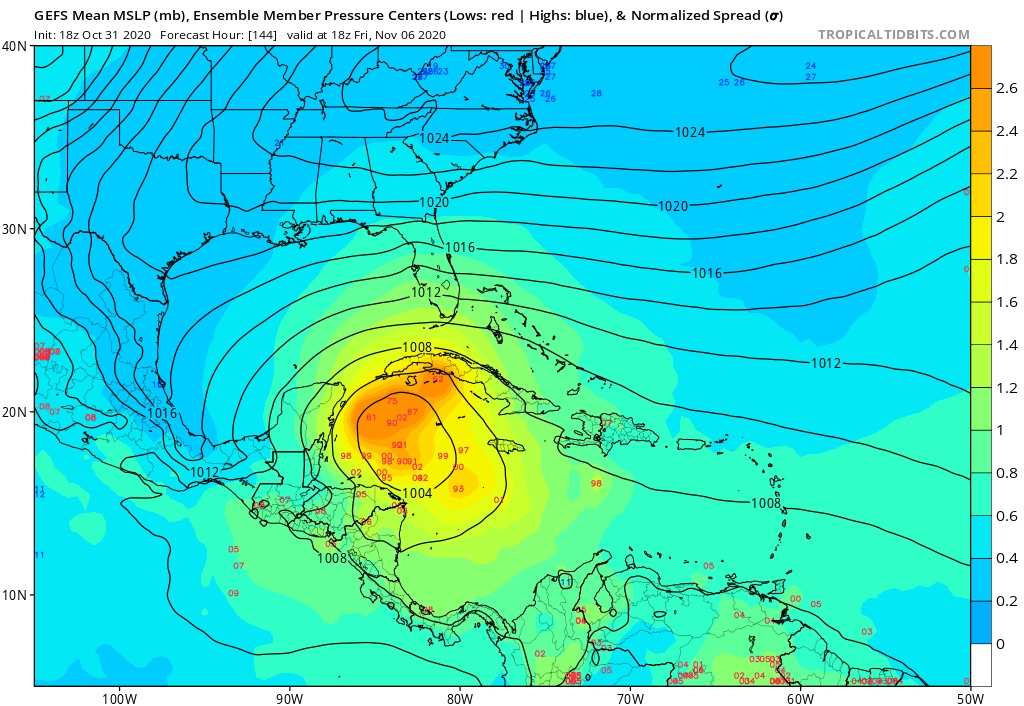
Spacecoast wrote:18z Spaghetti (courtesy of Tropical Atlantic)...
Euro, & it's ensembles not shown
*many are previous late cycle runs
(white is consensus of all shown)
https://i.ibb.co/pn8M5cr/Capture10031-G.jpg
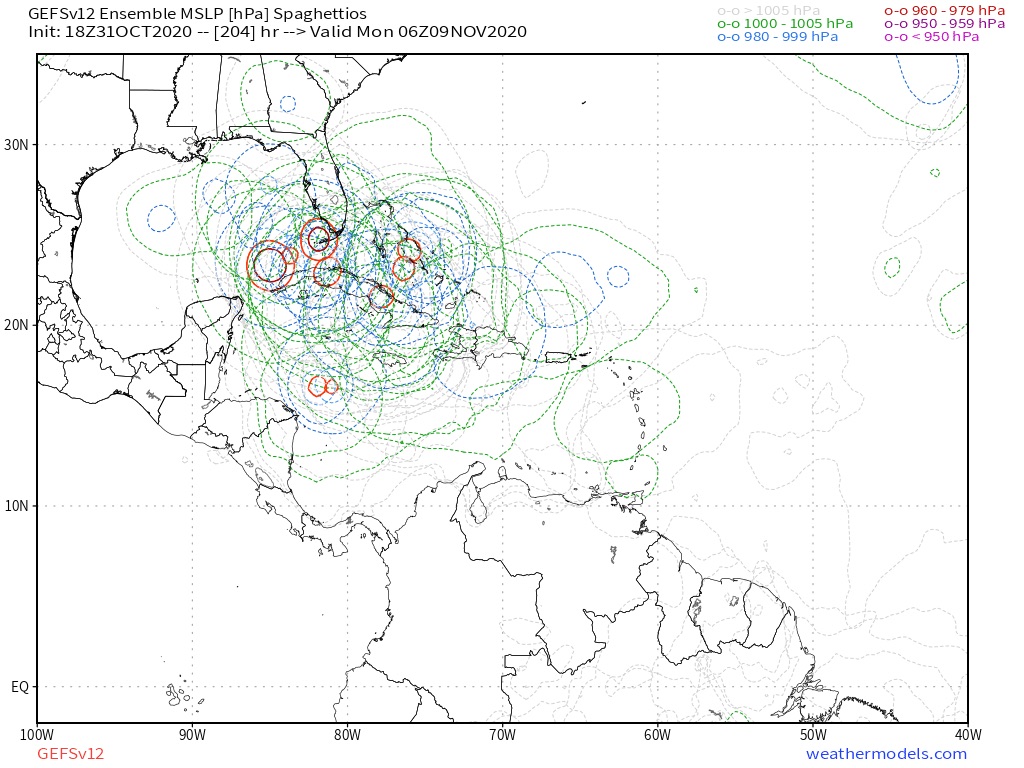
Same (with model labels)
APxx are GEFS members, AC00 is GEFS control. AVNO is Operational, AEMI is GEFS ensamble mean
https://i.ibb.co/v1z8pyK/Capture10031-H.jpg
Users browsing this forum: No registered users and 12 guests