ATL: ETA - Models
Moderator: S2k Moderators
-
SFLcane

- S2K Supporter

- Posts: 10281
- Age: 48
- Joined: Sat Jun 05, 2010 1:44 pm
- Location: Lake Worth Florida
Re: ATL: ETA - Models
12z hwrf heading north and east. Oh boy!
Last edited by SFLcane on Sun Nov 01, 2020 1:44 pm, edited 1 time in total.
6 likes

Re: ATL: ETA - Models
Recon should find much stronger winds in the northern quadrant because of its quick westward heading.

0 likes

Re: ATL: ETA - Models
SFLcane wrote:12z hwrf heading north and east. Oh boy!
https://i.postimg.cc/5NyZvCk4/582662-D5-E27-D-4-ECB-9216-3-FA1-F88-EDCB0.png
If Eta plays out similarly to the 12z HWRF run, it’s going to be a strong problems for DAYS, with several chances for RI into a Cat 4 or higher. The run ends with a recovered system once again bombing out. Stalling away from the coast might not rule out a Mitch-like scenario, and it would also add more problems for more areas.
0 likes
Irene '11 Sandy '12 Hermine '16 5/15/2018 Derecho Fay '20 Isaias '20 Elsa '21 Henri '21 Ida '21
I am only a meteorology enthusiast who knows a decent amount about tropical cyclones. Look to the professional mets, the NHC, or your local weather office for the best information.
I am only a meteorology enthusiast who knows a decent amount about tropical cyclones. Look to the professional mets, the NHC, or your local weather office for the best information.

-
AutoPenalti
- Category 5

- Posts: 4091
- Age: 29
- Joined: Mon Aug 17, 2015 4:16 pm
- Location: Ft. Lauderdale, Florida
Re: ATL: ETA - Models
I don’t care what anyone says, HWRF has been amazing this year.
2 likes
The posts in this forum are NOT official forecasts and should not be used as such. They are just the opinion of the poster and may or may not be backed by sound meteorological data. They are NOT endorsed by any professional institution or STORM2K. For official information, please refer to products from the NHC and NWS.
Model Runs Cheat Sheet:
GFS (5:30 AM/PM, 11:30 AM/PM)
HWRF, GFDL, UKMET, NAVGEM (6:30-8:00 AM/PM, 12:30-2:00 AM/PM)
ECMWF (1:45 AM/PM)
TCVN is a weighted averaged

Re: ATL: ETA - Models
LarryWx wrote:12Z UKMET: similar to NHC through landfall over Nicaragua though it never gets stronger than a low end cat 1 H per 994 mb pressure.
Current actual intensity is higher than the 12Z UKMET at peak
5 likes
-
Hypercane_Kyle

- Category 5
- Posts: 3465
- Joined: Sat Mar 07, 2015 7:58 pm
- Location: Cape Canaveral, FL
Re: ATL: ETA - Models
Worth noting the UKMET/Euro are showing an unrealistically weak storm vs. the GFS/HWRF. That may be, in part, why the Euro are further to the left with this system.
5 likes
My posts are my own personal opinion, defer to the National Hurricane Center (NHC) and other NOAA products for decision making during hurricane season.
-
Spacecoast

- Category 2

- Posts: 773
- Joined: Thu Aug 31, 2017 2:03 pm
Re: ATL: ETA - Models
AutoPenalti wrote:I don’t care what anyone says, HWRF has been amazing this year.
HWRF was good for Zeta, but OFCL, was a bit better...
Average Track Error (nautical miles):

Zeta Average Intensity Error (in knots)
HWRF
24hr: 7.7
48hr: 9.4
72hr: 15.7
96hr: 22.1
120hr: 32.1
3 likes

-
Blown Away

- S2K Supporter
- Posts: 10253
- Joined: Wed May 26, 2004 6:17 am
Re: ATL: ETA - Models
NDG wrote:https://i.imgur.com/LzZJDIv.png
It seems the Euro will have underestimated the strength of Eta in near term and nearly all those ensembles show a TD/weak TS at CA landfall. Wonder if this will have much influence over the operational track, Euro usually pretty solid within 72 hours and shows deep track into CA.
2 likes
Hurricane Eye Experience: David 79, Irene 99, Frances 04, Jeanne 04, Wilma 05… Hurricane Brush Experience: Andrew 92, Erin 95, Floyd 99, Matthew 16, Irma 17, Ian 22, Nicole 22…
Re: ATL: ETA - Models
NDG wrote:https://i.imgur.com/LzZJDIv.png
Looks to me like EPS is now ~ 40-60 on whether Eta keeps going WSW into EPac like UKMET or turns NW into Gulf of Honduras. Earlier runs were higher for Epac (more like 60-40% I think). So, somewhat of a trend away from moving to EPac for EPS.
Last edited by LarryWx on Sun Nov 01, 2020 3:06 pm, edited 2 times in total.
3 likes
Personal Forecast Disclaimer:
The posts in this forum are NOT official forecasts and should not be used as such. They are just the opinion of the poster and may or may not be backed by sound meteorological data. They are NOT endorsed by any professional institution or storm2k.org. For official information, please refer to the NHC and NWS products.
The posts in this forum are NOT official forecasts and should not be used as such. They are just the opinion of the poster and may or may not be backed by sound meteorological data. They are NOT endorsed by any professional institution or storm2k.org. For official information, please refer to the NHC and NWS products.
Re: ATL: ETA - Models
Would a stronger storm tend to move on a further N/NE track? That's what several here are saying. If so, why? How does the forecasted steering change, if any, when going up higher in the atmosphere?
0 likes
Personal Forecast Disclaimer:
The posts in this forum are NOT official forecasts and should not be used as such. They are just the opinion of the poster and may or may not be backed by sound meteorological data. They are NOT endorsed by any professional institution or storm2k.org. For official information, please refer to the NHC and NWS products.
The posts in this forum are NOT official forecasts and should not be used as such. They are just the opinion of the poster and may or may not be backed by sound meteorological data. They are NOT endorsed by any professional institution or storm2k.org. For official information, please refer to the NHC and NWS products.
-
SFLcane
- S2K Supporter
- Posts: 10281
- Age: 48
- Joined: Sat Jun 05, 2010 1:44 pm
- Location: Lake Worth Florida
Re: ATL: ETA - Models
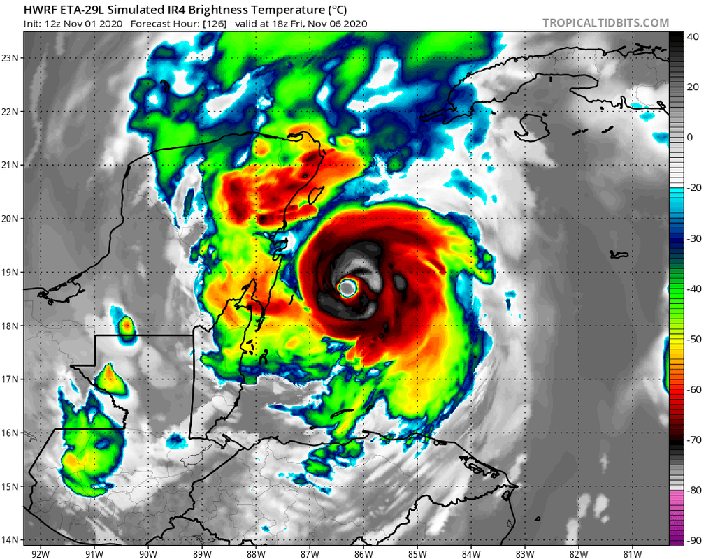
Euro ends with an intensifying storm heading north towards Florida. Here is another view of the hwrf

3 likes
-
TallahasseeMan
- Tropical Storm

- Posts: 120
- Joined: Sat Aug 01, 2020 1:49 pm
Re: ATL: ETA - Models
NDG wrote:https://i.imgur.com/LzZJDIv.png
https://www.tropicaltidbits.com/storminfo/29L_gefs_latest.png
GFS/Euro ensembles in good agreement that this gets back in the Caribbean
0 likes
Direct hit: Francis '04, Jeanne '04, Wilma '05 Hermine '16 Michael '18
Outer bands: Katrina '05 Irma '17
Outer bands: Katrina '05 Irma '17

Re: ATL: ETA - Models
Spacecoast wrote:AutoPenalti wrote:I don’t care what anyone says, HWRF has been amazing this year.
HWRF was good for Zeta, but OFCL, was a bit better...
Average Track Error (nautical miles):
https://i.ibb.co/9gfRpGP/Capture111e.jpg
So, this shows that for Zeta that the HWRF was the worst for track error for 72-120 hours out. That model has some really way off tracks sometimes.
0 likes
Personal Forecast Disclaimer:
The posts in this forum are NOT official forecasts and should not be used as such. They are just the opinion of the poster and may or may not be backed by sound meteorological data. They are NOT endorsed by any professional institution or storm2k.org. For official information, please refer to the NHC and NWS products.
The posts in this forum are NOT official forecasts and should not be used as such. They are just the opinion of the poster and may or may not be backed by sound meteorological data. They are NOT endorsed by any professional institution or storm2k.org. For official information, please refer to the NHC and NWS products.
-
Spacecoast
- Category 2
- Posts: 773
- Joined: Thu Aug 31, 2017 2:03 pm
Re: ATL: ETA - Models
LarryWx wrote:Spacecoast wrote:AutoPenalti wrote:I don’t care what anyone says, HWRF has been amazing this year.
HWRF was good for Zeta, but OFCL, was a bit better...
Average Track Error (nautical miles):
https://i.ibb.co/9gfRpGP/Capture111e.jpg
So, this shows that for Zeta that the HWRF was the worst for track error for 72-120 hours out. That model has some really way off tracks sometimes.
I wouldn't go that far... I only selected some of the guidance models.
Average track error for Zeta was 202 nm @72 hrs, &341 nm @240hrs. There were many guidance tracks that were worse.
I will say that accuracy really drops off for HWRF after 48hrs, and it is hard to beat OFCL for accuracy overall across all time frames
See for yourself..
Zeta Final Tracking error list for all models:
http://tropicalatlantic.com/models/models.cgi?basin=al&year=2020&storm=28&display=model_error&type=table&run=2020102918&error_type=average&interval=24&hour=120&position_unit=nm&intensity_unit=kts&show_cases=&heat_map=&hide_zero_hour=&model_toggle_option=&show_bearing=&trend=&show_trend_text=&zero_hour_within=10&intensity_option=&hide_model_names=&extra_info=2&sorting_error_method=&sorting_error_hour=72&sorting_error_option=1
0 likes
-
AutoPenalti
- Category 5
- Posts: 4091
- Age: 29
- Joined: Mon Aug 17, 2015 4:16 pm
- Location: Ft. Lauderdale, Florida
Re: ATL: ETA - Models
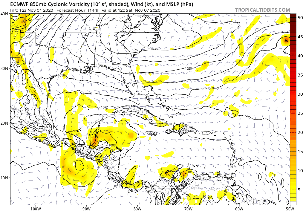
Is there a reason why this somehow intensifies over Cuba
1 likes
The posts in this forum are NOT official forecasts and should not be used as such. They are just the opinion of the poster and may or may not be backed by sound meteorological data. They are NOT endorsed by any professional institution or STORM2K. For official information, please refer to products from the NHC and NWS.
Model Runs Cheat Sheet:
GFS (5:30 AM/PM, 11:30 AM/PM)
HWRF, GFDL, UKMET, NAVGEM (6:30-8:00 AM/PM, 12:30-2:00 AM/PM)
ECMWF (1:45 AM/PM)
TCVN is a weighted averaged
Who is online
Users browsing this forum: No registered users and 21 guests