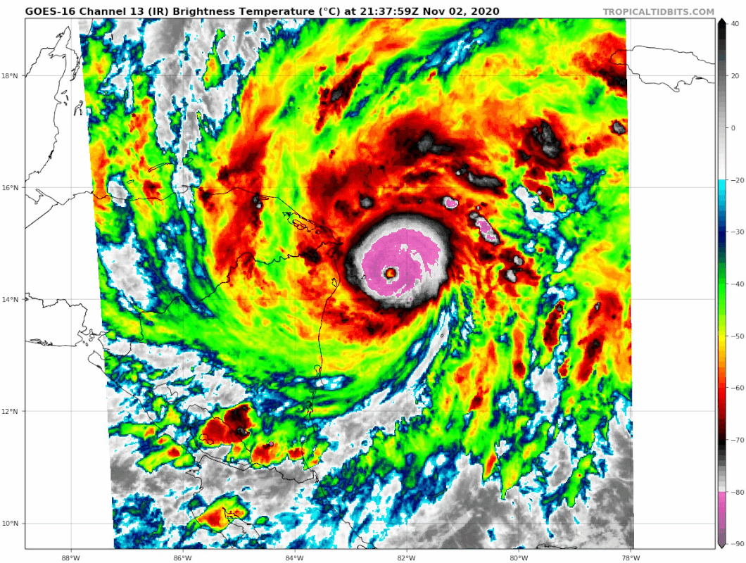
RL3AO wrote:It's looking better and better each frame. Eye becoming very round warmer. 7.5 seems very possible tonight.
I would think that's as high as it gets, it's running out of time now.
Moderator: S2k Moderators

RL3AO wrote:It's looking better and better each frame. Eye becoming very round warmer. 7.5 seems very possible tonight.
Cunxi Huang wrote:https://i.imgur.com/IpFPaT6.png https://i.imgur.com/eAeCeO2.png


NotoSans wrote:Aric Dunn wrote:RL3AO wrote:Only need the eye to warm and we're at 7.0
likely to small to fully clear for satellite estimates.
Have to disagree with this. GOES-16’s IR band resolution is at 2km, on par with Himawari-8. Goni a few days ago only have a 4nm eye and satellite is still able to depict a fully cleared-out WMG eye.
It may be the case before that satellite is unable to fully resolve a pinhole eye, but satellite resolution has improved so much that this difference is getting less and less significant.

RL3AO wrote:It's looking better and better each frame. Eye becoming very round warmer. 7.5 seems very possible tonight.
Chemmers wrote:Perfect pink ring around it now, history in the make maybe


SteveM wrote:RL3AO wrote:It's looking better and better each frame. Eye becoming very round warmer. 7.5 seems very possible tonight.
What does 7.5 mean, please?
CrazyC83 wrote:How strong is Eta now? If I were to make an estimate, I would go with 130 kt. Solid T6.5 when accounting for the fact that Dvorak does pinholes poorly.

Weather Dude wrote:SteveM wrote:RL3AO wrote:It's looking better and better each frame. Eye becoming very round warmer. 7.5 seems very possible tonight.
What does 7.5 mean, please?
It's the Dvorak T number estimate. T7.5 is a very powerful Cat 5
Weather Dude wrote:SteveM wrote:RL3AO wrote:It's looking better and better each frame. Eye becoming very round warmer. 7.5 seems very possible tonight.
What does 7.5 mean, please?
It's the Dvorak T number estimate. T7.5 is a very powerful Cat 5
Hammy wrote:Are we seriously not getting a pre-landfall pass? Looks like the plane turned around halfway there.
Users browsing this forum: No registered users and 24 guests


