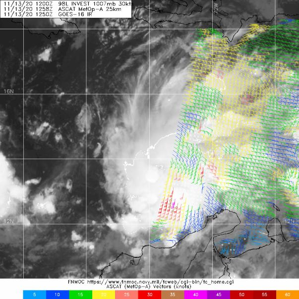
Owasso wrote:A-aand in the worst case of timeliness, the newest ASCAT pass has materialized.
https://i.postimg.cc/x1L3TMgf/image.png
How strong are the ASCAT measured winds?
Moderator: S2k Moderators


Owasso wrote:A-aand in the worst case of timeliness, the newest ASCAT pass has materialized.
https://i.postimg.cc/x1L3TMgf/image.png

Iceresistance wrote:DO WE HAVE 3 SYSTEMS ACTIVE AT ONCE!?
 (please correct me if I'm wrong). And they even mention that if it misses Honduras like HWRF and HMON show it could be even worse. I hope it won't be too bad for the areas affected, but I have a feeling that if it indeed misses Honduras this could be 2020's 'big one'. Pretty crazy considering we're in mid-November.
 AutoPenalti wrote:Iceresistance wrote:DO WE HAVE 3 SYSTEMS ACTIVE AT ONCE!?
No. Eta became post-Tropical.
The depression is moving west-southwestward at about 6 kt. A strong
mid-level ridge that lies over Florida and the western Atlantic
should steer the cyclone west-southwestward during the next 12 to 24
hours. After that time, the ridge is forecast to begin sliding
eastward, and a westward to west-northwestward motion should begin.
On the foreast track, the cyclone is expected to approach the
coast of Central America in 60-72 h. The track guidance is in good
agreement through the first couple of days, but there is increasing
cross-track spread after that time. The HMON, HWRF, and GFS show a
track near or north of the coast of Honduras after 72 hours, while
the ECMWF and UKMET are farther south. For now, the NHC track is
near the middle of the guidance envelope between the HFIP corrected
consensus model and the TCVA multi-model consensus.
kevin wrote:I can't remember seeing a 95 kt forecast in the very first advisory of any Atlantic storm this year

Iceresistance wrote:Owasso wrote:A-aand in the worst case of timeliness, the newest ASCAT pass has materialized.
https://i.postimg.cc/x1L3TMgf/image.png
How strong are the ASCAT measured winds?
Owasso wrote:Iceresistance wrote:Owasso wrote:A-aand in the worst case of timeliness, the newest ASCAT pass has materialized.
https://i.postimg.cc/x1L3TMgf/image.png
How strong are the ASCAT measured winds?
I can make out some 40kt barbs.


Owasso wrote:https://i.postimg.cc/2ygmTVq6/3-A4515-B1-3362-4-BC4-BAD6-A83167-DC7-B8-E.gif
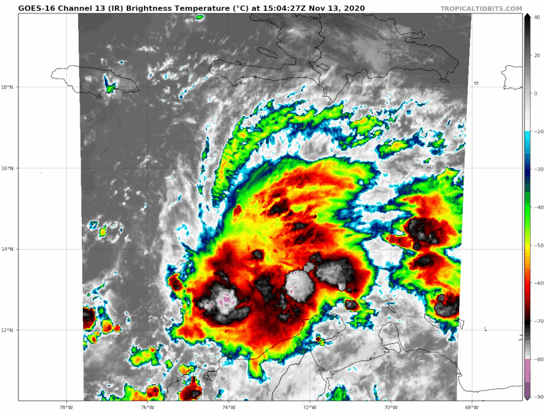
Already looks very impressive.
Owasso wrote:I know it sounds like a broken record at this point but this is probably 2020’s last chance to get a pretty powerful storm
SconnieCane wrote:Owasso wrote:I know it sounds like a broken record at this point but this is probably 2020’s last chance to get a pretty powerful storm
Laura and Eta already hit 130kt (and in the latter case, is a lower bound estimate).


AutoPenalti wrote:Iceresistance wrote:DO WE HAVE 3 SYSTEMS ACTIVE AT ONCE!?
No. Eta became post-Tropical.


Users browsing this forum: No registered users and 129 guests


