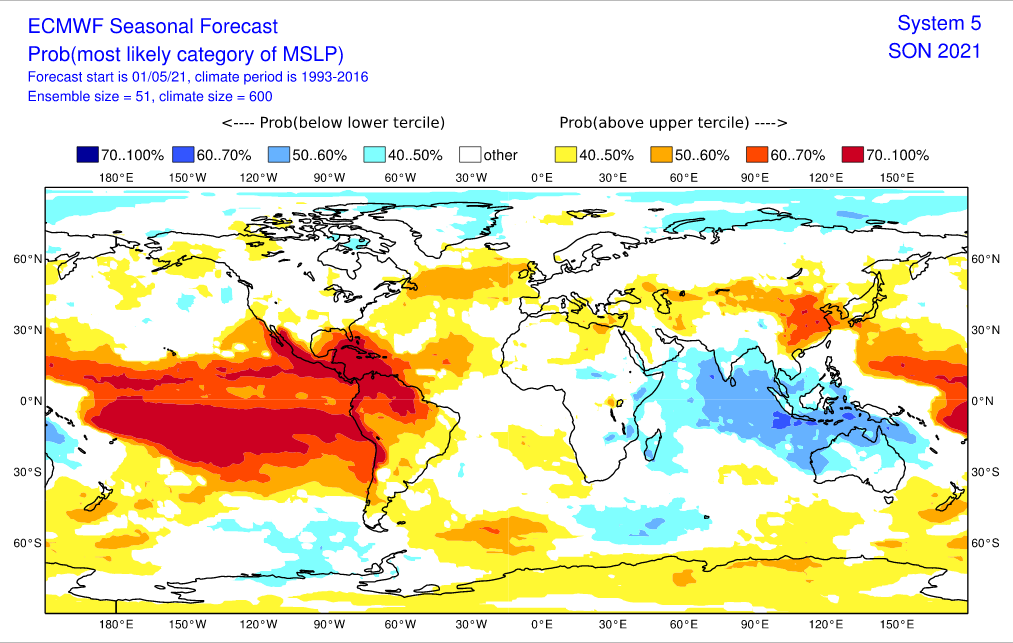
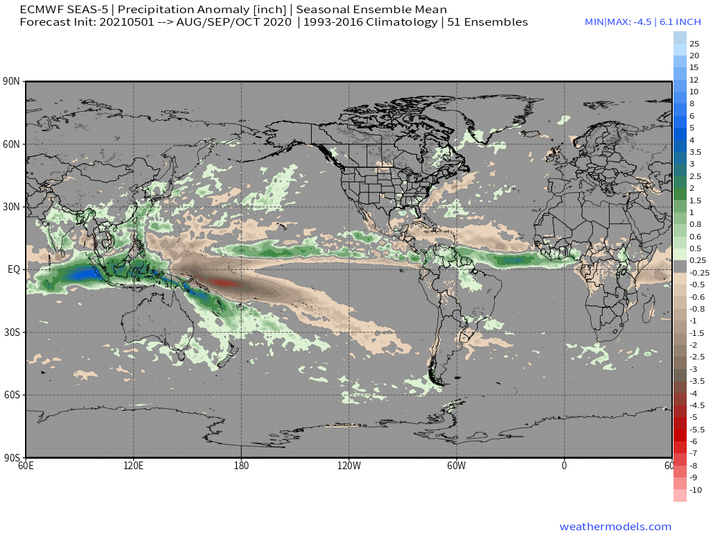
Warm neutral ENSO is not the same as warm ENSO (El Niño). The main point is that the EC indicates that the warmest SST in the equatorial Pacific will be in Niño 1+2 during ASO 2021. It also indicates the possibility of cooler-than-average SST in the MDR and Caribbean, along with warmer-than-average SST in the Gulf of Guinea. This is the opposite of what one would normally see during an active season. For example, in ASO 2020 the tropics featured a solid +AMO configuration, with negative anomalies over the Gulf of Guinea. Unlike in 2020, the MDR is not expected to the warmer than the rest of the (global) tropics, but rather cooler. Combined with a warm Niño 1+2, this would indicate enhanced TC activity over the EPAC, sinking air and increased VWS over the Caribbean/MDR, and an implied stronger TUTT, the last of which would weaken the subtropical ridge, thus allowing anything that enters the relatively favourable subtropics to curve OTS. In other words, the EC suggests an outcome similar to that of 2006, 2013, or 2019, regardless of its numbers. Finally, despite weaker-than-average trades over the past few weeks, SST in the tropical Atlantic have not changed significantly, if at all, suggesting a cooler subsurface than in 2020, regardless of the Canary Current being warmer. The main factor that will work toward an average or slightly-above-average season is the strong African monsoon, along with the neutral IOD. I still think we could see an average to slightly-above-average season, but certainly not a solidly-above-average or hyperactive one, based on current indicators. Reaching ACE of 150 or higher will be rather difficult. As for the CONUS, I think it is likely to escape significant impacts in 2021, but the Bahamas and/or the Canadian Maritimes could sustain at least one significant hit.


