hires showing more lime cordial on the runs.
Moderator: S2k Moderators


HurricaneFrances04 wrote:
That run will pull the Florida crew out of hibernation


That ridge has been locked in for 6 weeks thus our super droughty conditions on the east coast of sofla, of course that can change but persistence is the ruleCat5James wrote:South Floridian checking in… eagerly awaiting the 12Z model set.


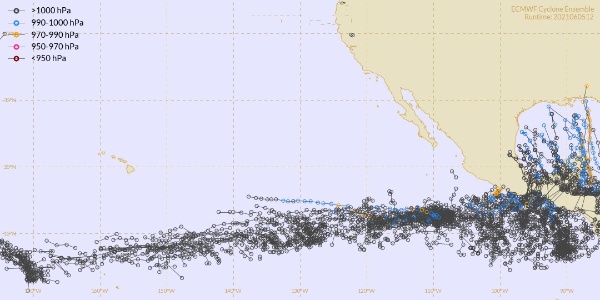
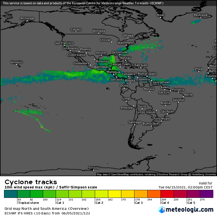
Hypercane_Kyle wrote:Looks like the typical GFS-on-crack vs ECMWF negative Nancy scenario. I think a sheared, 50-55 knot TS in the Gulf is a good possibility.
Hypercane_Kyle wrote:Looks like the typical GFS-on-crack vs ECMWF negative Nancy scenario. I think a sheared, 50-55 knot TS in the Gulf is a good possibility.

StPeteMike wrote:Hypercane_Kyle wrote:Looks like the typical GFS-on-crack vs ECMWF negative Nancy scenario. I think a sheared, 50-55 knot TS in the Gulf is a good possibility.
Fits with climatology. Though this could be a bunch of nothing to Cat 3 storm according the models. The CAG seems to be on overdrive though, so who knows what it will spit out.
Users browsing this forum: StPeteMike and 228 guests


