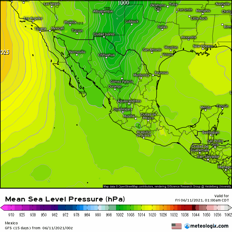
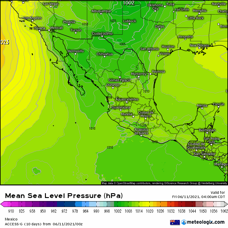
The GFS is still the most consistent model:
Generating
Fake
Storms
Watching Bay of Campeche & SW Gulf Next Week (Is Invest 92L)
Moderator: S2k Moderators
Forum rules

The posts in this forum are NOT official forecasts and should not be used as such. They are just the opinion of the poster and may or may not be backed by sound meteorological data. They are NOT endorsed by any professional institution or STORM2K. For official information, please refer to products from the National Hurricane Center and National Weather Service.
-
johngaltfla

- Category 5

- Posts: 2073
- Joined: Sun Jul 10, 2005 9:17 pm
- Location: Sarasota County, FL
- Contact:
Re: Watching SW Caribbean
4 likes
-
OuterBanker
- S2K Supporter

- Posts: 1761
- Joined: Wed Feb 26, 2003 10:53 am
- Location: Nags Head, NC
- Contact:
Re: Watching SW Caribbean
I know it might be a bit premature but I may as well get the ball rolling.
IT'S DEAD JIM
IT'S DEAD JIM
5 likes
-
AtlanticWind

- S2K Supporter
- Posts: 1898
- Age: 67
- Joined: Sun Aug 08, 2004 9:57 pm
- Location: Plantation,Fla
Re: Watching SW Caribbean
OuterBanker wrote:I know it might be a bit premature but I may as well get the ball rolling.
IT'S DEAD JIM
Was it ever alive ?
1 likes
-
EquusStorm
- Category 5
- Posts: 1649
- Age: 35
- Joined: Thu Nov 07, 2013 1:04 pm
- Location: Jasper, AL
- Contact:
Re: Watching SW Caribbean
Tried one last time to spin up as it came ashore looks like, but too little too late. Nicaragua can't catch much of a break though

2 likes
Colors of lost purpose on the canvas of irrelevance
Not a meteorologist, in fact more of an idiot than anything. You should probably check with the NHC or a local NWS office for official information.
Not a meteorologist, in fact more of an idiot than anything. You should probably check with the NHC or a local NWS office for official information.
-
rolltide

- Tropical Storm

- Posts: 234
- Age: 65
- Joined: Thu Sep 09, 2004 5:33 pm
- Location: Pensacola Florida
Re: Watching SW Caribbean
It's not expected to do anything until it moves northward into the southern GOM mid to late next week. It may not do anything then either.
1 likes

Re: Watching SW Caribbean
rolltide wrote:It's not expected to do anything until it moves northward into the southern GOM mid to late next week. It may not do anything then either.
That's a different system, currently in the East Pacific being monitored by the NHC for formation there (first).
0 likes
Kendall -> SLO -> PBC
Memorable Storms: Katrina (for its Florida landfall...) Wilma Matthew Irma
Memorable Storms: Katrina (for its Florida landfall...) Wilma Matthew Irma
-
rolltide
- Tropical Storm
- Posts: 234
- Age: 65
- Joined: Thu Sep 09, 2004 5:33 pm
- Location: Pensacola Florida
Re: Watching SW Caribbean
It's not expected to do anything until it moves northward into the southern GOM mid to late next week. It may not do anything then either.
That's a different system, currently in the East Pacific being monitored by the NHC for formation there (first).
That is not what I have been seeing or hearing. Can you provide a source? Thanks.
0 likes
Re: Watching SW Caribbean
rolltide wrote:It's not expected to do anything until it moves northward into the southern GOM mid to late next week. It may not do anything then either.
That's a different system, currently in the East Pacific being monitored by the NHC for formation there (first).
That is not what I have been seeing or hearing. Can you provide a source? Thanks.
The latest euro run has the NHC-tracked vorticity in the Pacific develop before crossing the Isthmus of Tehuantepec. It then develops Gulf side and interacts with this energy/a tropical wave to form a broad tropical low (the gfs is very similar). All this development potential is tied to a 'favorable circulation environment' and soon-to-be highly enhanced convection over Central America (https://www.cpc.ncep.noaa.gov/products/precip/CWlink/ghazards/). Considering that, individual systems are not as important to follow at this point as the general environment, and the specific impulse for Gulf formation has already shifted a few times among the big globals. So both of our claims are kinda disingenuous

1 likes
Kendall -> SLO -> PBC
Memorable Storms: Katrina (for its Florida landfall...) Wilma Matthew Irma
Memorable Storms: Katrina (for its Florida landfall...) Wilma Matthew Irma

Re: Watching SW Caribbean
Starting to look like an area of interest on tonite's satellite images.
I am surprised the NHC is not mentioning it in the 5 day out look based on the satellite presentation.
I am surprised the NHC is not mentioning it in the 5 day out look based on the satellite presentation.
1 likes
-
JW-_-
Re: Watching SW Caribbean
Cross over into the GOM GFS sees a cane. Likely I posted in the wrong thread. Just a heads up.
1 likes

Re: Watching SW Caribbean
Can we change the heading or do we want started a new thread for the lemoned area
ZCZC MIATWOAT ALL
TTAA00 KNHC DDHHMM
Tropical Weather Outlook
NWS National Hurricane Center Miami FL
800 AM EDT Fri Jun 11 2021
For the North Atlantic...Caribbean Sea and the Gulf of Mexico:
1. A trough of low pressure is expected to form early next week over
the Bay of Campeche and the southwestern Gulf of Mexico. Subsequent
slow development of this system is possible as it drifts
northwestward to northward.
* Formation chance through 48 hours...low...near 0 percent.
* Formation chance through 5 days...low...20 percent.
Forecaster Beven
1 likes
The following post is NOT an official forecast and should not be used as such. It is just the opinion of the poster and may or may not be backed by sound meteorological data. It is NOT endorsed by any professional institution including storm2k.org For Official Information please refer to the NHC and NWS products.

Re: Watching SW Caribbean
Salute!
Yep, the pesky Bay of Campeche may strike. Normally I don't look much there until later in the season, as most storms I have witnessed until September or so seem to come from north Caribb or SE Gulf from a wave. Oh well, we shall see.
Gums sends...
Yep, the pesky Bay of Campeche may strike. Normally I don't look much there until later in the season, as most storms I have witnessed until September or so seem to come from north Caribb or SE Gulf from a wave. Oh well, we shall see.
Gums sends...
4 likes

Watching Bay of Campeche & SW Gulf Next Week
Good point Tailgator, especially in light of NHC appropriately shifting their focus to the BOC for potential development late next week. I think that under normal circumstances creating a new thread minus an actual area of disturbed weather there at the moment might be pre-mature, however the SW Caribbean impulse is also moving westward into that region.
0 likes
Andy D
(For official information, please refer to the NHC and NWS products.)
(For official information, please refer to the NHC and NWS products.)
Watching Bay of Campeche & SW Gulf Next Week
I just tried but I'm not sure if anyone other then Cycloneye can actually change the Thread Header title since he started the thread
0 likes
Andy D
(For official information, please refer to the NHC and NWS products.)
(For official information, please refer to the NHC and NWS products.)
-
wxman57

- Moderator-Pro Met

- Posts: 23175
- Age: 68
- Joined: Sat Jun 21, 2003 8:06 pm
- Location: Houston, TX (southwest)
Watching Bay of Campeche & SW Gulf Next Week
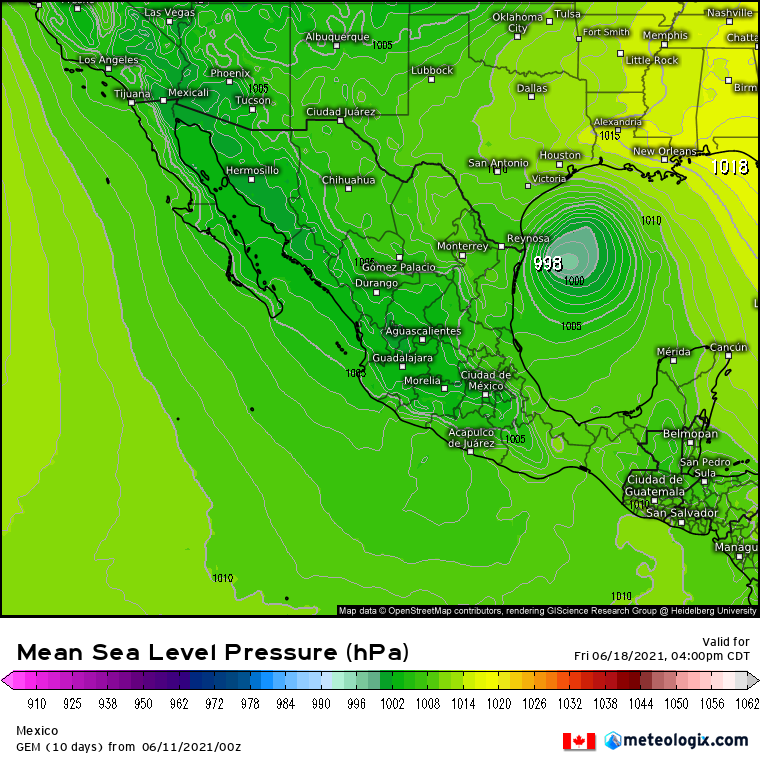
I changed the thread title. I'm becoming confident in what will happen next week. Squalls will increase in the BoC by next Monday/Tuesday. All models are now in very good agreement on the timing of development and the track. Still some disagreement on the intensity, but shear will be a factor. A low center will develop Tue-Wed and track northward, generally toward the upper TX coast or the SW LA coast. The NHC will classify this low as a depression Thursday morning and likely a TS prior to its moving ashore Fri/Sat, once recon finds a small area of TS winds. It will be a sheared, weak TS with heavy rainfall being the primary threat to TX/LA.
7 likes
-
lrak

- S2K Supporter
- Posts: 1770
- Age: 59
- Joined: Thu Jun 21, 2007 2:48 pm
- Location: Corpus Christi, TX
Re: Watching Bay of Campeche & SW Gulf Next Week
Love to read the words "sheared and weak." Keeping fingers crossed.
1 likes
AKA karl
Also
Personal Forecast Disclaimer:
My posts on this forum are NOT official forecast and should not be used as such. My posts are my basic observations and are definitely not backed by any "well some" meteorological knowledge. For official information, please refer to the NHC and NWS products.
Also
Personal Forecast Disclaimer:
My posts on this forum are NOT official forecast and should not be used as such. My posts are my basic observations and are definitely not backed by any "well some" meteorological knowledge. For official information, please refer to the NHC and NWS products.
-
USTropics
- Professional-Met

- Posts: 2739
- Joined: Sun Aug 12, 2007 3:45 am
- Location: Florida State University
Re: Watching Bay of Campeche & SW Gulf Next Week
Here are some new ECMWF ensemble products, TC genesis for the next 5 days:

ECMWF TS strike probability for next 9 days:

GFS Probability of development:

ECWMF ensemble tracks:

GFS ensemble tracks:

source: https://apps.ecmwf.int/webapps/opencharts/products/medium-tc-genesis?base_time=202106110000&layer_name=genesis_td&projection=opencharts_atl&valid_time=202106160000
ECMWF TS strike probability for next 9 days:
GFS Probability of development:
ECWMF ensemble tracks:
GFS ensemble tracks:
source: https://apps.ecmwf.int/webapps/opencharts/products/medium-tc-genesis?base_time=202106110000&layer_name=genesis_td&projection=opencharts_atl&valid_time=202106160000
5 likes
Re: Watching Bay of Campeche & SW Gulf Next Week
Pretty notable uptick on the 12z EPS.

0 likes
Kendall -> SLO -> PBC
Memorable Storms: Katrina (for its Florida landfall...) Wilma Matthew Irma
Memorable Storms: Katrina (for its Florida landfall...) Wilma Matthew Irma
-
Ivanhater

- Storm2k Moderator

- Posts: 11221
- Age: 39
- Joined: Fri Jul 01, 2005 8:25 am
- Location: Pensacola
Re: Watching Bay of Campeche & SW Gulf Next Week
12Z suite


Sent from my LM-G900TM using Tapatalk
Sent from my LM-G900TM using Tapatalk
1 likes
Michael
-
cycloneye

- Admin

- Posts: 149508
- Age: 69
- Joined: Thu Oct 10, 2002 10:54 am
- Location: San Juan, Puerto Rico
Watching Bay of Campeche & SW Gulf Next Week
wxman57 wrote:I changed the thread title. I'm becoming confident in what will happen next week. Squalls will increase in the BoC by next Monday/Tuesday. All models are now in very good agreement on the timing of development and the track. Still some disagreement on the intensity, but shear will be a factor. A low center will develop Tue-Wed and track northward, generally toward the upper TX coast or the SW LA coast. The NHC will classify this low as a depression Thursday morning and likely a TS prior to its moving ashore Fri/Sat, once recon finds a small area of TS winds. It will be a sheared, weak TS with heavy rainfall being the primary threat to TX/LA.
Thank you for the edit. I was without power and internet for 24 hours as a explosión happened at an important substation.
1 likes
Visit the Caribbean-Central America Weather Thread where you can find at first post web cams,radars
and observations from Caribbean basin members Click Here
and observations from Caribbean basin members Click Here
Who is online
Users browsing this forum: No registered users and 495 guests