Good writeup on the summer outlook:
https://spacecityweather.com/heres-the- ... and-texas/
Texas Summer 2021
Moderator: S2k Moderators
Forum rules

The posts in this forum are NOT official forecast and should not be used as such. They are just the opinion of the poster and may or may not be backed by sound meteorological data. They are NOT endorsed by any professional institution or STORM2K.
-
jasons2k

- Storm2k Executive

- Posts: 8290
- Age: 52
- Joined: Wed Jul 06, 2005 12:32 pm
- Location: The Woodlands, TX
Re: Texas Summer 2021
1 likes
-
captainbarbossa19

- Professional-Met

- Posts: 1094
- Age: 27
- Joined: Wed Aug 21, 2019 11:09 pm
- Location: Beaumont, TX
Re: Texas Summer 2021
Somehow I suspect that this dry trend going on now is going to be temporary. I think mid-late June is going to shift back to a wetter state. It seems that models are indicating that moisture levels will begin to increase starting next week.
2 likes
-
jasons2k
- Storm2k Executive
- Posts: 8290
- Age: 52
- Joined: Wed Jul 06, 2005 12:32 pm
- Location: The Woodlands, TX
Re: Texas Summer 2021
captainbarbossa19 wrote:Somehow I suspect that this dry trend going on now is going to be temporary. I think mid-late June is going to shift back to a wetter state. It seems that models are indicating that moisture levels will begin to increase starting next week.
Probably so. I’m imminently breaking ground on a new pool so I need it to dry out some. Not something I would usually ever would wish for, especially in summer, but this is a special (selfish) circumstance. I want my pool more than more rain right now.
3 likes


Re: Texas Summer 2021
Soil moisture is really saving us right in a bubble. The western US and midwest drought is fueling massive heat domes in those areas and they are experiencing feedback.
Given the proximity of the potential massive heat domes nearby I suspect we may see some short bouts of hot temperatures this summer but nothing sustained due to the wet soils and recent rainfall at least through mid season. The ridges have oomph to them due to the extreme drought in the southwest.
Given the proximity of the potential massive heat domes nearby I suspect we may see some short bouts of hot temperatures this summer but nothing sustained due to the wet soils and recent rainfall at least through mid season. The ridges have oomph to them due to the extreme drought in the southwest.
3 likes
The above post and any post by Ntxw is NOT an official forecast and should not be used as such. It is just the opinion of the poster and may or may not be backed by sound meteorological data. It is NOT endorsed by any professional institution including Storm2k. For official information, please refer to NWS products.
Help support Storm2K!
-
TeamPlayersBlue

- Category 5

- Posts: 3529
- Joined: Tue Feb 02, 2010 1:44 am
- Location: Denver/Applewood, CO
Re: Texas Summer 2021
Ntxw wrote:Soil moisture is really saving us right in a bubble. The western US and midwest drought is fueling massive heat domes in those areas and they are experiencing feedback.
Given the proximity of the potential massive heat domes nearby I suspect we may see some short bouts of hot temperatures this summer but nothing sustained due to the wet soils and recent rainfall at least through mid season. The ridges have oomph to them due to the extreme drought in the southwest.
I remember you bringing this up years ago and I completely agree with this theory. The soil moisture, the green landscape continuing to pump moisture into the air, will prevent a heat dome from forming over Texas this month. Hopefully there can be another wet period for a few days within the next couple weeks, and this trait can hold all summer.
2 likes
Personal Forecast Disclaimer:
The posts in this forum are NOT official forecast and should not be used as such. They are just the opinion of the poster and may or may not be backed by sound meteorological data. They are NOT endorsed by any professional institution or storm2k.org. For official information, please refer to the NHC and NWS products.
The posts in this forum are NOT official forecast and should not be used as such. They are just the opinion of the poster and may or may not be backed by sound meteorological data. They are NOT endorsed by any professional institution or storm2k.org. For official information, please refer to the NHC and NWS products.
-
rwfromkansas
- Category 5
- Posts: 3028
- Joined: Sat Aug 27, 2005 12:47 am
- Location: North Fort Worth
Re: Texas Summer 2021
We are considering a trip to the upper Midwest in July to escape the heat. Lol. It may be hotter there.
1 likes
-
captainbarbossa19
- Professional-Met
- Posts: 1094
- Age: 27
- Joined: Wed Aug 21, 2019 11:09 pm
- Location: Beaumont, TX
Re: Texas Summer 2021
TeamPlayersBlue wrote:Ntxw wrote:Soil moisture is really saving us right in a bubble. The western US and midwest drought is fueling massive heat domes in those areas and they are experiencing feedback.
Given the proximity of the potential massive heat domes nearby I suspect we may see some short bouts of hot temperatures this summer but nothing sustained due to the wet soils and recent rainfall at least through mid season. The ridges have oomph to them due to the extreme drought in the southwest.
I remember you bringing this up years ago and I completely agree with this theory. The soil moisture, the green landscape continuing to pump moisture into the air, will prevent a heat dome from forming over Texas this month. Hopefully there can be another wet period for a few days within the next couple weeks, and this trait can hold all summer.
Yes. I remember in one of the meteorology courses I took that a forecaster should be cognizant of the surrounding terrain because it can affect the daily afternoon temperatures. If the landscape is greener than normal, temperatures can be a few degrees cooler in the summer than if the landscape is browner. Also, a lot of atmospheric moisture originates from the local ground.
0 likes
Re: Texas Summer 2021
TeamPlayersBlue wrote:Ntxw wrote:Soil moisture is really saving us right in a bubble. The western US and midwest drought is fueling massive heat domes in those areas and they are experiencing feedback.
Given the proximity of the potential massive heat domes nearby I suspect we may see some short bouts of hot temperatures this summer but nothing sustained due to the wet soils and recent rainfall at least through mid season. The ridges have oomph to them due to the extreme drought in the southwest.
I remember you bringing this up years ago and I completely agree with this theory. The soil moisture, the green landscape continuing to pump moisture into the air, will prevent a heat dome from forming over Texas this month. Hopefully there can be another wet period for a few days within the next couple weeks, and this trait can hold all summer.
Over the years of just summer watching and through reading various papers, there's about two dominant/semi permanent ridges in the summer time. The Sonoran (southwest desert) and the Bermuda (Atlantic driven) ridges that permeate back and forth. Their strength and duration is often a seesaw depending on several things including feedback from drought. During heavy stricken drought years in Texas both ridges likes to flex over us and linger which creates the extremely hot summers. When the region is wet and ample soil moisture they tend to get beaten down and are transient over the state.
So to get the heat waves from these ridges, when in doubt follow drought.
1 likes
The above post and any post by Ntxw is NOT an official forecast and should not be used as such. It is just the opinion of the poster and may or may not be backed by sound meteorological data. It is NOT endorsed by any professional institution including Storm2k. For official information, please refer to NWS products.
Help support Storm2K!
Help support Storm2K!
-
jasons2k
- Storm2k Executive
- Posts: 8290
- Age: 52
- Joined: Wed Jul 06, 2005 12:32 pm
- Location: The Woodlands, TX
Re: Texas Summer 2021
Morning update from Jeff Lindner:
Impressive heat ridge of high pressure is building over the SW US and will continue to build into the weekend and next week with heights of potentially 600dm located over portions of Utah, Arizona, and New Mexico. This ridge extends NE into the US central plains with SE TX on the east/southeast side of the heat dome. This high pressure ridge will influence our weather into the weekend, but then begins to retreat toward the W and NW by late in the weekend and early next week allowing disturbances to approach from the NE as early as Sunday afternoon with increasing chances of showers and thunderstorms. Will have to keep an eye on this period as sometimes these “NE flow” event can produce some strong and severe thunderstorms over the region.
Gulf of Mexico Late Next Week:
There is and has been “lots” of talk about the potential for some sort of tropical system to form in the southern Gulf of Mexico late next week. Global model solutions continue with the 00Z runs to show surface low pressure forming in the southern Gulf of Mexico toward the middle to end of next week and then moving generally northward. This system appears to evolve from the current area of disturbed weather in the Eastern Pacific south of Mexico. While there is a lot to be worked out on the “when” and “where” and “how organized” there continues to be enough consistency in the guidance to signal that something may develop. Regardless of development a significant surge of tropical moisture looks at least possible toward the NW Gulf/Texas by the end of next week with at the very least an increase in rain chances. For now something to monitor in the coming days.
A good reminder we are in hurricane season and now is a good time to make sure your plans and kits are fully stocked and ready for any potential threats that we may face this season.
Jeff Lindner
Director Hydrologic Operations Division/Meteorologist
Harris County Flood Control District
1 likes
-
bubba hotep

- S2K Supporter

- Posts: 6013
- Joined: Wed Dec 28, 2016 1:00 am
- Location: Collin County Texas
Re: Texas Summer 2021
18z 3k NAM and latest HRRR both show the Oklahoma MCS making a run at North Texas late tonight into tomorrow morning.
1 likes
Winter time post are almost exclusively focused on the DFW area.
Re: Texas Summer 2021
bubba hotep wrote:18z 3k NAM and latest HRRR both show the Oklahoma MCS making a run at North Texas late tonight into tomorrow morning.
Bueno. Hopefully the cap can break down just enough for the storms. I'm already counting the days until the first fall front in September.
1 likes

Re: Texas Summer 2021
bubba hotep wrote:18z 3k NAM and latest HRRR both show the Oklahoma MCS making a run at North Texas late tonight into tomorrow morning.
She survived! Packing a punch too.
1 likes
-
bubba hotep
- S2K Supporter
- Posts: 6013
- Joined: Wed Dec 28, 2016 1:00 am
- Location: Collin County Texas
Re: Texas Summer 2021
DonWrk wrote:bubba hotep wrote:18z 3k NAM and latest HRRR both show the Oklahoma MCS making a run at North Texas late tonight into tomorrow morning.
She survived! Packing a punch too.
Not what I expected the radar to look like this morning!

2 likes
Winter time post are almost exclusively focused on the DFW area.
-
bubba hotep
- S2K Supporter
- Posts: 6013
- Joined: Wed Dec 28, 2016 1:00 am
- Location: Collin County Texas
Re: Texas Summer 2021
12z FWD sounding showed a huge CAP in place but nearly 4,000 CAPE! So these storms have plenty of fuel to tap into as long as they can access it.
Looking South as the storms move in.
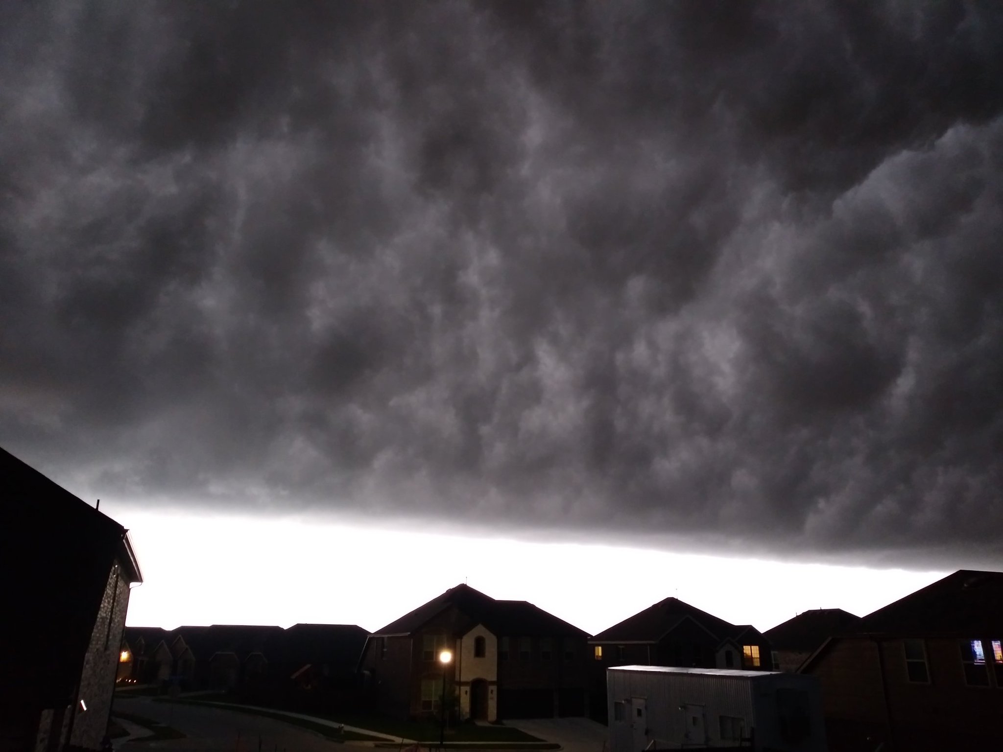
Looking South as the storms move in.
3 likes
Winter time post are almost exclusively focused on the DFW area.
-
bubba hotep
- S2K Supporter
- Posts: 6013
- Joined: Wed Dec 28, 2016 1:00 am
- Location: Collin County Texas
Re: Texas Summer 2021
Models... both the 06z 3K NAM and the 09z HRRR showed these storms dying before reaching DFW lol
ETA: Technically, it looks like storms did miss the airport, so no official rainfall recorded for these storms. Also, they just spit a massive outflow and collapsed as they moved out of Collin County.
ETA: Technically, it looks like storms did miss the airport, so no official rainfall recorded for these storms. Also, they just spit a massive outflow and collapsed as they moved out of Collin County.
0 likes
Winter time post are almost exclusively focused on the DFW area.
-
rwfromkansas
- Category 5
- Posts: 3028
- Joined: Sat Aug 27, 2005 12:47 am
- Location: North Fort Worth
-
captainbarbossa19
- Professional-Met
- Posts: 1094
- Age: 27
- Joined: Wed Aug 21, 2019 11:09 pm
- Location: Beaumont, TX
Re: Texas Summer 2021
TeamPlayersBlue wrote:I wanted to let you guys know that I have moved to Denver Colorado! Actually more in Lakewood but whatever. I will still be active in this board and interested in Texas weather so I'm not leaving entirely, just wanted to let you guys know!
Yes, stick around and join us from time to time. Good luck to you up there and in the meantime fire up the Colorado thread!!!
0 likes
-
aggiecutter
- Category 5
- Posts: 1755
- Joined: Thu Oct 14, 2004 9:22 pm
- Location: Texarkana
Re: Texas Summer 2021
Where did this come from. The high today was supposed to be 94. I've double checked. That is not a mistake. You can feel it when you walk outside.

1 likes
Re: Texas Summer 2021
aggiecutter wrote:Where did this come from. The high today was supposed to be 94. I've double checked. That is not a mistake. You can feel it when you walk outside.
[url]https://i.ibb.co/n6rHmjB/HOT.png [/url]
From my posts above you can tell this ridge is very powerful being fed by the exceptional drought out west. 600dm heights is mid to late summer material in the hottest dog days. If not for the rain recently we'd all be well over 100!
0 likes
The above post and any post by Ntxw is NOT an official forecast and should not be used as such. It is just the opinion of the poster and may or may not be backed by sound meteorological data. It is NOT endorsed by any professional institution including Storm2k. For official information, please refer to NWS products.
Help support Storm2K!
Help support Storm2K!
Return to “USA & Caribbean Weather”
Who is online
Users browsing this forum: AnnularCane, Brent, Google [Bot] and 57 guests