

Ubuntwo wrote:Shell Mound wrote:Category5Kaiju wrote:https://cyclonicwx.com/data/sst/crw_ssta_global.png
Well, looks like the Atlantic was listening to all of us mock it for its cool MDR and is trying to show something a *bit* different
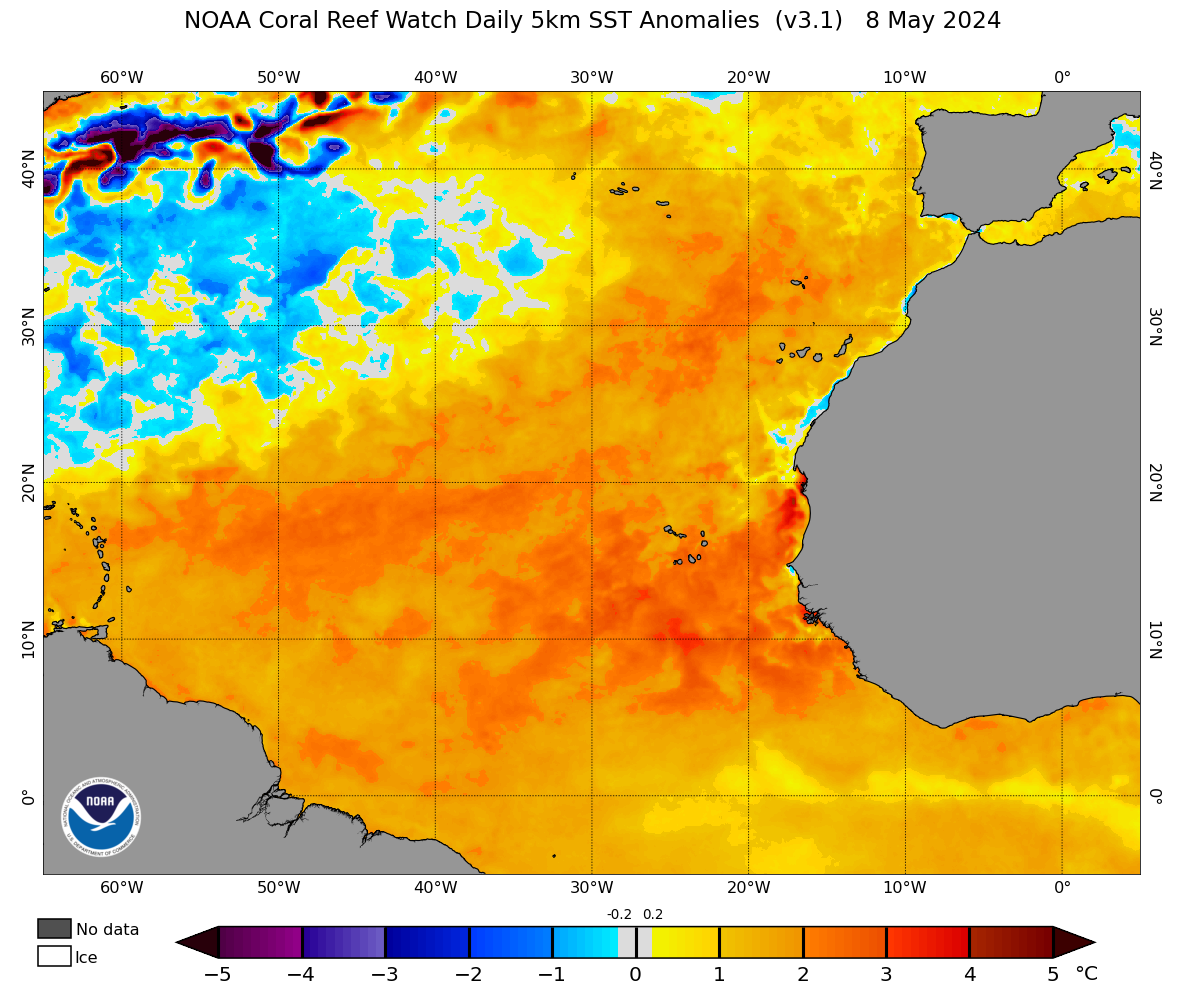
Here's a closer look at what is going on with the MDR:
https://coralreefwatch.noaa.gov/data_current/5km/v3.1_op/daily/png/ct5km_ssta_v3.1_nwel_current.png
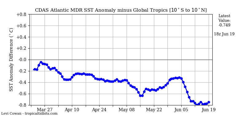
The warming has already stopped and cooling has resumed, according to the latest CDAS data. Additionally, the ongoing WWB is expected to be short-lived and migrate westward, so it is related to the CCKW/MJO passage rather than the ASW. So far there are absolutely no indicators of a substantial long-term warmup, and even the ASW will be insufficient to totally negate the -AMM signature and Atlantic Niño. We will need to see significant, sustained, continuous low-level westerlies to ensure a hyperactive Atlantic season that meets CSU’s call for ACE of ≥ 150. At this point ACE of ≤ 130 seems most plausible.
The MDR is still warming, at least for now.
3 day change in SST:
https://cdn.discordapp.com/attachments/289981599448039425/855128039180468226/oisst_diff_3d_tropatl_2021061600.png
Really, there's more to activity than a 1C difference in sea surface profile, 2+ months before peak season. For Gulf and Caribbean systems SST is almost never an inhibiting factor. A very active WAM, below avg shear, and favorable velocities through ASO look to have a much more profound impact. We might see not see a hyperactive season per se, but above average looks very likely.
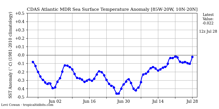
I was referring to CSU’s forecast for an ACE of ≥ 150. As of now, actual ACE looks to be far lower. We could still see an above-average season, certainly, but only slightly above average, comparable to 2018–19, in terms of ACE. Given that ENSO looks to be ending up warmer than forecast in the short term, particularly in Niño 1+2, it raises the possibility that VWS and suppression over the Caribbean and MDR may be stronger than expected during ASO. Currently, moreover, the MDR is much cooler than the global tropics and shows no sign of changing significantly any time soon:


