Tropical Weather Outlook
NWS National Hurricane Center Miami FL
500 PM PDT Mon Jun 21 2021
For the eastern North Pacific...east of 140 degrees west longitude:
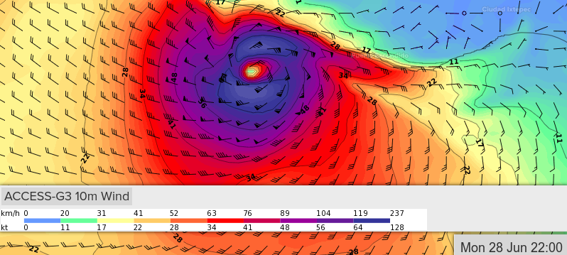
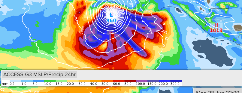
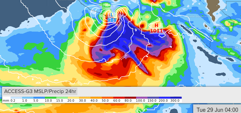
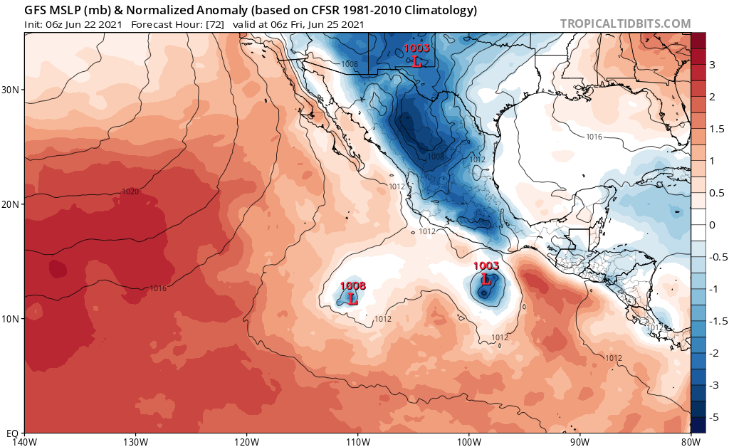
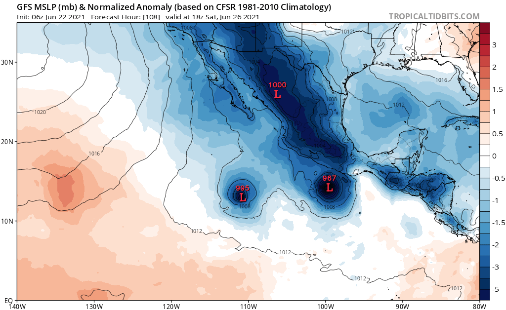
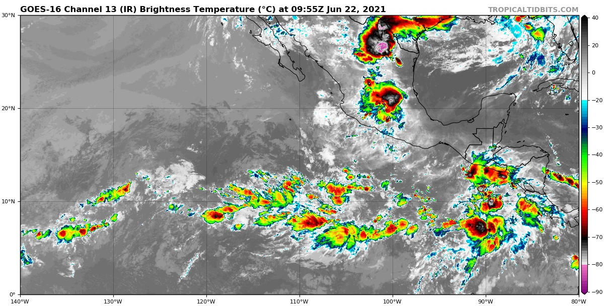
1. An area of low pressure is expected to form south of southeastern
Mexico in a few days. Environmental conditions appear conducive for
gradual development thereafter, and a tropical depression is likely
to form late this week or this weekend while the system moves
west-northwestward parallel to and just offshore of the southern
coast of Mexico.
* Formation chance through 48 hours...low...near 0 percent.
* Formation chance through 5 days...high...70 percent.
Forecaster Latto
NWS National Hurricane Center Miami FL
500 PM PDT Mon Jun 21 2021
For the eastern North Pacific...east of 140 degrees west longitude:
1. An area of low pressure is expected to form south of southeastern
Mexico in a few days. Environmental conditions appear conducive for
gradual development thereafter, and a tropical depression is likely
to form late this week or this weekend while the system moves
west-northwestward parallel to and just offshore of the southern
coast of Mexico.
* Formation chance through 48 hours...low...near 0 percent.
* Formation chance through 5 days...high...70 percent.
Forecaster Latto
I think eventually they'll add another circle.