ATL: ELSA - Post-Tropical - Discussion
Moderator: S2k Moderators
-
Sciencerocks
- Category 5

- Posts: 10181
- Age: 40
- Joined: Thu Jul 06, 2017 1:51 am

Re: ATL: ELSA - Tropical Storm - Discussion
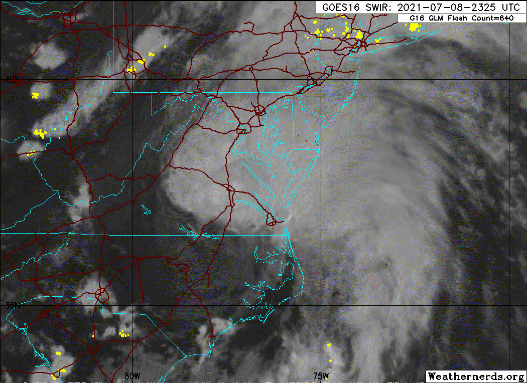
Some tornado warnings out for MD. Sorry for anyone caught in that, but I'm kind of surprised we didn't get any decent drinking whiskey on the porch reports from Raleigh on up. Hopefully some of those northern bands don't produce more tornadoes into NJ/NY/CT/RI/MA.
Edit to say some radar indicated ones moving up through Delaware now.
https://www.weather.gov/phi/
Edit to say some radar indicated ones moving up through Delaware now.
https://www.weather.gov/phi/
0 likes
-
InfernoFlameCat

- Category 5
- Posts: 2127
- Age: 22
- Joined: Mon Dec 14, 2020 10:52 am
- Location: Buford, GA
Re: ATL: ELSA - Tropical Storm - Discussion
She is redeveloping a core. If this were warmer waters she would be able to refire deep convection at the center immediately. She is definitely a baroclinic force now though with her shape.
0 likes
I am by no means a professional. DO NOT look at my forecasts for official information or make decisions based on what I post.
Goal: to become a registered expert over tropical and subtropical cyclones.
Goal: to become a registered expert over tropical and subtropical cyclones.

Re: ATL: ELSA - Tropical Storm - Discussion
It’s been a constant heavy downpour for hours, but thankfully, despite Elsa having strengthened a bit, there have been negligible to not wind impacts here in SW CT.
5 likes
Irene '11 Sandy '12 Hermine '16 5/15/2018 Derecho Fay '20 Isaias '20 Elsa '21 Henri '21 Ida '21
I am only a meteorology enthusiast who knows a decent amount about tropical cyclones. Look to the professional mets, the NHC, or your local weather office for the best information.
I am only a meteorology enthusiast who knows a decent amount about tropical cyclones. Look to the professional mets, the NHC, or your local weather office for the best information.
-
TallyTracker
- Category 2

- Posts: 787
- Joined: Thu Oct 11, 2018 2:46 pm
Re: ATL: ELSA - Tropical Storm - Discussion
Elsa is looking frontal this morning. It appears to be more nor’easter than tropical storm. Is it being maintained as a tropical storm for continuity?
0 likes
Fran '96, Georges '98, Gordon '00, Gabrielle '01, Charley '04, Frances '04, Jeanne '04, Barry '07, Fay '08, Debby '12, Matthew '16, Emily '17, Irma '17, Michael ‘18, Elsa ‘21, Fred ‘21, Mindy ‘21, Nicole ‘22, Idalia ‘23, Debby ‘24, Helene ‘24
-
tolakram
- Admin

- Posts: 20178
- Age: 62
- Joined: Sun Aug 27, 2006 8:23 pm
- Location: Florence, KY (name is Mark)
Re: ATL: ELSA - Tropical Storm - Discussion
Tropical Storm Elsa Discussion Number 38
NWS National Hurricane Center Miami FL AL052021
1100 AM EDT Fri Jul 09 2021
The extratropical transition of Elsa is well underway. A frontal
boundary located over southern New England nearly wraps into the
circulation center, and the primary area of cold cloud tops and
heavy rainfall has now shifted to the northwestern portion of the
cyclone. Elsa is expected to complete its extratropical transition
this afternoon. Buoy and surface observations indicate that the
cyclone's intensity has changed little since early this morning.
Based on those data, Elsa's peak winds and minimum pressure
remain 45 kt and 1000 mb for this advisory, respectively.
Elsa continues to move quickly northeastward or 045/27 kt. The
post-tropical cyclone is forecast to continue accelerating
northeastward over the next day or two as it remains embedded
within deep-layer southwesterly flow. After 48 hours, the system is
expected to slow before it dissipates over the north Atlantic
around day 3. The track guidance remains in good agreement, but has
shifted slightly southward after 24 hours and the NHC forecast has
been adjusted accordingly.
Little change in strength is anticipated in the short-term as Elsa
completes its extratropical transition. After that time, gradual
weakening is anticipated and the wind speed forecast calls for the
system to weaken below gale-force in a couple of days. The global
models show the post-tropical cyclone dissipating over the north
Atlantic by early next week, and the official forecast follows
suit.
Key Messages:
1. As Elsa moves near southern and coastal New England today, heavy
rainfall could lead to considerable flash and urban flooding.
2. Tropical storm conditions are expected to continue in portions
of the warning area in Long Island and southern New England
through this afternoon. Gusty winds are expected over portions of
Atlantic Canada tonight and Saturday.
FORECAST POSITIONS AND MAX WINDS
INIT 09/1500Z 41.0N 72.1W 45 KT 50 MPH
12H 10/0000Z 44.0N 67.7W 45 KT 50 MPH...POST-TROP/EXTRATROP
24H 10/1200Z 48.4N 60.3W 40 KT 45 MPH...POST-TROP/EXTRATROP
36H 11/0000Z 52.2N 51.0W 35 KT 40 MPH...POST-TROP/EXTRATROP
48H 11/1200Z 56.5N 41.0W 30 KT 35 MPH...POST-TROP/EXTRATROP
60H 12/0000Z 60.0N 32.5W 30 KT 35 MPH...POST-TROP/EXTRATROP
72H 12/1200Z...DISSIPATED
$$
Forecaster Brown
0 likes
M a r k
- - - - -
Join us in chat: Storm2K Chatroom Invite. Android and IOS apps also available.
The posts in this forum are NOT official forecasts and should not be used as such. Posts are NOT endorsed by any professional institution or STORM2K.org. For official information and forecasts, please refer to NHC and NWS products.
-
InfernoFlameCat
- Category 5
- Posts: 2127
- Age: 22
- Joined: Mon Dec 14, 2020 10:52 am
- Location: Buford, GA
Re: ATL: ELSA - Tropical Storm - Discussion
Elsa is now post tropical
0 likes
I am by no means a professional. DO NOT look at my forecasts for official information or make decisions based on what I post.
Goal: to become a registered expert over tropical and subtropical cyclones.
Goal: to become a registered expert over tropical and subtropical cyclones.
Re: ATL: ELSA - Tropical Storm - Discussion
aspen wrote:It’s been a constant heavy downpour for hours, but thankfully, despite Elsa having strengthened a bit, there have been negligible to not wind impacts here in SW CT.
Hi Aspen...are yall on the west side of Elsa?
0 likes
Re: ATL: ELSA - Tropical Storm - Discussion
underthwx wrote:aspen wrote:It’s been a constant heavy downpour for hours, but thankfully, despite Elsa having strengthened a bit, there have been negligible to not wind impacts here in SW CT.
Hi Aspen...are yall on the west side of Elsa?
Technically the NW quadrant during its closest approach at 8am EST, but yes. Based on the NHC graphic, most of the TS winds were on the SE side.
0 likes
Irene '11 Sandy '12 Hermine '16 5/15/2018 Derecho Fay '20 Isaias '20 Elsa '21 Henri '21 Ida '21
I am only a meteorology enthusiast who knows a decent amount about tropical cyclones. Look to the professional mets, the NHC, or your local weather office for the best information.
I am only a meteorology enthusiast who knows a decent amount about tropical cyclones. Look to the professional mets, the NHC, or your local weather office for the best information.
-
storminabox
- Category 1

- Posts: 263
- Joined: Sun Jul 09, 2017 10:50 pm
Re: ATL: ELSA - Post-Tropical Storm - Discussion
We’ve picked up over 3 inches over the course of only several hours here in Northern Massachusetts from what is now post tropical storm Elsa. I always find it so fascinating when a storm that originates east of the Lesser Antilles ends up in our neck of the woods. Great storm to track however the fact that we got a storm like this so early in the season, is certainly a bad sign for what the meat of the hurricane season could bring!
4 likes
-
cycloneye

- Admin
- Posts: 149275
- Age: 69
- Joined: Thu Oct 10, 2002 10:54 am
- Location: San Juan, Puerto Rico
Re: ATL: ELSA - Post-Tropical Storm - Discussion
It was a historic storm for early July.

12 likes
Visit the Caribbean-Central America Weather Thread where you can find at first post web cams,radars
and observations from Caribbean basin members Click Here
and observations from Caribbean basin members Click Here
-
ncforecaster89
- Category 1
- Posts: 269
- Age: 55
- Joined: Sat Oct 20, 2018 12:32 pm
- Contact:
Re: ATL: ELSA - Post-Tropical - Discussion
I intercepted the NE eyewall (so to speak, if not technically accurate given it wasn’t a hurricane) at Horseshoe Beach, Fl. The highest wind gust was recorded up to 71 mph, with the strongest winds surprisingly being in the SE quadrant of the storm...as the winds shifted to a direct onshore flow. I chose to avoid the storm surge since I was driving my wife’s car and weren’t looking for a divorce. 
Here’s a brief clip of what I observed during this particular event:
[youtube]https://youtu.be/_oejAgsjAhM[/youtube]
Here’s a brief clip of what I observed during this particular event:
[youtube]https://youtu.be/_oejAgsjAhM[/youtube]
Last edited by tolakram on Fri Jul 09, 2021 5:35 pm, edited 1 time in total.
Reason: added Youtube tags
Reason: added Youtube tags
12 likes
-
cycloneye
- Admin
- Posts: 149275
- Age: 69
- Joined: Thu Oct 10, 2002 10:54 am
- Location: San Juan, Puerto Rico
Re: ATL: ELSA - Post-Tropical - Discussion
3 likes
Visit the Caribbean-Central America Weather Thread where you can find at first post web cams,radars
and observations from Caribbean basin members Click Here
and observations from Caribbean basin members Click Here
-
ElectricStorm

- Category 5
- Posts: 5139
- Age: 25
- Joined: Tue Aug 13, 2019 11:23 pm
- Location: Norman, OK
Re: ATL: ELSA - Post-Tropical - Discussion
Impressive storm for July. We shall meet again in 2027 Elsa...
5 likes
B.S Meteorology, University of Oklahoma '25
Please refer to the NHC, NWS, or SPC for official information.
Please refer to the NHC, NWS, or SPC for official information.
Re: ATL: ELSA - Post-Tropical - Discussion
Well that was…something…to track. An unusual storm in so many ways and an ominous sign for what’s to come ahead. At least it wasn’t near as bad as Isaias up here.
7 likes
Irene '11 Sandy '12 Hermine '16 5/15/2018 Derecho Fay '20 Isaias '20 Elsa '21 Henri '21 Ida '21
I am only a meteorology enthusiast who knows a decent amount about tropical cyclones. Look to the professional mets, the NHC, or your local weather office for the best information.
I am only a meteorology enthusiast who knows a decent amount about tropical cyclones. Look to the professional mets, the NHC, or your local weather office for the best information.
-
TallyTracker
- Category 2
- Posts: 787
- Joined: Thu Oct 11, 2018 2:46 pm
Re: ATL: ELSA - Post-Tropical - Discussion
I drove down US 19 south of Perry today where Elsa made landfall. Didn’t really see much sign of damage except for some power line replacement in Chiefland. The big issue is that there is standing water everywhere. Hopefully the area has time to dry out some or there could be severe flooding in systems later in the season.
0 likes
Fran '96, Georges '98, Gordon '00, Gabrielle '01, Charley '04, Frances '04, Jeanne '04, Barry '07, Fay '08, Debby '12, Matthew '16, Emily '17, Irma '17, Michael ‘18, Elsa ‘21, Fred ‘21, Mindy ‘21, Nicole ‘22, Idalia ‘23, Debby ‘24, Helene ‘24
-
toad strangler

- S2K Supporter

- Posts: 4546
- Joined: Sun Jul 28, 2013 3:09 pm
- Location: Earth
- Contact:
-
Shell Mound
- Category 5
- Posts: 2432
- Age: 33
- Joined: Thu Sep 07, 2017 3:39 pm
- Location: St. Petersburg, FL → Scandinavia
Re: ATL: ELSA - Post-Tropical - Discussion
ncforecaster89 wrote:I intercepted the NE eyewall (so to speak, if not technically accurate given it wasn’t a hurricane) at Horseshoe Beach, Fl. The highest wind gust was recorded up to 71 mph, with the strongest winds surprisingly being in the SE quadrant of the storm...as the winds shifted to a direct onshore flow. I chose to avoid the storm surge since I was driving my wife’s car and weren’t looking for a divorce.
Here’s a brief clip of what I observed during this particular event:
https://youtu.be/_oejAgsjAhM
Do you agree with the NHC’s 55-kt intensity at landfall, based on your observations? There was a sustained reading of 54 kt from Horseshoe Beach, after all.
https://twitter.com/StormChasingVid/status/1412857643761385479
https://twitter.com/SimonStormRider/status/1412847773360218118
https://twitter.com/DanielleUliano/status/1412845126293016597
2 likes
CVW / MiamiensisWx / Shell Mound
The posts in this forum are NOT official forecasts and should not be used as such. They are just the opinion of the poster and may or may not be backed by sound meteorological data. They are NOT endorsed by any professional institution or STORM2K. For official information, please refer to products from the NHC and NWS.
-
ncforecaster89
- Category 1
- Posts: 269
- Age: 55
- Joined: Sat Oct 20, 2018 12:32 pm
- Contact:
Re: ATL: ELSA - Post-Tropical - Discussion
Shell Mound wrote:ncforecaster89 wrote:I intercepted the NE eyewall (so to speak, if not technically accurate given it wasn’t a hurricane) at Horseshoe Beach, Fl. The highest wind gust was recorded up to 71 mph, with the strongest winds surprisingly being in the SE quadrant of the storm...as the winds shifted to a direct onshore flow. I chose to avoid the storm surge since I was driving my wife’s car and weren’t looking for a divorce.
Here’s a brief clip of what I observed during this particular event:
https://youtu.be/_oejAgsjAhM
Do you agree with the NHC’s 55-kt intensity at landfall, based on your observations? There was a sustained reading of 54 kt from Horseshoe Beach, after all.
Yes...I think 55 kt was the correct intensity estimate based on both my own observations as well as the in-situ data you mentioned from Horseshoe Beach. The latter being far more significant, naturally. I’m not too confident that Elsa even produced a single hurricane-force wind gust, much less any HF sustained winds, on Horseshoe Beach...based on what I observed first-hand. That said, it was every bit a high-end TS event for that portion of the shoreline.
As an aside, this was the second chase I’ve conducted in the area (Hermine 2016 being the other), and on both occasions, I lost internet and phone service. Ironically, I’ve never had this happen in any of the other locations I’ve documented TC’s from every state along the coast from south Texas all the way to the NC Outer Banks (and NJ for Sandy). Guess I need to get a better cell service provider; using AT&T, currently
6 likes
Who is online
Users browsing this forum: No registered users and 21 guests