2021 Indicators: SST's / SAL / MSLP / Shear / Steering / Instability / Sat Images

This is the general tropical discussion area. Anyone can take their shot at predicting a storms path.

Moderator: S2k Moderators

Forum rules

The posts in this forum are NOT official forecasts and should not be used as such. They are just the opinion of the poster and may or may not be backed by sound meteorological data. They are NOT endorsed by any professional institution or STORM2K. For official information, please refer to products from the National Hurricane Center and National Weather Service.

Help Support Storm2K
Message
Author
User avatar
Category5Kaiju
Category 5
Category 5
Posts: 4097
Joined: Thu Dec 24, 2020 12:45 pm
Location: Seattle

Re: 2021 Indicators: SST's / SAL / MSLP / Shear / Steering / Instability / Sat Images

#981 Postby Category5Kaiju » Thu Jul 08, 2021 10:37 pm

Teban54 wrote:I thought July 8 is when people are supposed to talk about how SAL is plaguing the Atlantic and how nothing will develop in the peak season because of that? :lol:

The fact that such conversations are not happening is already quite alarming. Especially when many people expect a busy late July and early August with several MDR systems after the suppressed CCKW is over, despite climo saying otherwise.


Here's how it goes:

1. By July 8, how many storms have there been? If 4 or less, do not proceed and immediately cancel season.
5 have formed.

2. By July 8, what is the total ACE score? If at least slightly below average for what should be expected at this point, do not proceed and immediately cancel season.
ACE so far is 10, which is way above the average.

3. By July 8, has there been a hurricane in the MDR? If no, do not proceed and immediately cancel season.
Elsa, became a Category 1 and made landfall over Barbados.

4. By July 8, did that MDR hurricane fail to become a Category 4 or 5 hurricane (remember, in order for this season to be active, it must be a 2005 repeat and feature a very powerful July storm)! If yes, do not proceed and immediately cancel season.
SEASON HAS BEEN CANCELED. 2021 WILL NOT BE A BAD SEASON. END OF DISCUSSION.
12 likes   
Unless explicitly stated, all info in my posts is based on my own opinions and observations. Tropical storms and hurricanes can be extremely dangerous. Do not think you can beat Mother Nature. Refer to an accredited weather research agency or meteorologist if you need to make serious decisions regarding an approaching storm.

User avatar
cycloneye
Admin
Admin
Posts: 145310
Age: 68
Joined: Thu Oct 10, 2002 10:54 am
Location: San Juan, Puerto Rico

Re: 2021 Indicators: SST's / SAL / MSLP / Shear / Steering / Instability / Sat Images

#982 Postby cycloneye » Thu Jul 08, 2021 10:40 pm

Category5Kaiju wrote:
Teban54 wrote:I thought July 8 is when people are supposed to talk about how SAL is plaguing the Atlantic and how nothing will develop in the peak season because of that? :lol:

The fact that such conversations are not happening is already quite alarming. Especially when many people expect a busy late July and early August with several MDR systems after the suppressed CCKW is over, despite climo saying otherwise.


Here's how it goes:

1. By July 8, how many storms have there been? If 4 or less, do not proceed and immediately cancel season.
5 have formed.

2. By July 8, what is the total ACE score? If at least slightly below average for what should be expected at this point, do not proceed and immediately cancel season.
ACE so far is 10, which is way above the average.

3. By July 8, has there been a hurricane in the MDR? If no, do not proceed and immediately cancel season.
Elsa, became a Category 1 and made landfall over Barbados.

4. By July 8, did that MDR hurricane fail to become a Category 4 or 5 hurricane (remember, in order for this season to be active, it must be a 2005 repeat and feature a very powerful July storm)! If yes, do not proceed and immediately cancel season.
SEASON HAS BEEN CANCELED. 2021 WILL NOT BE A BAD SEASON. END OF DISCUSSION.


ACE for North Atlantic as of 11 PM is 12.4 units.
0 likes   
Visit the Caribbean-Central America Weather Thread where you can find at first post web cams,radars
and observations from Caribbean basin members Click Here

User avatar
Yellow Evan
Professional-Met
Professional-Met
Posts: 16143
Age: 27
Joined: Fri Jul 15, 2011 12:48 pm
Location: Henderson, Nevada/Honolulu, HI
Contact:

Re: 2021 Indicators: SST's / SAL / MSLP / Shear / Steering / Instability / Sat Images

#983 Postby Yellow Evan » Thu Jul 08, 2021 10:51 pm

1 likes   

User avatar
Category5Kaiju
Category 5
Category 5
Posts: 4097
Joined: Thu Dec 24, 2020 12:45 pm
Location: Seattle

Re: 2021 Indicators: SST's / SAL / MSLP / Shear / Steering / Instability / Sat Images

#984 Postby Category5Kaiju » Thu Jul 08, 2021 11:08 pm


Mother Nature: "So, 2021, how strong do you want the velocity signature over the West Coast of Africa to be?"

2021: "Yes."
12 likes   
Unless explicitly stated, all info in my posts is based on my own opinions and observations. Tropical storms and hurricanes can be extremely dangerous. Do not think you can beat Mother Nature. Refer to an accredited weather research agency or meteorologist if you need to make serious decisions regarding an approaching storm.

IsabelaWeather
Category 1
Category 1
Posts: 287
Age: 35
Joined: Tue Jul 07, 2020 7:29 am
Location: Isabela, Puerto Rico

Re: 2021 Indicators: SST's / SAL / MSLP / Shear / Steering / Instability / Sat Images

#985 Postby IsabelaWeather » Fri Jul 09, 2021 2:49 am

Teban54 wrote:I thought July 8 is when people are supposed to talk about how SAL is plaguing the Atlantic and how nothing will develop in the peak season because of that? :lol:

The fact that such conversations are not happening is already quite alarming. Especially when many people expect a busy late July and early August with several MDR systems after the suppressed CCKW is over, despite climo saying otherwise.


There has been some noticeable SAL here in PR but nothing like normal. Way less than Ive seen since I got here a few year ago. Should be interesting
0 likes   

Shell Mound
Category 5
Category 5
Posts: 2434
Age: 32
Joined: Thu Sep 07, 2017 3:39 pm
Location: St. Petersburg, FL → Scandinavia

Re: 2021 Indicators: SST's / SAL / MSLP / Shear / Steering / Instability / Sat Images

#986 Postby Shell Mound » Fri Jul 09, 2021 2:50 am

0 likes   
CVW / MiamiensisWx / Shell Mound
The posts in this forum are NOT official forecasts and should not be used as such. They are just the opinion of the poster and may or may not be backed by sound meteorological data. They are NOT endorsed by any professional institution or STORM2K. For official information, please refer to products from the NHC and NWS.

User avatar
cycloneye
Admin
Admin
Posts: 145310
Age: 68
Joined: Thu Oct 10, 2002 10:54 am
Location: San Juan, Puerto Rico

Re: 2021 Indicators: SST's / SAL / MSLP / Shear / Steering / Instability / Sat Images

#987 Postby cycloneye » Fri Jul 09, 2021 10:41 am

Yeah, I and other members of S2K live in the Caribbean. Less recurves. :eek:

 https://twitter.com/BenNollWeather/status/1413511509230161923


0 likes   
Visit the Caribbean-Central America Weather Thread where you can find at first post web cams,radars
and observations from Caribbean basin members Click Here

User avatar
SFLcane
S2K Supporter
S2K Supporter
Posts: 10163
Age: 47
Joined: Sat Jun 05, 2010 1:44 pm
Location: Lake Worth Florida

Re: 2021 Indicators: SST's / SAL / MSLP / Shear / Steering / Instability / Sat Images

#988 Postby SFLcane » Fri Jul 09, 2021 10:51 am

0 likes   

User avatar
cycloneye
Admin
Admin
Posts: 145310
Age: 68
Joined: Thu Oct 10, 2002 10:54 am
Location: San Juan, Puerto Rico

Re: 2021 Indicators: SST's / SAL / MSLP / Shear / Steering / Instability / Sat Images

#989 Postby cycloneye » Fri Jul 09, 2021 10:54 am

SFLCane You are 50/50 on active MDR?
0 likes   
Visit the Caribbean-Central America Weather Thread where you can find at first post web cams,radars
and observations from Caribbean basin members Click Here

User avatar
aspen
Category 5
Category 5
Posts: 8818
Joined: Sat Oct 12, 2019 7:10 pm
Location: Connecticut, USA

Re: 2021 Indicators: SST's / SAL / MSLP / Shear / Steering / Instability / Sat Images

#990 Postby aspen » Fri Jul 09, 2021 10:55 am

cycloneye wrote:Yeah, I and other members of S2K live in the Caribbean. Less recurves. :eek:

https://twitter.com/BenNollWeather/status/1413511509230161923

That shockingly looks really dry…perhaps too dry. The seemingly less conductive moisture outlook for 2021 is the only major thing I see in the way of an active season, although a dry MDR isn’t going to do anything to stop a wave that waits until the Caribbean to develop and go nuclear.
0 likes   
Irene '11 Sandy '12 Hermine '16 5/15/2018 Derecho Fay '20 Isaias '20 Elsa '21 Henri '21 Ida '21

I am only a meteorology enthusiast who knows a decent amount about tropical cyclones. Look to the professional mets, the NHC, or your local weather office for the best information.

User avatar
SFLcane
S2K Supporter
S2K Supporter
Posts: 10163
Age: 47
Joined: Sat Jun 05, 2010 1:44 pm
Location: Lake Worth Florida

Re: 2021 Indicators: SST's / SAL / MSLP / Shear / Steering / Instability / Sat Images

#991 Postby SFLcane » Fri Jul 09, 2021 10:57 am

cycloneye wrote:SFLCane You are 50/50 on active MDR?


Hey Luis, You know something in my opinion that’s just not an active look. Florida’s signal as could be a front or something else not necessarily a tc. It’s been quite sometime since I have seen so many mixed signals
1 likes   

User avatar
aspen
Category 5
Category 5
Posts: 8818
Joined: Sat Oct 12, 2019 7:10 pm
Location: Connecticut, USA

Re: 2021 Indicators: SST's / SAL / MSLP / Shear / Steering / Instability / Sat Images

#992 Postby aspen » Fri Jul 09, 2021 11:14 am

SFLcane wrote:
cycloneye wrote:SFLCane You are 50/50 on active MDR?


Hey Luis, You know something in my opinion that’s just not an active look. Florida’s signal as could be a front or something else not necessarily a tc. It’s been quite sometime since I have seen so many mixed signals

If 2018 of all seasons can manage to produce a MDR system that peaks as a Cat 4 twice and crosses the entire ocean from Cape Verde to North Carolina — despite having a very unfavorable looking MDR and an unusually quiet August — then 2021 should be able to produce at least one decent MDR hurricane. Yeah it’s looking rather dry, but like 2018, the WAM will dominate and there was an early July western MDR hurricane (Beryl ‘18, Elsa ‘21).
7 likes   
Irene '11 Sandy '12 Hermine '16 5/15/2018 Derecho Fay '20 Isaias '20 Elsa '21 Henri '21 Ida '21

I am only a meteorology enthusiast who knows a decent amount about tropical cyclones. Look to the professional mets, the NHC, or your local weather office for the best information.

User avatar
Category5Kaiju
Category 5
Category 5
Posts: 4097
Joined: Thu Dec 24, 2020 12:45 pm
Location: Seattle

Re: 2021 Indicators: SST's / SAL / MSLP / Shear / Steering / Instability / Sat Images

#993 Postby Category5Kaiju » Fri Jul 09, 2021 11:26 am

I wonder if the dry MDR is the result of the model having some trouble trying to assess the extremely potent Atlantic Nino (which if I am not mistaken is the first time in recent years that such a signal appeared) pushing activity further south of what would typically be expected in a given year and interpreting that as waves not coming off of the usual latitudes.
4 likes   
Unless explicitly stated, all info in my posts is based on my own opinions and observations. Tropical storms and hurricanes can be extremely dangerous. Do not think you can beat Mother Nature. Refer to an accredited weather research agency or meteorologist if you need to make serious decisions regarding an approaching storm.

User avatar
SFLcane
S2K Supporter
S2K Supporter
Posts: 10163
Age: 47
Joined: Sat Jun 05, 2010 1:44 pm
Location: Lake Worth Florida

Re: 2021 Indicators: SST's / SAL / MSLP / Shear / Steering / Instability / Sat Images

#994 Postby SFLcane » Fri Jul 09, 2021 11:38 am

Category5Kaiju wrote:I wonder if the dry MDR is the result of the model having some trouble trying to assess the extremely potent Atlantic Nino (which if I am not mistaken is the first time in recent years that such a signal appeared) pushing activity further south of what would typically be expected in a given year and interpreting that as waves not coming off of the usual latitudes.


Yes that’s certainly possible!
0 likes   

User avatar
toad strangler
S2K Supporter
S2K Supporter
Posts: 4543
Joined: Sun Jul 28, 2013 3:09 pm
Location: Earth
Contact:

Re: 2021 Indicators: SST's / SAL / MSLP / Shear / Steering / Instability / Sat Images

#995 Postby toad strangler » Fri Jul 09, 2021 11:43 am


There is no way those dry precip progs hold water (see what I did there) IF the 200 hPa velocity maps we keep seeing are to believed. So, ya, there WILL be some busting going on. Of course we just don't know which side!
7 likes   

User avatar
captainbarbossa19
Professional-Met
Professional-Met
Posts: 1092
Age: 27
Joined: Wed Aug 21, 2019 11:09 pm
Location: Beaumont, TX

Re: 2021 Indicators: SST's / SAL / MSLP / Shear / Steering / Instability / Sat Images

#996 Postby captainbarbossa19 » Fri Jul 09, 2021 12:25 pm


I can already tell you that this model is probably going to be wrong. It is showing drier weather for my region. This has been one of the wettest summers in probably 20-30 years right now. The semi-permanent pattern has been weaknesses over the Southern Plains while ridges have been to the west and east. Maybe this pattern will change, but I have real doubts since I recall one of these models showing drying over my region in the past and it failed to materialize.
5 likes   

Shell Mound
Category 5
Category 5
Posts: 2434
Age: 32
Joined: Thu Sep 07, 2017 3:39 pm
Location: St. Petersburg, FL → Scandinavia

Re: 2021 Indicators: SST's / SAL / MSLP / Shear / Steering / Instability / Sat Images

#997 Postby Shell Mound » Fri Jul 09, 2021 12:41 pm

cycloneye wrote:Yeah, I and other members of S2K live in the Caribbean. Less recurves. :eek:

https://twitter.com/BenNollWeather/status/1413511509230161923

Image

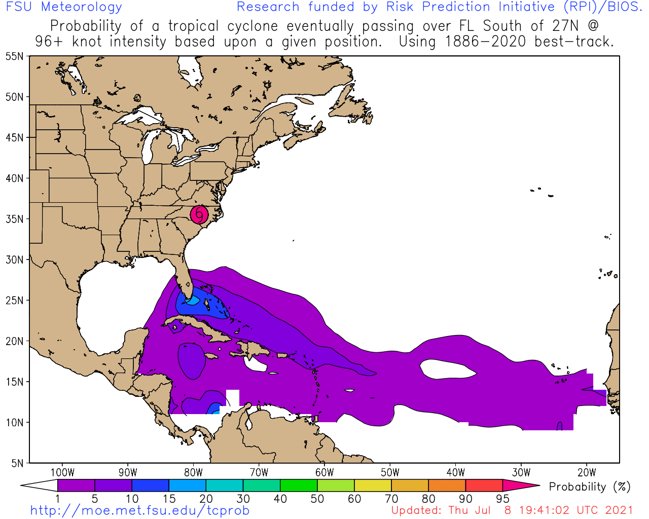
If that dry MDR holds, then maybe South FL will feature less of a threat of a MH (especially Cat-4+), given climatology. Most of the Cat-4+ hurricanes to strike South FL originated in the MDR and tracked over/near the Leeward Islands via the infamous Hebert Box #1. There could be a threat of a MH from the south via Hebert Box #2 in the Caribbean, especially in October, but such a storm would need to interact with western Cuba or the Yucatán Peninsula and would thus be less likely to be a Cat-4+ by the time it reaches South FL, unlike a classic MDR-type system heading WNW through Hebert Box #1. Michael had an advantage, unlike Wilma, because it managed to stay over the Yucatán Channel, a very narrow conduit.
0 likes   
CVW / MiamiensisWx / Shell Mound
The posts in this forum are NOT official forecasts and should not be used as such. They are just the opinion of the poster and may or may not be backed by sound meteorological data. They are NOT endorsed by any professional institution or STORM2K. For official information, please refer to products from the NHC and NWS.

User avatar
Stormybajan
Category 1
Category 1
Posts: 448
Joined: Thu May 20, 2021 3:21 pm
Location: Windward Islands

Re: 2021 Indicators: SST's / SAL / MSLP / Shear / Steering / Instability / Sat Images

#998 Postby Stormybajan » Fri Jul 09, 2021 12:44 pm

cycloneye wrote:Yeah, I and other members of S2K live in the Caribbean. Less recurves. :eek:

https://twitter.com/BenNollWeather/status/1413511509230161923


Ugh thats a not a good sign at all (atleast for us in the Lesser Antilies). However surely that model is showing the MDR a bit TOO dry. I dont see any reason for it to be so dry given how strong the waves coming off Africa in June and July have looked so far...Given we've already had Elsa. Im getting more and more concerned of a powerful Hurricane like Hurricane Dean, Hurricane Flora or Hurricane Ivan tracking through the islands in peak season :double:
4 likes   
Sad West Indies and Manchester United fan ⚽️

User avatar
cycloneye
Admin
Admin
Posts: 145310
Age: 68
Joined: Thu Oct 10, 2002 10:54 am
Location: San Juan, Puerto Rico

Re: 2021 Indicators: SST's / SAL / MSLP / Shear / Steering / Instability / Sat Images

#999 Postby cycloneye » Fri Jul 09, 2021 12:47 pm

Stormybajan wrote:
cycloneye wrote:Yeah, I and other members of S2K live in the Caribbean. Less recurves. :eek:

https://twitter.com/BenNollWeather/status/1413511509230161923


Ugh thats a not a good sign at all (atleast for us in the Lesser Antilies). However surely that model is showing the MDR a bit TOO dry. I dont see any reason for it to be so dry given how strong the waves coming off Africa in June and July have looked so far...Given we've already had Elsa. Im getting more and more concerned of a powerful Hurricane like Hurricane Dean, Hurricane Flora or Hurricane Ivan tracking through the islands in peak season :double:


Imagine a cat 4 like Allen 1980.
2 likes   
Visit the Caribbean-Central America Weather Thread where you can find at first post web cams,radars
and observations from Caribbean basin members Click Here

Shell Mound
Category 5
Category 5
Posts: 2434
Age: 32
Joined: Thu Sep 07, 2017 3:39 pm
Location: St. Petersburg, FL → Scandinavia

Re: 2021 Indicators: SST's / SAL / MSLP / Shear / Steering / Instability / Sat Images

#1000 Postby Shell Mound » Fri Jul 09, 2021 12:56 pm

HurricaneCity.com’s predictions seem to be verifying quite well once again (they were very accurate in 2020):
My picks for the 2021 season released on June 1st for a named storm affecting certain areas. (subjective to wind fields giving areas TS force winds plus) (yellowed locations indicate they were affected ).

VERY HIGH THREAT....... Wilmington, North Carolina.(ts Elsa br) .... Cayman Islands... .... Belize... .... Negril, Jamaica... .... Homosassa, Florida.(Elsa tsbr)
MODERATE THREAT....... Ceday Key, Florida.(ts Elsa) .... Kingston, Jamaica(ts Elsa br) .... Vero bch, Florida..... .... Antigua..... .... Cape Cod, Massachusetts..... .... Eleuthera Island, Bahamas..... .... Steinhatchee, Florida.(Elsa ts) .... Ft Lauderdale, Florida..... .... Savannah, Georgia (ts Elsa) .... Beaufort, South Carolina.(ts Danny) (ts Elsa br) .... Bimini, Bahamas..... .... Dominica(Hurricane Elsa br) .... Martinique(Hurricane Elsa br) .... Tampico, Mexico..... .... Oviedo,Dominican Republic (TS Elsa)
Blog post about predictions | Map of potential tracks | video
Image

Source
0 likes   
CVW / MiamiensisWx / Shell Mound
The posts in this forum are NOT official forecasts and should not be used as such. They are just the opinion of the poster and may or may not be backed by sound meteorological data. They are NOT endorsed by any professional institution or STORM2K. For official information, please refer to products from the NHC and NWS.


Return to “Talkin' Tropics”

Who is online

Users browsing this forum: abajan, Google [Bot], Google Adsense [Bot], IsabelaWeather and 47 guests