
18z GFS develops the westward system pretty quickly now calling for a near hurricane in 3 days.

18z GFS develops the eastward system later on still, bringing it to 959 mbar.
Moderator: S2k Moderators


Kingarabian wrote:Pretty out there as this would at least be 14 days away and not likely due to this years setup: Most recent ECMWF runs show that the 0/70 system remains weak for an extended period, moving west (possibly WSW) until it reaches the 12N-14N/126W-129W area where it begins to develop.
https://i.imgur.com/0zWVpfe.gif
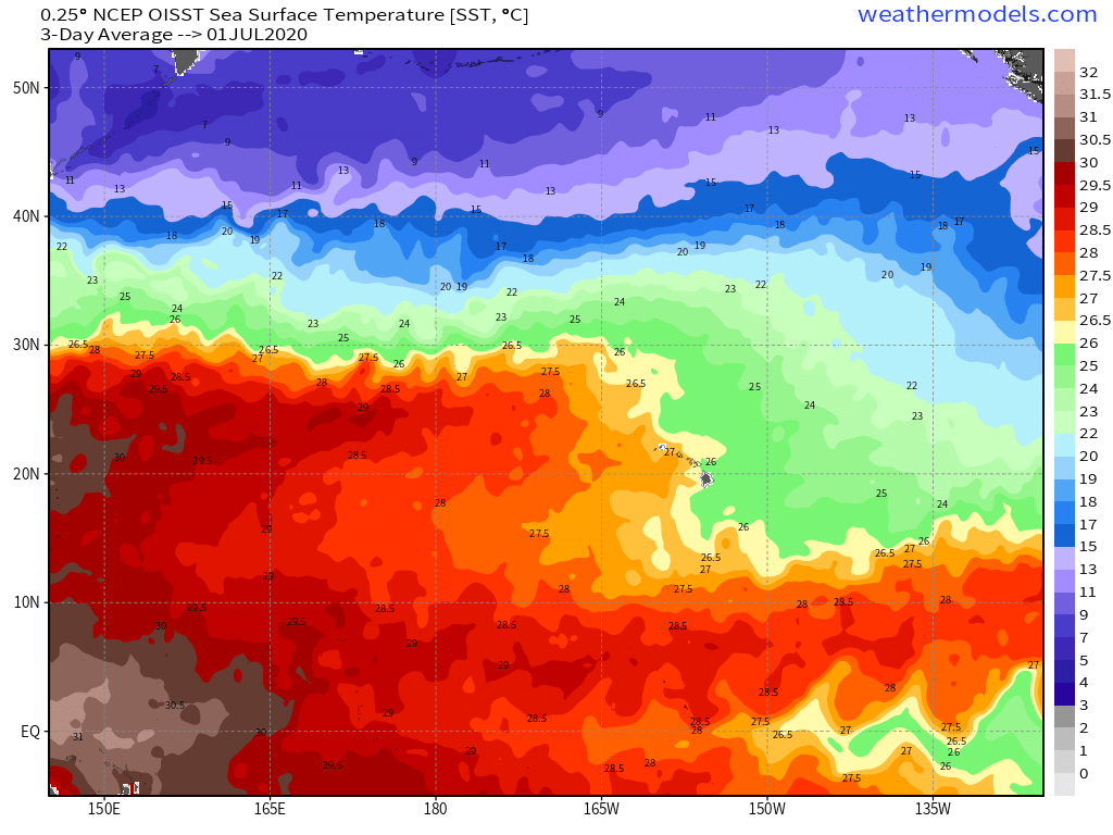
Most recently, this is a spot where Hilda 2015, Hector 2018, Lane 2018, and Douglas 2020 were able to intensify while slowly lifting WNW then NW as they round the ridge. These systems all had recon so they were a Hawaii concern at one point. Of course this year's ENSO state is not on the level of 2015 and 2018 but there is some +ENSO conditions, similar to July 2020, as well as a similar SST configuration to 2020. This could be something for Hawaii to pay attention to in about 2 weeks.


Yellow Evan wrote:Kingarabian wrote:Pretty out there as this would at least be 14 days away and not likely due to this years setup: Most recent ECMWF runs show that the 0/70 system remains weak for an extended period, moving west (possibly WSW) until it reaches the 12N-14N/126W-129W area where it begins to develop.
https://i.imgur.com/0zWVpfe.gif
Most recently, this is a spot where Hilda 2015, Hector 2018, Lane 2018, and Douglas 2020 were able to intensify while slowly lifting WNW then NW as they round the ridge. These systems all had recon so they were a Hawaii concern at one point. Of course this year's ENSO state is not on the level of 2015 and 2018 but there is some +ENSO conditions, similar to July 2020, as well as a similar SST configuration to 2020. This could be something for Hawaii to pay attention to in about 2 weeks.
[url]https://i.imgur.com/ZDvValk.gif[url]
[url]https://i.imgur.com/UYNMeCc.png[/rl]
This is why this isn't likely to happen. Too much shear, -PMM (unlike 2020 mind you), -PDO. Raw SST's don't really support strong hurricanes north of 15N atm.


aspen wrote:The 12z Euro and CMC are now a lot less enthusiastic about the 0/70 system compared to the 40/70 system.


Users browsing this forum: cycloneye and 87 guests
