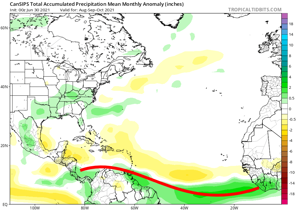
2021 Indicators: SST's / SAL / MSLP / Shear / Steering / Instability / Sat Images

This is the general tropical discussion area. Anyone can take their shot at predicting a storms path.

Moderator: S2k Moderators

Forum rules

The posts in this forum are NOT official forecasts and should not be used as such. They are just the opinion of the poster and may or may not be backed by sound meteorological data. They are NOT endorsed by any professional institution or STORM2K. For official information, please refer to products from the National Hurricane Center and National Weather Service.

Help Support Storm2K
Message
Author
User avatar
Yellow Evan
Professional-Met
Professional-Met
Posts: 16143
Age: 27
Joined: Fri Jul 15, 2011 12:48 pm
Location: Henderson, Nevada/Honolulu, HI
Contact:

Re: 2021 Indicators: SST's / SAL / MSLP / Shear / Steering / Instability / Sat Images

#1361 Postby Yellow Evan » Sat Jul 17, 2021 2:16 pm

SteveM wrote:
Yellow Evan wrote:It is plausible that the summer WAM is causing the summer reversals of AMO and preventing us from a true -AMO phase. Whether this is a sign of a true -AMO pattern down the line or a replacement of a true -AMO phase altogether are up for debate.


If the WAM (or other factors like climate change) are masking us actually now being in a -AMO, it's quite scary what we might see in 15 years when the +AMO phase returns.


By that point, it’s possible WAM could be in a dry phase though, helping offset a +AMO SST configuration.
0 likes   

User avatar
CyclonicFury
Category 5
Category 5
Posts: 2025
Age: 26
Joined: Sun Jul 02, 2017 12:32 pm
Location: NC
Contact:

Re: 2021 Indicators: SST's / SAL / MSLP / Shear / Steering / Instability / Sat Images

#1362 Postby CyclonicFury » Sat Jul 17, 2021 2:17 pm

It is interesting though for much of the 1995-2012 period the Sahel region of Africa was drier than normal.
10 likes   
NCSU B.S. in Meteorology Class of 2021. Tropical weather blogger at http://www.cyclonicfury.com. My forecasts and thoughts are NOT official, for official forecasts please consult the National Hurricane Center.

AlphaToOmega
Category 5
Category 5
Posts: 1448
Joined: Sat Jun 26, 2021 10:51 am
Location: Somewhere in Massachusetts

Re: 2021 Indicators: SST's / SAL / MSLP / Shear / Steering / Instability / Sat Images

#1363 Postby AlphaToOmega » Sat Jul 17, 2021 2:19 pm

Yellow Evan wrote:
SteveM wrote:
Yellow Evan wrote:It is plausible that the summer WAM is causing the summer reversals of AMO and preventing us from a true -AMO phase. Whether this is a sign of a true -AMO pattern down the line or a replacement of a true -AMO phase altogether are up for debate.


If the WAM (or other factors like climate change) are masking us actually now being in a -AMO, it's quite scary what we might see in 15 years when the +AMO phase returns.


By that point, it’s possible WAM could be in a dry phase though, helping offset a +AMO SST configuration.


WAM dry/wet phases seem to coincide with AMO. During +AMO, VP anomalies in West Africa are negative. During -AMO, VP anomalies in West Africa are typically positive.
0 likes   

User avatar
Category5Kaiju
Category 5
Category 5
Posts: 4095
Joined: Thu Dec 24, 2020 12:45 pm
Location: Seattle

Re: 2021 Indicators: SST's / SAL / MSLP / Shear / Steering / Instability / Sat Images

#1364 Postby Category5Kaiju » Sat Jul 17, 2021 2:38 pm

CyclonicFury wrote:It is interesting though for much of the 1995-2012 period the Sahel region of Africa was drier than normal.


It is indeed; it does make me want to believe that having a wetter Sahel region as well as this summer shift from - to + AMO is still contributing to all of the intense and above average seasons we have seen since 2016. In what exact manner I do not know, but it is intriguing to say the least.
1 likes   
Unless explicitly stated, all info in my posts is based on my own opinions and observations. Tropical storms and hurricanes can be extremely dangerous. Do not think you can beat Mother Nature. Refer to an accredited weather research agency or meteorologist if you need to make serious decisions regarding an approaching storm.

User avatar
Yellow Evan
Professional-Met
Professional-Met
Posts: 16143
Age: 27
Joined: Fri Jul 15, 2011 12:48 pm
Location: Henderson, Nevada/Honolulu, HI
Contact:

Re: 2021 Indicators: SST's / SAL / MSLP / Shear / Steering / Instability / Sat Images

#1365 Postby Yellow Evan » Sat Jul 17, 2021 2:40 pm

AlphaToOmega wrote:
Yellow Evan wrote:
SteveM wrote:
If the WAM (or other factors like climate change) are masking us actually now being in a -AMO, it's quite scary what we might see in 15 years when the +AMO phase returns.


By that point, it’s possible WAM could be in a dry phase though, helping offset a +AMO SST configuration.


WAM dry/wet phases seem to coincide with AMO. During +AMO, VP anomalies in West Africa are negative. During -AMO, VP anomalies in West Africa are typically positive.


The historic record seems to somewhat agree with this but we don’t have a very long historical record (only 2 -AMO cycles, one of which was drier in Africa than the other).
0 likes   

User avatar
NDG
S2K Supporter
S2K Supporter
Posts: 15446
Joined: Sun Jul 09, 2006 10:14 pm
Location: Orlando, FL

Re: 2021 Indicators: SST's / SAL / MSLP / Shear / Steering / Instability / Sat Images

#1366 Postby NDG » Sat Jul 17, 2021 2:40 pm

USTropics wrote:
NDG wrote:I believe CDAS daily SSTs charts have a cooler bias over the MDR when dust is present over it, looking at the two images they both match pretty good in all areas except over the MDR.

https://i.imgur.com/rIfm2zU.png
https://i.imgur.com/XnETZPA.png


That is correct. To be more specific, CDAS relies more on satellite derived data input compared to NOAA's Coral Reef Watch products or OISST products. CDAS uses the following satellite spectrums for color:
- 6.925, 10.65 GHz Brightness Temperature (V/H Polarization)
- 23.8, 36.5 GHz Brightness Temperature (H Polarization)

The CDAS documentation states that when data is contaminated by convection/SAL outbreaks (i.e., color spectrum becomes opaque), a formula is implemented that essentially counts the number of pixels within 6 GHz or 10 GHz spatial resolution. We can see from CIMSS SAL products, this has caused an issue with the CDAS data input:

https://i.imgur.com/PYjWzz7.jpg


Makes sense!
0 likes   

User avatar
toad strangler
S2K Supporter
S2K Supporter
Posts: 4543
Joined: Sun Jul 28, 2013 3:09 pm
Location: Earth
Contact:

Re: 2021 Indicators: SST's / SAL / MSLP / Shear / Steering / Instability / Sat Images

#1367 Postby toad strangler » Sat Jul 17, 2021 2:55 pm

No deviation in anticipated schedule as of yet

 http://twitter.com/AndyHazelton/status/1416129137698299904


0 likes   

User avatar
aspen
Category 5
Category 5
Posts: 8818
Joined: Sat Oct 12, 2019 7:10 pm
Location: Connecticut, USA

Re: 2021 Indicators: SST's / SAL / MSLP / Shear / Steering / Instability / Sat Images

#1368 Postby aspen » Sat Jul 17, 2021 3:00 pm

toad strangler wrote:No deviation in anticipated schedule as of yet

http://twitter.com/AndyHazelton/status/1416129137698299904?s=20

Week 2 will still have suppressive air over Africa, but further west might be favorable for a sleeper wave that survives over to there.
3 likes   
Irene '11 Sandy '12 Hermine '16 5/15/2018 Derecho Fay '20 Isaias '20 Elsa '21 Henri '21 Ida '21

I am only a meteorology enthusiast who knows a decent amount about tropical cyclones. Look to the professional mets, the NHC, or your local weather office for the best information.

User avatar
Stormybajan
Category 1
Category 1
Posts: 448
Joined: Thu May 20, 2021 3:21 pm
Location: Windward Islands

Re: 2021 Indicators: SST's / SAL / MSLP / Shear / Steering / Instability / Sat Images

#1369 Postby Stormybajan » Sat Jul 17, 2021 3:48 pm

toad strangler wrote:No deviation in anticipated schedule as of yet

http://twitter.com/AndyHazelton/status/1416129137698299904?s=20


Based on this, looks like we may have to wait until August 7th for activity to get going again. Elsa formed July 1st so this will be a massive break..even longer than I first thought
1 likes   
Sad West Indies and Manchester United fan ⚽️

User avatar
toad strangler
S2K Supporter
S2K Supporter
Posts: 4543
Joined: Sun Jul 28, 2013 3:09 pm
Location: Earth
Contact:

Re: 2021 Indicators: SST's / SAL / MSLP / Shear / Steering / Instability / Sat Images

#1370 Postby toad strangler » Sat Jul 17, 2021 3:57 pm

Stormybajan wrote:
toad strangler wrote:No deviation in anticipated schedule as of yet

http://twitter.com/AndyHazelton/status/1416129137698299904?s=20


Based on this, looks like we may have to wait until August 7th for activity to get going again. Elsa formed July 1st so this will be a massive break..even longer than I first thought


Anything pre 8/15 ish would be gravy IMO.
8 likes   

AlphaToOmega
Category 5
Category 5
Posts: 1448
Joined: Sat Jun 26, 2021 10:51 am
Location: Somewhere in Massachusetts

Re: 2021 Indicators: SST's / SAL / MSLP / Shear / Steering / Instability / Sat Images

#1371 Postby AlphaToOmega » Sat Jul 17, 2021 4:06 pm

Remember there was a lull of activity in August 2020. I would caution anyone trying to make "season cancelled" posts just because of this. It is called an unfavorable MJO phase.
4 likes   

User avatar
Category5Kaiju
Category 5
Category 5
Posts: 4095
Joined: Thu Dec 24, 2020 12:45 pm
Location: Seattle

Re: 2021 Indicators: SST's / SAL / MSLP / Shear / Steering / Instability / Sat Images

#1372 Postby Category5Kaiju » Sat Jul 17, 2021 4:21 pm

Also while the deep tropics may be asleep for a bit we could easily get some subtropical action or pop up storms as those seem to be quite frequent in recent years; also given the decently warmer than average subtropics, who knows if we’ll see one or two of these before the “real” action begins?
4 likes   
Unless explicitly stated, all info in my posts is based on my own opinions and observations. Tropical storms and hurricanes can be extremely dangerous. Do not think you can beat Mother Nature. Refer to an accredited weather research agency or meteorologist if you need to make serious decisions regarding an approaching storm.

User avatar
Steve
S2K Supporter
S2K Supporter
Posts: 9620
Joined: Sat Apr 05, 2003 11:41 pm
Location: Not a state-caster

Re: 2021 Indicators: SST's / SAL / MSLP / Shear / Steering / Instability / Sat Images

#1373 Postby Steve » Sat Jul 17, 2021 11:18 pm

Agree with the tweets on the MJO not indicating anything for now. Looks to be headed toward Phase 6/7. We might see some bursts within a slow/constant burn season though later on. If we mimic 2020 at all per A/O’s analog, September and October could be cooking. Bursts tend to come in the quick swings down through phases 8-1-2. That’s especially true when patterns are more amplified. We’ll see if the MJO can be a dominant predictor for 2021.
5 likes   

User avatar
SFLcane
S2K Supporter
S2K Supporter
Posts: 10163
Age: 47
Joined: Sat Jun 05, 2010 1:44 pm
Location: Lake Worth Florida

Re: 2021 Indicators: SST's / SAL / MSLP / Shear / Steering / Instability / Sat Images

#1374 Postby SFLcane » Sun Jul 18, 2021 1:27 pm

Last edited by SFLcane on Sun Jul 18, 2021 1:28 pm, edited 1 time in total.
2 likes   

User avatar
cycloneye
Admin
Admin
Posts: 145284
Age: 68
Joined: Thu Oct 10, 2002 10:54 am
Location: San Juan, Puerto Rico

Re: 2021 Indicators: SST's / SAL / MSLP / Shear / Steering / Instability / Sat Images

#1375 Postby cycloneye » Sun Jul 18, 2021 1:28 pm


Oh Lesser Antilles / Puerto Rico.
2 likes   
Visit the Caribbean-Central America Weather Thread where you can find at first post web cams,radars
and observations from Caribbean basin members Click Here

User avatar
SFLcane
S2K Supporter
S2K Supporter
Posts: 10163
Age: 47
Joined: Sat Jun 05, 2010 1:44 pm
Location: Lake Worth Florida

Re: 2021 Indicators: SST's / SAL / MSLP / Shear / Steering / Instability / Sat Images

#1376 Postby SFLcane » Sun Jul 18, 2021 1:29 pm

cycloneye wrote:


Oh Lesser Antilles / Puerto Rico.


Yes yes…look out if your in that purple shading.
0 likes   

User avatar
SFLcane
S2K Supporter
S2K Supporter
Posts: 10163
Age: 47
Joined: Sat Jun 05, 2010 1:44 pm
Location: Lake Worth Florida

Re: 2021 Indicators: SST's / SAL / MSLP / Shear / Steering / Instability / Sat Images

#1377 Postby SFLcane » Sun Jul 18, 2021 1:31 pm

3 likes   


AlphaToOmega
Category 5
Category 5
Posts: 1448
Joined: Sat Jun 26, 2021 10:51 am
Location: Somewhere in Massachusetts

Re: 2021 Indicators: SST's / SAL / MSLP / Shear / Steering / Instability / Sat Images

#1379 Postby AlphaToOmega » Sun Jul 18, 2021 4:22 pm

Here is where the ITCZ is likely to be come peak season. Obviously, it is and will be much farther south this year than it was last year.
Image
5 likes   

User avatar
SFLcane
S2K Supporter
S2K Supporter
Posts: 10163
Age: 47
Joined: Sat Jun 05, 2010 1:44 pm
Location: Lake Worth Florida

Re: 2021 Indicators: SST's / SAL / MSLP / Shear / Steering / Instability / Sat Images

#1380 Postby SFLcane » Sun Jul 18, 2021 6:58 pm

AlphaToOmega wrote:Here is where the ITCZ is likely to be come peak season. Obviously, it is and will be much farther south this year than it was last year.
https://i.postimg.cc/BQ0Q2pYy/itcz.png


Id advise not to use precipitation from climate models to determine potential tropical cyclone tracks. I would take those forecast with caution this season as some of these models are having trouble with Atlantic El Niño and have dry bias. I for one think it probably won’t be a very high number season but more of an impactful year in terms of impacts. I will be ready in SFL as the signs are ominous from looking z500 model output. Just because an area is shaded brown doesn’t mean a tc won’t track through through there.
5 likes   


Return to “Talkin' Tropics”

Who is online

Users browsing this forum: Google Adsense [Bot], Steve H. and 34 guests