

Shell Mound wrote:AlphaToOmega wrote:Shell Mound wrote:https://i.postimg.cc/g0mn1hLM/EC51003-B-BA3-B-48-AB-933-C-1343-E10-E7-CDE.png
https://i.ibb.co/jvrbBbv/LIhurrimpact-2.png
https://i.ibb.co/tQXKZ6J/LIFLhurrcomp-1.png
https://i.ibb.co/51MdKPL/Ska-rmavbild-2021-07-21-kl-16-28-46.png
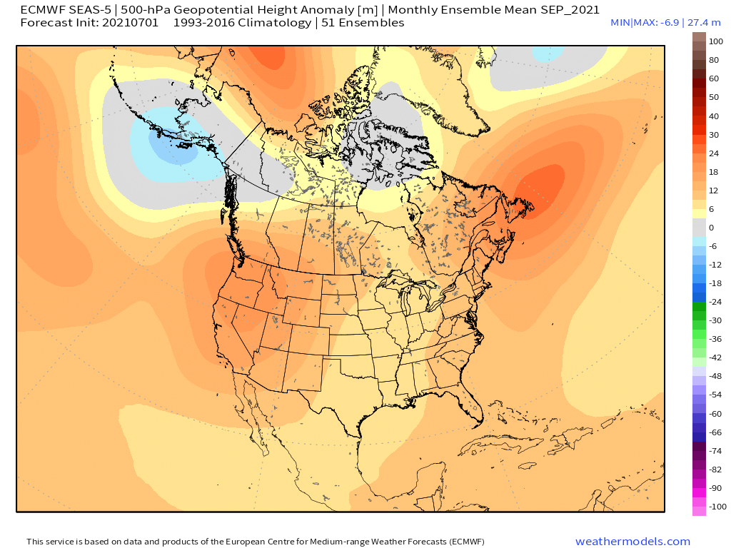
If the 2021 Atlantic hurricane season were to be delayed, for the most part, until the last week of August, then the EPS’s H5 composite for September is startlingly similar to that of the years that featured at least one hurricane impact on Long Island, NY, during the month of September. These years include the infamous seasons of 1938, 1944, 1960, and 1985. When blended with the years 1945 and 1949 as well, the composite becomes even more similar to the EPS’s H5 forecast for September. One interesting difference between the two subsets is that 1945 and 1949 featured a stronger +PNA signature than the years that featured a hurricane impact on Long Island, suggesting a PDO closer to positive rather than negative territory, and the EPS’s forecast suggests more of a neutral PDO/PNA, in line with recent trends indicating a rise in the PDO over the past month or so. This kind of setup would suggest the potential for a CV-type long-tracker that impacts much of the U.S. East Coast from South FL northward to the Carolinas and New England, similar to Donna (1960).
What are you using for the storm tracks?
https://coast.noaa.gov/hurricanes/
As an aside, why are you using 2004 and 2017 as analogs for 2021 in some of your previous posts? Do you have any evidence? Those are extreme years.
2004 was a steering analog, and 2017 is an MJO analog. 2017 had a burst of activity in June and a lull in July, just like this year.


