

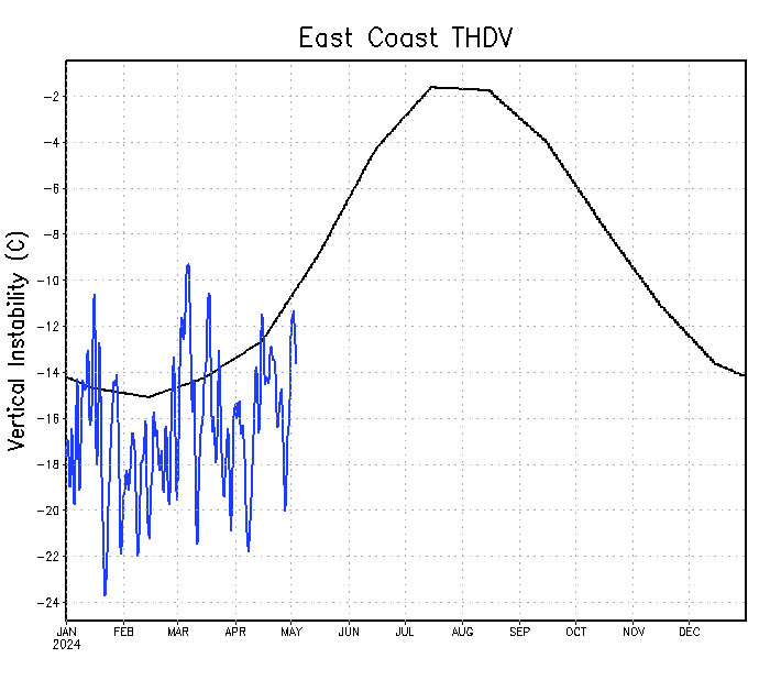
MarioProtVI wrote:wxman57 wrote:The instability charts are not an indicator of whether or not the season will be active or impactful. Take last year, for example. Part of the reason that the western Caribbean and Gulf were so active was because the Tropical Atlantic was generally stable. Teddy became a hurricane there, but it didn't really get going until it moved out of the deep tropics. Laura could barely survive until it reached the Gulf. Gonzalo died as it reached the Caribbean. A stable Tropical Atlantic could mean activity shifts west to the Gulf and U.S. East Coast. The East U.S. Coast is the only area currently close to normal levels of instability, and that's the only region that has a slight chance of seeing a storm in the next 2 weeks.
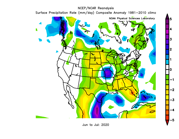
I'm thinking that the currently stable Tropical Atlantic will remain stable through the season. No long-tracked hurricanes between the Caribbean and Africa, but development occurring farther west in the Caribbean, which threatens the Gulf Coast. A very wet July in Texas may signal an increased chance for a major impact on the Gulf Coast.
Tropical Atlantic: https://www.ssd.noaa.gov/PS/TROP/TCFP/data/current/ts_al_tat_THDV.gif
Caribbean: https://www.ssd.noaa.gov/PS/TROP/TCFP/data/current/ts_al_car_THDV.gif
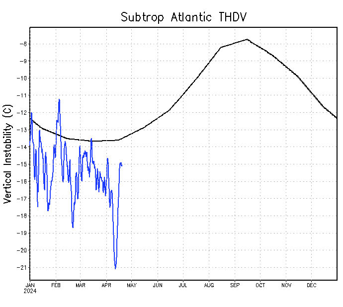
Subtropical Atlantic: https://www.ssd.noaa.gov/PS/TROP/TCFP/data/current/ts_al_sat_THDV.gif
East U.S. Coast: https://www.ssd.noaa.gov/PS/TROP/TCFP/data/current/ts_al_eco_THDV.gif
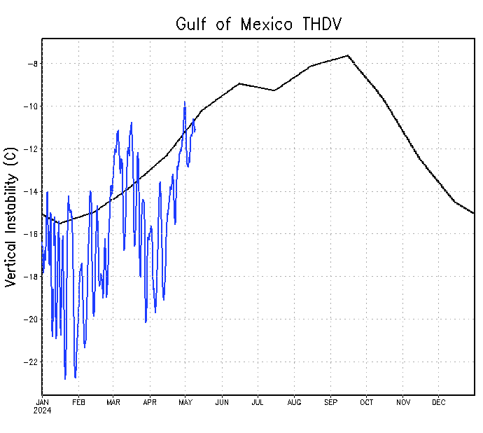
Gulf of Mexico: https://www.ssd.noaa.gov/PS/TROP/TCFP/data/current/ts_al_gmx_THDV.gif
I can guarantee there will be at least some long trackers in the MDR and Caribbean this year.
By “long-tracked hurricanes” wxman57 is likely alluding to storms that become (major) hurricanes in the MDR, like Ivan, Dean, or Irma. 2021 will likely lack those.*
*I am referring to (major) hurricanes in the MDR during the peak of the season, so I am excluding Elsa.


